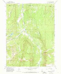
1967 Map of Lyman Lake
USGS Topo · Published 1973About this map
Wasatch National Forest defines this high-elevation landscape along the border of Utah and Wyoming, where the headwaters of the Blacks Fork river system converge. This 1967 field check documents a wilderness in transition, specifically noting blue hatched areas destined to be submerged by the Meeks Cabin Reservoir. Evidence of early 20th-century occupation remains at the Old Blacks Fork Commissary and nearby Ruins, while the emergence of modern recreation is seen at the Lyman Lake Campground, Picnic Area, and a Youth Camp situated near Little Lyman Lake. The map reveals a network of Jeep Trails and Pack Trails that navigate through named landmarks like The Woodpile and Mansfield Meadows. Key administrative and infrastructure points include the East Fork Blacks Fork Guard Station and a Gaging Station on the river, marking the active management of these timbered mountain drainages.
Find a feature on this map
31 named features on this map. Tap any name to fly to it.
Don’t see what you’re looking for? This feature index may not catch every label — zoom into the map to look around manually.
Map Details
Editions of this 1967 Lyman Lake Map
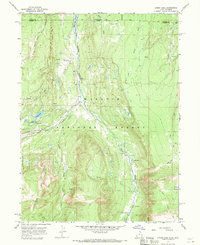
2 editions found
Other maps of this area

1885 · Uinta
USGS Topo · 1:250,000

1901 · Hayden Peak
USGS Topo · 1:125,000

1903 · Hayden Peak
USGS Topo · 1:125,000

1905 · Gilbert Peak
USGS Topo · 1:125,000

1906 · Gilbert Peak
USGS Topo · 1:125,000

1954 · Salt Lake City
USGS Topo · 1:250,000

1954 · Ogden
USGS Topo · 1:250,000

1958 · Ogden
USGS Topo · 1:250,000

1958 · Salt Lake City
USGS Topo · 1:250,000

1960 · Ogden
USGS Topo · 1:250,000