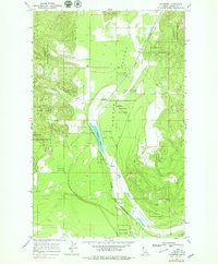
1968 Map of Edgemere
USGS Topo · Published 1979About this map
Hoodoo Valley forms the central spine of this Idaho panhandle landscape, where the Spokane International railroad and the waters of Hoodoo Creek run parallel through the timberlands. The late 1960s environment is defined by small, dispersed rural centers such as Edgemere, Vay, Harlem, and Clagstone. In this era, the area remained heavily tied to the Kaniksu National Forest, which blankets the high ground around Horn Mtn to the north and the western ridges drained by Curtis Creek. Local social infrastructure is anchored by the Edgemere Sch, while the presence of scattered Gravel Pits and a Well suggest the modest industrial and utility footprint required for these isolated Bonner County settlements. The geography here is a transition between the marshy shores of Hoodoo Lake and the steep, wooded hillsides typical of the Selkirk Mountains region.
Find a feature on this map
20 named features on this map. Tap any name to fly to it.
Don’t see what you’re looking for? This feature index may not catch every label — zoom into the map to look around manually.
Map Details
Editions of this 1968 Edgemere Map
2 editions found
Other maps of this area

1901 · Sandpoint
USGS Topo · 1:125,000

1903 · Rathdrum
USGS Topo · 1:125,000

1911 · Priest Lake
USGS Topo · 1:250,000

1911 · Sandpoint
USGS Topo · 1:125,000

1913 · Priest Lake
USGS Topo · 1:250,000

1955 · Spokane
USGS Topo · 1:250,000

1958 · Spokane
USGS Topo · 1:250,000

1958 · Sandpoint
USGS Topo · 1:250,000

1961 · Spirit Lake East
USGS Topo · 1:24,000

1961 · Athol
USGS Topo · 1:24,000