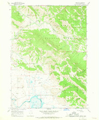
1966 Map of Herman
USGS Topo · Published 1969About this map
Herman sits near the marshy northern edge of Grays Lake in this mid-1960s survey of Bonneville County. The landscape is defined by the transition from the lake basin to the timbered slopes of the Caribou National Forest, where the Brockman Guard Station serves as a remote outpost for forest management. This area is heavily influenced by its water systems, featuring a network of drainages including Sawmill Creek, Brockman Creek, and Bear Creek that feed into the valley floor. The map documents the localized infrastructure of the era, such as a Cinder Pit and various Storage Bins, alongside a Gaging Station and Clark Outlet that monitored the hydrology of the valley. A series of Jeep Trails provide the primary means of navigating the higher elevations toward Della Basin and the forest interior.
Find a feature on this map
22 named features on this map. Tap any name to fly to it.
Don’t see what you’re looking for? This feature index may not catch every label — zoom into the map to look around manually.
Map Details
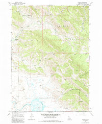
Editions of this 1966 Herman Map
2 editions found
Other maps of this area

1917 · Cranes Flat
USGS Topo · 1:62,500

1924 · Hell Creek
USGS Topo · 1:62,500

1926 · Hell Creek
USGS Topo · 1:62,500

1932 · Irwin
USGS Topo · 1:96,000

1935 · Irwin
USGS Topo · 1:125,000

1955 · Driggs
USGS Topo · 1:250,000

1958 · Driggs
USGS Topo · 1:250,000

1962 · Driggs
USGS Topo · 1:250,000
1966 · Bear Island
USGS Topo · 1:24,000

1966 · Big Elk Mtn
USGS Topo · 1:24,000