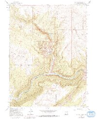
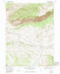
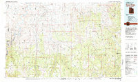
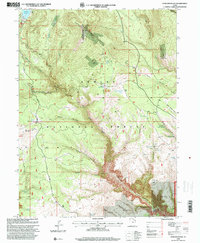
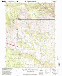
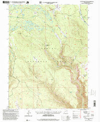
2023 Map of Agency Draw NW
USGS Topo · Published 2023About this map
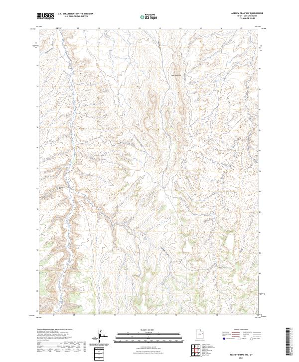
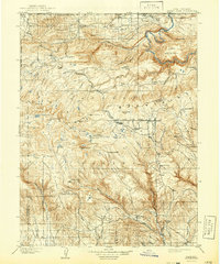
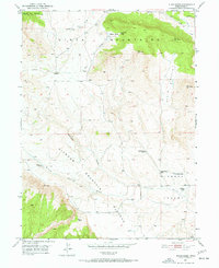
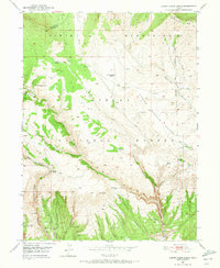
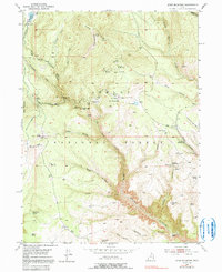
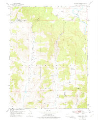
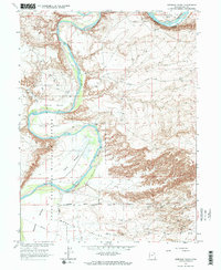
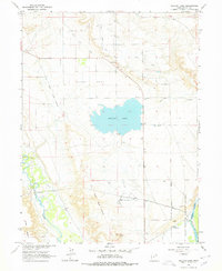
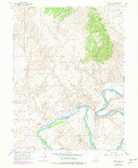
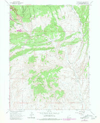
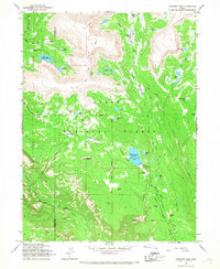
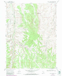
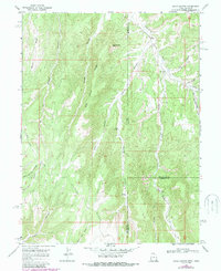
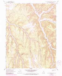
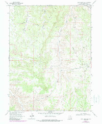
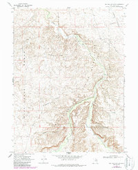
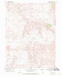
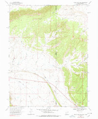
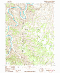
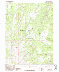
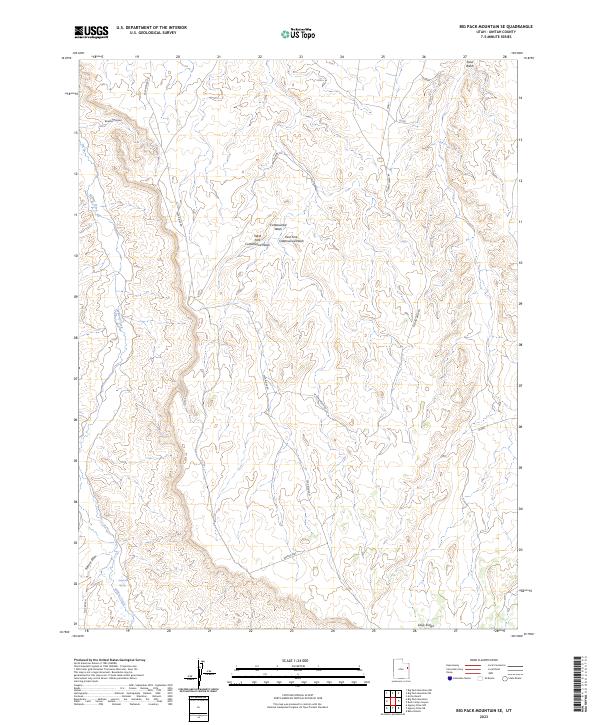
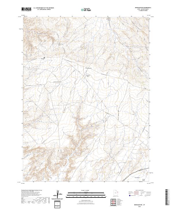
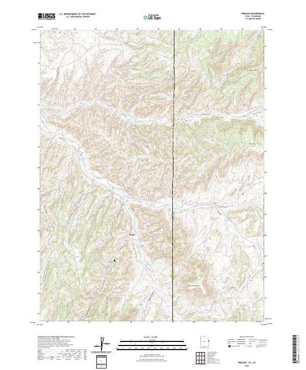
Hill Creek snakes through the southwestern corner of this high-desert terrain in Uintah County, cutting through a landscape defined by dramatic draws and high plateaus. The topography is dominated by the distinct ridge of Little Pack Mountain, which rises between Green Canyon and the surrounding drainage systems. In the northeastern portion of the sheet, the Agency Complex and the general Agency label indicate administrative or tribal infrastructure near the head of Agency Draw. The map reveals a complex network of seasonal watercourses, including Flat Rock Canyon and Cedar Draw, which illustrate how water has sculpted this arid region over time. This modern survey provides a detailed look at the land's contours, from the depths of Johnson Draw to the various peaks of Little Pack Mtn, serving as an essential reference for understanding the physical geography and administrative footprints in this part of eastern Utah.
Find a feature on this map
12 named features on this map. Tap any name to fly to it.
Don’t see what you’re looking for? This feature index may not catch every label — zoom into the map to look around manually.
Map Details
Editions of this 2023 Agency Draw NW Map
This is the sole edition of this map. No revisions or reprints were ever made.
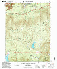
Historical Maps of Fairbanks Crossing Through Time
164 maps found
1885 Ashley
Uintah County, UT
1885 East Tavaputs
Uintah County, UT
1906 Marsh Peak
Uintah County, UT
1908 Marsh Peak
Uintah County, UT
1950 Blair Basin
Uintah County, UT
1950 Burnt Cabin Gorge
Uintah County, UT
1950 Dyer Mountain
Uintah County, UT
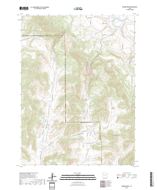
1952 Warren Draw
Uintah County, UT
1953 Firewater Canyon
Uintah County, UT
1953 Nutters Hole
Uintah County, UT
1955 Island Park
Uintah County, UT
1955 Jones Hole
Uintah County, UT
1955 Split Mountain
Uintah County, UT
1955 Stuntz Reservoir
Uintah County, UT
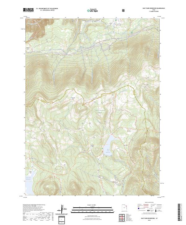
1963 East Park Reservoir
Uintah County, UT
1964 Brennan Basin
Uintah County, UT
1964 Ouray SE
Uintah County, UT
1964 Ouray
Uintah County, UT
1964 Pariette Draw SW
Uintah County, UT
1964 Pelican Lake
Uintah County, UT
1964 Uteland Butte
Uintah County, UT
1964 Vernal NE
Uintah County, UT
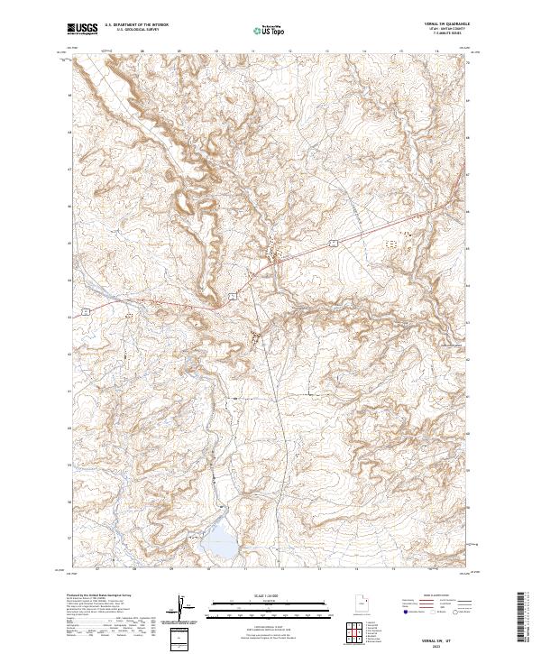
1964 Vernal NW
Uintah County, UT
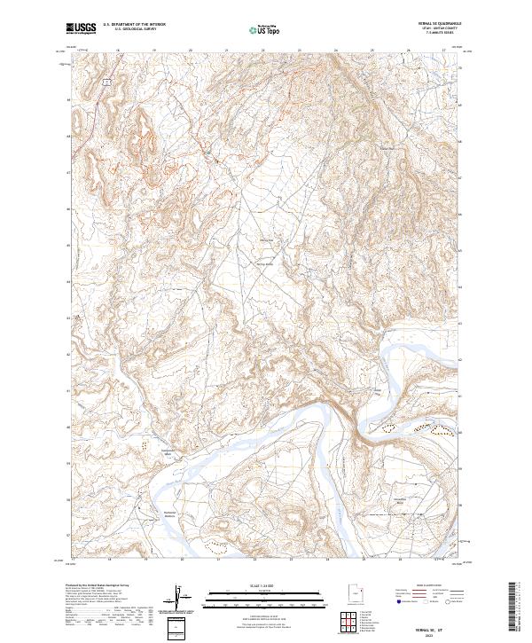
1964 Vernal SE
Uintah County, UT
1964 Vernal SW
Uintah County, UT
1964 Windy Ridge
Uintah County, UT
1965 Dinosaur Quarry
Uintah County, UT
1965 Donkey Flat
Uintah County, UT
1965 Ice Cave Peak
Uintah County, UT
1965 Lake Mountain
Uintah County, UT
1965 Marsh Peak
Uintah County, UT
1965 Paradise Park
Uintah County, UT
1965 Rasmussen Hollow
Uintah County, UT
1965 Steinaker Reservoir
Uintah County, UT
1966 Agency Draw NE
Uintah County, UT
1966 Agency Draw NW
Uintah County, UT
1966 Bates Knolls
Uintah County, UT
1966 Burnt Timber Canyon
Uintah County, UT
1966 Copper Canyon
Uintah County, UT
1966 Davis Canyon
Uintah County, UT
1966 Dry Fork
Uintah County, UT
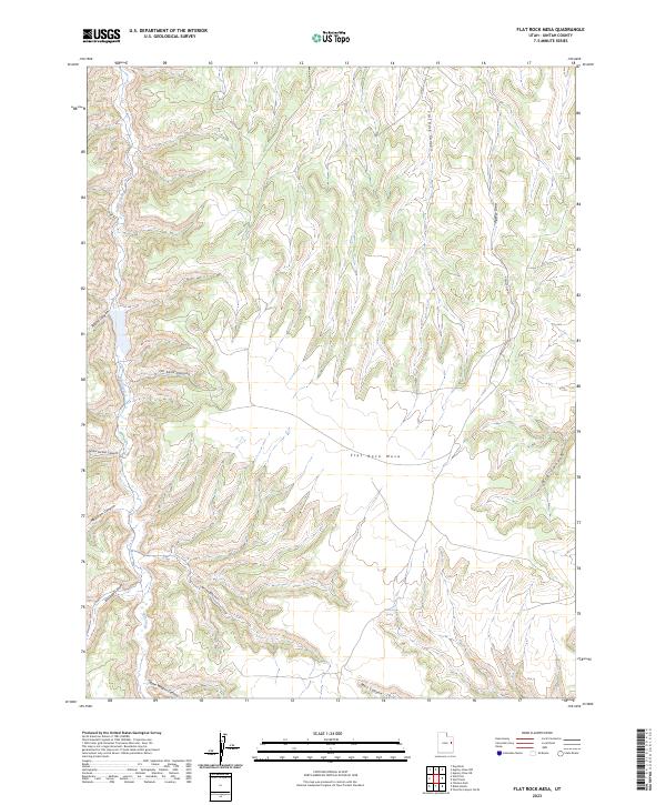
1966 Flat Rock Mesa
Uintah County, UT
1966 Jensen Ridge
Uintah County, UT
1966 Pine Spring Canyon
Uintah County, UT
1966 Rat Hole Ridge
Uintah County, UT
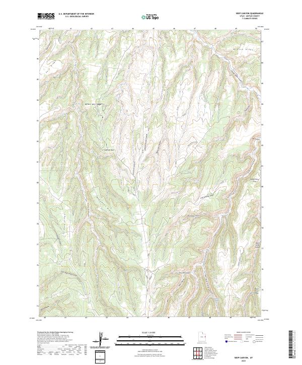
1966 Seep Canyon
Uintah County, UT
1966 Taylor Mtn
Uintah County, UT
1966 Tom Patterson Canyon
Uintah County, UT
1966 Wolf Point
Uintah County, UT
1967 Crouse Reservoir
Uintah County, UT
1967 Jackson Draw
Uintah County, UT
1968 Archy Bench SE
Uintah County, UT
1968 Archy Bench
Uintah County, UT
1968 Asphalt Wash
Uintah County, UT
1968 Big Pack Mtn. NE
Uintah County, UT
1968 Big Pack Mtn. NW
Uintah County, UT
1968 Big Pack Mtn. SE
Uintah County, UT
1968 Big Pack Mtn.
Uintah County, UT
1968 Buck Camp Canyon
Uintah County, UT
1968 Cliff Ridge
Uintah County, UT
1968 Dinosaur NW
Uintah County, UT
1968 Dragon
Uintah County, UT
1968 Rainbow
Uintah County, UT
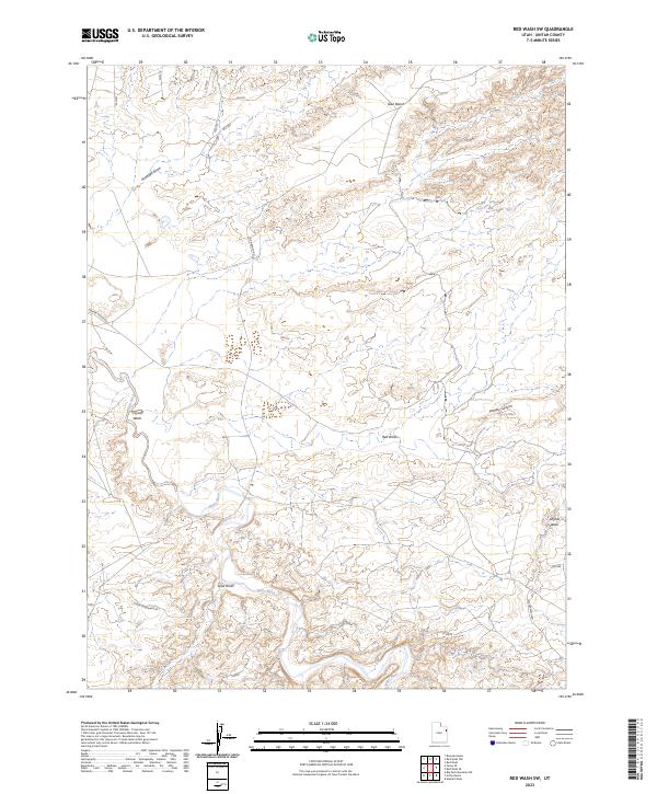
1968 Red Wash NW
Uintah County, UT
1968 Red Wash SE
Uintah County, UT
1968 Red Wash SW
Uintah County, UT
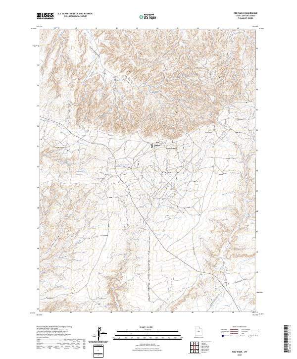
1968 Red Wash
Uintah County, UT
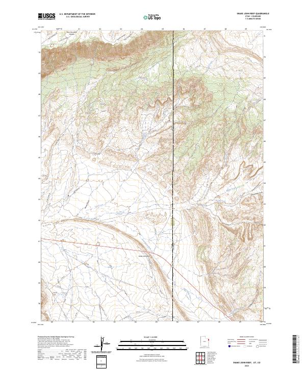
1968 Snake John Reef
Uintah County, UT
1968 Southam Canyon
Uintah County, UT
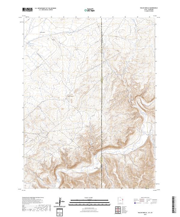
1968 Walsh Knolls
Uintah County, UT
1968 Weaver Ridge
Uintah County, UT
1981 Seep Ridge
Uintah County, UT
1985 Crow Knoll
Uintah County, UT
1985 Dog Knoll
Uintah County, UT
1985 Duches Hole
Uintah County, UT
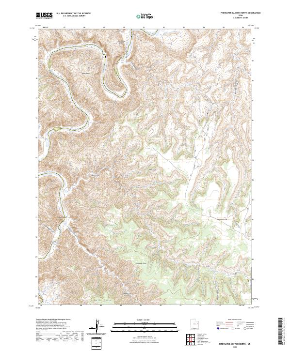
1985 Firewater Canyon North
Uintah County, UT
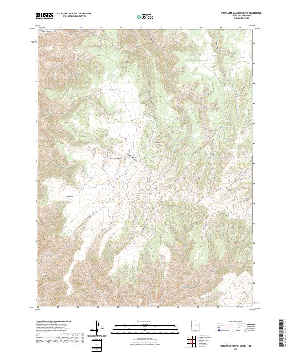
1985 Firewater Canyon South
Uintah County, UT
1985 Moon Bottom
Uintah County, UT
1985 Nutters Hole
Uintah County, UT
1985 Wolf Flat
Uintah County, UT
1996 Blair Basin
Uintah County, UT
1996 Burnt Cabin Gorge
Uintah County, UT
1996 Dry Fork
Uintah County, UT
1996 Dyer Mountain
Uintah County, UT
1996 East Park Reservoir
Uintah County, UT
1996 Ice Cave Peak
Uintah County, UT
1996 Jackson Draw
Uintah County, UT
1996 Lake Mountain
Uintah County, UT
1996 Marsh Peak
Uintah County, UT
1996 Paradise Park
Uintah County, UT
1996 Steinaker Reservoir
Uintah County, UT
1996 Taylor Mountain
Uintah County, UT
2023 Agency Draw NE
Uintah County, UT
2023 Agency Draw NW
Uintah County, UT
2023 Archy Bench SE
Uintah County, UT
2023 Archy Bench
Uintah County, UT
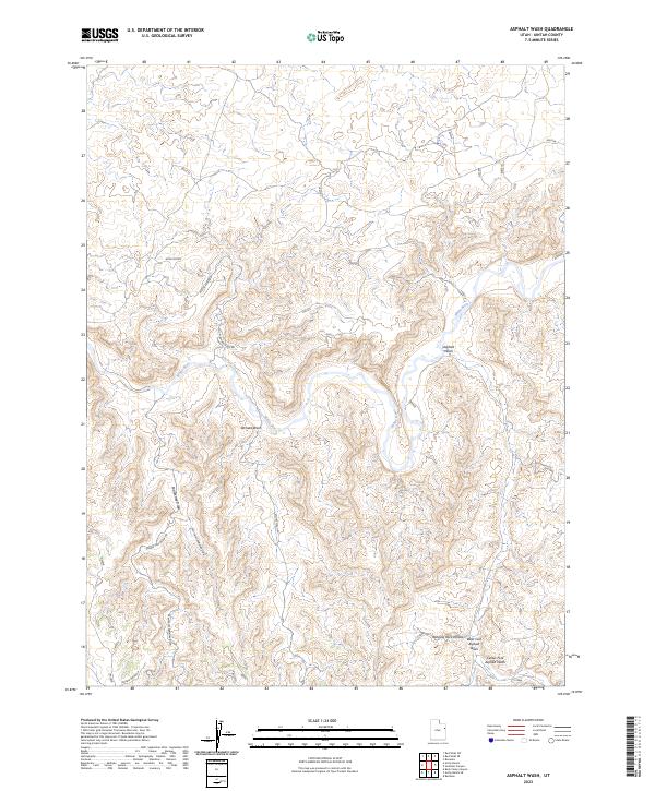
2023 Asphalt Wash
Uintah County, UT
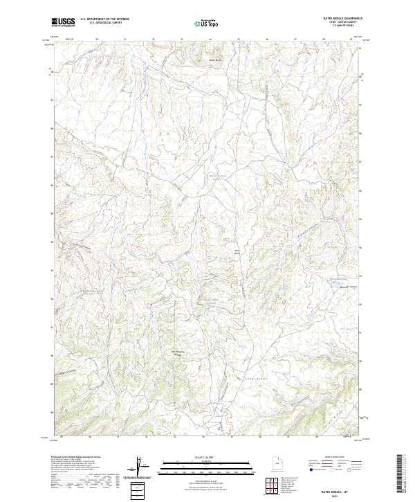
2023 Bates Knolls
Uintah County, UT
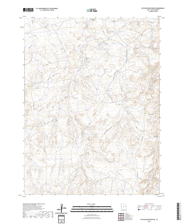
2023 Big Pack Mountain NE
Uintah County, UT
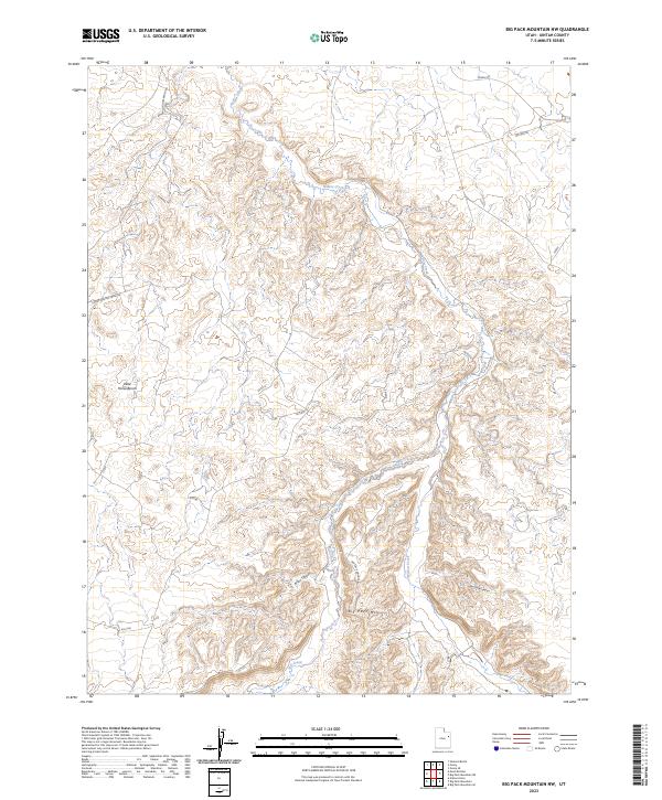
2023 Big Pack Mountain NW
Uintah County, UT
2023 Big Pack Mountain SE
Uintah County, UT
2023 Big Pack Mountain
Uintah County, UT
2023 Blair Basin
Uintah County, UT
2023 Brennan Basin
Uintah County, UT
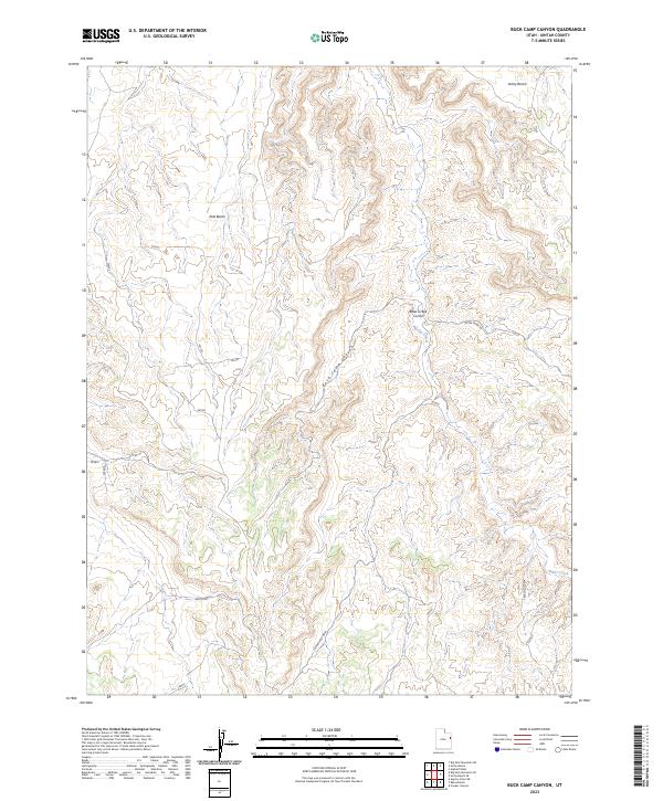
2023 Buck Camp Canyon
Uintah County, UT
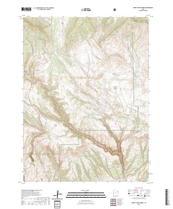
2023 Burnt Cabin Gorge
Uintah County, UT
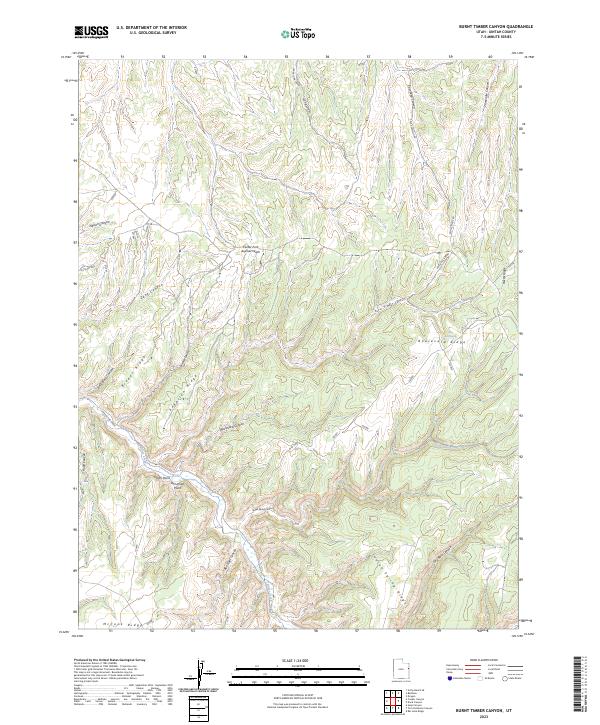
2023 Burnt Timber Canyon
Uintah County, UT
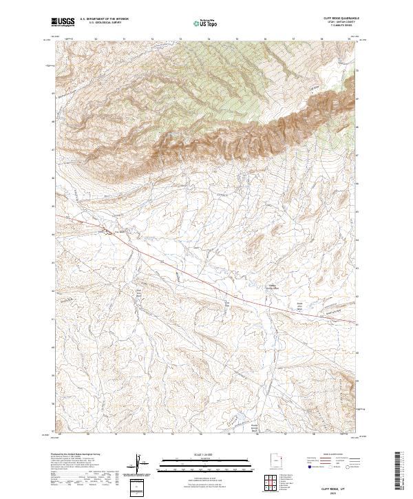
2023 Cliff Ridge
Uintah County, UT
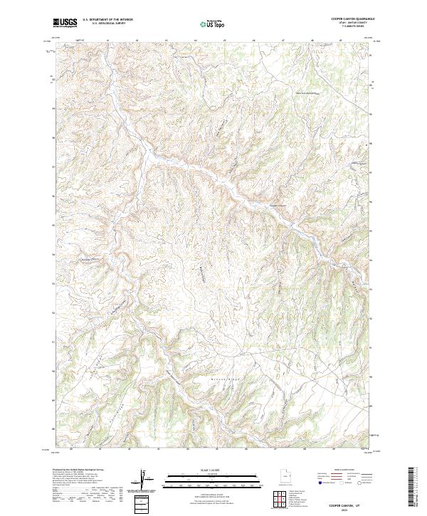
2023 Cooper Canyon
Uintah County, UT
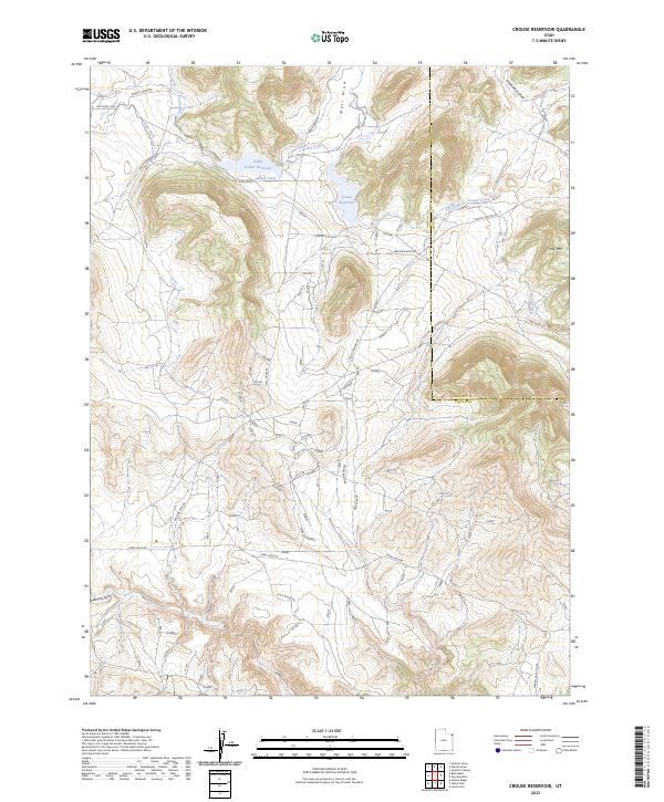
2023 Crouse Reservoir
Uintah County, UT
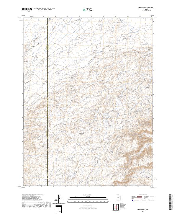
2023 Crow Knoll
Uintah County, UT
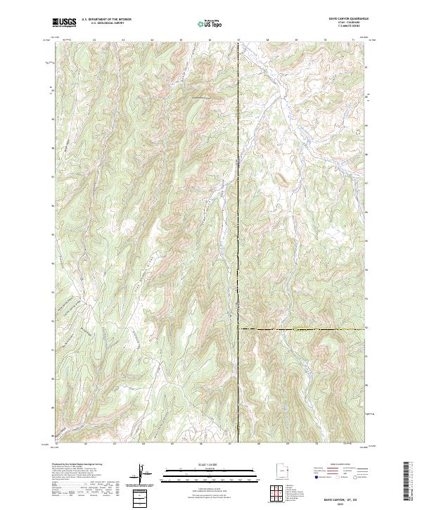
2023 Davis Canyon
Uintah County, UT
2023 Dinosaur NW
Uintah County, UT
2023 Dinosaur Quarry
Uintah County, UT
2023 Dog Knoll
Uintah County, UT
2023 Donkey Flat
Uintah County, UT
2023 Dragon
Uintah County, UT
2023 Dry Fork
Uintah County, UT
2023 Duches Hole
Uintah County, UT
2023 Dyer Mountain
Uintah County, UT
2023 East Park Reservoir
Uintah County, UT
2023 Firewater Canyon North
Uintah County, UT
2023 Firewater Canyon South
Uintah County, UT
2023 Flat Rock Mesa
Uintah County, UT
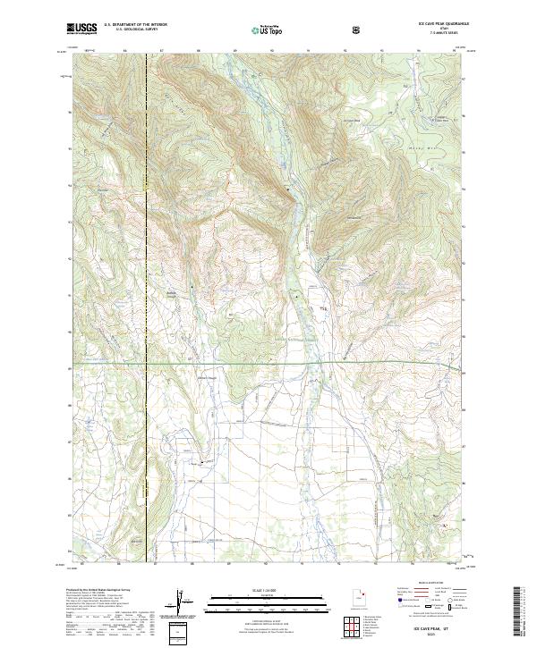
2023 Ice Cave Peak
Uintah County, UT
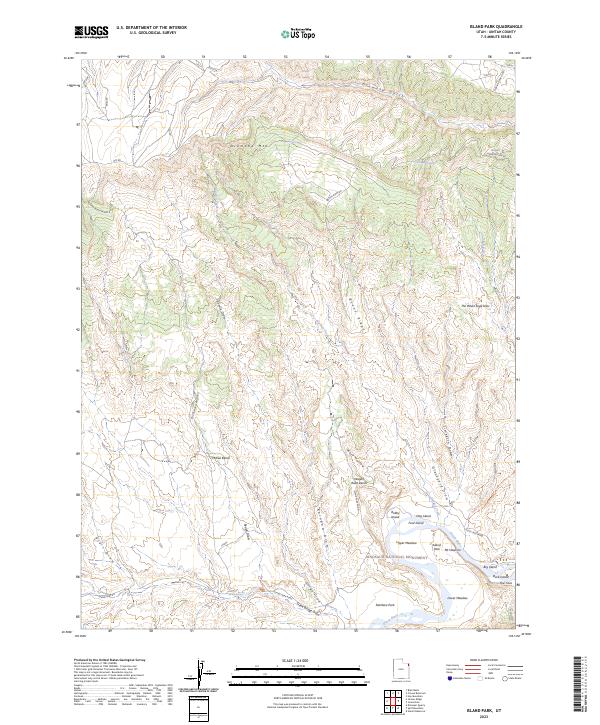
2023 Island Park
Uintah County, UT
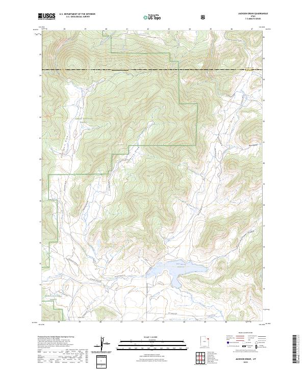
2023 Jackson Draw
Uintah County, UT
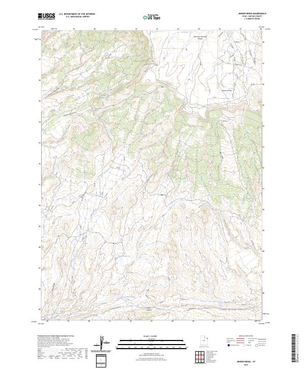
2023 Jensen Ridge
Uintah County, UT
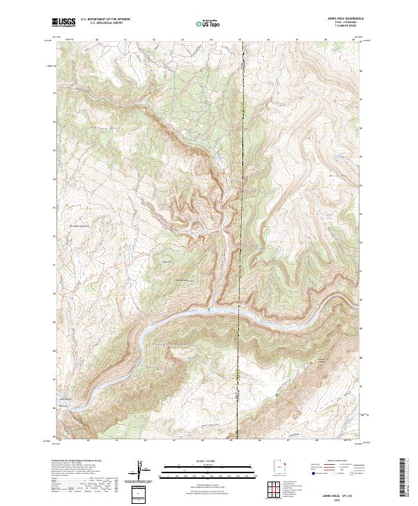
2023 Jones Hole
Uintah County, UT
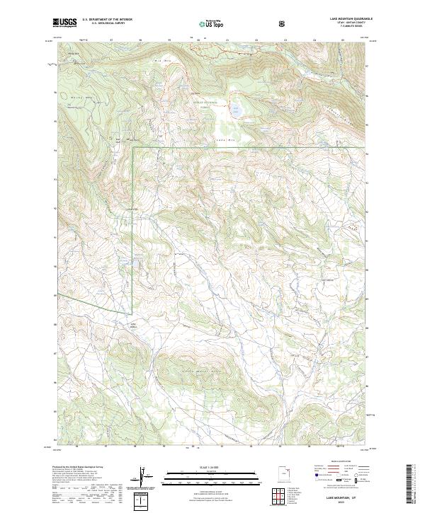
2023 Lake Mountain
Uintah County, UT
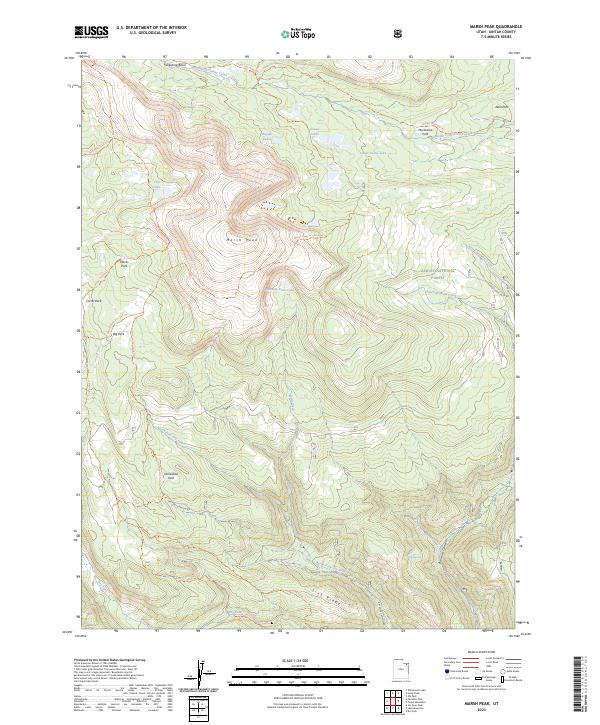
2023 Marsh Peak
Uintah County, UT
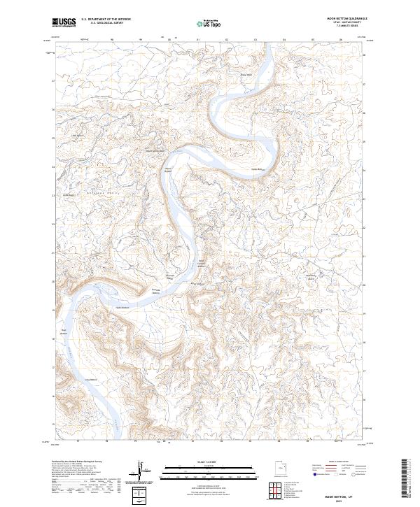
2023 Moon Bottom
Uintah County, UT
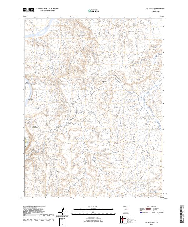
2023 Nutters Hole
Uintah County, UT
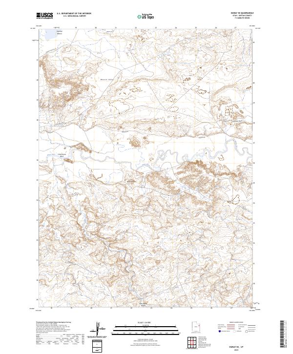
2023 Ouray SE
Uintah County, UT
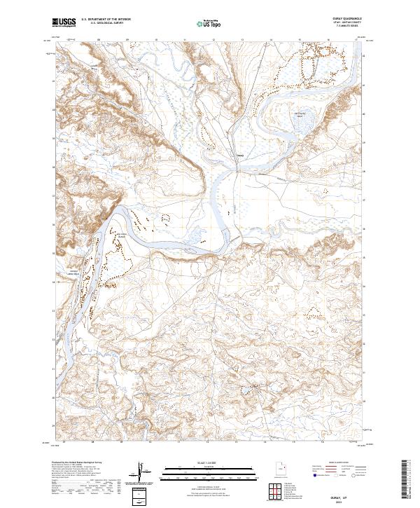
2023 Ouray
Uintah County, UT
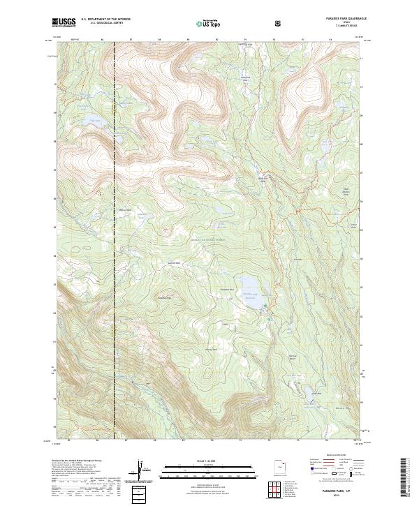
2023 Paradise Park
Uintah County, UT
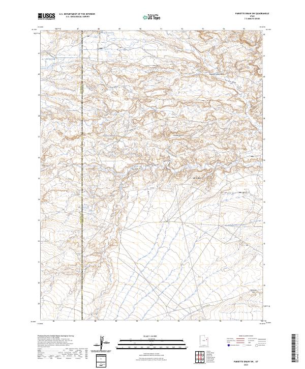
2023 Pariette Draw SW
Uintah County, UT
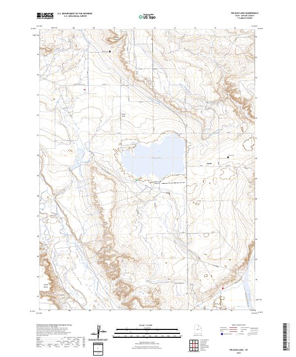
2023 Pelican Lake
Uintah County, UT
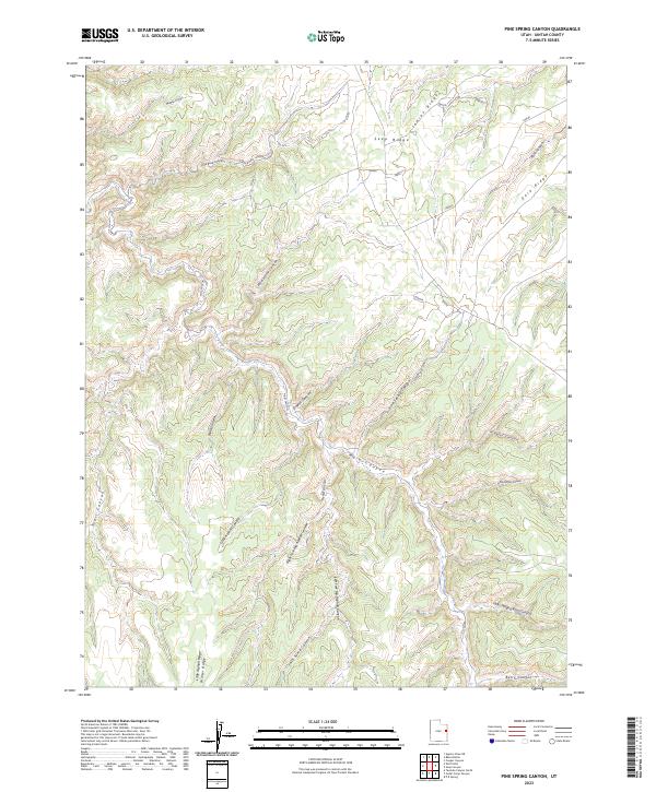
2023 Pine Spring Canyon
Uintah County, UT
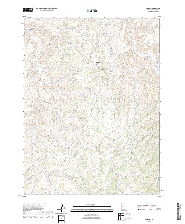
2023 Rainbow
Uintah County, UT
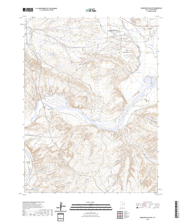
2023 Rasmussen Hollow
Uintah County, UT
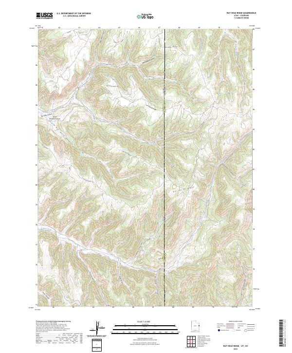
2023 Rat Hole Ridge
Uintah County, UT
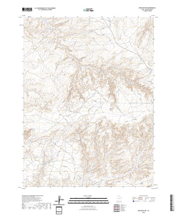
2023 Red Wash NW
Uintah County, UT
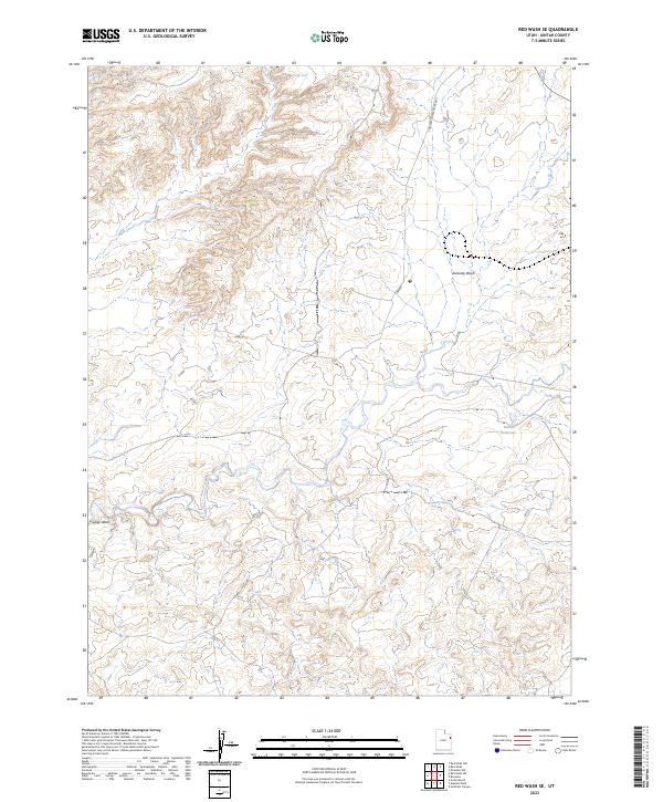
2023 Red Wash SE
Uintah County, UT
2023 Red Wash SW
Uintah County, UT
2023 Red Wash
Uintah County, UT
2023 Seep Canyon
Uintah County, UT
2023 Snake John Reef
Uintah County, UT
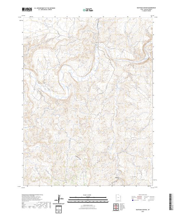
2023 Southam Canyon
Uintah County, UT
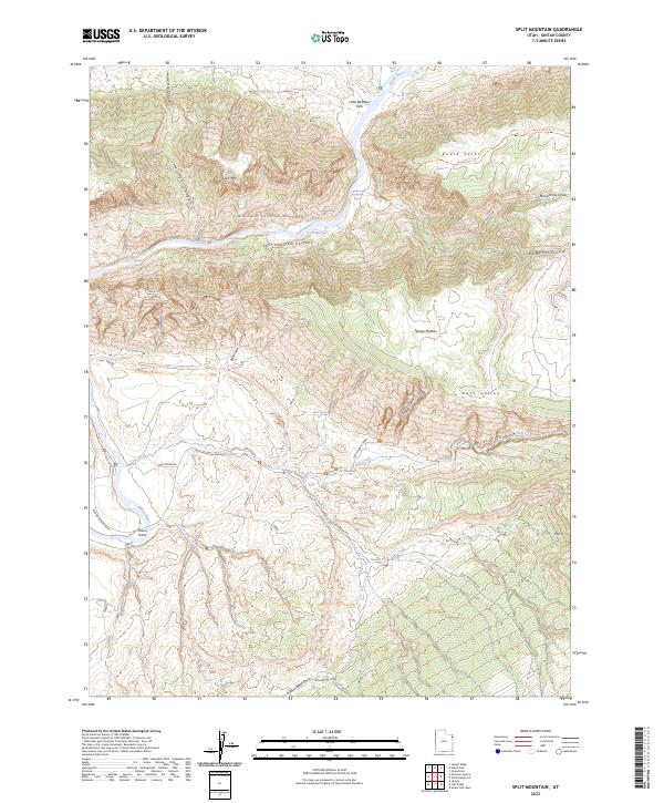
2023 Split Mountain
Uintah County, UT
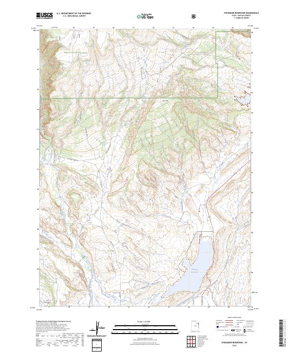
2023 Steinaker Reservoir
Uintah County, UT
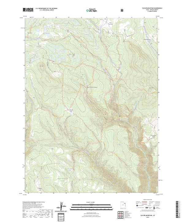
2023 Taylor Mountain
Uintah County, UT
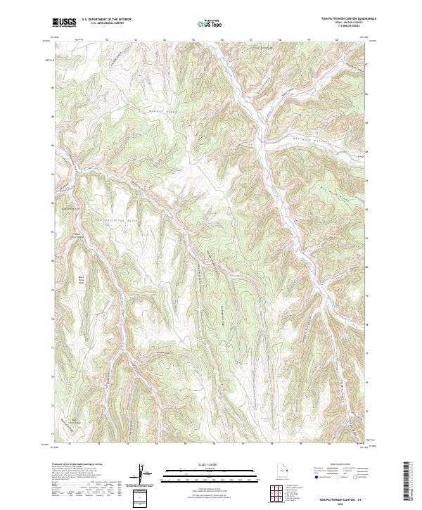
2023 Tom Patterson Canyon
Uintah County, UT
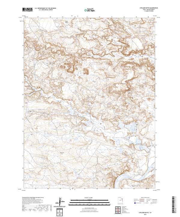
2023 Uteland Butte
Uintah County, UT
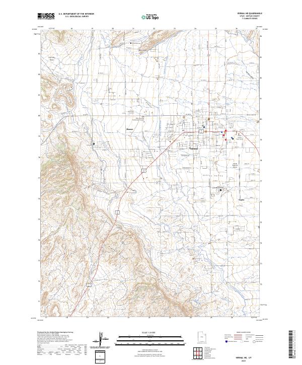
2023 Vernal NE
Uintah County, UT
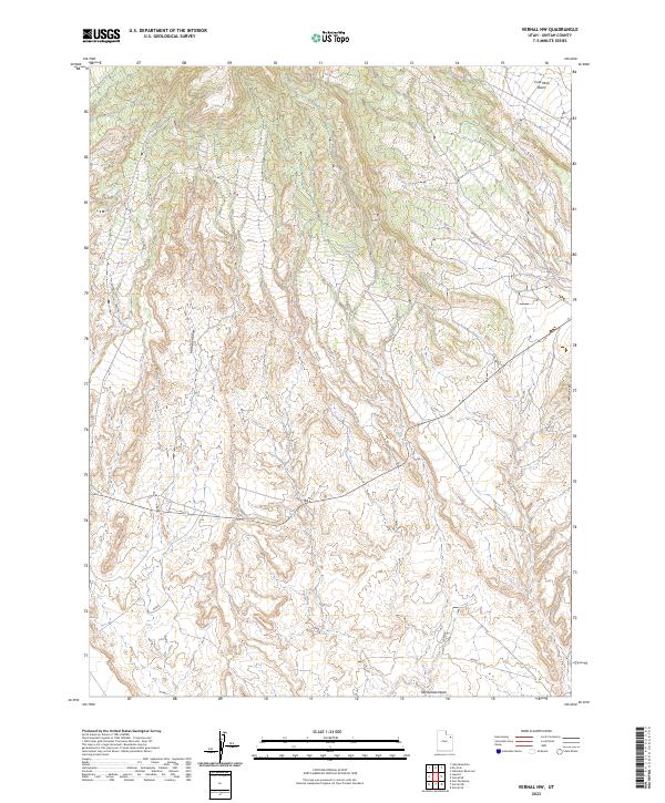
2023 Vernal NW
Uintah County, UT
2023 Vernal SE
Uintah County, UT
2023 Vernal SW
Uintah County, UT
2023 Walsh Knolls
Uintah County, UT
2023 Warren Draw
Uintah County, UT
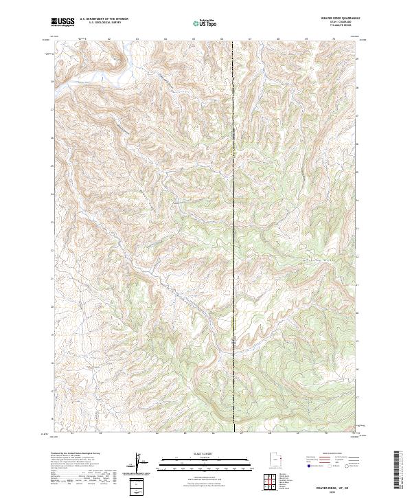
2023 Weaver Ridge
Uintah County, UT
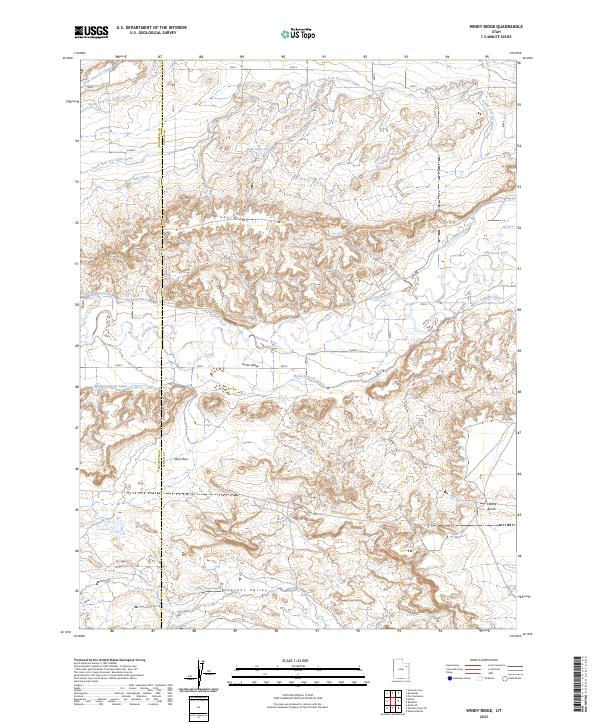
2023 Windy Ridge
Uintah County, UT
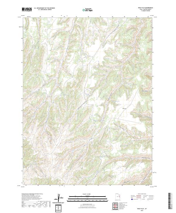
2023 Wolf Flat
Uintah County, UT
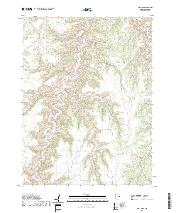
2023 Wolf Point
Uintah County, UT