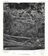
1975 Map of Johnsons Bayou
USGS Topo · Published 1976About this map
The coastal marshes of Cameron Parish appear in high-contrast detail in this 1975 orthophotoquad, which captures the unique chenier landscape along the Gulf of Mexico. The small settlement of Johnsons Bayou is visible as a scattered collection of structures and roads set against a complex network of wetlands and tidal channels. The image highlights the intricate relationship between the land and water, showing how local infrastructure follows the higher ridges of the cheniers to avoid the lower marshland. To the south, the winding course of Old East Bayou cuts through the terrain before meeting the coast. This rectified aerial imagery provides a clear look at the agricultural patterns and drainage canals that defined the region in the mid-1970s, making it a valuable tool for understanding the historical footprint of this coastal community before decades of shoreline change.
Find a feature on this map
3 named features on this map. Tap any name to fly to it.
Don’t see what you’re looking for? This feature index may not catch every label — zoom into the map to look around manually.
Map Details
Editions of this 1975 Johnsons Bayou Map
This is the sole edition of this map. No revisions or reprints were ever made.
Other maps of this area

1932 · Sabine Pass NE
USGS Topo · 1:31,680

1932 · Port Arthur NE
USGS Topo · 1:31,680

1934 · Johnsons Bayou
USGS Topo · 1:24,000

1934 · Peveto Beach
USGS Topo · 1:24,000

1934 · Greens Bayou
USGS Topo · 1:24,000

1934 · Five Lakes
USGS Topo · 1:24,000

1935 · Peveto Beach
USGS Topo · 1:31,680

1935 · Five Lakes
USGS Topo · 1:31,680

1935 · Greens Bayou
USGS Topo · 1:31,680

1935 · Johnsons Bayou
USGS Topo · 1:31,680