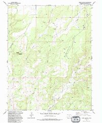
1994 Map of Negro Canyon
USGS Topo · Published 1994About this map
Hovenweep Nat Mon anchors this corner of Montezuma County, where the high desert plateau is deeply incised by a network of drainage systems. The presence of the Cutthroat Castle Group Ruins near the head of Hovenweep Canyon highlights the archaeological significance of this landscape, marking where ancient dwellings were established among the sandstone outcrops. The terrain is dominated by Mockingbird Mesa, a wide upland separated from the McLean Basin by the dramatic drops of Cajon Canyon.
Find a feature on this map
20 named features on this map. Tap any name to fly to it.
Don’t see what you’re looking for? This feature index may not catch every label — zoom into the map to look around manually.
Map Details
Editions of this 1994 Negro Canyon Map
This is the sole edition of this map. No revisions or reprints were ever made.
Other maps of this area

1886 · Abajo
USGS Topo · 1:250,000

1892 · Abajo
USGS Topo · 1:250,000

1893 · Abajo
USGS Topo · 1:250,000

1956 · Cortez
USGS Topo · 1:250,000

1957 · Moqui NW
USGS Topo · 1:24,000

1957 · Aneth 1 NE
USGS Topo · 1:24,000

1957 · Cedar 3 SW
USGS Topo · 1:24,000

1957 · Moqui SW
USGS Topo · 1:24,000

1957 · Moqui SE
USGS Topo · 1:24,000

1957 · Monument Canyon
USGS Topo · 1:62,500