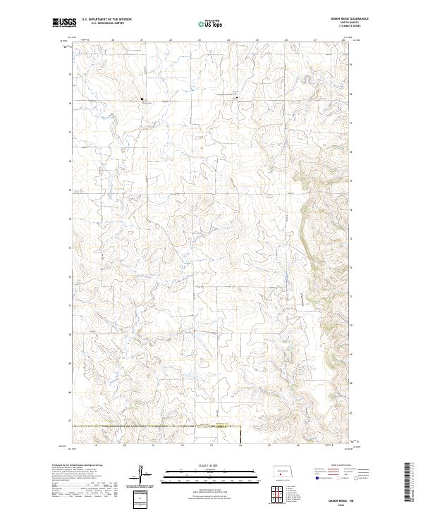
2024 Map of Green Ridge
USGS Topo · Published 2024About this map
Green Ridge rises as a prominent topographical feature in this section of the Great Plains, defining the high ground between the watercourses of the Missouri River plateau. The landscape is primarily shaped by the winding path of Beaver Creek, which cuts through the western half of the territory. This 2024 survey illustrates a rural environment defined by the Public Land Survey System, where sections are divided by a network of gravel and section-line roads such as Co Rd 84 and Co Rd 137. Local heritage is centered around the Bethel Church and its accompanying Bethel Church Cem, alongside the Zion Evangelical Lutheran Cem to the northeast. These sites, situated near the border of Morton and Grant Counties, serve as the primary landmarks for genealogists tracing the settlement patterns of this agrarian region.
Find a feature on this map
22 named features on this map. Tap any name to fly to it.
Don’t see what you’re looking for? This feature index may not catch every label — zoom into the map to look around manually.
Map Details
Editions of this 2024 Green Ridge Map
This is the sole edition of this map. No revisions or reprints were ever made.
Other maps of this area

1954 · Bismarck
USGS Topo · 1:250,000

1958 · Bismarck
USGS Topo · 1:250,000

1960 · New Salem
USGS Topo · 1:24,000

1970 · Judson
USGS Topo · 1:24,000

1972 · Sweet Briar
USGS Topo · 1:24,000

1980 · Otter Creek West
USGS Topo · 1:24,000

1980 · Green Ridge
USGS Topo · 1:24,000

1980 · Otter Creek East
USGS Topo · 1:24,000

1980 · Almont East
USGS Topo · 1:24,000
1980 · Fish Creek Lake
USGS Topo · 1:24,000