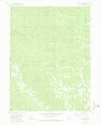
1980 Map of Gore Mountain
USGS Topo · Published 1980About this map
Routt National Forest and Arapaho National Forest meet across high mountain terrain on this 1980 survey, which highlights the drainage systems of the Colorado wilderness. The landscape is defined by the peak of Gore Mountain and a complex network of watercourses including Morrison Creek, Rock Creek, and Service Creek. Transportation in this era was limited to rudimentary paths, indicated by a Pack Trail in the southwest and several instances of Foot Trail and Jeep Trail winding through the northern and eastern sections. The boundary between Routt Co and Grand Co is clearly delineated as it traverses the ridges. This map captures the area before modern development, showing only the primitive routes used by foresters and early recreationists to reach remote Springs and the various forks of the mountain streams.
Find a feature on this map
15 named features on this map. Tap any name to fly to it.
Don’t see what you’re looking for? This feature index may not catch every label — zoom into the map to look around manually.
Map Details
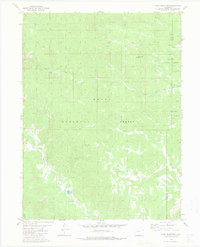
Editions of this 1980 Gore Mountain Map
2 editions found
Other maps of this area

1954 · Craig
USGS Topo · 1:250,000

1956 · Lake Agnes
USGS Topo · 1:24,000

1956 · Walton Peak
USGS Topo · 1:24,000

1956 · Gore Pass
USGS Topo · 1:62,500

1956 · Rabbit Ears Peak
USGS Topo · 1:62,500

1957 · Craig
USGS Topo · 1:250,000

1958 · Craig
USGS Topo · 1:250,000

1960 · Craig
USGS Topo · 1:250,000

1962 · Craig
USGS Topo · 1:250,000

1964 · Craig
USGS Topo · 1:250,000