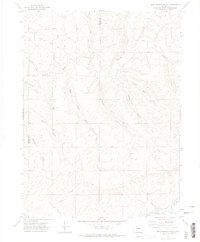
1971 Map of Rock Spring Gulch
USGS Topo · Published 1974About this map
The Yampa River corridor and its complex network of drainage gulches define this area of northwestern Colorado. The terrain is a maze of named geographic features, from the northern reaches of Little Cottonwood Creek and Elkhead Creek down to the southern confluence points. The map documents the shared boundary between Moffat County and Routt County, which zig-zags across the landscape following topographic ridges. This 1971 survey captures the area's essential hydrology and early infrastructure, including a Radio Tower and Water Tank, illustrating how water management and communication were established in this stretch of the Colorado high country. Researchers will find numerous named landmarks such as Jimmy Dunn Gulch, Cary Gulch, and Maynard Gulch, providing clear evidence of local place-naming traditions tied to early residents or specific land uses.
Find a feature on this map
20 named features on this map. Tap any name to fly to it.
Don’t see what you’re looking for? This feature index may not catch every label — zoom into the map to look around manually.
Map Details
Editions of this 1971 Rock Spring Gulch Map
This is the sole edition of this map. No revisions or reprints were ever made.
Other maps of this area

1916 · Daton Peak
USGS Topo · 1:62,500

1920 · Daton Peak
USGS Topo · 1:62,500

1923 · Elkhead Creek
USGS Topo · 1:62,500

1923 · Pilot Knob
USGS Topo · 1:62,500

1924 · Elkhead Creek
USGS Topo · 1:62,500

1924 · Mt. Harris
USGS Topo · 1:48,000

1925 · Pilot Knob
USGS Topo · 1:62,500

1926 · Mount Harris
USGS Topo · 1:62,500

1954 · Craig
USGS Topo · 1:250,000

1957 · Craig
USGS Topo · 1:250,000