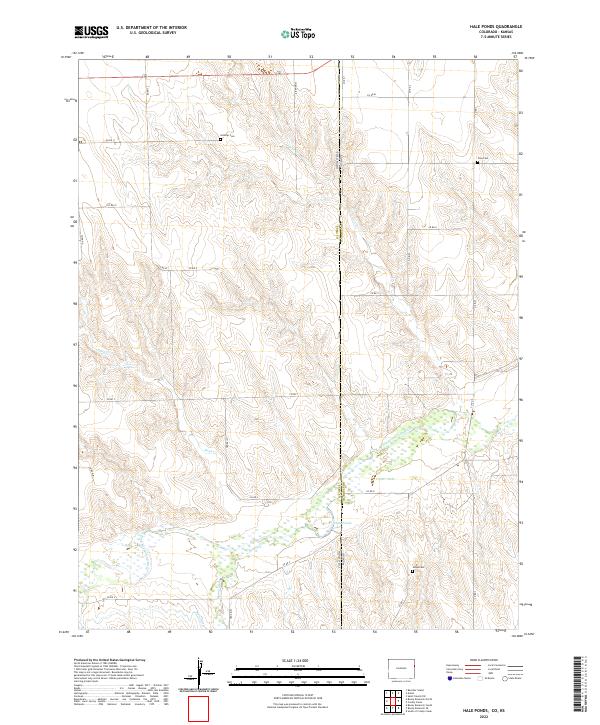
2022 Map of Hale Ponds
USGS Topo · Published 2022About this map
The borderlands of the High Plains are defined by the convergence of water and boundary lines, where Colorado and Kansas meet along the Yuma County and Cheyenne County line. This landscape is shaped by the S Fork Republican River, which feeds into the managed waters of Corder Lake and the distinctive Hale Ponds. The agricultural history of the region is evident in the path of the Hale Ditch and a network of section-line roads, such as Co RD 4 and Co RD 11, which connect isolated homesteads to the land. Genealogists can trace early settlers through several preserved burial sites scattered across the plains, including Gilstrap Cem in the north and Jaqua Cem to the south. The drainage patterns of Cowpe Cr, Sand Cr, and Bonny Creek illustrate the natural hydrology that dictated settlement patterns in this semi-arid environment.
Find a feature on this map
36 named features on this map. Tap any name to fly to it.
Don’t see what you’re looking for? This feature index may not catch every label — zoom into the map to look around manually.
Map Details
Editions of this 2022 Hale Ponds Map
This is the sole edition of this map. No revisions or reprints were ever made.
Other maps of this area

1942 · St. Francis
USGS Topo · 1:62,500

1943 · St. Francis
USGS Topo · 1:62,500

1950 · Bonny Reservoir
USGS Topo · 1:62,500

1951 · St Francis
USGS Topo · 1:62,500

1952 · St Francis 3
USGS Topo · 1:62,500

1954 · Limon
USGS Topo · 1:250,000

1954 · Goodland
USGS Topo · 1:250,000

1956 · Goodland
USGS Topo · 1:250,000

1957 · Limon
USGS Topo · 1:250,000

1957 · Goodland
USGS Topo · 1:250,000