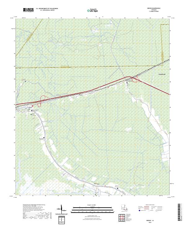
2024 Map of Gibson
USGS Topo · Published 2024About this map
The confluence of waterways and wetlands in southwestern Lafourche Parish and northern Terrebonne Parish defines the landscape surrounding Gibson. This area is characterized by a network of drainage systems and natural bayous that dictated the historic settlement pattern, with communities like Donner and Chacahoula situated along established corridors. The map records numerous ecclesiastical landmarks and burial sites, including the Saint Patrick Catholic Cem and the Triumph Baptist Church Cem, which serve as vital touchstones for family historians tracing roots in these Cajun parishes. To the east, the Terrebonne-Lafourche Drainage Canal runs through the marshy terrain, while residential developments such as Oak Forest appear along the banks of Bayou Black. The survey also documents significant transportation routes like Bull Run Rd and Parish Rd 15 that cut through the low-lying wetlands.
Find a feature on this map
48 named features on this map. Tap any name to fly to it.
Don’t see what you’re looking for? This feature index may not catch every label — zoom into the map to look around manually.
Map Details
Editions of this 2024 Gibson Map
This is the sole edition of this map. No revisions or reprints were ever made.
Other maps of this area

1892 · Gibson
USGS Topo · 1:62,500

1892 · Thibodaux
USGS Topo · 1:62,500

1897 · Gibson
USGS Topo · 1:62,500

1932 · Thibodaux SE
USGS Topo · 1:31,680

1932 · Thibodaux SW
USGS Topo · 1:31,680

1935 · Morgan City
USGS Topo · 1:62,500

1938 · Labadieville
USGS Topo · 1:24,000
1938 · Lafourche
USGS Topo · 1:24,000

1939 · Gibson
USGS Topo · 1:62,500
1940 · Lafourche
USGS Topo · 1:31,680