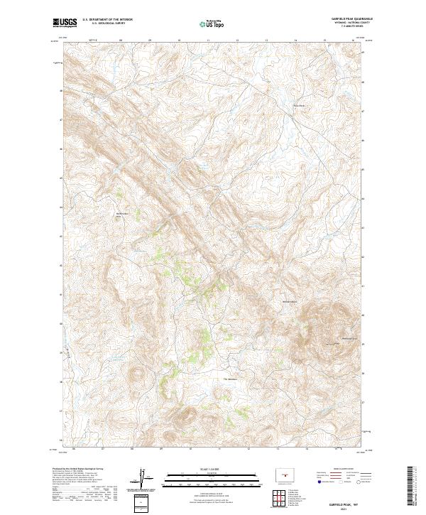
2021 Map of Garfield Peak
USGS Topo · Published 2021About this map
Garfield Peak rises as a prominent landmark in the Rattlesnake Hills of Natrona County, where the high desert terrain is marked by a complex network of seasonal drainages and small basins. The hydrology of the area is defined by features such as Middle Fork Casper Cr and the Six Mile Reservoir, reflecting the necessity of water management in this arid landscape. Named landmarks like McKenzie Boggs and Rhobaugh Draw suggest a history of local land use and ranching, while Fales Rocks and the Woodard Basin provide geological variety across the township lines. The placement of Lady Emma Reservoir near Dry Cr further illustrates the pastoral development that has long characterized this portion of Wyoming's central plateau.
Find a feature on this map
27 named features on this map. Tap any name to fly to it.
Don’t see what you’re looking for? This feature index may not catch every label — zoom into the map to look around manually.
Map Details
Editions of this 2021 Garfield Peak Map
This is the sole edition of this map. No revisions or reprints were ever made.
Other maps of this area

1952 · Ervay Basin SW
USGS Topo · 1:24,000

1952 · Ervay Basin
USGS Topo · 1:24,000

1955 · Casper
USGS Topo · 1:250,000

1958 · Casper
USGS Topo · 1:250,000

1959 · Broad Mesa
USGS Topo · 1:24,000
1959 · Mc Rae Gap
USGS Topo · 1:24,000
1959 · Stinking Water Creek
USGS Topo · 1:24,000

1959 · Saddle Rock
USGS Topo · 1:24,000

1959 · Blackjack Ranch
USGS Topo · 1:24,000

1959 · Barlow Gap
USGS Topo · 1:24,000