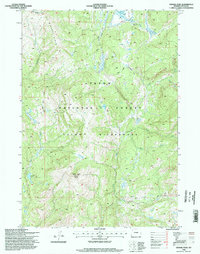
1996 Map of Gravel Peak
USGS Topo · Published 1998About this map
Big Game Ridge and the high-altitude drainage systems of the Teton National Forest define this 1996 survey of the Wyoming wilderness. The map captures a primitive landscape where human presence is limited to the Fox Park Patrol Cabin and a network of remote paths including the South Boundary Trail and Mink Creek Cutoff Trail. A complex hydrography of creeks, such as Fox Park Creek, Mink Creek, and Pacific Creek, feeds into the headwaters of the Snake River. This specific area within the Teton Wilderness reflects the mid-1990s conservation management of the Forest Service, featuring specialized points of interest like the FS Radio Repeater near the summit of Gravel Peak and secluded water bodies like Emerald Lake and Gravel Lake.
Find a feature on this map
21 named features on this map. Tap any name to fly to it.
Don’t see what you’re looking for? This feature index may not catch every label — zoom into the map to look around manually.
Map Details
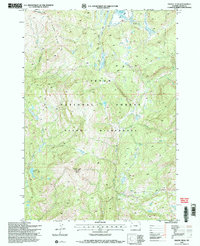
Editions of this 1996 Gravel Peak Map
2 editions found
Other maps of this area

1885 · Lake
USGS Topo · 1:125,000

1895 · Lake
USGS Topo · 1:125,000

1896 · Lake
USGS Topo · 1:125,000

1901 · Lake
USGS Topo · 1:125,000

1902 · Mt Leidy
USGS Topo · 1:125,000

1906 · Lake
USGS Topo · 1:125,000

1911 · Lake
USGS Topo · 1:125,000

1955 · Ashton
USGS Topo · 1:250,000

1955 · Driggs
USGS Topo · 1:250,000

1958 · Driggs
USGS Topo · 1:250,000