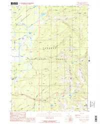
1989 Map of Hominy Peak
USGS Topo · Published 1989About this map
Hominy Peak and the high basins of Teton County define this mountain landscape in the late 1980s, where three major wilderness and park boundaries converge. The area is a complex drainage system centered on Boone Creek and its many branches, including the Middle Fork and South Fork, which carve through the Targhee National Forest and the Jedediah Smith Wilderness.
Find a feature on this map
34 named features on this map. Tap any name to fly to it.
Don’t see what you’re looking for? This feature index may not catch every label — zoom into the map to look around manually.
Map Details
Editions of this 1989 Hominy Peak Map
2 editions found
Other maps of this area

1886 · Shoshone
USGS Topo · 1:125,000

1888 · Shoshone
USGS Topo · 1:125,000

1895 · Shoshone
USGS Topo · 1:125,000

1899 · Grand Teton
USGS Topo · 1:125,000

1901 · Shoshone
USGS Topo · 1:125,000

1901 · Grand Teton
USGS Topo · 1:125,000

1908 · Shoshone
USGS Topo · 1:125,000

1911 · Shoshone
USGS Topo · 1:125,000

1955 · Ashton
USGS Topo · 1:250,000

1955 · Driggs
USGS Topo · 1:250,000