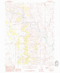
1985 Map of Grassy
USGS Topo · Published 1985About this map
The Price River carves a complex, meandering path through this high desert terrain in Emery County, serving as the dominant geographic feature of the landscape. Along the eastern edge of the quadrangle, the Denver and Rio Grande Western RR follows a more linear course, providing a critical transportation link through the Grassy area. The topographic detail highlights a series of significant drainage systems, including Coleman Wash, Humbug Wash, and Summerville Wash, which define the erosion patterns across Humbug Flats. Landforms such as Sugarloaf and Cliff 5358 rise above the surrounding washes, while the curiously named Neuversweat area suggests local nomenclature tied to the difficulty of the terrain. This 1980s-era survey documents the intersection of rail infrastructure and the naturally winding watercourses that have shaped this portion of the Utah interior.
Find a feature on this map
18 named features on this map. Tap any name to fly to it.
Don’t see what you’re looking for? This feature index may not catch every label — zoom into the map to look around manually.
Map Details
Editions of this 1985 Grassy Map
This is the sole edition of this map. No revisions or reprints were ever made.
Other maps of this area

1886 · Price River
USGS Topo · 1:250,000

1896 · Price River
USGS Topo · 1:250,000

1948 · Woodside
USGS Topo · 1:62,500

1949 · Woodside
USGS Topo · 1:62,500

1950 · Woodside
USGS Topo · 1:62,500

1956 · Price
USGS Topo · 1:250,000

1960 · Price
USGS Topo · 1:250,000

1962 · Price
USGS Topo · 1:250,000
1969 · Dry Mesa
USGS Topo · 1:24,000
1969 · Chimney Rock
USGS Topo · 1:24,000