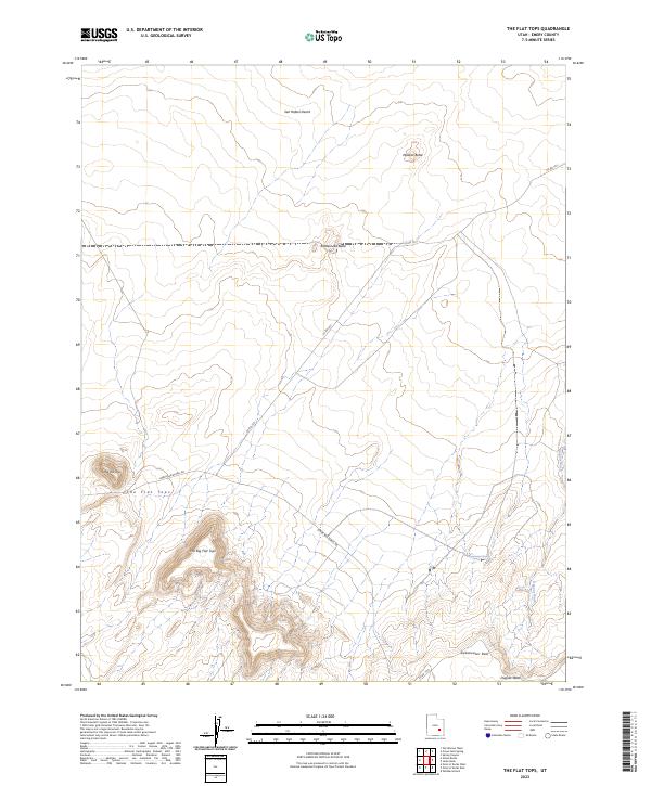
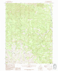
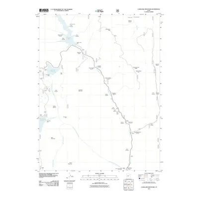
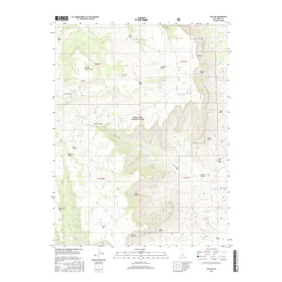
2023 Map of The Flat Tops
USGS Topo · Published 2023About this map
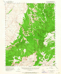
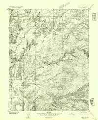
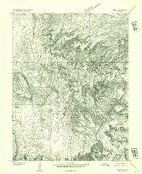
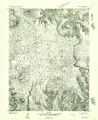
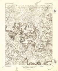
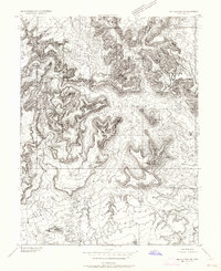
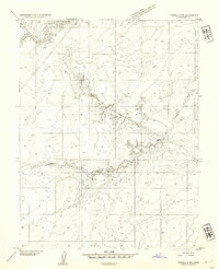
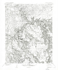
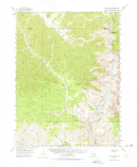
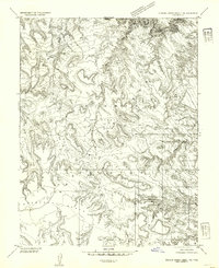
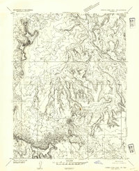
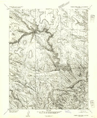
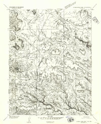
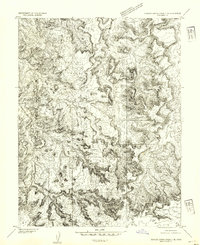
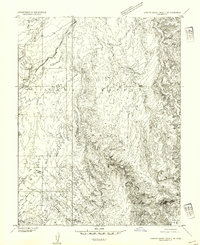
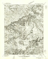
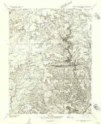
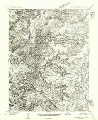
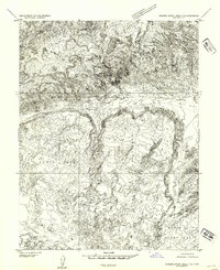
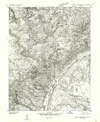
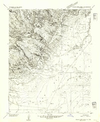
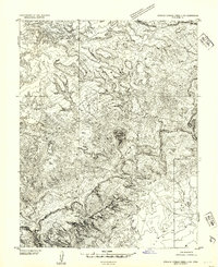
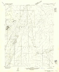
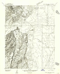
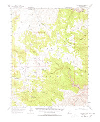
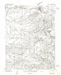
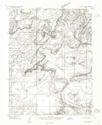
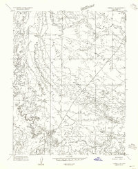
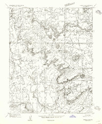
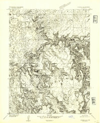
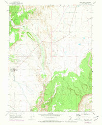
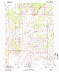
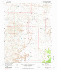
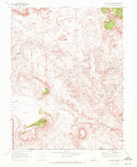
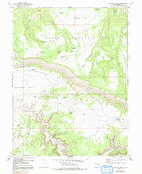
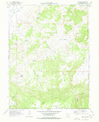
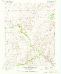
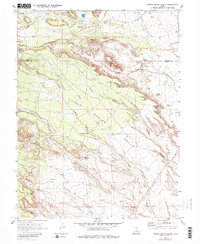
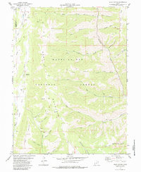
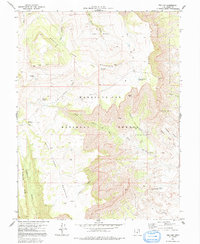
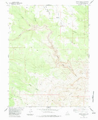
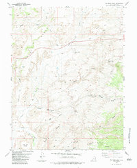
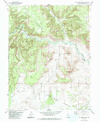
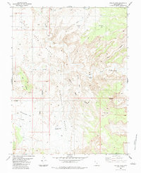
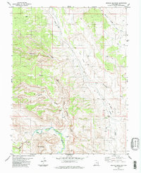
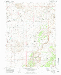
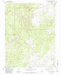
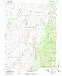
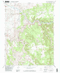
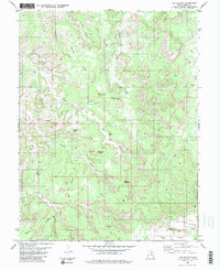
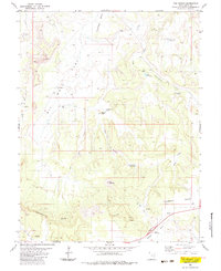
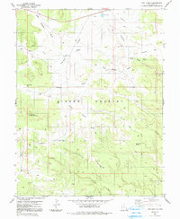
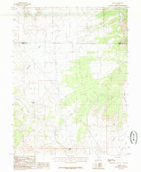
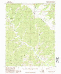
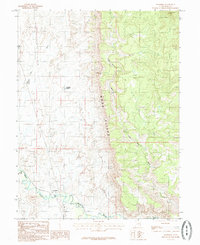
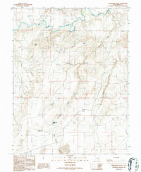
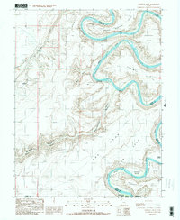
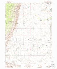
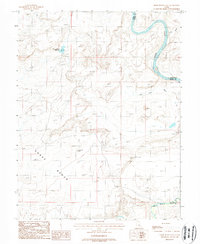
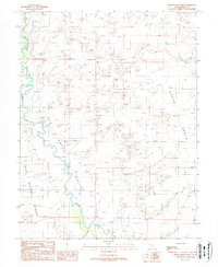
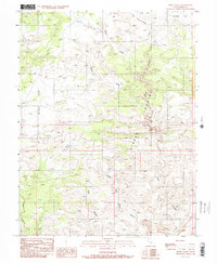
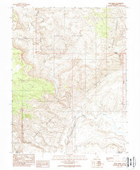
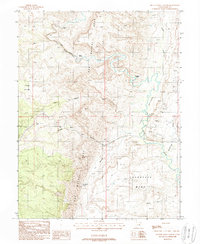
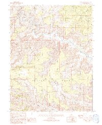
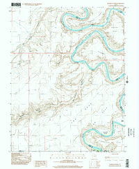
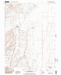
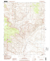
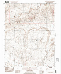
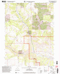
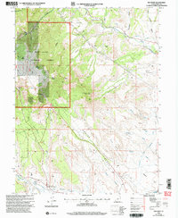
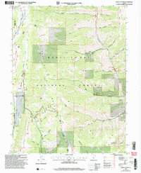
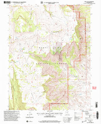
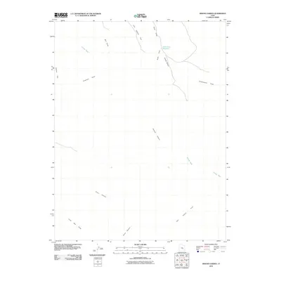
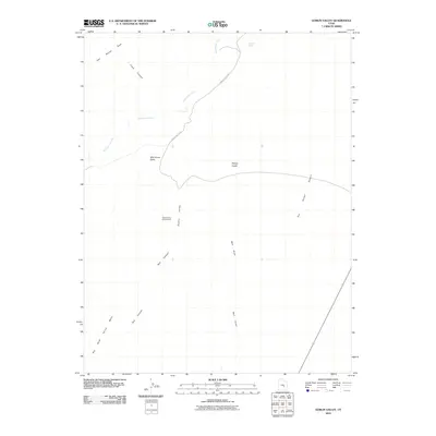
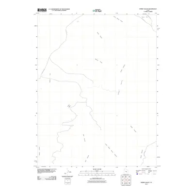
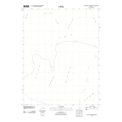
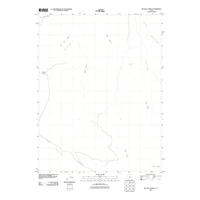
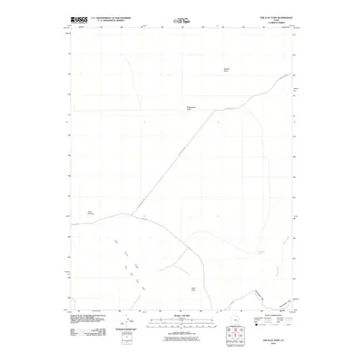
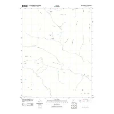
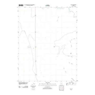
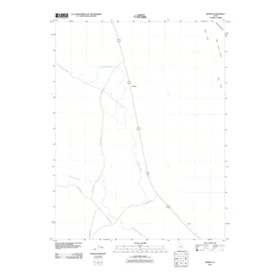
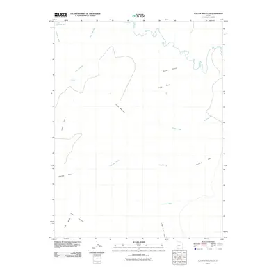
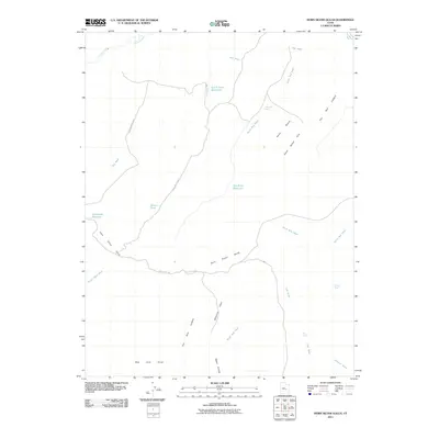
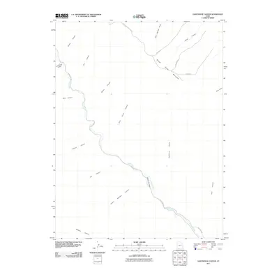
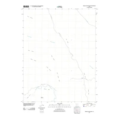
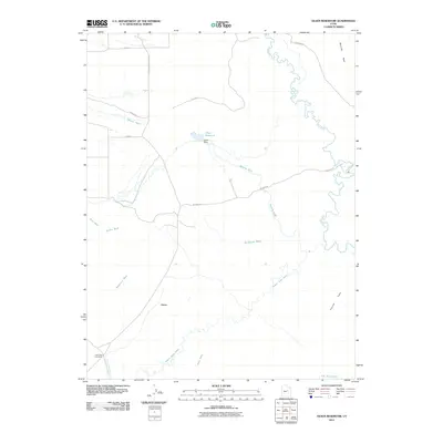
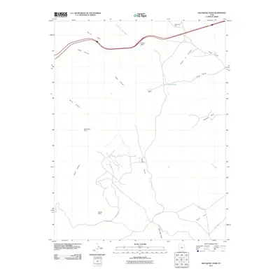
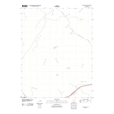
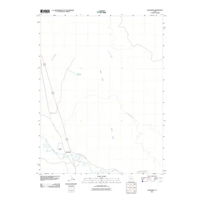
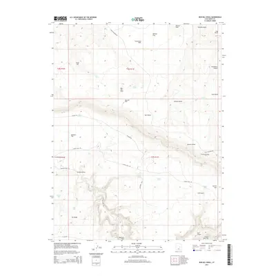
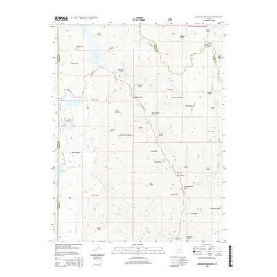
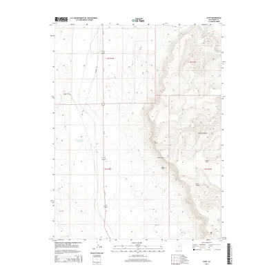
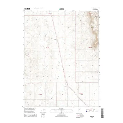
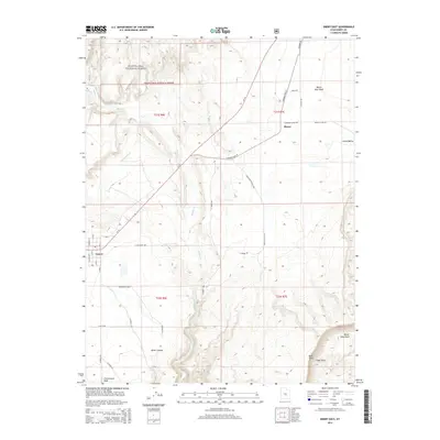
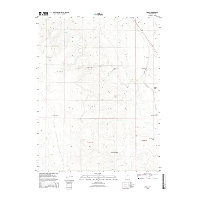
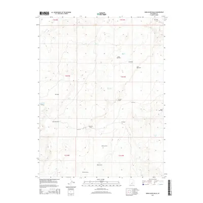
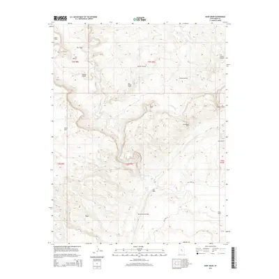
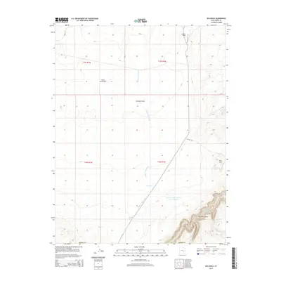
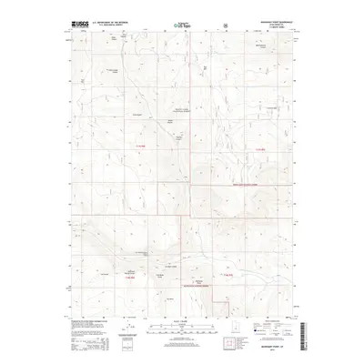
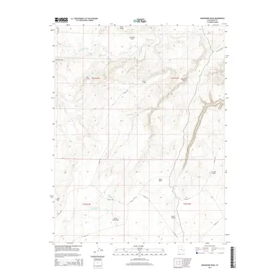
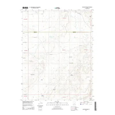
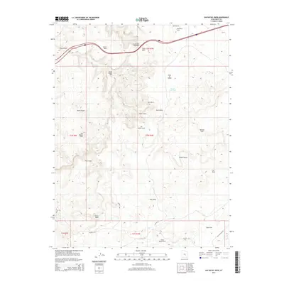
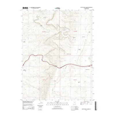
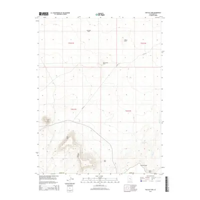
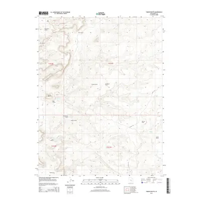
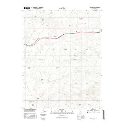
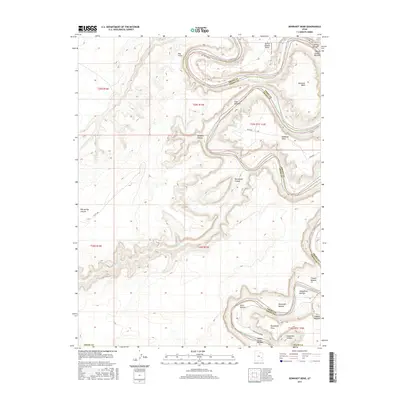
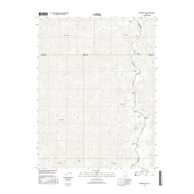
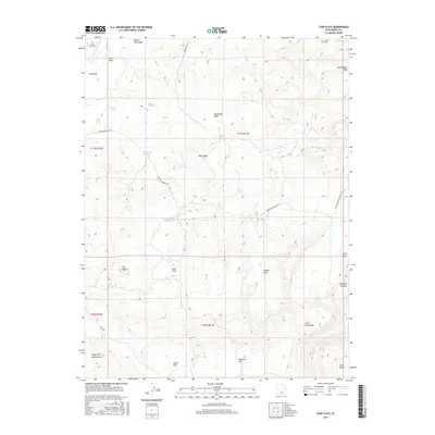
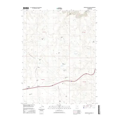
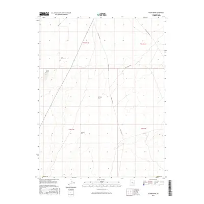
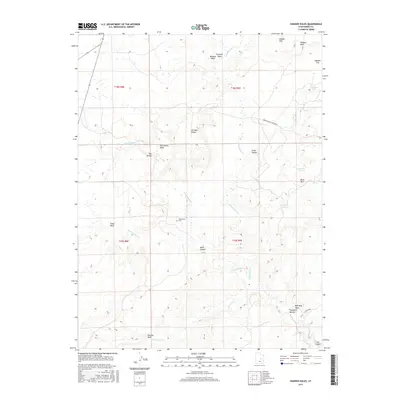
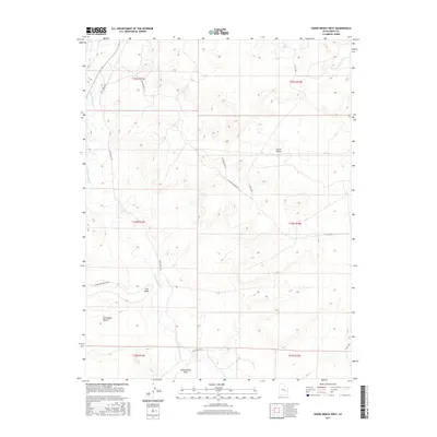
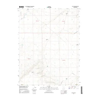
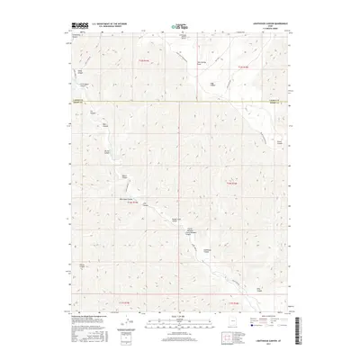
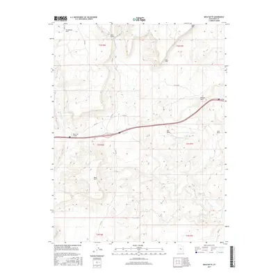
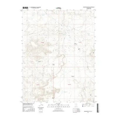
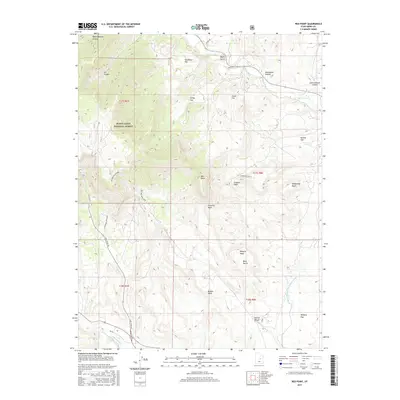
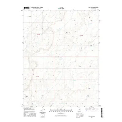
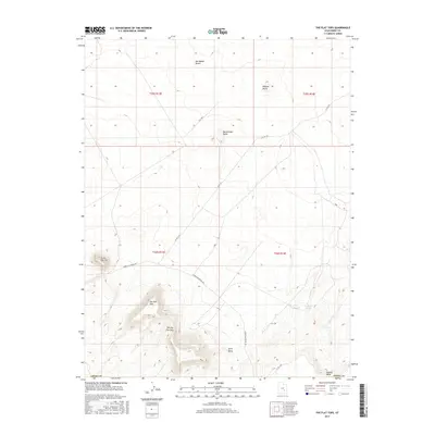
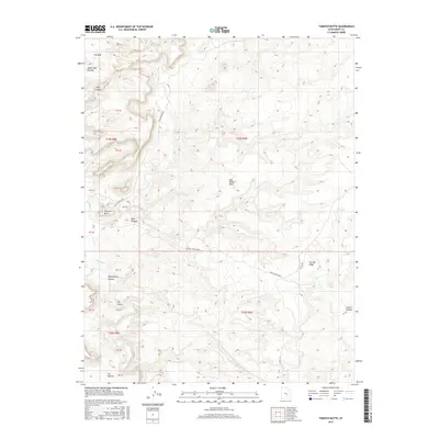
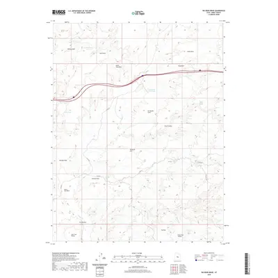
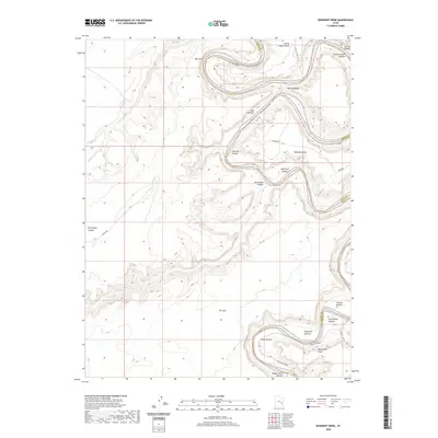
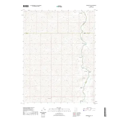
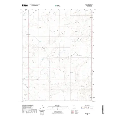
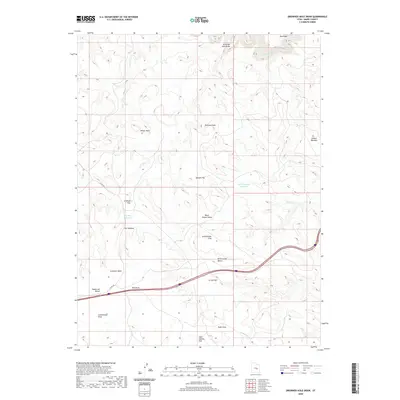
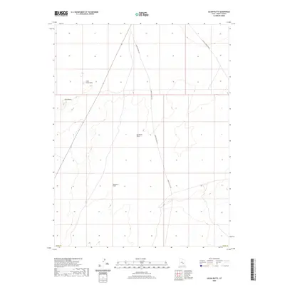
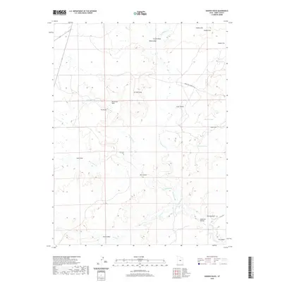
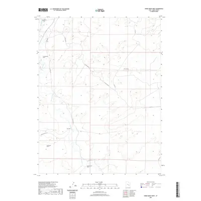
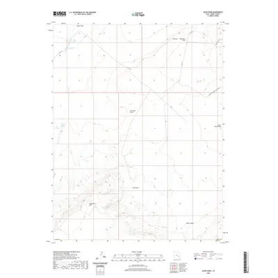
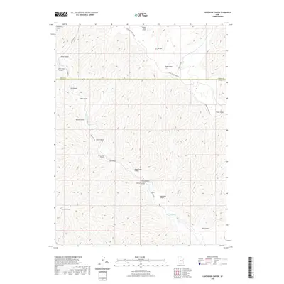
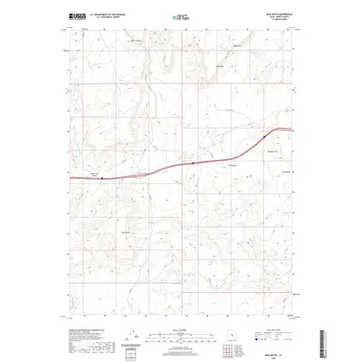
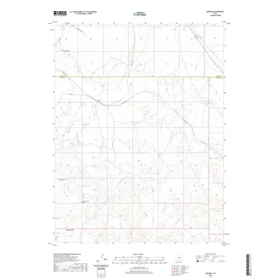
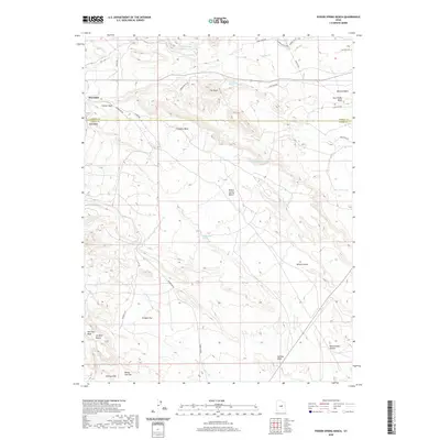
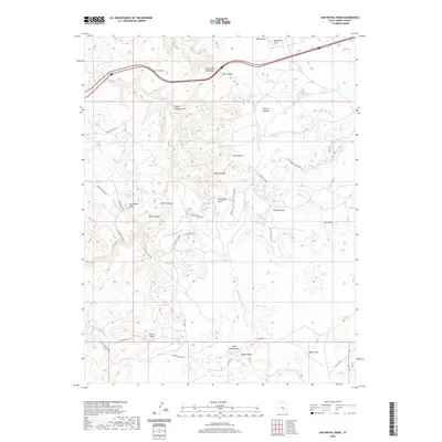
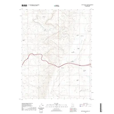
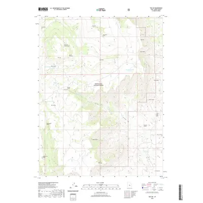
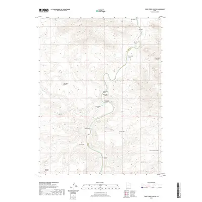
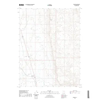
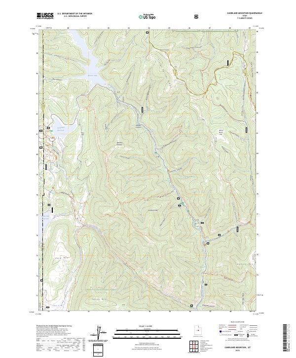
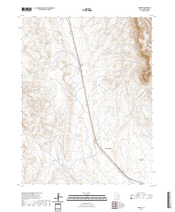
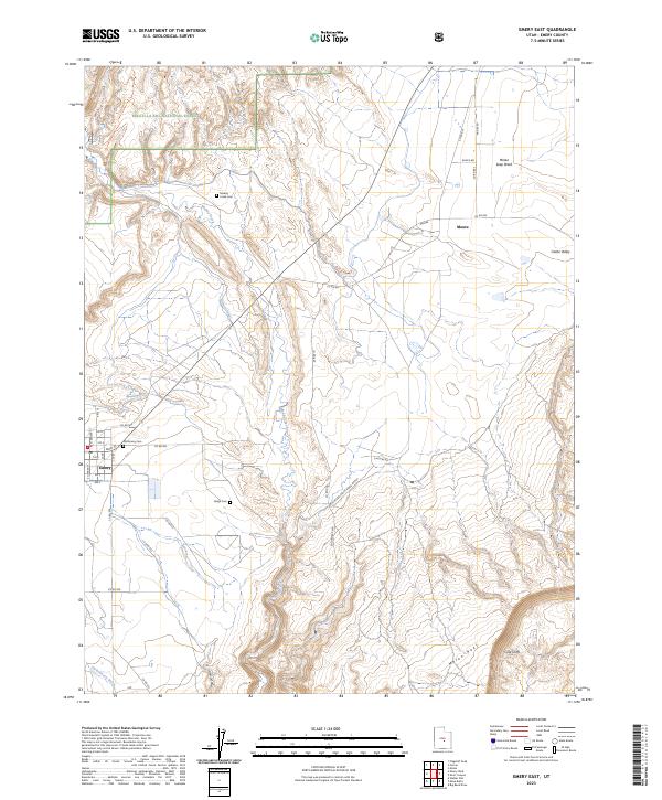
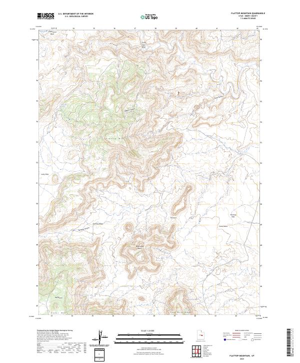
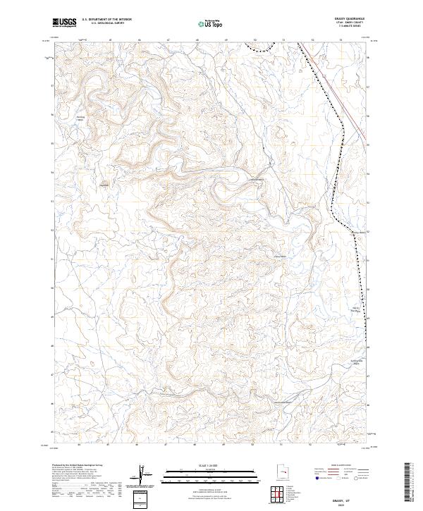
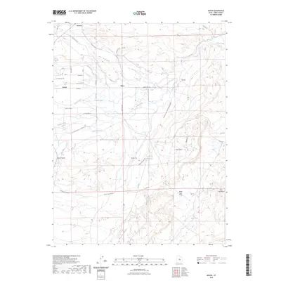
The Flat Tops rise from the arid floor of the San Rafael Desert in Emery County, Utah, providing a distinct profile in a landscape defined by dramatic elevation changes. This modern survey illustrates the remote desert terrain, where topographic features like Wildcat Butte and Rattlesnake Butte serve as primary navigational landmarks. The map tracks the passage of Lower San Rafael Rd and several backcountry routes such as Co RD 1011 as they navigate the ridges and washes of the high plateau. Along the southern reaches, the prominent Sweetwater Reef overlooks Sweetwater Spring, a critical water source in this dry environment. The detail captured here reflects the intricate drainages of Dugout Wash and the varied summits of The Big Flat Tops, highlighting how the natural geography dictates the movement of people and livestock across these public lands.
Find a feature on this map
12 named features on this map. Tap any name to fly to it.
Don’t see what you’re looking for? This feature index may not catch every label — zoom into the map to look around manually.
Map Details
Editions of this 2023 The Flat Tops Map
This is the sole edition of this map. No revisions or reprints were ever made.
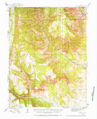
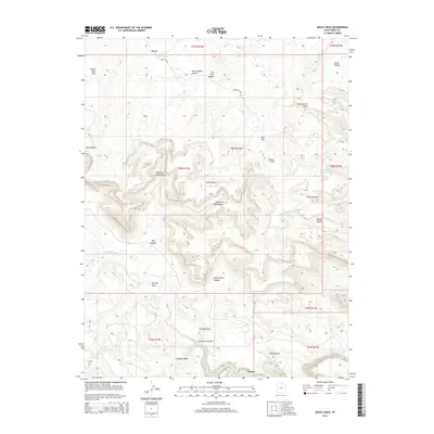
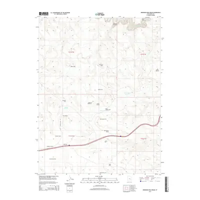
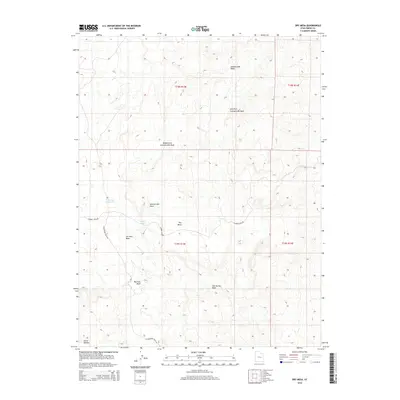
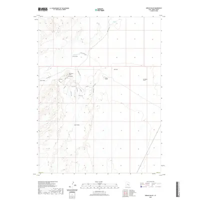
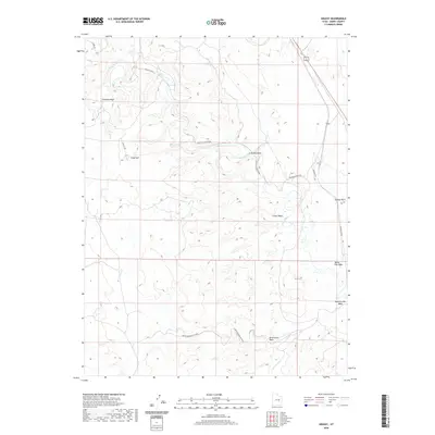
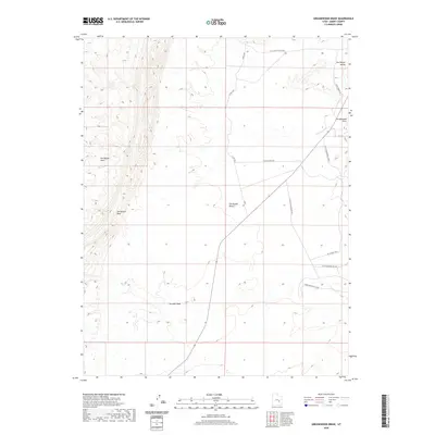
Historical Maps of Emery County Through Time
482 maps found
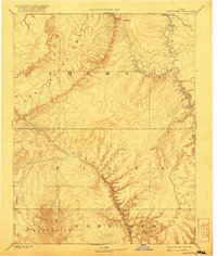
1885 San Rafael
Emery County, UT
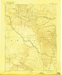
1886 Price River
Emery County, UT

1896 Price River
Emery County, UT
1923 Hiawatha
Emery County, UT

1925 Hiawatha
Emery County, UT

1948 Woodside
Emery County, UT

1949 Woodside
Emery County, UT

1950 Woodside
Emery County, UT
1952 San Rafael Knob
Emery County, UT

1952 Tidwell 4 SE
Emery County, UT
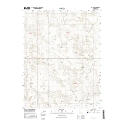
1952 Wild Horse
Emery County, UT
1953 Beckwith Peak SW
Emery County, UT
1953 Emery 1 NE
Emery County, UT
1953 Emery 1 SE
Emery County, UT
1953 Emery 4 NE
Emery County, UT
1953 Emery 4 SE
Emery County, UT
1953 Red Plateau SE
Emery County, UT
1953 Red Plateau SW
Emery County, UT
1953 Stinking Spring Creek 2 SE
Emery County, UT
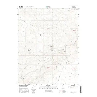
1953 Temple Mtn
Emery County, UT

1953 Tidwell 2 NW
Emery County, UT
1953 Tidwell 2 SW
Emery County, UT
1953 Tidwell 3 NW
Emery County, UT
1953 Wilsonville SE
Emery County, UT
1954 Range Creek
Emery County, UT
1954 Stinking Spring Creek 1 NE
Emery County, UT
1954 Stinking Spring Creek 1 NW
Emery County, UT
1954 Stinking Spring Creek 1 SE
Emery County, UT
1954 Stinking Spring Creek 1 SW
Emery County, UT
1954 Stinking Spring Creek 2 NE
Emery County, UT
1954 Stinking Spring Creek 2 NW
Emery County, UT
1954 Stinking Spring Creek 2 SW
Emery County, UT
1954 Stinking Spring Creek 3 NE
Emery County, UT
1954 Stinking Spring Creek 3 NW
Emery County, UT
1954 Stinking Spring Creek 3 SE
Emery County, UT
1954 Stinking Spring Creek 3 SW
Emery County, UT
1954 Stinking Spring Creek 4 NE
Emery County, UT
1954 Stinking Spring Creek 4 NW
Emery County, UT
1954 Stinking Spring Creek 4 SE
Emery County, UT
1954 Stinking Springs Creek 4 SW
Emery County, UT
1954 The Wickiup
Emery County, UT
1954 Tidwell 1 NW
Emery County, UT
1954 Tidwell 1 SW
Emery County, UT
1954 Tidwell 2 NE
Emery County, UT
1954 Tidwell 2 SE
Emery County, UT
1954 Tidwell Bottoms
Emery County, UT
1954 Wilsonville SE
Emery County, UT
1963 Bowknot Bend
Emery County, UT
1963 Gunnison Butte
Emery County, UT
1963 The Flat Tops
Emery County, UT
1968 Emery East
Emery County, UT
1968 Mesa Butte
Emery County, UT
1968 Mussentuchit Flat
Emery County, UT
1968 Salvation Creek
Emery County, UT
1969 Bob Hill Knoll
Emery County, UT
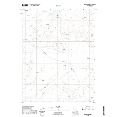
1969 Buckhorn Reservoir
Emery County, UT
1969 Chimney Rock
Emery County, UT
1969 Cliff
Emery County, UT
1969 Cow Flats
Emery County, UT
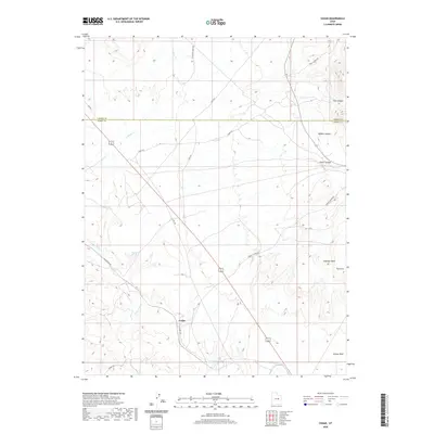
1969 Desert
Emery County, UT
1969 Dry Mesa
Emery County, UT
1969 Flattop Mtn
Emery County, UT
1969 Hadden Holes
Emery County, UT
1969 Horn Silver Gulch
Emery County, UT
1969 Mounds
Emery County, UT
1969 Olsen Reservoir
Emery County, UT
1969 Poison Spring Bench
Emery County, UT
1978 Hiawatha
Emery County, UT
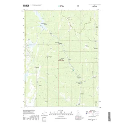
1979 Candland Mountain
Emery County, UT
1979 Mahogany Point
Emery County, UT
1979 Rilda Canyon
Emery County, UT
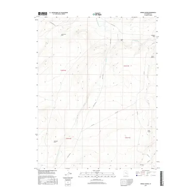
1979 The Cap
Emery County, UT
1983 Arsons Garden
Emery County, UT
1983 Big Bend Draw
Emery County, UT
1983 Bottleneck Peak
Emery County, UT
1983 Copper Globe
Emery County, UT
1983 Devils Hole
Emery County, UT
1983 Drowned Hole Draw
Emery County, UT
1983 Ireland Mesa
Emery County, UT
1983 Mexican Mountain
Emery County, UT
1983 Molen
Emery County, UT
1983 San Rafael Knob
Emery County, UT

1983 Short Canyon
Emery County, UT
1983 Sid and Charley
Emery County, UT
1983 Sids Mountain
Emery County, UT
1983 The Blocks
Emery County, UT

1983 The Frying Pan
Emery County, UT
1983 The Wickiup
Emery County, UT
1983 Twin Knolls
Emery County, UT
1985 Cedar
Emery County, UT
1985 Chandler Falls
Emery County, UT
1985 Grassy
Emery County, UT
1985 Lighthouse Canyon
Emery County, UT
1985 Lila Point
Emery County, UT
1985 San Rafael Desert
Emery County, UT
1985 Three Fords Canyon
Emery County, UT
1985 Turtle Canyon
Emery County, UT
1985 Woodside
Emery County, UT
1986 Jacks Knob
Emery County, UT
1986 Keg Knoll
Emery County, UT
1986 Moonshine Wash
Emery County, UT
1986 San Rafael Desert
Emery County, UT
1986 Spring Canyon
Emery County, UT
1986 The Flat Tops
Emery County, UT
1988 Bowknot Bend
Emery County, UT
1988 Crows Nest Spring
Emery County, UT
1988 Gilson Butte
Emery County, UT
1988 Goblin Valley
Emery County, UT
1988 Greasewood Draw
Emery County, UT
1988 Horse Bench East
Emery County, UT
1988 Horse Bench West
Emery County, UT
1988 Horse Valley
Emery County, UT
1988 Hunt Draw
Emery County, UT
1988 Jessies Twist
Emery County, UT
1988 Little Wild Horse Mesa
Emery County, UT
1988 Old Woman Wash
Emery County, UT
1988 Spotted Wolf Canyon
Emery County, UT
1988 Temple Mountain
Emery County, UT
1988 Tomsich Butte
Emery County, UT
1991 Blue Castle Butte
Emery County, UT
1991 Jenny Canyon
Emery County, UT
1996 Bowknot Bend
Emery County, UT
1996 Goblin Valley
Emery County, UT
1996 Hunt Draw
Emery County, UT
1996 Little Wild Horse Mesa
Emery County, UT
2001 Candland Mountain
Emery County, UT
2001 Emery East
Emery County, UT
2001 Hiawatha
Emery County, UT
2001 Mahogany Point
Emery County, UT
2001 Red Point
Emery County, UT
2001 Rilda Canyon
Emery County, UT
2001 The Cap
Emery County, UT
2010 Arsons Garden
Emery County, UT
2010 Big Bend Draw
Emery County, UT
2010 Drowned Hole Draw
Emery County, UT
2010 Gilson Butte
Emery County, UT
2010 Goblin Valley
Emery County, UT
2010 Greasewood Draw
Emery County, UT
2010 Horse Bench East
Emery County, UT
2010 Horse Bench West
Emery County, UT
2010 Horse Valley
Emery County, UT
2010 Hunt Draw
Emery County, UT
2010 Ireland Mesa
Emery County, UT
2010 Jacks Knob
Emery County, UT
2010 Little Wild Horse Mesa
Emery County, UT
2010 Moonshine Wash
Emery County, UT
2010 Old Woman Wash
Emery County, UT

2010 Salvation Creek
Emery County, UT
2010 Short Canyon
Emery County, UT
2010 Sid And Charley
Emery County, UT
2010 Spotted Wolf Canyon
Emery County, UT
2010 Temple Mountain
Emery County, UT
2010 The Blocks
Emery County, UT
2010 The Flat Tops
Emery County, UT
2010 The Frying Pan
Emery County, UT
2010 Tomsich Butte
Emery County, UT
2011 Blue Castle Butte
Emery County, UT
2011 Bob Hill Knoll
Emery County, UT
2011 Bottleneck Peak
Emery County, UT
2011 Bowknot Bend
Emery County, UT
2011 Buckhorn Reservoir
Emery County, UT
2011 Candland Mountain
Emery County, UT
2011 Cedar
Emery County, UT
2011 Chandler Falls
Emery County, UT
2011 Chimney Rock
Emery County, UT
2011 Cliff
Emery County, UT
2011 Copper Globe
Emery County, UT
2011 Cow Flats
Emery County, UT
2011 Crows Nest Spring
Emery County, UT
2011 Desert
Emery County, UT
2011 Devils Hole
Emery County, UT
2011 Dry Mesa
Emery County, UT
2011 Emery East
Emery County, UT
2011 Flattop Mountain
Emery County, UT
2011 Grassy
Emery County, UT
2011 Hadden Holes
Emery County, UT
2011 Hiawatha
Emery County, UT
2011 Horn Silver Gulch
Emery County, UT
2011 Jenny Canyon
Emery County, UT
2011 Jessies Twist
Emery County, UT
2011 Keg Knoll
Emery County, UT
2011 Lighthouse Canyon
Emery County, UT
2011 Lila Point
Emery County, UT
2011 Mahogany Point
Emery County, UT
2011 Mesa Butte
Emery County, UT
2011 Mexican Mountain
Emery County, UT
2011 Molen
Emery County, UT
2011 Mounds
Emery County, UT
2011 Mussentuchit Flat
Emery County, UT
2011 Olsen Reservoir
Emery County, UT
2011 Poison Spring Bench
Emery County, UT
2011 Red Point
Emery County, UT
2011 Rilda Canyon
Emery County, UT
2011 San Rafael Knob
Emery County, UT
2011 Sids Mountain
Emery County, UT
2011 Spring Canyon
Emery County, UT
2011 The Cap
Emery County, UT
2011 The Wickiup
Emery County, UT
2011 Three Fords Canyon
Emery County, UT
2011 Turtle Canyon
Emery County, UT
2011 Twin Knolls
Emery County, UT
2011 Woodside
Emery County, UT
2014 Arsons Garden
Emery County, UT
2014 Big Bend Draw
Emery County, UT
2014 Blue Castle Butte
Emery County, UT
2014 Bob Hill Knoll
Emery County, UT
2014 Bottleneck Peak
Emery County, UT
2014 Bowknot Bend
Emery County, UT
2014 Buckhorn Reservoir
Emery County, UT
2014 Candland Mountain
Emery County, UT
2014 Cedar
Emery County, UT
2014 Chandler Falls
Emery County, UT
2014 Chimney Rock
Emery County, UT
2014 Cliff
Emery County, UT
2014 Copper Globe
Emery County, UT
2014 Cow Flats
Emery County, UT
2014 Crows Nest Spring
Emery County, UT
2014 Desert
Emery County, UT
2014 Devils Hole
Emery County, UT
2014 Drowned Hole Draw
Emery County, UT
2014 Dry Mesa
Emery County, UT
2014 Emery East
Emery County, UT
2014 Flattop Mountain
Emery County, UT
2014 Gilson Butte
Emery County, UT
2014 Goblin Valley
Emery County, UT
2014 Grassy
Emery County, UT
2014 Greasewood Draw
Emery County, UT
2014 Hadden Holes
Emery County, UT
2014 Hiawatha
Emery County, UT
2014 Horn Silver Gulch
Emery County, UT
2014 Horse Bench East
Emery County, UT
2014 Horse Bench West
Emery County, UT
2014 Horse Valley
Emery County, UT
2014 Hunt Draw
Emery County, UT
2014 Ireland Mesa
Emery County, UT

2014 Jacks Knob
Emery County, UT
2014 Jenny Canyon
Emery County, UT
2014 Jessies Twist
Emery County, UT
2014 Keg Knoll
Emery County, UT
2014 Lighthouse Canyon
Emery County, UT
2014 Lila Point
Emery County, UT
2014 Little Wild Horse Mesa
Emery County, UT
2014 Mahogany Point
Emery County, UT
2014 Mesa Butte
Emery County, UT
2014 Mexican Mountain
Emery County, UT
2014 Molen
Emery County, UT
2014 Moonshine Wash
Emery County, UT
2014 Mounds
Emery County, UT
2014 Mussentuchit Flat
Emery County, UT
2014 Old Woman Wash
Emery County, UT
2014 Olsen Reservoir
Emery County, UT
2014 Poison Spring Bench
Emery County, UT
2014 Red Point
Emery County, UT
2014 Rilda Canyon
Emery County, UT

2014 Salvation Creek
Emery County, UT
2014 San Rafael Knob
Emery County, UT
2014 Short Canyon
Emery County, UT
2014 Sid And Charley
Emery County, UT
2014 Sids Mountain
Emery County, UT
2014 Spotted Wolf Canyon
Emery County, UT
2014 Spring Canyon
Emery County, UT

2014 Temple Mountain
Emery County, UT
2014 The Blocks
Emery County, UT
2014 The Cap
Emery County, UT
2014 The Flat Tops
Emery County, UT
2014 The Frying Pan
Emery County, UT
2014 The Wickiup
Emery County, UT
2014 Three Fords Canyon
Emery County, UT
2014 Tomsich Butte
Emery County, UT

2014 Turtle Canyon
Emery County, UT
2014 Twin Knolls
Emery County, UT
2014 Woodside
Emery County, UT
2017 Arsons Garden
Emery County, UT
2017 Big Bend Draw
Emery County, UT
2017 Blue Castle Butte
Emery County, UT
2017 Bob Hill Knoll
Emery County, UT
2017 Bottleneck Peak
Emery County, UT
2017 Bowknot Bend
Emery County, UT
2017 Buckhorn Reservoir
Emery County, UT
2017 Candland Mountain
Emery County, UT
2017 Cedar
Emery County, UT
2017 Chandler Falls
Emery County, UT
2017 Chimney Rock
Emery County, UT
2017 Cliff
Emery County, UT
2017 Copper Globe
Emery County, UT
2017 Cow Flats
Emery County, UT
2017 Crows Nest Spring
Emery County, UT
2017 Desert
Emery County, UT
2017 Devils Hole
Emery County, UT
2017 Drowned Hole Draw
Emery County, UT
2017 Dry Mesa
Emery County, UT
2017 Emery East
Emery County, UT
2017 Flattop Mountain
Emery County, UT
2017 Gilson Butte
Emery County, UT
2017 Goblin Valley
Emery County, UT
2017 Grassy
Emery County, UT
2017 Greasewood Draw
Emery County, UT
2017 Hadden Holes
Emery County, UT
2017 Hiawatha
Emery County, UT
2017 Horn Silver Gulch
Emery County, UT
2017 Horse Bench East
Emery County, UT
2017 Horse Bench West
Emery County, UT
2017 Horse Valley
Emery County, UT
2017 Hunt Draw
Emery County, UT
2017 Ireland Mesa
Emery County, UT
2017 Jacks Knob
Emery County, UT
2017 Jenny Canyon
Emery County, UT
2017 Jessies Twist
Emery County, UT
2017 Keg Knoll
Emery County, UT
2017 Lighthouse Canyon
Emery County, UT
2017 Lila Point
Emery County, UT
2017 Little Wild Horse Mesa
Emery County, UT
2017 Mahogany Point
Emery County, UT
2017 Mesa Butte
Emery County, UT
2017 Mexican Mountain
Emery County, UT
2017 Molen
Emery County, UT

2017 Moonshine Wash
Emery County, UT
2017 Mounds
Emery County, UT
2017 Mussentuchit Flat
Emery County, UT
2017 Old Woman Wash
Emery County, UT
2017 Olsen Reservoir
Emery County, UT
2017 Poison Spring Bench
Emery County, UT
2017 Red Point
Emery County, UT
2017 Rilda Canyon
Emery County, UT
2017 Salvation Creek
Emery County, UT
2017 San Rafael Knob
Emery County, UT
2017 Short Canyon
Emery County, UT
2017 Sid And Charley
Emery County, UT
2017 Sids Mountain
Emery County, UT
2017 Spotted Wolf Canyon
Emery County, UT
2017 Spring Canyon
Emery County, UT
2017 Temple Mountain
Emery County, UT
2017 The Blocks
Emery County, UT
2017 The Cap
Emery County, UT
2017 The Flat Tops
Emery County, UT
2017 The Frying Pan
Emery County, UT
2017 The Wickiup
Emery County, UT
2017 Three Fords Canyon
Emery County, UT
2017 Tomsich Butte
Emery County, UT
2017 Turtle Canyon
Emery County, UT
2017 Twin Knolls
Emery County, UT
2017 Woodside
Emery County, UT

2020 Arsons Garden
Emery County, UT
2020 Big Bend Draw
Emery County, UT
2020 Blue Castle Butte
Emery County, UT
2020 Bob Hill Knoll
Emery County, UT
2020 Bottleneck Peak
Emery County, UT
2020 Bowknot Bend
Emery County, UT
2020 Buckhorn Reservoir
Emery County, UT
2020 Candland Mountain
Emery County, UT
2020 Cedar
Emery County, UT
2020 Chandler Falls
Emery County, UT
2020 Chimney Rock
Emery County, UT
2020 Cliff
Emery County, UT
2020 Copper Globe
Emery County, UT
2020 Cow Flats
Emery County, UT
2020 Crows Nest Spring
Emery County, UT
2020 Desert
Emery County, UT
2020 Devils Hole
Emery County, UT
2020 Drowned Hole Draw
Emery County, UT
2020 Dry Mesa
Emery County, UT
2020 Emery East
Emery County, UT
2020 Flattop Mountain
Emery County, UT
2020 Gilson Butte
Emery County, UT
2020 Goblin Valley
Emery County, UT
2020 Grassy
Emery County, UT
2020 Greasewood Draw
Emery County, UT
2020 Hadden Holes
Emery County, UT
2020 Hiawatha
Emery County, UT
2020 Horn Silver Gulch
Emery County, UT
2020 Horse Bench East
Emery County, UT
2020 Horse Bench West
Emery County, UT
2020 Horse Valley
Emery County, UT
2020 Hunt Draw
Emery County, UT
2020 Ireland Mesa
Emery County, UT
2020 Jacks Knob
Emery County, UT
2020 Jenny Canyon
Emery County, UT
2020 Jessies Twist
Emery County, UT
2020 Keg Knoll
Emery County, UT
2020 Lighthouse Canyon
Emery County, UT
2020 Lila Point
Emery County, UT
2020 Little Wild Horse Mesa
Emery County, UT
2020 Mahogany Point
Emery County, UT
2020 Mesa Butte
Emery County, UT
2020 Mexican Mountain
Emery County, UT
2020 Molen
Emery County, UT
2020 Moonshine Wash
Emery County, UT
2020 Mounds
Emery County, UT
2020 Mussentuchit Flat
Emery County, UT
2020 Old Woman Wash
Emery County, UT
2020 Olsen Reservoir
Emery County, UT
2020 Poison Spring Bench
Emery County, UT
2020 Red Point
Emery County, UT
2020 Rilda Canyon
Emery County, UT
2020 Salvation Creek
Emery County, UT
2020 San Rafael Knob
Emery County, UT
2020 Short Canyon
Emery County, UT
2020 Sid And Charley
Emery County, UT
2020 Sids Mountain
Emery County, UT
2020 Spotted Wolf Canyon
Emery County, UT
2020 Spring Canyon
Emery County, UT
2020 Temple Mountain
Emery County, UT
2020 The Blocks
Emery County, UT
2020 The Cap
Emery County, UT
2020 The Flat Tops
Emery County, UT
2020 The Frying Pan
Emery County, UT
2020 The Wickiup
Emery County, UT
2020 Three Fords Canyon
Emery County, UT
2020 Tomsich Butte
Emery County, UT
2020 Turtle Canyon
Emery County, UT
2020 Twin Knolls
Emery County, UT
2020 Woodside
Emery County, UT
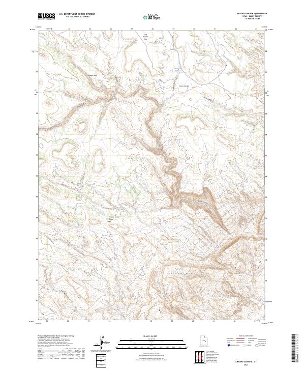
2023 Arsons Garden
Emery County, UT
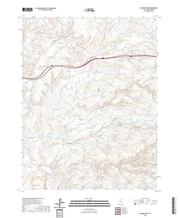
2023 Big Bend Draw
Emery County, UT
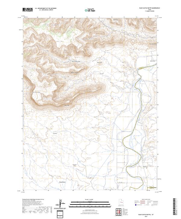
2023 Blue Castle Butte
Emery County, UT
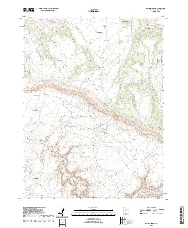
2023 Bob Hill Knoll
Emery County, UT
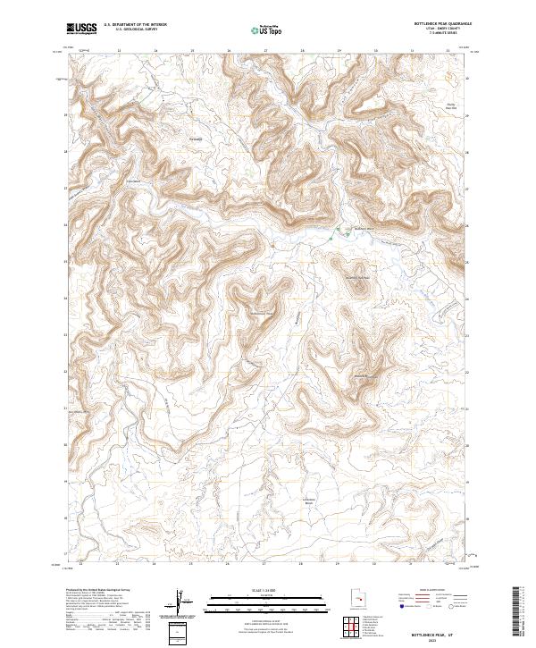
2023 Bottleneck Peak
Emery County, UT
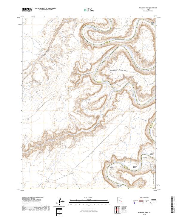
2023 Bowknot Bend
Emery County, UT
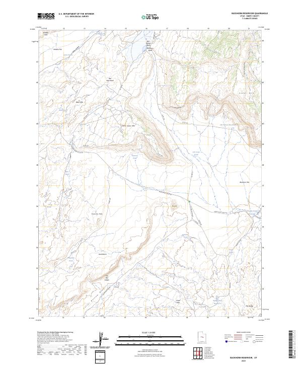
2023 Buckhorn Reservoir
Emery County, UT
2023 Candland Mountain
Emery County, UT
2023 Cedar
Emery County, UT
2023 Chandler Falls
Emery County, UT
2023 Chimney Rock
Emery County, UT
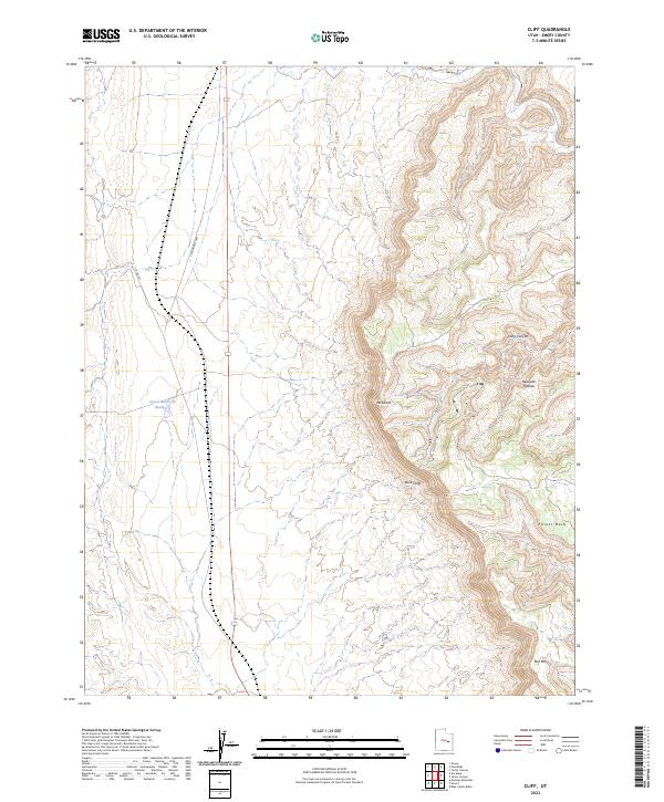
2023 Cliff
Emery County, UT
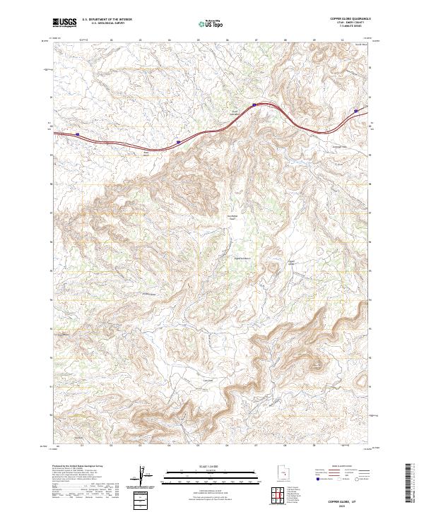
2023 Copper Globe
Emery County, UT
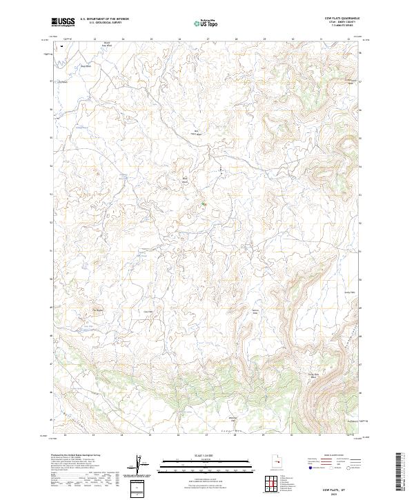
2023 Cow Flats
Emery County, UT
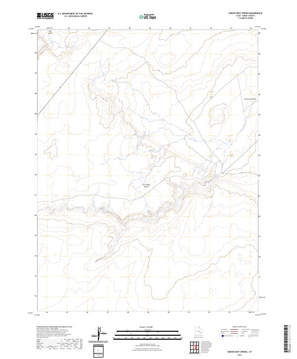
2023 Crows Nest Spring
Emery County, UT
2023 Desert
Emery County, UT
2023 Devils Hole
Emery County, UT
2023 Drowned Hole Draw
Emery County, UT
2023 Dry Mesa
Emery County, UT
2023 Emery East
Emery County, UT
2023 Flattop Mountain
Emery County, UT
2023 Gilson Butte
Emery County, UT
2023 Goblin Valley
Emery County, UT
2023 Grassy
Emery County, UT
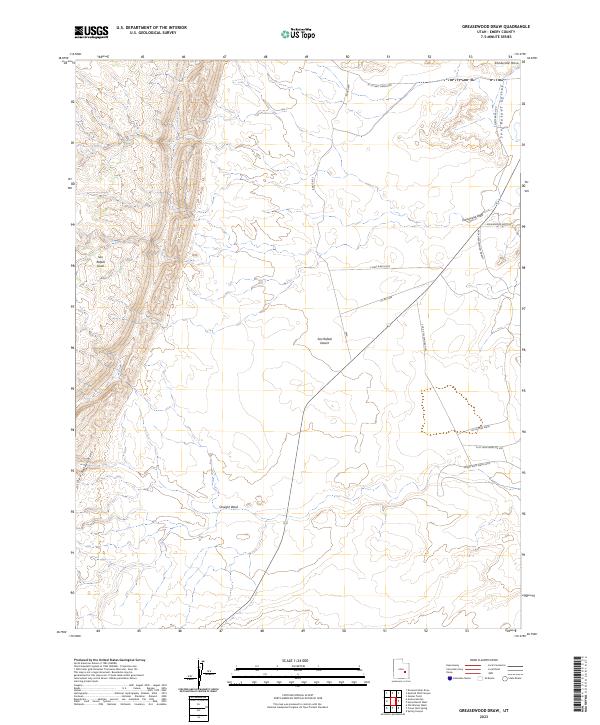
2023 Greasewood Draw
Emery County, UT
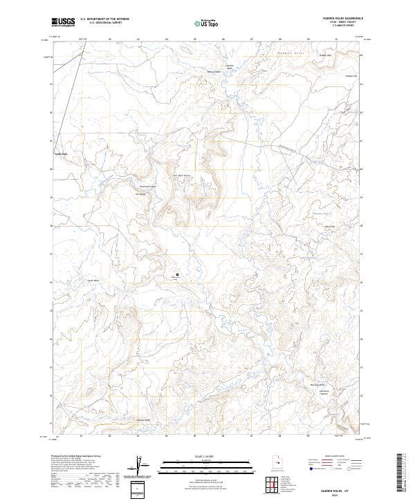
2023 Hadden Holes
Emery County, UT
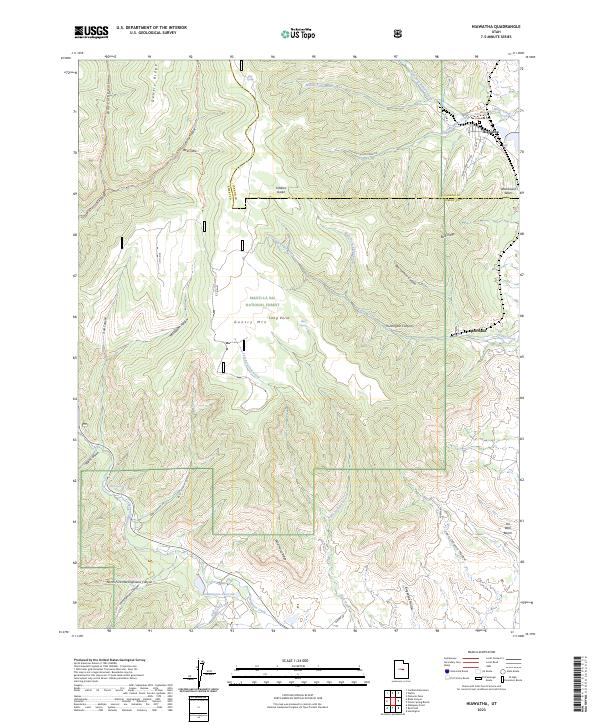
2023 Hiawatha
Emery County, UT
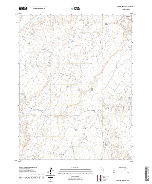
2023 Horn Silver Gulch
Emery County, UT
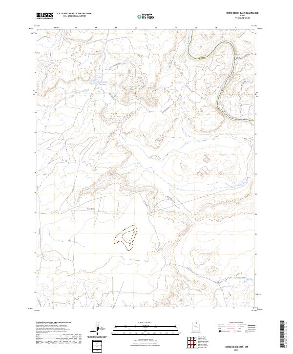
2023 Horse Bench East
Emery County, UT
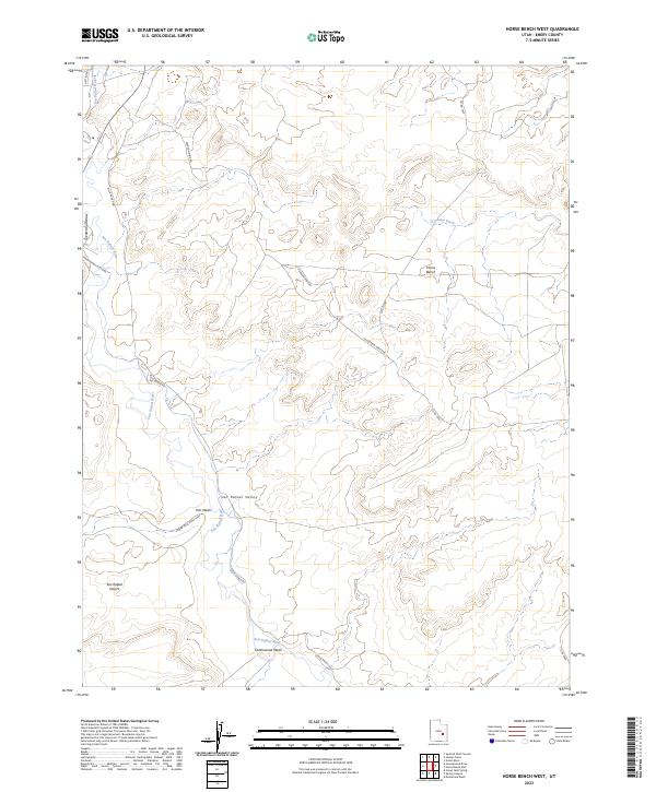
2023 Horse Bench West
Emery County, UT
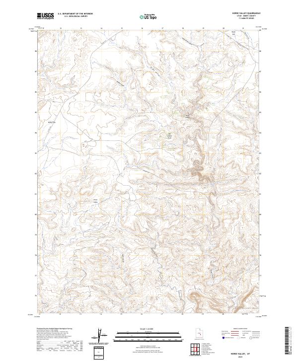
2023 Horse Valley
Emery County, UT
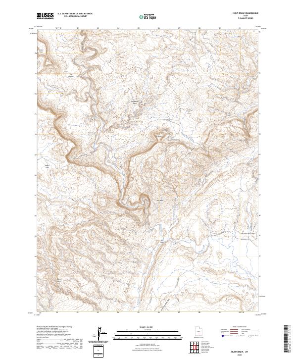
2023 Hunt Draw
Emery County, UT
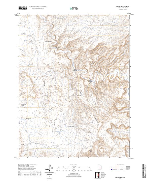
2023 Ireland Mesa
Emery County, UT
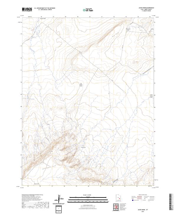
2023 Jacks Knob
Emery County, UT
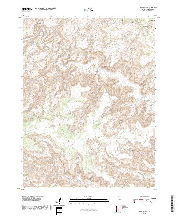
2023 Jenny Canyon
Emery County, UT
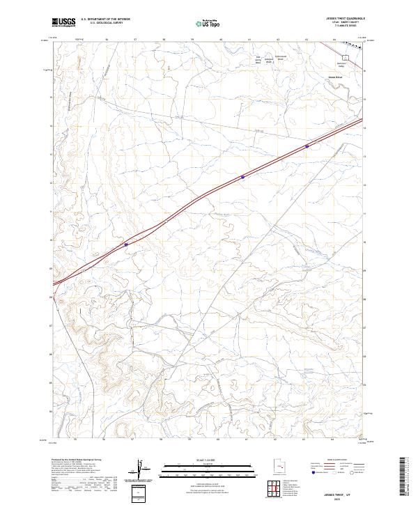
2023 Jessies Twist
Emery County, UT
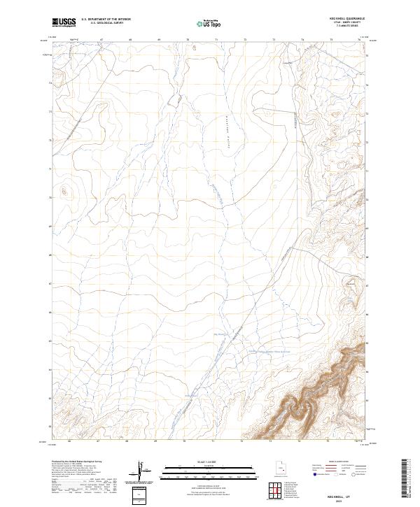
2023 Keg Knoll
Emery County, UT
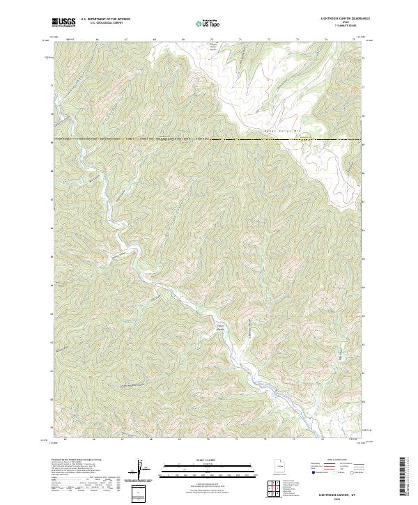
2023 Lighthouse Canyon
Emery County, UT
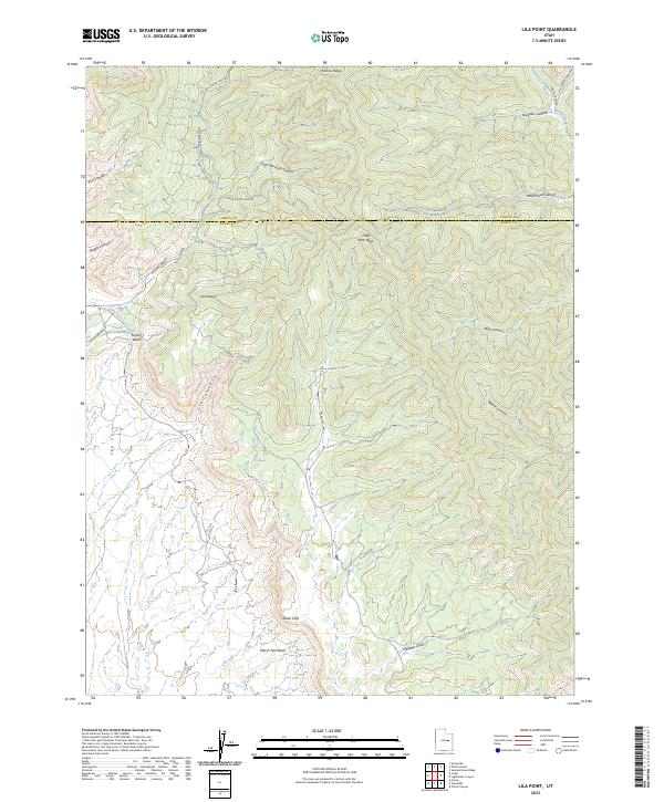
2023 Lila Point
Emery County, UT
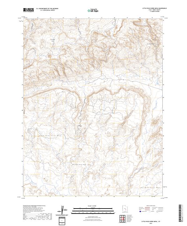
2023 Little Wild Horse Mesa
Emery County, UT
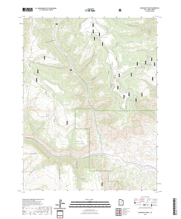
2023 Mahogany Point
Emery County, UT
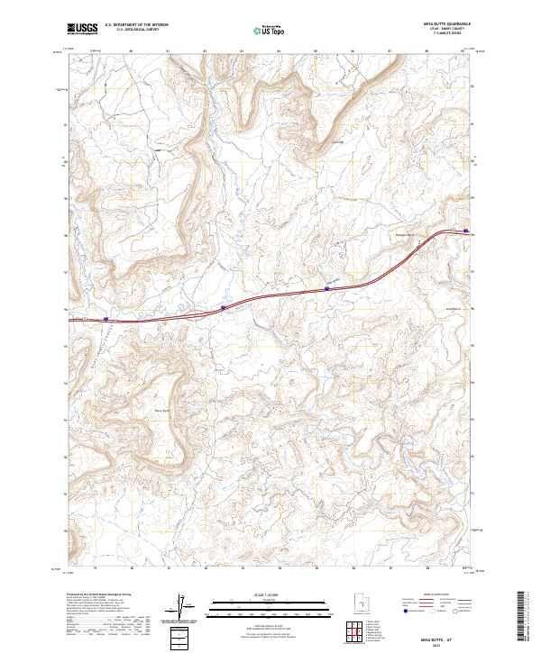
2023 Mesa Butte
Emery County, UT
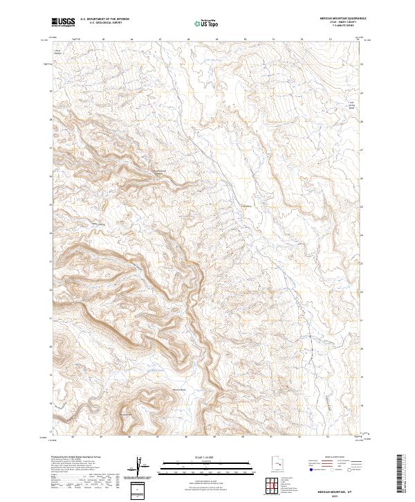
2023 Mexican Mountain
Emery County, UT
2023 Molen
Emery County, UT
2023 Moonshine Wash
Emery County, UT
2023 Mounds
Emery County, UT
2023 Mussentuchit Flat
Emery County, UT
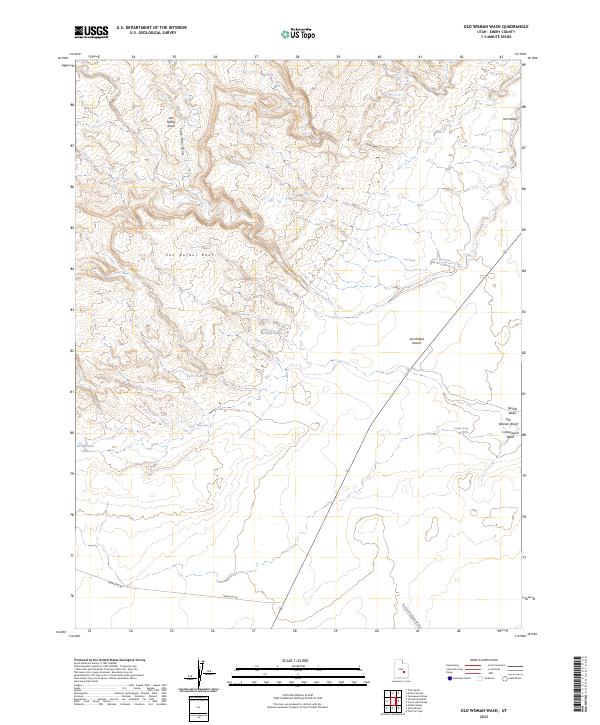
2023 Old Woman Wash
Emery County, UT
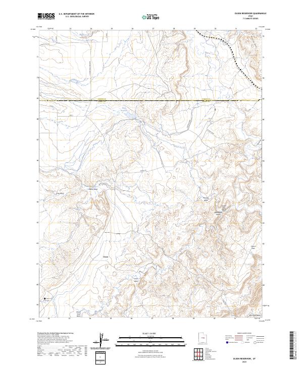
2023 Olsen Reservoir
Emery County, UT
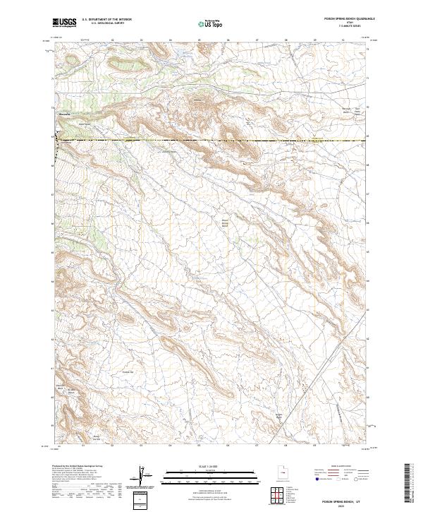
2023 Poison Spring Bench
Emery County, UT
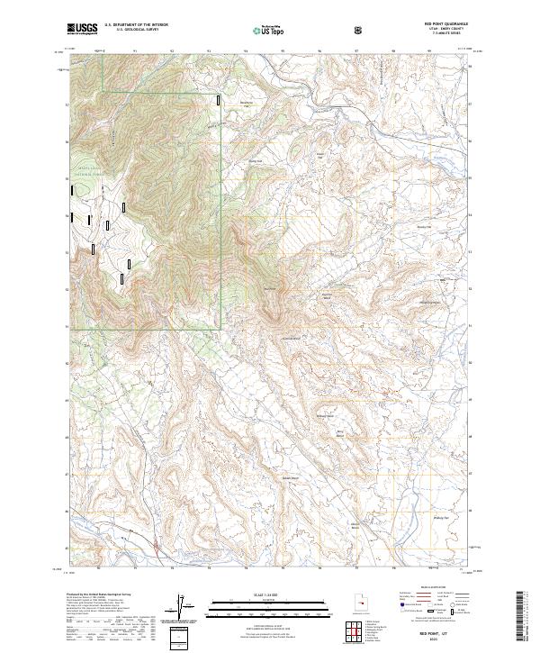
2023 Red Point
Emery County, UT
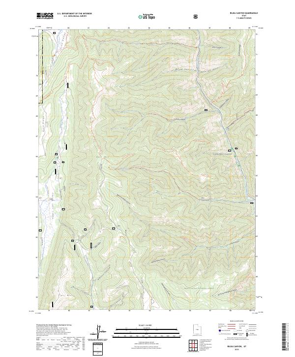
2023 Rilda Canyon
Emery County, UT
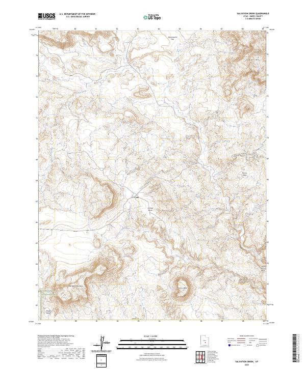
2023 Salvation Creek
Emery County, UT
2023 San Rafael Knob
Emery County, UT
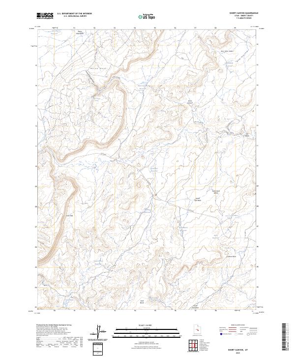
2023 Short Canyon
Emery County, UT
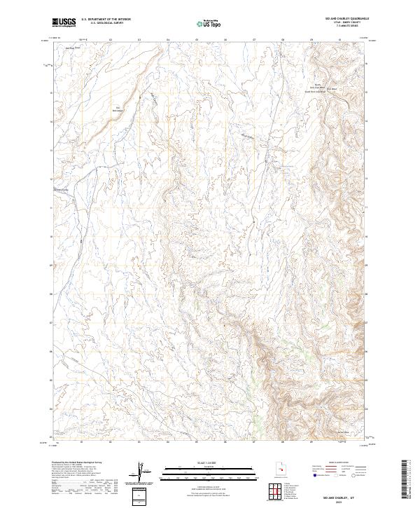
2023 Sid And Charley
Emery County, UT
2023 Sids Mountain
Emery County, UT
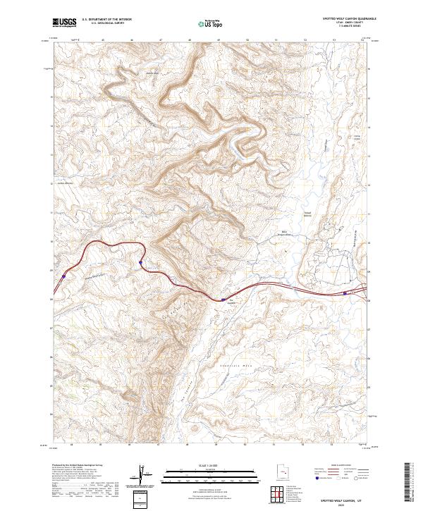
2023 Spotted Wolf Canyon
Emery County, UT
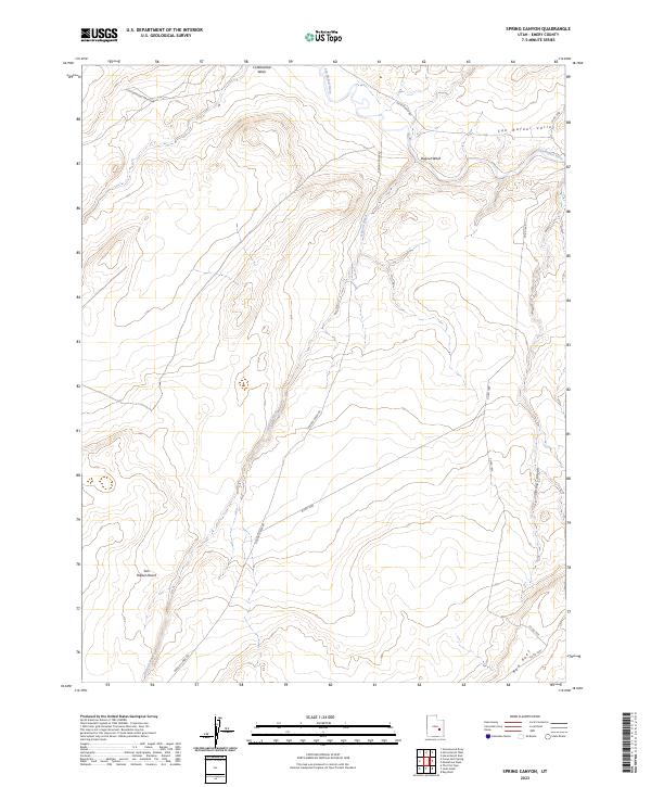
2023 Spring Canyon
Emery County, UT
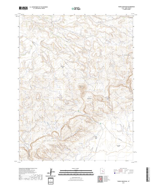
2023 Temple Mountain
Emery County, UT
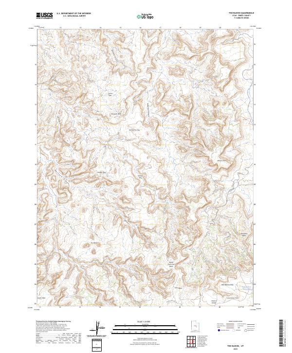
2023 The Blocks
Emery County, UT
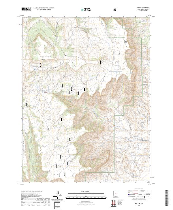
2023 The Cap
Emery County, UT
2023 The Flat Tops
Emery County, UT
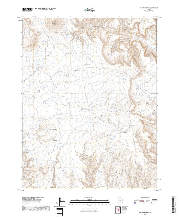
2023 The Frying Pan
Emery County, UT
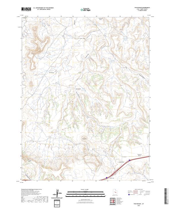
2023 The Wickiup
Emery County, UT
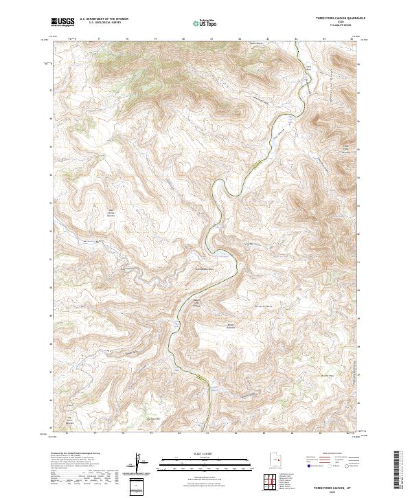
2023 Three Fords Canyon
Emery County, UT
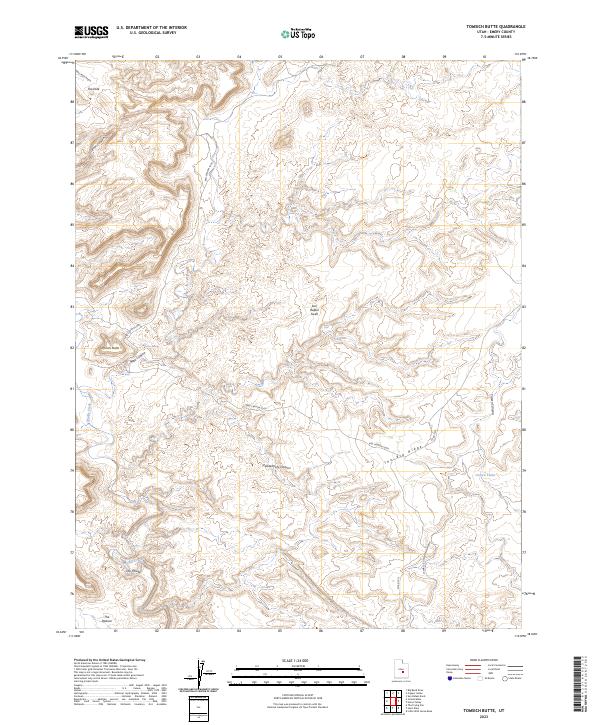
2023 Tomsich Butte
Emery County, UT
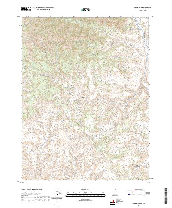
2023 Turtle Canyon
Emery County, UT
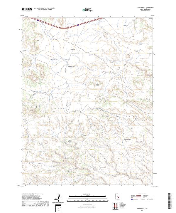
2023 Twin Knolls
Emery County, UT
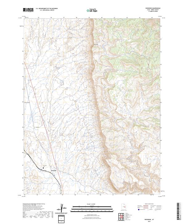
2023 Woodside
Emery County, UT