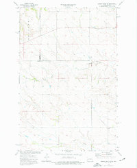
1974 Map of Grassy Butte SE
USGS Topo · Published 1977About this map
Little Knife River and the Knife River wind through this mid-1970s landscape, which spans the intersection of McKenzie, Billings, and Dunn counties. The map reflects a rural cultural landscape marked by isolated religious and communal sites, most notably the Russian Cem and Greek Ch. These labels, alongside a separate Cem and the settlement of Graves, suggest a history of immigrant settlement and established community roots in the North Dakota badlands. The northern portion of the map is dominated by the linear marking of Rhoades, while the terrain is defined by intricate contour lines showing the complex erosion patterns typical of this river-cut plateau region.
Find a feature on this map
10 named features on this map. Tap any name to fly to it.
Don’t see what you’re looking for? This feature index may not catch every label — zoom into the map to look around manually.
Map Details
Editions of this 1974 Grassy Butte SE Map
This is the sole edition of this map. No revisions or reprints were ever made.
Other maps of this area

1953 · Watford City
USGS Topo · 1:250,000

1957 · Watford City
USGS Topo · 1:250,000

1963 · Fairfield
USGS Topo · 1:24,000

1963 · Hungry Man Butte
USGS Topo · 1:24,000

1967 · Watford City
USGS Topo · 1:250,000

1973 · Manning NW
USGS Topo · 1:24,000

1974 · Killdeer
USGS Topo · 1:100,000

1974 · Grassy Butte SW
USGS Topo · 1:24,000

1974 · Petes Creek
USGS Topo · 1:24,000

1974 · Fayette
USGS Topo · 1:24,000