
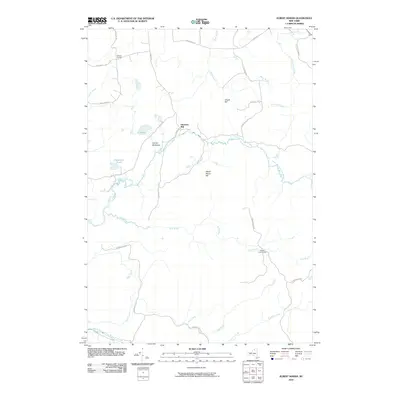
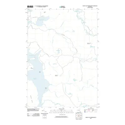
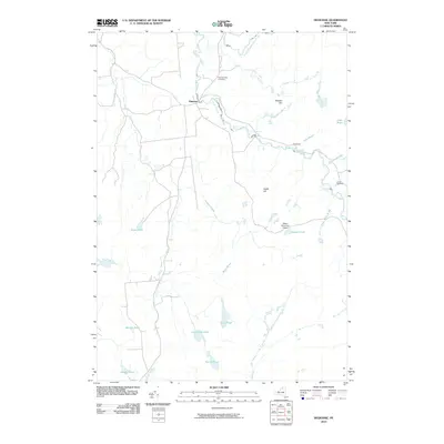
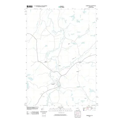
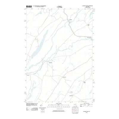
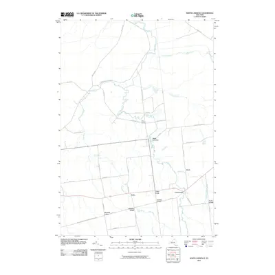
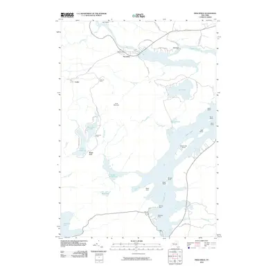
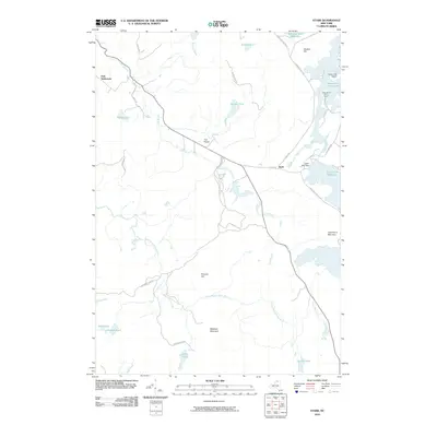
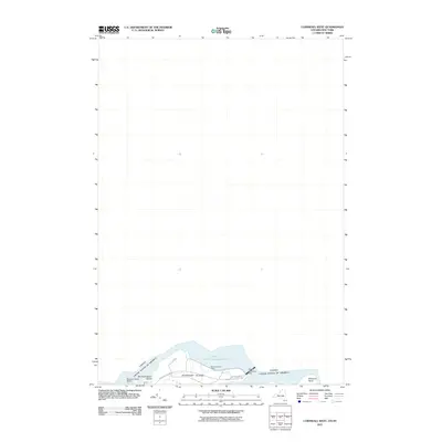
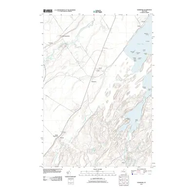
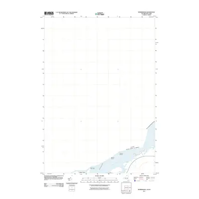
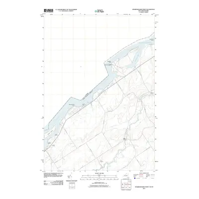
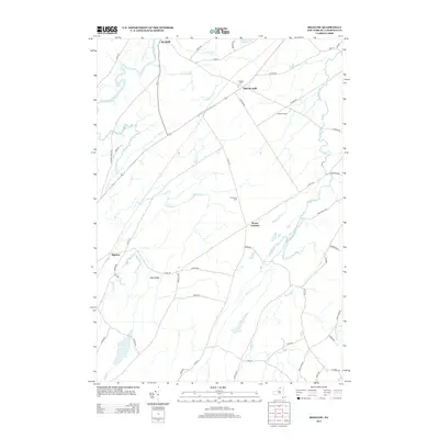
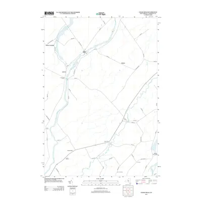
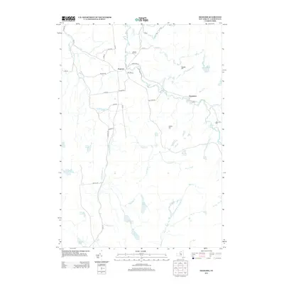
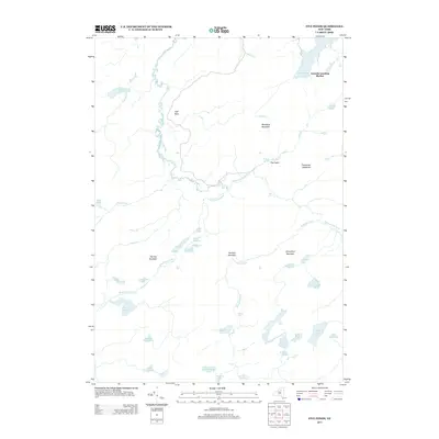
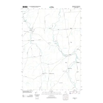
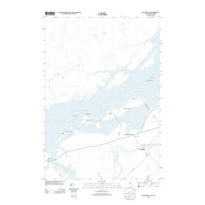
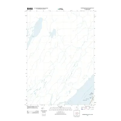
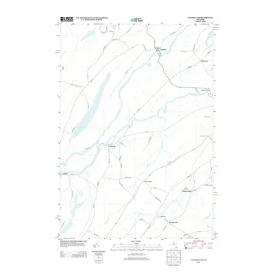
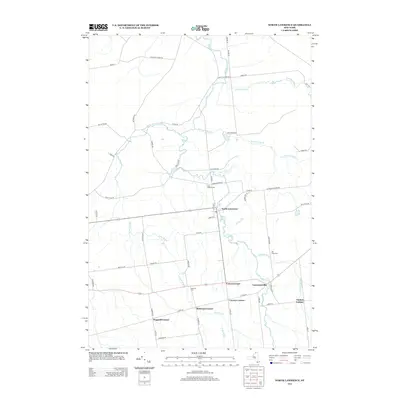
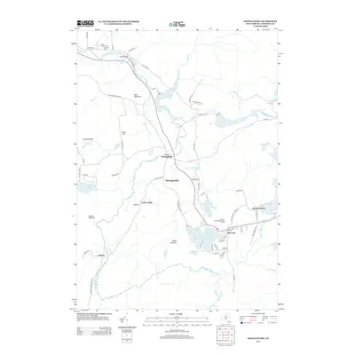
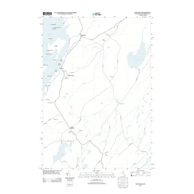
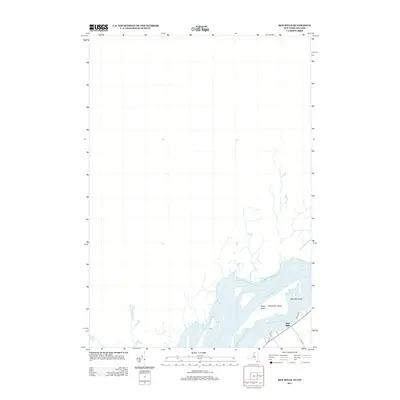
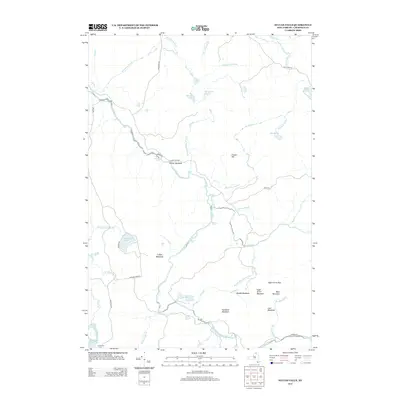
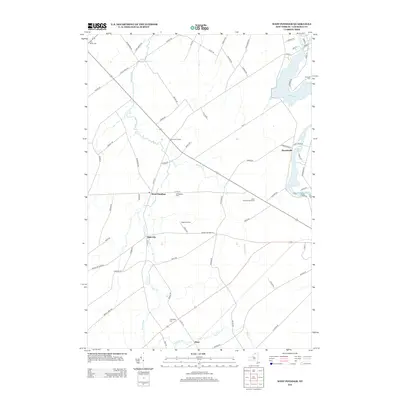
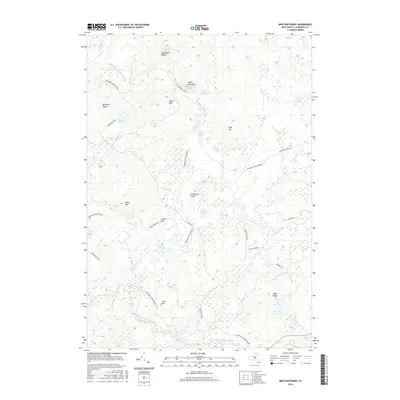
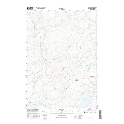
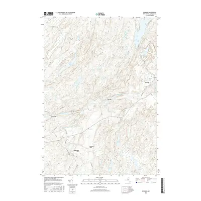
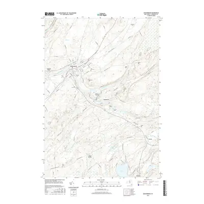
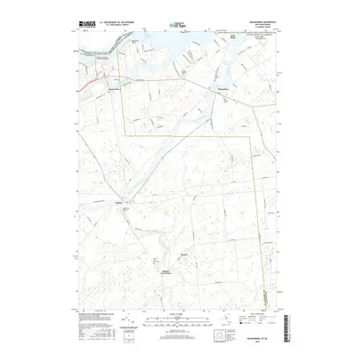
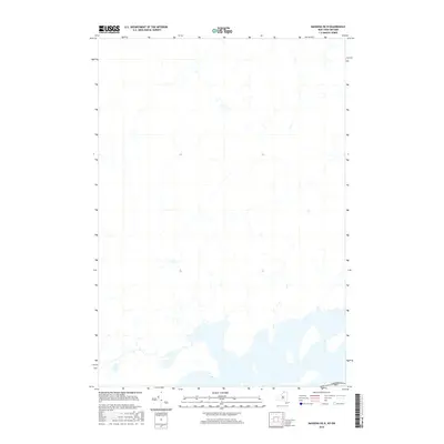
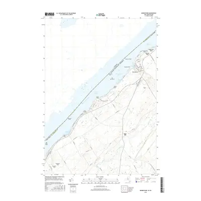
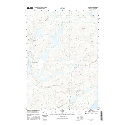
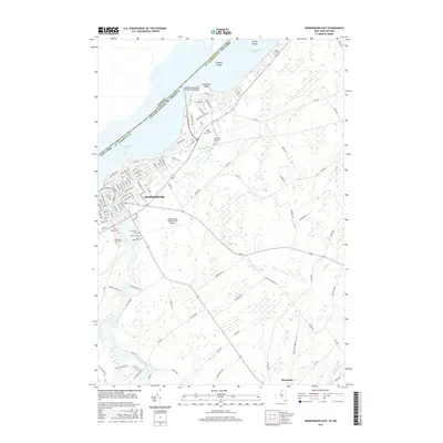
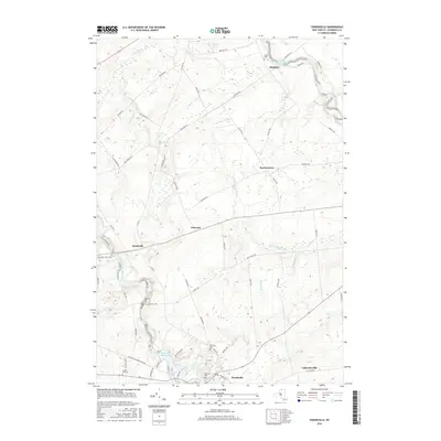
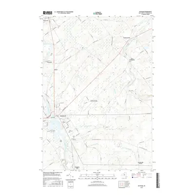
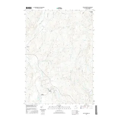
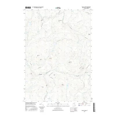
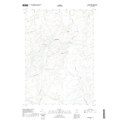
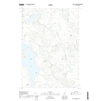
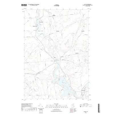
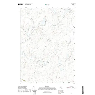
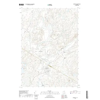
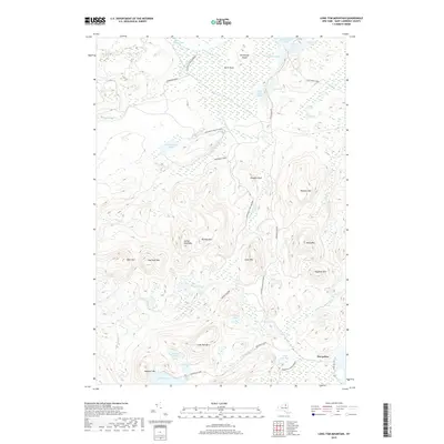
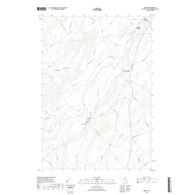
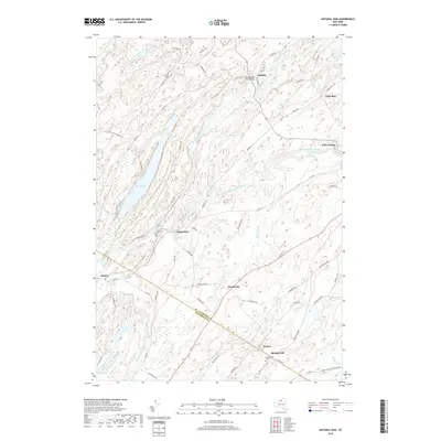
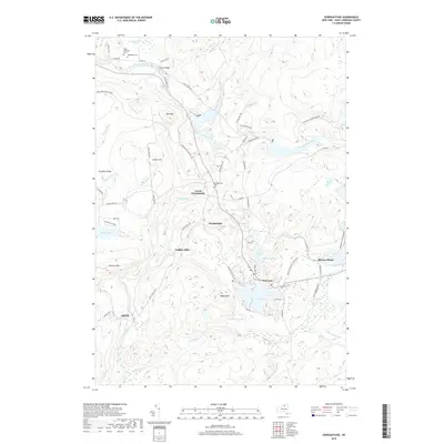
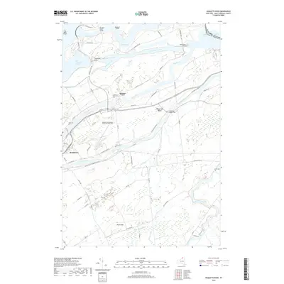
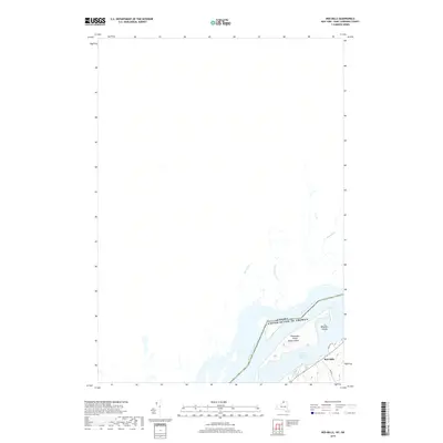
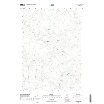
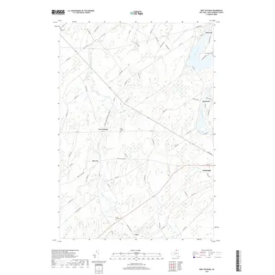
1964 Map of Cornwall West
USGS Topo · Published 1974About this map
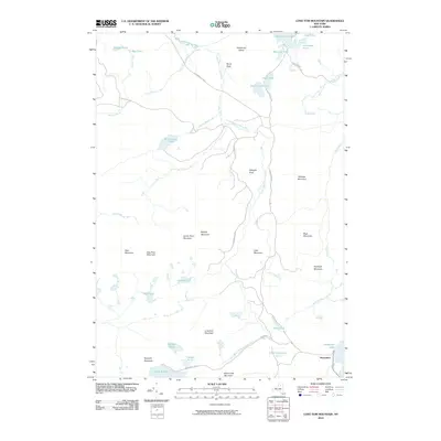
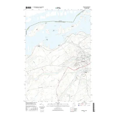
Lake St Lawrence and the massive Moses-Saunders Dam anchor this mid-1960s borderlands survey, capturing the industrial and navigational transformation of the international boundary. The St Lawrence River corridor is defined by complex infrastructure, including the Canal and several large islands like Barnhart Island and Sheek Island. North of the border, the landscape of Ontario's Stormont County transitions from the urban street grid of Cornwall—featuring named ways such as Rosemount St and Dover St—to a rural interior dotted with numerous gravel pits and quarries. The transportation network is in a period of high development, shown through the path of the Macdonald-Cartier Freeway and the Canadian National Railroad. Local commerce and community life are marked by landmarks like a drive-in theater and the St Andrews West Post Office.
Find a feature on this map
58 named features on this map. Tap any name to fly to it.
Don’t see what you’re looking for? This feature index may not catch every label — zoom into the map to look around manually.
Map Details
Editions of this 1964 Cornwall West Map
This is the sole edition of this map. No revisions or reprints were ever made.
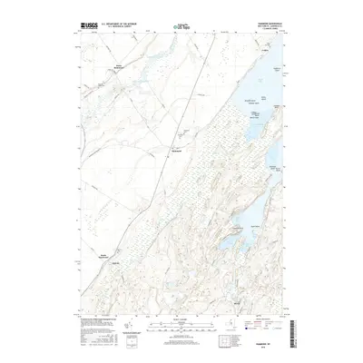
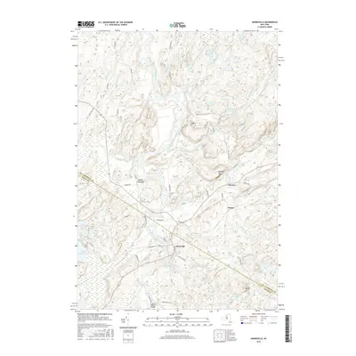
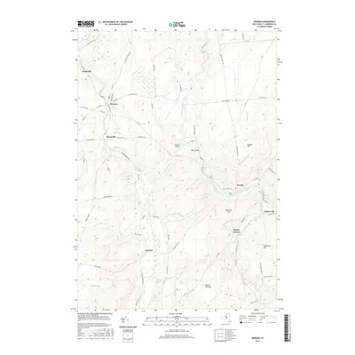
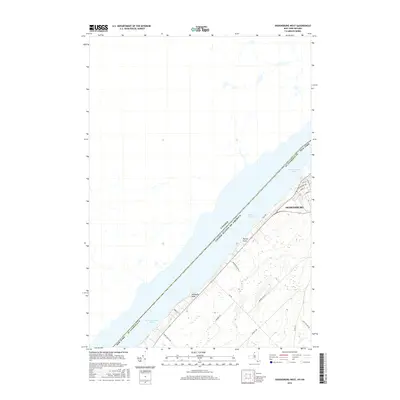
Historical Maps of Saint Lawrence County Through Time
390 maps found

1904 Lisbon
St. Lawrence County, NY

1905 Waddington
St. Lawrence County, NY

1906 Brier Hill
St. Lawrence County, NY

1906 Massena
St. Lawrence County, NY

1906 Red Mills
St. Lawrence County, NY

1907 Massena
St. Lawrence County, NY

1907 Tupper Lake
St. Lawrence County, NY

1908 Potsdam
St. Lawrence County, NY

1910 Canton
St. Lawrence County, NY

1911 Canton
St. Lawrence County, NY

1912 Hammond
St. Lawrence County, NY

1915 Gouverneur
St. Lawrence County, NY

1915 Russell
St. Lawrence County, NY

1916 Oswegatchie
St. Lawrence County, NY

1918 Oswegatchie
St. Lawrence County, NY

1918 Russell
St. Lawrence County, NY

1919 Nicholville
St. Lawrence County, NY

1920 Childwold
St. Lawrence County, NY

1921 Childwold
St. Lawrence County, NY

1921 Nicholville
St. Lawrence County, NY

1921 Stark
St. Lawrence County, NY

1922 Childwold
St. Lawrence County, NY

1923 Stark
St. Lawrence County, NY

1937 Gouverneur
St. Lawrence County, NY

1940 Stark
St. Lawrence County, NY

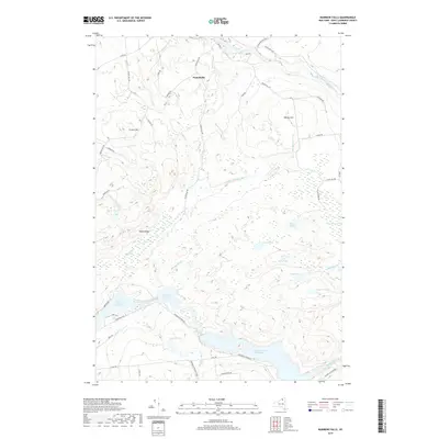
1942 Barnhart Island
St. Lawrence County, NY

1942 Chase Mills
St. Lawrence County, NY

1942 Long Bow
St. Lawrence County, NY

1942 Massena
St. Lawrence County, NY

1942 Morristown
St. Lawrence County, NY

1942 Murphy Island
St. Lawrence County, NY

1942 Norfolk
St. Lawrence County, NY

1942 Waddington
St. Lawrence County, NY

1943 Barnhart Island
St. Lawrence County, NY

1943 Chase Mills
St. Lawrence County, NY

1943 Colton
St. Lawrence County, NY

1943 Edwardsville
St. Lawrence County, NY

1943 Lisbon
St. Lawrence County, NY

1943 Long Bow
St. Lawrence County, NY

1943 Massena
St. Lawrence County, NY

1943 Morristown
St. Lawrence County, NY

1943 Murphy Island
St. Lawrence County, NY

1943 Norfolk
St. Lawrence County, NY

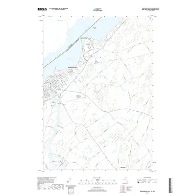
1943 Ogdensburg East
St. Lawrence County, NY

1943 Ogdensburg West
St. Lawrence County, NY

1943 Parishville
St. Lawrence County, NY

1943 Potsdam
St. Lawrence County, NY

1943 Red Mills
St. Lawrence County, NY

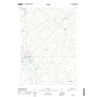
1943 Sparrowhawk Point
St. Lawrence County, NY

1943 Waddington
St. Lawrence County, NY

1944 Canton
St. Lawrence County, NY

1944 Hammond
St. Lawrence County, NY

1946 Louisville
St. Lawrence County, NY

1946 Raquette River
St. Lawrence County, NY

1948 Chippewa Bay
St. Lawrence County, NY

1949 Hammond
St. Lawrence County, NY

1951 Hammond
St. Lawrence County, NY

1951 Harrisville
St. Lawrence County, NY

1951 Natural Dam
St. Lawrence County, NY

1951 Pope Mills
St. Lawrence County, NY

1954 Tupper Lake
St. Lawrence County, NY

1956 Bigelow
St. Lawrence County, NY

1956 Edwards
St. Lawrence County, NY

1956 Gouverneur
St. Lawrence County, NY

1958 Chippewa Bay
St. Lawrence County, NY

1961 Hammond
St. Lawrence County, NY

1961 Natural Dam
St. Lawrence County, NY

1961 Pope Mills
St. Lawrence County, NY

1963 Edwardsville
St. Lawrence County, NY

1963 Lisbon
St. Lawrence County, NY

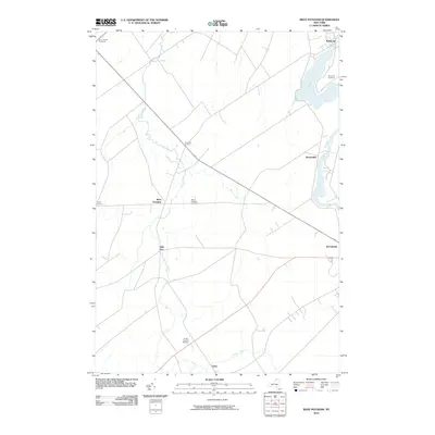
1963 Morristown
St. Lawrence County, NY

1963 Ogdensburg East
St. Lawrence County, NY

1963 Ogdensburg West
St. Lawrence County, NY

1963 Red Mills
St. Lawrence County, NY

1963 Sparrowhawk Point
St. Lawrence County, NY

1964 Canton
St. Lawrence County, NY

1964 Chase Mills
St. Lawrence County, NY

1964 Colton
St. Lawrence County, NY
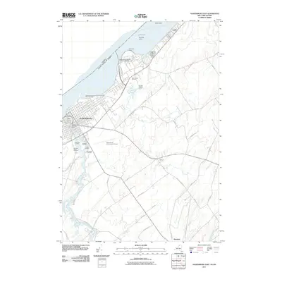
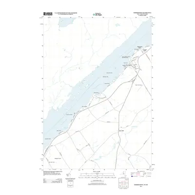
1964 Cornwall West
St. Lawrence County, NY

1964 Hogansburg
St. Lawrence County, NY

1964 Louisville
St. Lawrence County, NY

1964 Massena
St. Lawrence County, NY

1964 Morley
St. Lawrence County, NY

1964 Morrisburg
St. Lawrence County, NY

1964 Nicholville
St. Lawrence County, NY

1964 Norfolk
St. Lawrence County, NY

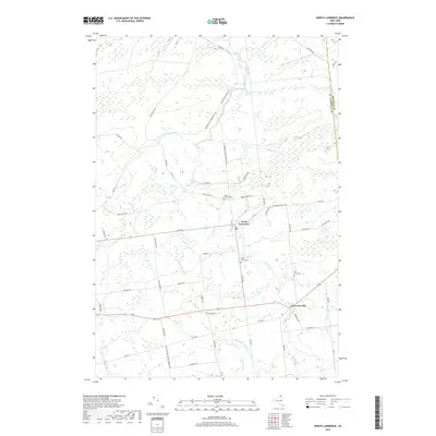
1964 North Lawrence
St. Lawrence County, NY

1964 Parishville
St. Lawrence County, NY

1964 Pierrepont
St. Lawrence County, NY

1964 Potsdam
St. Lawrence County, NY

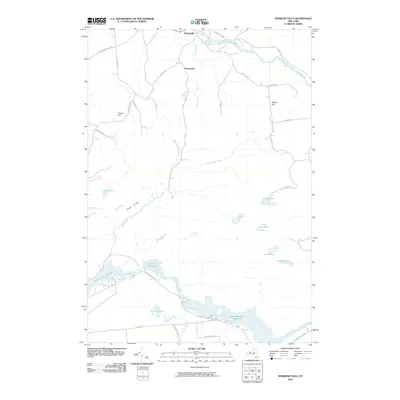
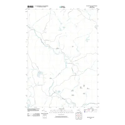
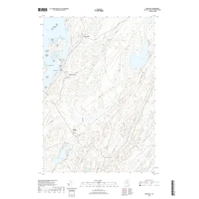
1964 Rainbow Falls
St. Lawrence County, NY

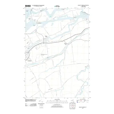
1964 Raquette River
St. Lawrence County, NY

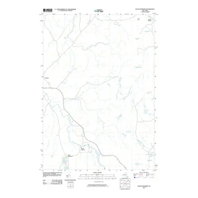
1964 Sylvan Falls
St. Lawrence County, NY

1964 Waddington
St. Lawrence County, NY

1964 West Potsdam
St. Lawrence County, NY

1966 Fine
St. Lawrence County, NY

1966 Hermon
St. Lawrence County, NY

1966 Oswegatchie SE
St. Lawrence County, NY

1966 Oswegatchie
St. Lawrence County, NY

1968 Childwold
St. Lawrence County, NY

1968 Mount Matumbla
St. Lawrence County, NY

1968 Newton Falls
St. Lawrence County, NY

1968 Stark
St. Lawrence County, NY

1969 Degrasse
St. Lawrence County, NY

1969 Five Ponds
St. Lawrence County, NY

1969 South Edwards
St. Lawrence County, NY

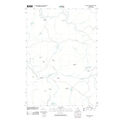
1969 Tooley Pond
St. Lawrence County, NY

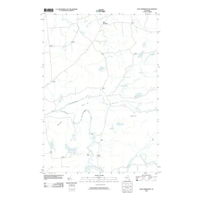
1969 West Pierrepont
St. Lawrence County, NY

1970 Albert Marsh
St. Lawrence County, NY

1970 Brother Ponds
St. Lawrence County, NY

1970 Carry Falls Reservoir
St. Lawrence County, NY

1982 Gouverneur
St. Lawrence County, NY

1985 Gouverneur
St. Lawrence County, NY

1985 Tupper Lake
St. Lawrence County, NY

1990 Piercefield
St. Lawrence County, NY

1999 Five Ponds
St. Lawrence County, NY

1999 Newton Falls
St. Lawrence County, NY

1999 Piercefield
St. Lawrence County, NY
2010 Albert Marsh
St. Lawrence County, NY
2010 Bigelow
St. Lawrence County, NY
2010 Brother Ponds
St. Lawrence County, NY
2010 Canton
St. Lawrence County, NY
2010 Carry Falls Reservoir
St. Lawrence County, NY
2010 Chase Mills
St. Lawrence County, NY
2010 Childwold
St. Lawrence County, NY
2010 Colton
St. Lawrence County, NY
2010 Degrasse
St. Lawrence County, NY
2010 Edwards
St. Lawrence County, NY
2010 Fine
St. Lawrence County, NY
2010 Five Ponds
St. Lawrence County, NY
2010 Harrisville
St. Lawrence County, NY
2010 Hermon
St. Lawrence County, NY
2010 Hogansburg
St. Lawrence County, NY
2010 Lisbon
St. Lawrence County, NY
2010 Long Tom Mountain
St. Lawrence County, NY
2010 Massena
St. Lawrence County, NY
2010 Morley
St. Lawrence County, NY
2010 Mount Matumbla
St. Lawrence County, NY
2010 Natural Dam
St. Lawrence County, NY
2010 Newton Falls
St. Lawrence County, NY
2010 Nicholville
St. Lawrence County, NY
2010 Norfolk
St. Lawrence County, NY
2010 North Lawrence
St. Lawrence County, NY
2010 Oswegatchie SE
St. Lawrence County, NY
2010 Oswegatchie
St. Lawrence County, NY
2010 Parishville
St. Lawrence County, NY
2010 Piercefield
St. Lawrence County, NY
2010 Pierrepont
St. Lawrence County, NY
2010 Pope Mills
St. Lawrence County, NY
2010 Potsdam
St. Lawrence County, NY
2010 Rainbow Falls
St. Lawrence County, NY
2010 Raquette River
St. Lawrence County, NY
2010 South Edwards
St. Lawrence County, NY
2010 Stark
St. Lawrence County, NY
2010 Sylvan Falls
St. Lawrence County, NY
2010 Tooley Pond
St. Lawrence County, NY
2010 West Pierrepont
St. Lawrence County, NY
2010 West Potsdam
St. Lawrence County, NY
2011 Barnhart Island
St. Lawrence County, NY
2011 Chippewa Bay
St. Lawrence County, NY
2011 Edwardsville
St. Lawrence County, NY
2011 Gouverneur
St. Lawrence County, NY
2011 Hammond
St. Lawrence County, NY
2011 Louisville
St. Lawrence County, NY
2011 Morristown OE W
St. Lawrence County, NY
2011 Morristown
St. Lawrence County, NY
2011 Murphy Islands
St. Lawrence County, NY
2011 Ogdensburg East
St. Lawrence County, NY
2011 Ogdensburg West
St. Lawrence County, NY
2011 Red Mills
St. Lawrence County, NY
2011 Sparrowhawk Point
St. Lawrence County, NY
2011 Waddington
St. Lawrence County, NY
2013 Albert Marsh
St. Lawrence County, NY
2013 Barnhart Island
St. Lawrence County, NY
2013 Bigelow
St. Lawrence County, NY
2013 Brother Ponds
St. Lawrence County, NY
2013 Canton
St. Lawrence County, NY
2013 Carry Falls Reservoir
St. Lawrence County, NY
2013 Chase Mills
St. Lawrence County, NY
2013 Childwold
St. Lawrence County, NY
2013 Chippewa Bay
St. Lawrence County, NY
2013 Colton
St. Lawrence County, NY
2013 Degrasse
St. Lawrence County, NY
2013 Edwards
St. Lawrence County, NY
2013 Edwardsville
St. Lawrence County, NY
2013 Fine
St. Lawrence County, NY
2013 Five Ponds
St. Lawrence County, NY
2013 Gouverneur
St. Lawrence County, NY
2013 Hammond
St. Lawrence County, NY
2013 Harrisville
St. Lawrence County, NY
2013 Hermon
St. Lawrence County, NY
2013 Hogansburg
St. Lawrence County, NY
2013 Lisbon
St. Lawrence County, NY
2013 Long Tom Mountain
St. Lawrence County, NY
2013 Louisville
St. Lawrence County, NY
2013 Massena OE N
St. Lawrence County, NY
2013 Massena
St. Lawrence County, NY
2013 Morley
St. Lawrence County, NY
2013 Morristown OE W
St. Lawrence County, NY
2013 Morristown
St. Lawrence County, NY
2013 Mount Matumbla
St. Lawrence County, NY
2013 Murphy Islands
St. Lawrence County, NY
2013 Natural Dam
St. Lawrence County, NY
2013 Newton Falls
St. Lawrence County, NY
2013 Nicholville
St. Lawrence County, NY
2013 Norfolk
St. Lawrence County, NY
2013 North Lawrence
St. Lawrence County, NY
2013 Ogdensburg East
St. Lawrence County, NY
2013 Ogdensburg West
St. Lawrence County, NY
2013 Oswegatchie SE
St. Lawrence County, NY
2013 Oswegatchie
St. Lawrence County, NY
2013 Parishville
St. Lawrence County, NY
2013 Piercefield
St. Lawrence County, NY
2013 Pierrepont
St. Lawrence County, NY
2013 Pope Mills
St. Lawrence County, NY
2013 Potsdam
St. Lawrence County, NY
2013 Rainbow Falls
St. Lawrence County, NY
2013 Raquette River
St. Lawrence County, NY
2013 Red Mills
St. Lawrence County, NY
2013 South Edwards
St. Lawrence County, NY
2013 Sparrowhawk Point
St. Lawrence County, NY
2013 Stark
St. Lawrence County, NY
2013 Sylvan Falls
St. Lawrence County, NY
2013 Tooley Pond
St. Lawrence County, NY
2013 Waddington
St. Lawrence County, NY
2013 West Pierrepont
St. Lawrence County, NY
2013 West Potsdam
St. Lawrence County, NY
2016 Albert Marsh
St. Lawrence County, NY
2016 Barnhart Island
St. Lawrence County, NY
2016 Bigelow
St. Lawrence County, NY
2016 Brother Ponds
St. Lawrence County, NY
2016 Canton
St. Lawrence County, NY
2016 Carry Falls Reservoir
St. Lawrence County, NY
2016 Chase Mills
St. Lawrence County, NY
2016 Childwold
St. Lawrence County, NY
2016 Chippewa Bay
St. Lawrence County, NY
2016 Colton
St. Lawrence County, NY
2016 Degrasse
St. Lawrence County, NY
2016 Edwards
St. Lawrence County, NY
2016 Edwardsville
St. Lawrence County, NY
2016 Fine
St. Lawrence County, NY
2016 Five Ponds
St. Lawrence County, NY
2016 Gouverneur
St. Lawrence County, NY
2016 Hammond
St. Lawrence County, NY
2016 Harrisville
St. Lawrence County, NY
2016 Hermon
St. Lawrence County, NY
2016 Hogansburg
St. Lawrence County, NY
2016 Lisbon
St. Lawrence County, NY
2016 Long Tom Mountain
St. Lawrence County, NY
2016 Louisville
St. Lawrence County, NY
2016 Massena OE N
St. Lawrence County, NY
2016 Massena
St. Lawrence County, NY
2016 Morley
St. Lawrence County, NY
2016 Morristown OE W
St. Lawrence County, NY
2016 Morristown
St. Lawrence County, NY
2016 Mount Matumbla
St. Lawrence County, NY
2016 Murphy Islands
St. Lawrence County, NY
2016 Natural Dam
St. Lawrence County, NY
2016 Newton Falls
St. Lawrence County, NY
2016 Nicholville
St. Lawrence County, NY
2016 Norfolk
St. Lawrence County, NY
2016 North Lawrence
St. Lawrence County, NY
2016 Ogdensburg East
St. Lawrence County, NY
2016 Ogdensburg West
St. Lawrence County, NY
2016 Oswegatchie SE
St. Lawrence County, NY
2016 Oswegatchie
St. Lawrence County, NY
2016 Parishville
St. Lawrence County, NY
2016 Piercefield
St. Lawrence County, NY
2016 Pierrepont
St. Lawrence County, NY
2016 Pope Mills
St. Lawrence County, NY
2016 Potsdam
St. Lawrence County, NY
2016 Rainbow Falls
St. Lawrence County, NY
2016 Raquette River
St. Lawrence County, NY
2016 Red Mills
St. Lawrence County, NY
2016 South Edwards
St. Lawrence County, NY
2016 Sparrowhawk Point
St. Lawrence County, NY
2016 Stark
St. Lawrence County, NY
2016 Sylvan Falls
St. Lawrence County, NY
2016 Tooley Pond
St. Lawrence County, NY
2016 Waddington
St. Lawrence County, NY
2016 West Pierrepont
St. Lawrence County, NY
2016 West Potsdam
St. Lawrence County, NY
2019 Albert Marsh
St. Lawrence County, NY
2019 Bigelow
St. Lawrence County, NY
2019 Brother Ponds
St. Lawrence County, NY
2019 Canton
St. Lawrence County, NY
2019 Carry Falls Reservoir
St. Lawrence County, NY
2019 Chase Mills
St. Lawrence County, NY
2019 Childwold
St. Lawrence County, NY
2019 Chippewa Bay
St. Lawrence County, NY
2019 Colton
St. Lawrence County, NY
2019 Degrasse
St. Lawrence County, NY
2019 Edwards
St. Lawrence County, NY
2019 Edwardsville
St. Lawrence County, NY
2019 Fine
St. Lawrence County, NY
2019 Five Ponds
St. Lawrence County, NY
2019 Gouverneur
St. Lawrence County, NY
2019 Hammond
St. Lawrence County, NY
2019 Harrisville
St. Lawrence County, NY
2019 Hermon
St. Lawrence County, NY
2019 Hogansburg
St. Lawrence County, NY
2019 Lisbon
St. Lawrence County, NY
2019 Long Tom Mountain
St. Lawrence County, NY
2019 Louisville
St. Lawrence County, NY
2019 Massena OE N
St. Lawrence County, NY
2019 Massena
St. Lawrence County, NY
2019 Morley
St. Lawrence County, NY
2019 Morristown OE W
St. Lawrence County, NY
2019 Morristown
St. Lawrence County, NY
2019 Mount Matumbla
St. Lawrence County, NY
2019 Natural Dam
St. Lawrence County, NY
2019 Newton Falls
St. Lawrence County, NY
2019 Nicholville
St. Lawrence County, NY
2019 Norfolk
St. Lawrence County, NY
2019 North Lawrence
St. Lawrence County, NY
2019 Ogdensburg East
St. Lawrence County, NY
2019 Ogdensburg West
St. Lawrence County, NY
2019 Oswegatchie SE
St. Lawrence County, NY
2019 Oswegatchie
St. Lawrence County, NY
2019 Parishville
St. Lawrence County, NY
2019 Piercefield
St. Lawrence County, NY
2019 Pierrepont
St. Lawrence County, NY
2019 Pope Mills
St. Lawrence County, NY
2019 Potsdam
St. Lawrence County, NY
2019 Rainbow Falls
St. Lawrence County, NY
2019 Raquette River
St. Lawrence County, NY
2019 Red Mills
St. Lawrence County, NY
2019 South Edwards
St. Lawrence County, NY
2019 Sparrowhawk Point
St. Lawrence County, NY
2019 Stark
St. Lawrence County, NY
2019 Sylvan Falls
St. Lawrence County, NY
2019 Tooley Pond
St. Lawrence County, NY
2019 Waddington
St. Lawrence County, NY
2019 West Pierrepont
St. Lawrence County, NY
2019 West Potsdam
St. Lawrence County, NY

2023 Albert Marsh
St. Lawrence County, NY

2023 Barnhart Island
St. Lawrence County, NY

2023 Bigelow
St. Lawrence County, NY

2023 Brother Ponds
St. Lawrence County, NY

2023 Canton
St. Lawrence County, NY

2023 Carry Falls Reservoir
St. Lawrence County, NY

2023 Chase Mills
St. Lawrence County, NY

2023 Childwold
St. Lawrence County, NY

2023 Chippewa Bay
St. Lawrence County, NY

2023 Colton
St. Lawrence County, NY

2023 Degrasse
St. Lawrence County, NY

2023 Edwards
St. Lawrence County, NY

2023 Edwardsville
St. Lawrence County, NY

2023 Fine
St. Lawrence County, NY

2023 Five Ponds
St. Lawrence County, NY

2023 Gouverneur
St. Lawrence County, NY

2023 Hammond
St. Lawrence County, NY

2023 Harrisville
St. Lawrence County, NY

2023 Hermon
St. Lawrence County, NY

2023 Hogansburg
St. Lawrence County, NY

2023 Lisbon
St. Lawrence County, NY

2023 Long Tom Mountain
St. Lawrence County, NY

2023 Louisville
St. Lawrence County, NY

2023 Massena OE N
St. Lawrence County, NY

2023 Massena
St. Lawrence County, NY

2023 Morley
St. Lawrence County, NY

2023 Morristown OE W
St. Lawrence County, NY

2023 Morristown
St. Lawrence County, NY

2023 Mount Matumbla
St. Lawrence County, NY

2023 Murphy Islands
St. Lawrence County, NY

2023 Natural Dam
St. Lawrence County, NY

2023 Newton Falls
St. Lawrence County, NY

2023 Nicholville
St. Lawrence County, NY

2023 Norfolk
St. Lawrence County, NY

2023 North Lawrence
St. Lawrence County, NY

2023 Ogdensburg East
St. Lawrence County, NY

2023 Ogdensburg West
St. Lawrence County, NY

2023 Oswegatchie SE
St. Lawrence County, NY

2023 Oswegatchie
St. Lawrence County, NY

2023 Parishville
St. Lawrence County, NY

2023 Piercefield
St. Lawrence County, NY

2023 Pierrepont
St. Lawrence County, NY

2023 Pope Mills
St. Lawrence County, NY

2023 Potsdam
St. Lawrence County, NY

2023 Rainbow Falls
St. Lawrence County, NY

2023 Raquette River
St. Lawrence County, NY

2023 Red Mills
St. Lawrence County, NY

2023 South Edwards
St. Lawrence County, NY

2023 Sparrowhawk Point
St. Lawrence County, NY

2023 Stark
St. Lawrence County, NY

2023 Sylvan Falls
St. Lawrence County, NY

2023 Tooley Pond
St. Lawrence County, NY

2023 Waddington
St. Lawrence County, NY

2023 West Pierrepont
St. Lawrence County, NY

2023 West Potsdam
St. Lawrence County, NY