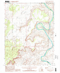
1988 Map of Horsethief Canyon
USGS Topo · Published 1988About this map
The Green River carves a winding path through this desert landscape at the meeting of Wayne, Emery, Grand, and San Juan counties. In the late 1980s, this area was defined by the overlapping boundaries of Canyonlands National Park and the Glen Canyon National Recreation Area. The river's serpentine course creates distinct alluvial benches known as bottoms, including Fort Bottom, Potato Bottom, and Beaver Bottom, which sit beneath towering features like the Orange Cliffs and Bighorn Mesa. The transition from the high-walled Labyrinth Canyon into Stillwater Canyon highlights the dramatic vertical relief of the White Rim and the expansive tablelands of The Spur. This survey captures a wild stretch of river and rimrock before the proliferation of modern GPS mapping, showing the intricate network of canyons like Horsethief Canyon and Millard Canyon that drain into the Green.
Find a feature on this map
26 named features on this map. Tap any name to fly to it.
Don’t see what you’re looking for? This feature index may not catch every label — zoom into the map to look around manually.
Map Details
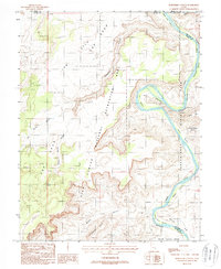
Editions of this 1988 Horsethief Canyon Map
2 editions found
Other maps of this area

1885 · San Rafael
USGS Topo · 1:250,000

1885 · La Sal
USGS Topo · 1:250,000

1951 · The Knoll
USGS Topo · 1:62,500

1951 · Upheaval Dome
USGS Topo · 1:62,500

1952 · Tidwell 4 SE
USGS Topo · 1:24,000

1952 · Carlisle 2 NW
USGS Topo · 1:24,000

1952 · Carlisle 2 SW
USGS Topo · 1:24,000

1952 · Moab 3 SW
USGS Topo · 1:24,000

1953 · Orange Cliffs 1 SE
USGS Topo · 1:24,000

1953 · Orange Cliffs 1 NE
USGS Topo · 1:24,000