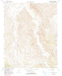
1966 Map of La Panza Ranch
USGS Topo · Published 1991About this map
La Panza Ranch serves as the central landmark for this section of San Luis Obispo County, reflecting the deep agricultural and ranching roots of the Central Coast hinterland in the mid-1960s. The landscape is defined by the convergence of several major drainages, including Navajo Creek, San Juan Creek, and Windmill Creek, which carve through the high terrain. Human activity is marked by scattered infrastructure like French Camp in the north and various Wells and Drill Holes that suggest local efforts to tap subsurface resources. Along the southern edge, the boundary of the Los Padres National Forest meets the private ranch lands near a Fire Control Station. The map captures a working landscape where water sources like Sixteen Spring and Cedar Spring were critical for sustaining operations across the vast, open range before modern developments altered the character of the region.
Find a feature on this map
19 named features on this map. Tap any name to fly to it.
Don’t see what you’re looking for? This feature index may not catch every label — zoom into the map to look around manually.
Map Details
Editions of this 1966 La Panza Ranch Map
2 editions found
Other maps of this area

1914 · Cholame
USGS Topo · 1:125,000

1915 · Cholame
USGS Topo · 1:125,000

1917 · Cholame
USGS Topo · 1:125,000

1922 · Pozo
USGS Topo · 1:62,500

1932 · La Panza
USGS Topo · 1:48,000

1935 · La Panza
USGS Topo · 1:62,500

1936 · La Panza
USGS Topo · 1:62,500

1943 · Packwood
USGS Topo · 1:31,680

1943 · Grant Lake
USGS Topo · 1:31,680

1943 · Commatti Canyon
USGS Topo · 1:31,680