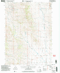
2001 Map of Lyman Pass
USGS Topo · Published 2006About this map
California Historic National Trail winds through the southern reaches of this landscape, marking a legacy of westward migration across the Idaho high country. This high-elevation terrain is defined by the massive Mountain Middle range and the protected timberlands of the Sawtooth National Forest. The map documents a sparse, high-altitude environment where water is the primary catalyst for movement and settlement, evidenced by the numerous named Springs and drainages like Birch Creek and Cottonwood Creek that carve through the slopes. In the lower valleys, evidence of early cattle ranching and freighting remains in the form of several Corral locations and the Moulton (Site) settlement. High on the ridgelines, Quarries indicate localized extraction efforts, while family-named sites like Wolters and natural landmarks such as Emery Canyon provide specific points of interest for genealogists and local historians tracing the development of Cassia County.
Find a feature on this map
16 named features on this map. Tap any name to fly to it.
Don’t see what you’re looking for? This feature index may not catch every label — zoom into the map to look around manually.
Map Details
Editions of this 2001 Lyman Pass Map
This is the sole edition of this map. No revisions or reprints were ever made.
Other maps of this area

1954 · Pocatello
USGS Topo · 1:250,000

1954 · Brigham City
USGS Topo · 1:250,000

1958 · Pocatello
USGS Topo · 1:250,000

1958 · Brigham City
USGS Topo · 1:250,000

1959 · Cotton Thomas Basin
USGS Topo · 1:62,500

1959 · Yost
USGS Topo · 1:62,500

1962 · Brigham City
USGS Topo · 1:250,000

1968 · Almo
USGS Topo · 1:24,000

1968 · Cache Peak
USGS Topo · 1:24,000

1968 · Basin
USGS Topo · 1:24,000