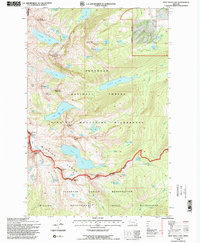
1994 Map of Gray Wolf Lake
USGS Topo · Published 1996About this map
The high alpine basins of the Mission Range define this mid-1990s survey, where the glacial landscape of the Mission Mountains Wilderness meets the Flathead Indian Reservation. At the heart of the map lies the expansive Gray Wolf Lake, fed by the melt of the Gray Wolf Glacier beneath the shadow of Gray Wolf Peak. The map illustrates a dense network of high-elevation water bodies, from the prominent Crystal Lake and Turquoise Lake to uniquely named features like Angels Bathing Pool and Giant Spring.
Find a feature on this map
61 named features on this map. Tap any name to fly to it.
Don’t see what you’re looking for? This feature index may not catch every label — zoom into the map to look around manually.
Map Details
Editions of this 1994 Gray Wolf Lake Map
2 editions found
Other maps of this area

1921 · Elbow Lake
USGS Topo · 1:125,000

1955 · Choteau
USGS Topo · 1:250,000

1957 · Choteau
USGS Topo · 1:250,000

1958 · Choteau
USGS Topo · 1:250,000

1962 · Choteau
USGS Topo · 1:250,000

1965 · Upper Jocko Lake
USGS Topo · 1:24,000
1965 · Belmore Sloughs
USGS Topo · 1:24,000

1965 · Gray Wolf Lake
USGS Topo · 1:24,000

1965 · Lake Marshall
USGS Topo · 1:24,000
1965 · St Marys Lake
USGS Topo · 1:24,000