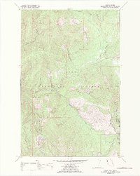
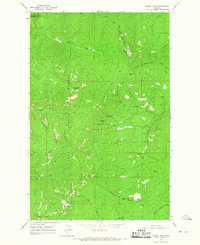
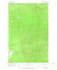
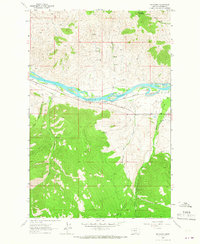
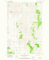
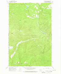
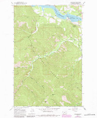
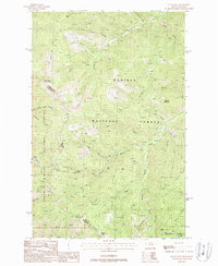
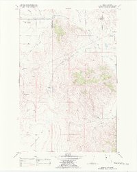
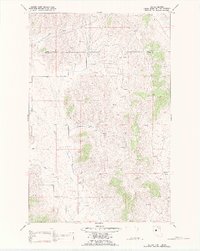
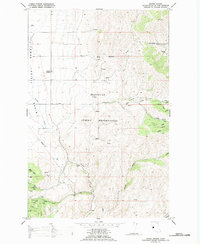
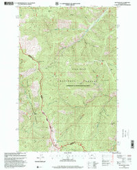
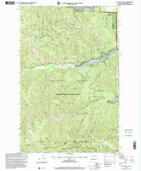
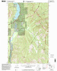
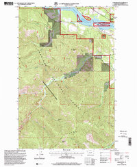
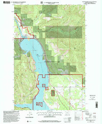
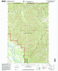
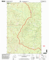
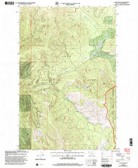
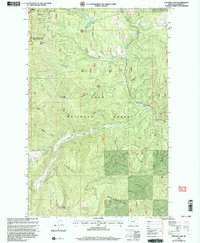
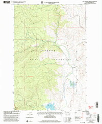
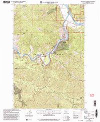
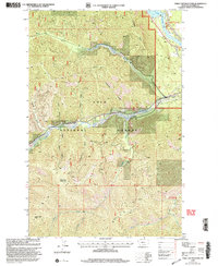
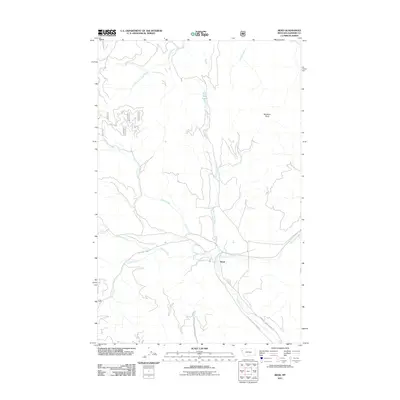
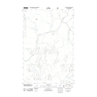
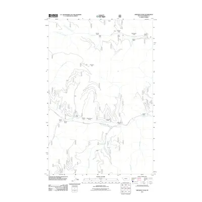
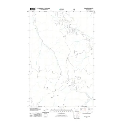
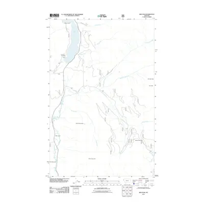
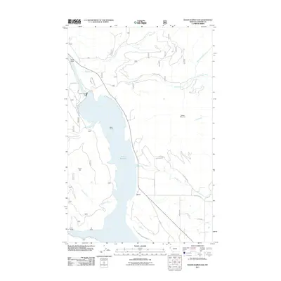
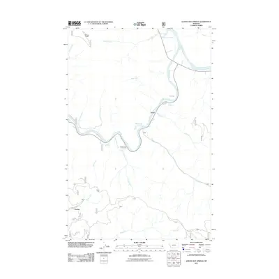
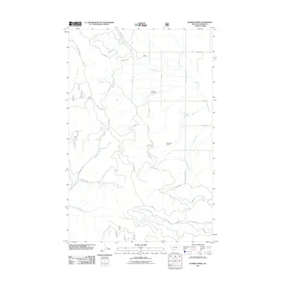
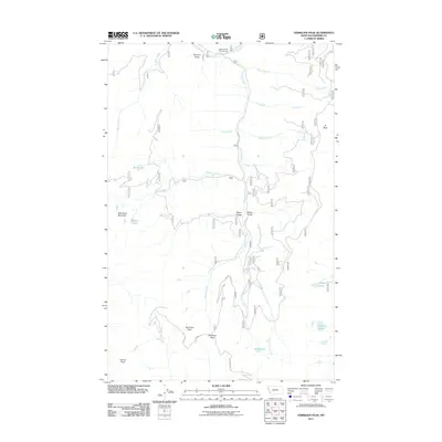
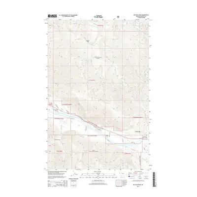
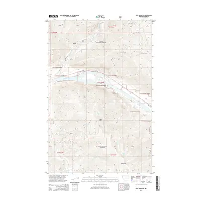
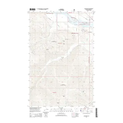
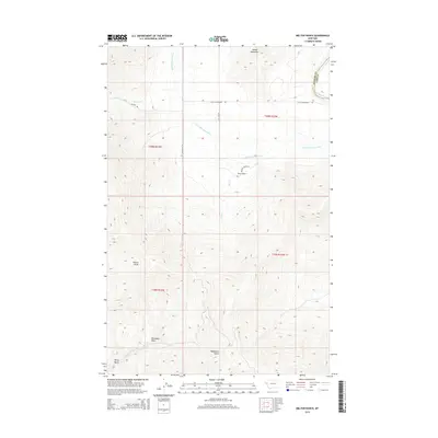
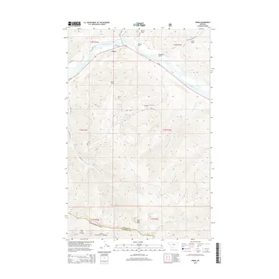
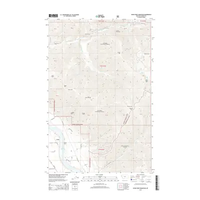
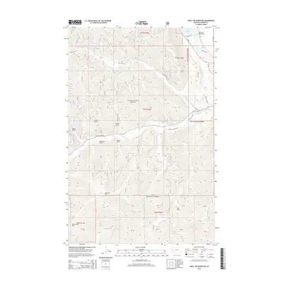
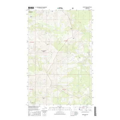
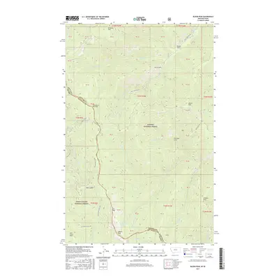
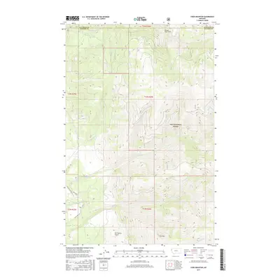
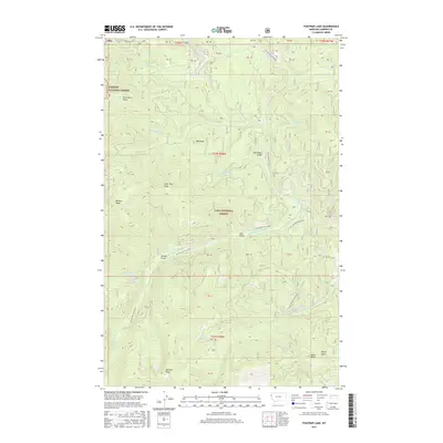
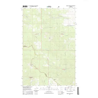
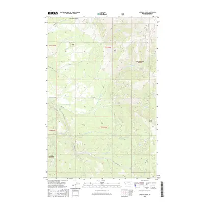
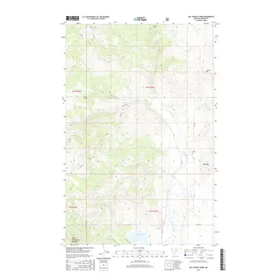
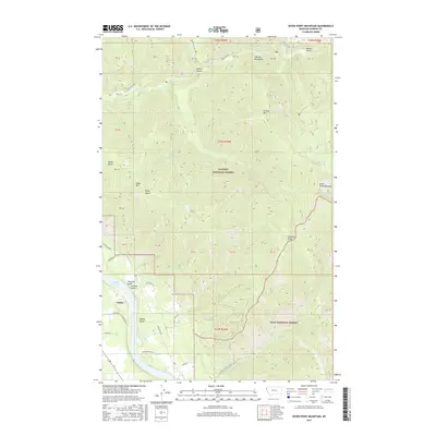
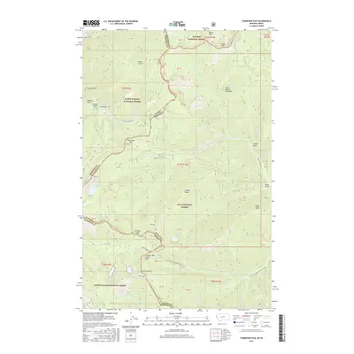
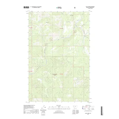
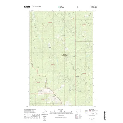
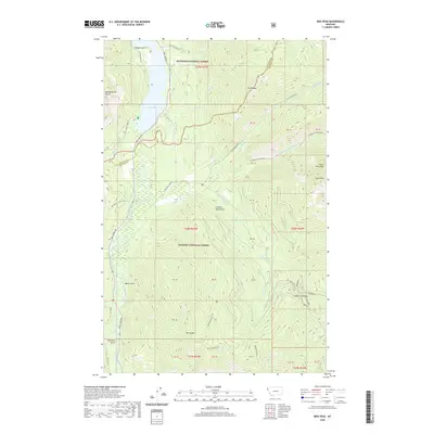
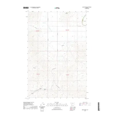
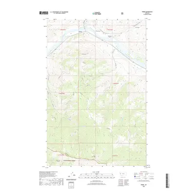
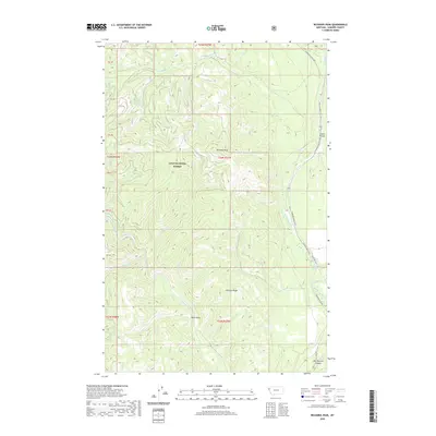
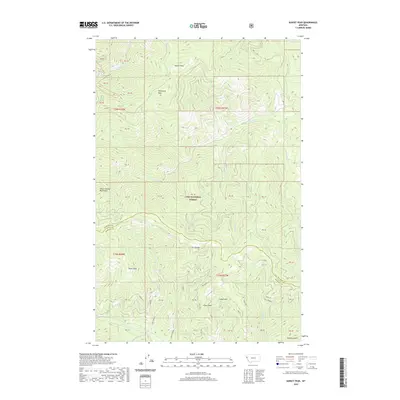
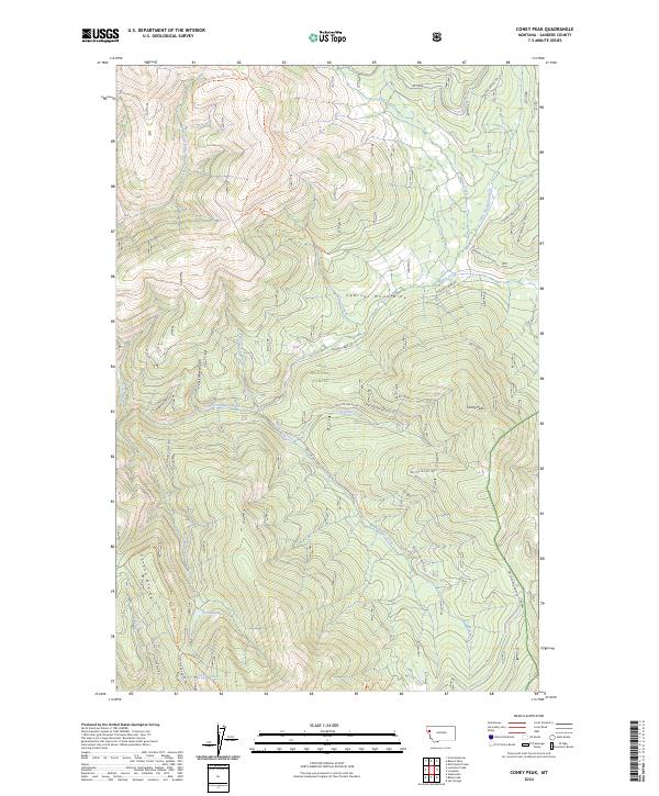
1989 Map of Coney Peak
USGS Topo · Published 1989About this map
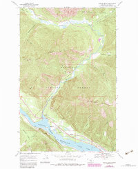
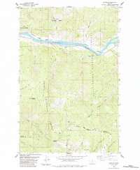
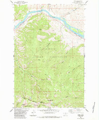
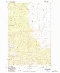
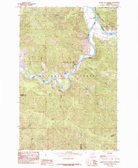
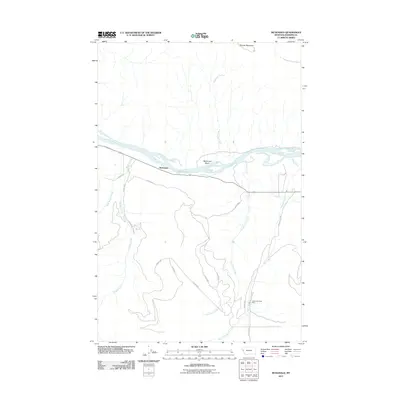
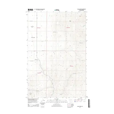
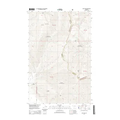
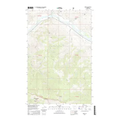
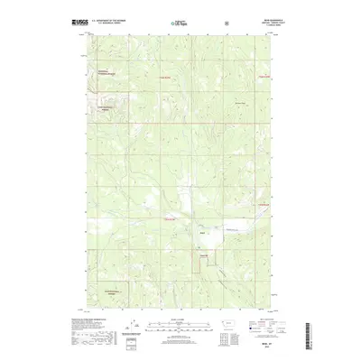
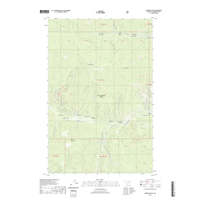
Coney Peak stands as the central landmark in this high-altitude landscape where the western edge of the Flathead Indian Reservation Boundary meets the Lolo National Forest. The 1989 topography reveals a rugged drainage network defined by the Little Thompson River and its numerous tributaries, including Alder Creek, Tepee Creek, and McGinnis Creek. The terrain is marked by significant elevation changes, from the heights of the Corona Divide down to the secluded waters of Corona Lake and the flow of Corona Spring.
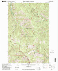
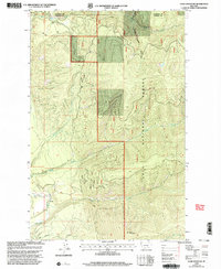
Find a feature on this map
20 named features on this map. Tap any name to fly to it.
Don’t see what you’re looking for? This feature index may not catch every label — zoom into the map to look around manually.
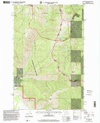
Map Details
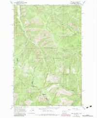
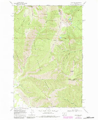
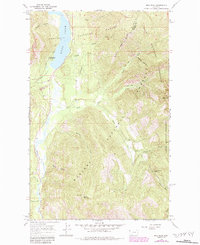
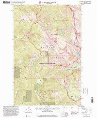
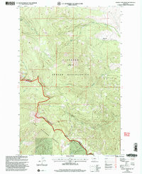
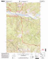
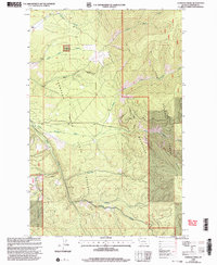
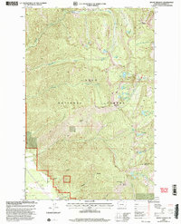
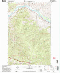
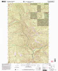
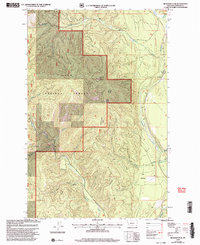
Editions of this 1989 Coney Peak Map
This is the sole edition of this map. No revisions or reprints were ever made.
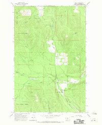
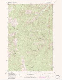
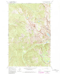
Historical Maps of Sanders County Through Time
286 maps found
1956 Cooper Gulch
Sanders County, MT
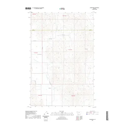
1959 Perma
Sanders County, MT
1964 Baldy Lake
Sanders County, MT
1964 Bassoo Peak
Sanders County, MT
1964 Big Hole Peak
Sanders County, MT
1964 Calico Creek
Sanders County, MT
1964 Coney Peak
Sanders County, MT
1964 Cook Mountain
Sanders County, MT
1964 Eddy Mountain
Sanders County, MT
1964 Loneman Creek
Sanders County, MT
1964 Markle Pass
Sanders County, MT
1964 Mc Donald
Sanders County, MT
1964 Melton Ranch
Sanders County, MT
1964 Mill Pocket Creek
Sanders County, MT
1964 Priscilla Peak
Sanders County, MT
1965 Oliver Point
Sanders County, MT
1966 Bend
Sanders County, MT
1966 Bloom Peak
Sanders County, MT
1966 Elephant Peak
Sanders County, MT
1966 Fishtrap Lake
Sanders County, MT
1966 Gem Peak
Sanders County, MT
1966 Goat Peak
Sanders County, MT
1966 Ibex Peak
Sanders County, MT
1966 Larchwood
Sanders County, MT
1966 Noxon Rapids Dam
Sanders County, MT
1966 Richards Peak
Sanders County, MT
1966 Seven Point Mountain
Sanders County, MT
1966 Smeads Bench
Sanders County, MT
1966 Vermilion Peak
Sanders County, MT
1984 Camas Prairie
Sanders County, MT
1984 Hewolf Mountain
Sanders County, MT
1984 Knowles
Sanders County, MT
1984 Perma
Sanders County, MT
1984 Sunrise Spring
Sanders County, MT
1985 Quinns Hot Springs
Sanders County, MT
1988 Black Peak
Sanders County, MT
1988 Driveway Peak
Sanders County, MT
1988 Helwick Peak
Sanders County, MT
1988 Hewolf Mountain
Sanders County, MT
1988 Markle Pass
Sanders County, MT
1988 Mc Donald
Sanders County, MT
1988 Melton Ranch
Sanders County, MT
1988 Mount Headley
Sanders County, MT
1988 Oliver Point
Sanders County, MT
1988 Sunset Peak
Sanders County, MT
1988 Table Top Mountain
Sanders County, MT
1988 Thompson Pass
Sanders County, MT
1989 Camas Prairie
Sanders County, MT
1989 Coney Peak
Sanders County, MT
1989 Knowles
Sanders County, MT
1989 Mill Pocket Creek
Sanders County, MT
1997 Black Peak
Sanders County, MT
1997 Bloom Peak
Sanders County, MT
1997 Elephant Peak
Sanders County, MT
1997 Gem Peak
Sanders County, MT
1997 Goat Peak
Sanders County, MT
1997 Helwick Peak
Sanders County, MT
1997 Ibex Peak
Sanders County, MT
1997 Larchwood
Sanders County, MT
1997 Noxon Rapids Dam
Sanders County, MT
1997 Seven Point Mountain
Sanders County, MT
1997 Smeads Bench
Sanders County, MT
1997 Vermilion Peak
Sanders County, MT
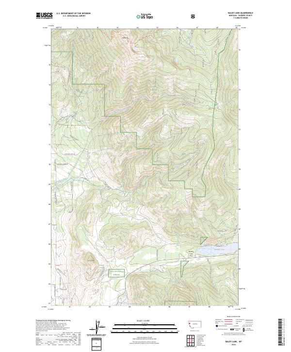
1999 Baldy Lake
Sanders County, MT
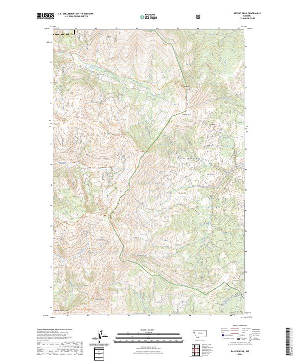
1999 Bassoo Peak
Sanders County, MT
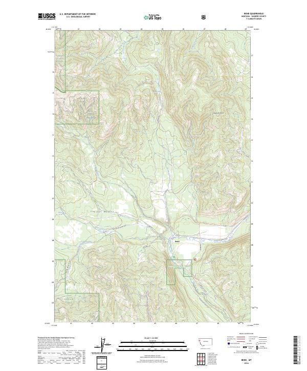
1999 Bend
Sanders County, MT
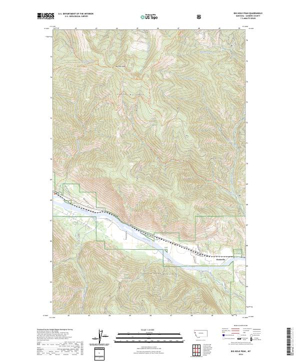
1999 Big Hole Peak
Sanders County, MT
1999 Calico Creek
Sanders County, MT
1999 Coney Peak
Sanders County, MT
1999 Cook Mountain
Sanders County, MT
1999 Driveway Peak
Sanders County, MT
1999 Eddy Mountain
Sanders County, MT
1999 Fishtrap Lake
Sanders County, MT
1999 Hewolf Mountain
Sanders County, MT
1999 Knowles
Sanders County, MT
1999 Loneman Creek
Sanders County, MT
1999 Mill Pocket Creek
Sanders County, MT
1999 Mount Headley
Sanders County, MT
1999 Perma
Sanders County, MT
1999 Priscilla Peak
Sanders County, MT
1999 Quinns Hot Springs
Sanders County, MT
1999 Richards Peak
Sanders County, MT
1999 Sunrise Spring
Sanders County, MT
1999 Sunset Peak
Sanders County, MT
1999 Table Top Mountain
Sanders County, MT
1999 Thompson Pass
Sanders County, MT
2011 Baldy Lake
Sanders County, MT
2011 Bassoo Peak
Sanders County, MT
2011 Bend
Sanders County, MT
2011 Big Hole Peak
Sanders County, MT
2011 Black Peak
Sanders County, MT
2011 Bloom Peak
Sanders County, MT
2011 Calico Creek
Sanders County, MT
2011 Camas Prairie
Sanders County, MT
2011 Coney Peak
Sanders County, MT
2011 Cook Mountain
Sanders County, MT
2011 Driveway Peak
Sanders County, MT
2011 Eddy Mountain
Sanders County, MT
2011 Elephant Peak
Sanders County, MT
2011 Fishtrap Lake
Sanders County, MT
2011 Gem Peak
Sanders County, MT
2011 Goat Peak
Sanders County, MT
2011 Helwick Peak
Sanders County, MT
2011 Hewolf Mountain
Sanders County, MT
2011 Ibex Peak
Sanders County, MT
2011 Knowles
Sanders County, MT
2011 Larchwood
Sanders County, MT
2011 Loneman Creek
Sanders County, MT

2011 Markle Pass
Sanders County, MT
2011 McDonald
Sanders County, MT
2011 Melton Ranch
Sanders County, MT
2011 Mill Pocket Creek
Sanders County, MT
2011 Mount Headley
Sanders County, MT
2011 Noxon Rapids Dam
Sanders County, MT
2011 Oliver Point
Sanders County, MT
2011 Perma
Sanders County, MT
2011 Priscilla Peak
Sanders County, MT
2011 Quinns Hot Springs
Sanders County, MT
2011 Richards Peak
Sanders County, MT
2011 Seven Point Mountain
Sanders County, MT
2011 Smeads Bench
Sanders County, MT
2011 Sunrise Spring
Sanders County, MT
2011 Sunset Peak
Sanders County, MT
2011 Table Top Mountain
Sanders County, MT
2011 Thompson Pass
Sanders County, MT
2011 Vermilion Peak
Sanders County, MT
2014 Baldy Lake
Sanders County, MT
2014 Bassoo Peak
Sanders County, MT
2014 Bend
Sanders County, MT
2014 Big Hole Peak
Sanders County, MT
2014 Black Peak
Sanders County, MT
2014 Bloom Peak
Sanders County, MT
2014 Calico Creek
Sanders County, MT
2014 Camas Prairie
Sanders County, MT
2014 Coney Peak
Sanders County, MT
2014 Cook Mountain
Sanders County, MT
2014 Driveway Peak
Sanders County, MT
2014 Eddy Mountain
Sanders County, MT
2014 Elephant Peak
Sanders County, MT
2014 Fishtrap Lake
Sanders County, MT
2014 Gem Peak
Sanders County, MT
2014 Goat Peak
Sanders County, MT
2014 Helwick Peak
Sanders County, MT
2014 Hewolf Mountain
Sanders County, MT
2014 Ibex Peak
Sanders County, MT

2014 Knowles
Sanders County, MT
2014 Larchwood
Sanders County, MT
2014 Loneman Creek
Sanders County, MT
2014 Markle Pass
Sanders County, MT
2014 McDonald
Sanders County, MT
2014 Melton Ranch
Sanders County, MT
2014 Mill Pocket Creek
Sanders County, MT
2014 Mount Headley
Sanders County, MT
2014 Noxon Rapids Dam
Sanders County, MT

2014 Oliver Point
Sanders County, MT
2014 Perma
Sanders County, MT
2014 Priscilla Peak
Sanders County, MT
2014 Quinns Hot Springs
Sanders County, MT
2014 Richards Peak
Sanders County, MT
2014 Seven Point Mountain
Sanders County, MT
2014 Smeads Bench
Sanders County, MT
2014 Sunrise Spring
Sanders County, MT
2014 Sunset Peak
Sanders County, MT
2014 Table Top Mountain
Sanders County, MT
2014 Thompson Pass
Sanders County, MT
2014 Vermilion Peak
Sanders County, MT
2017 Baldy Lake
Sanders County, MT
2017 Bassoo Peak
Sanders County, MT
2017 Bend
Sanders County, MT
2017 Big Hole Peak
Sanders County, MT
2017 Black Peak
Sanders County, MT
2017 Bloom Peak
Sanders County, MT
2017 Calico Creek
Sanders County, MT
2017 Camas Prairie
Sanders County, MT
2017 Coney Peak
Sanders County, MT
2017 Cook Mountain
Sanders County, MT
2017 Driveway Peak
Sanders County, MT
2017 Eddy Mountain
Sanders County, MT
2017 Elephant Peak
Sanders County, MT
2017 Fishtrap Lake
Sanders County, MT
2017 Gem Peak
Sanders County, MT
2017 Goat Peak
Sanders County, MT
2017 Helwick Peak
Sanders County, MT
2017 Hewolf Mountain
Sanders County, MT
2017 Ibex Peak
Sanders County, MT
2017 Knowles
Sanders County, MT
2017 Larchwood
Sanders County, MT
2017 Loneman Creek
Sanders County, MT
2017 Markle Pass
Sanders County, MT
2017 McDonald
Sanders County, MT
2017 Melton Ranch
Sanders County, MT
2017 Mill Pocket Creek
Sanders County, MT
2017 Mount Headley
Sanders County, MT
2017 Noxon Rapids Dam
Sanders County, MT
2017 Oliver Point
Sanders County, MT
2017 Perma
Sanders County, MT
2017 Priscilla Peak
Sanders County, MT
2017 Quinns Hot Springs
Sanders County, MT
2017 Richards Peak
Sanders County, MT
2017 Seven Point Mountain
Sanders County, MT
2017 Smeads Bench
Sanders County, MT
2017 Sunrise Spring
Sanders County, MT

2017 Sunset Peak
Sanders County, MT
2017 Table Top Mountain
Sanders County, MT
2017 Thompson Pass
Sanders County, MT
2017 Vermilion Peak
Sanders County, MT
2020 Baldy Lake
Sanders County, MT
2020 Bassoo Peak
Sanders County, MT
2020 Bend
Sanders County, MT
2020 Big Hole Peak
Sanders County, MT
2020 Black Peak
Sanders County, MT
2020 Bloom Peak
Sanders County, MT
2020 Calico Creek
Sanders County, MT
2020 Camas Prairie
Sanders County, MT
2020 Coney Peak
Sanders County, MT
2020 Cook Mountain
Sanders County, MT
2020 Driveway Peak
Sanders County, MT
2020 Eddy Mountain
Sanders County, MT
2020 Elephant Peak
Sanders County, MT
2020 Fishtrap Lake
Sanders County, MT
2020 Gem Peak
Sanders County, MT
2020 Goat Peak
Sanders County, MT
2020 Helwick Peak
Sanders County, MT
2020 Hewolf Mountain
Sanders County, MT
2020 Ibex Peak
Sanders County, MT

2020 Knowles
Sanders County, MT
2020 Larchwood
Sanders County, MT
2020 Loneman Creek
Sanders County, MT
2020 Markle Pass
Sanders County, MT

2020 McDonald
Sanders County, MT
2020 Melton Ranch
Sanders County, MT
2020 Mill Pocket Creek
Sanders County, MT
2020 Mount Headley
Sanders County, MT
2020 Noxon Rapids Dam
Sanders County, MT
2020 Oliver Point
Sanders County, MT
2020 Perma
Sanders County, MT
2020 Priscilla Peak
Sanders County, MT
2020 Quinns Hot Springs
Sanders County, MT
2020 Richards Peak
Sanders County, MT
2020 Seven Point Mountain
Sanders County, MT
2020 Smeads Bench
Sanders County, MT
2020 Sunrise Spring
Sanders County, MT
2020 Sunset Peak
Sanders County, MT
2020 Table Top Mountain
Sanders County, MT
2020 Thompson Pass
Sanders County, MT
2020 Vermilion Peak
Sanders County, MT
2024 Baldy Lake
Sanders County, MT
2024 Bassoo Peak
Sanders County, MT
2024 Bend
Sanders County, MT
2024 Big Hole Peak
Sanders County, MT
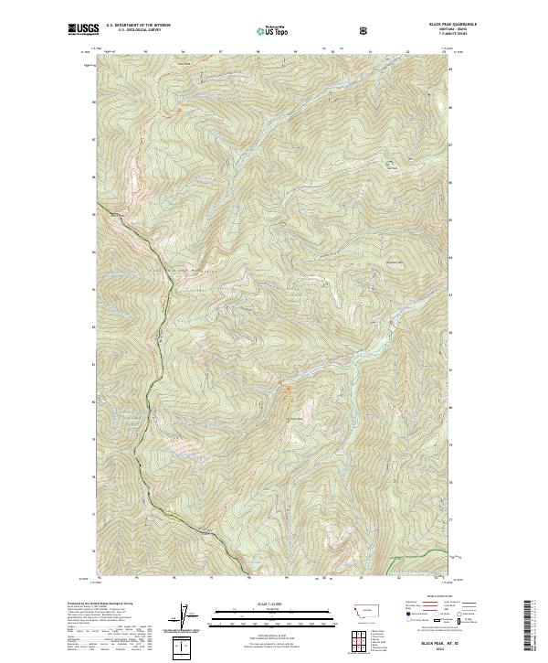
2024 Black Peak
Sanders County, MT
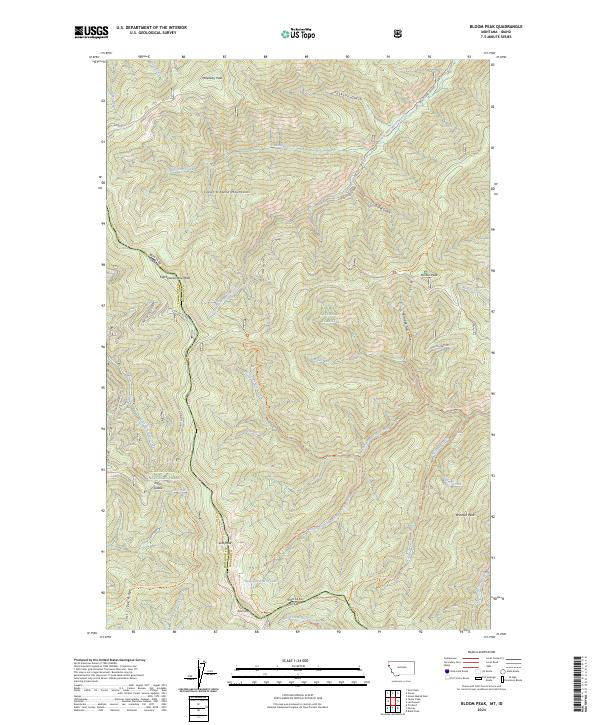
2024 Bloom Peak
Sanders County, MT
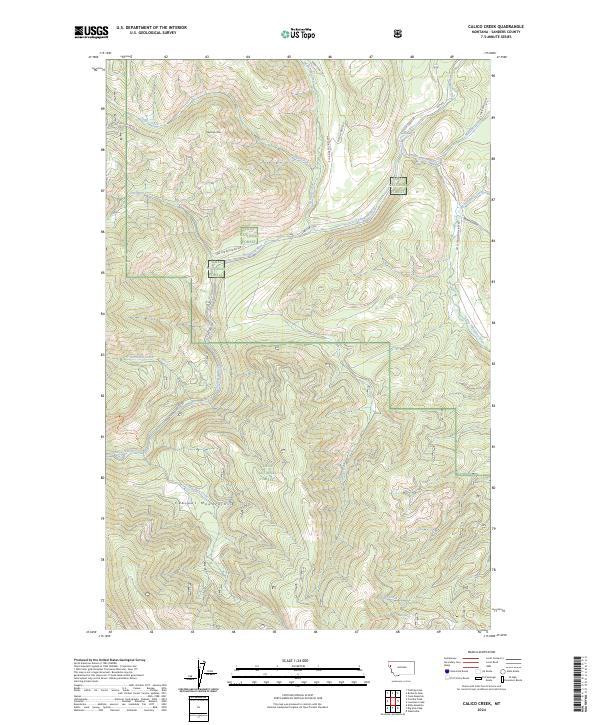
2024 Calico Creek
Sanders County, MT
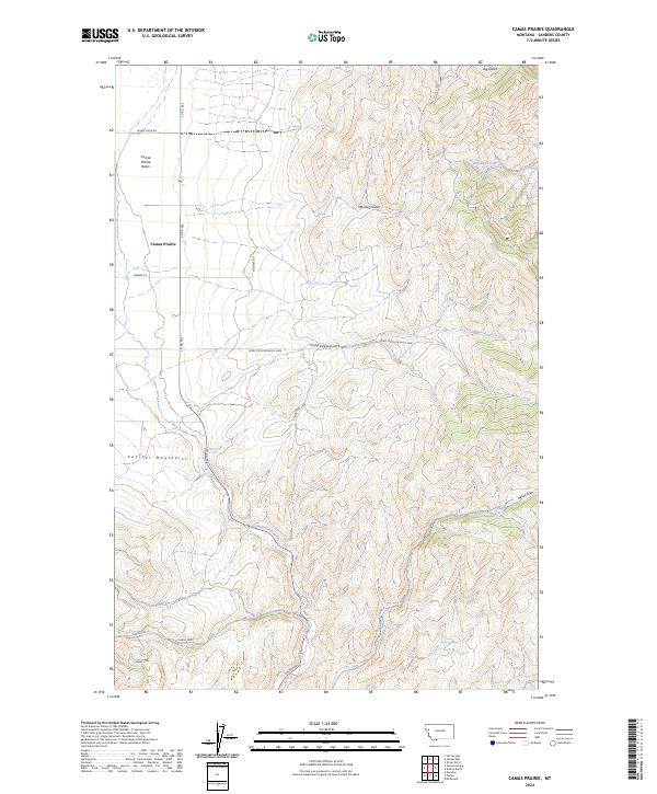
2024 Camas Prairie
Sanders County, MT
2024 Coney Peak
Sanders County, MT
2024 Cook Mountain
Sanders County, MT
2024 Driveway Peak
Sanders County, MT
2024 Eddy Mountain
Sanders County, MT
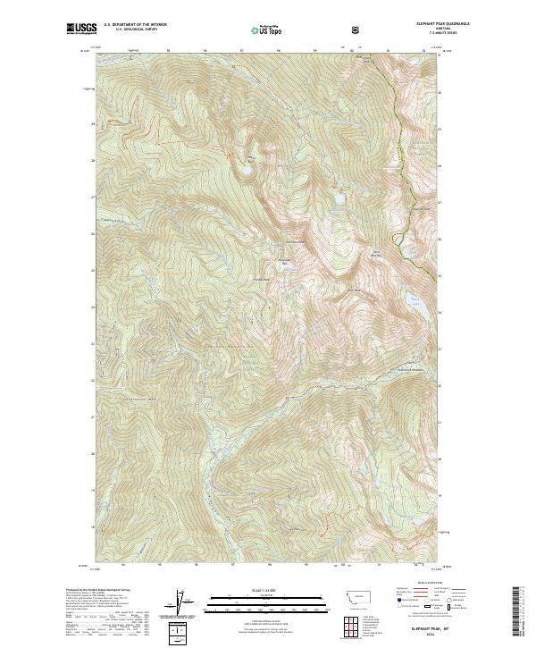
2024 Elephant Peak
Sanders County, MT
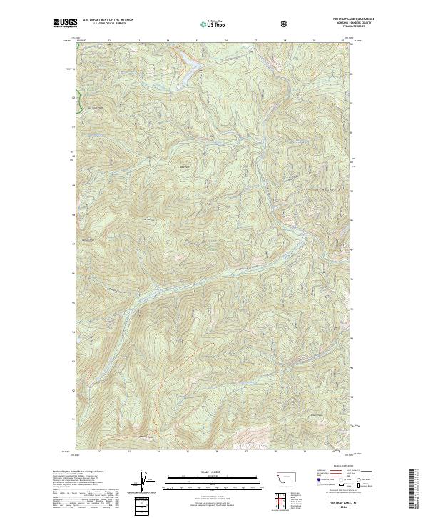
2024 Fishtrap Lake
Sanders County, MT
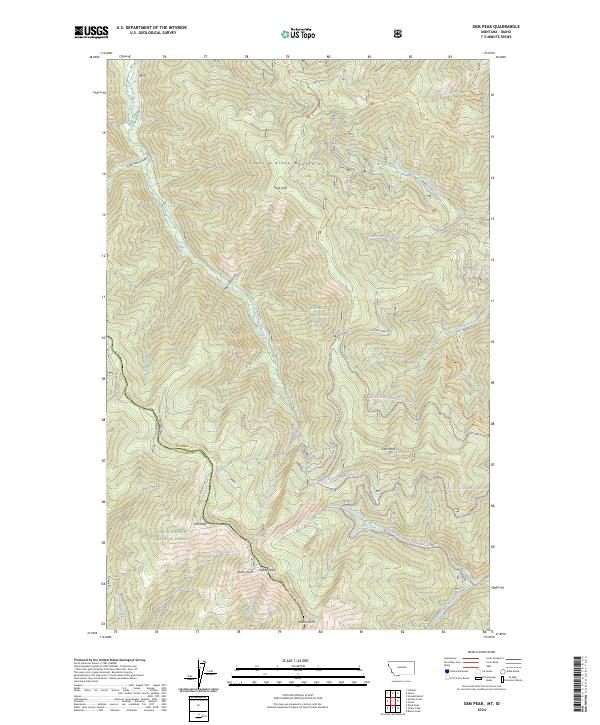
2024 Gem Peak
Sanders County, MT
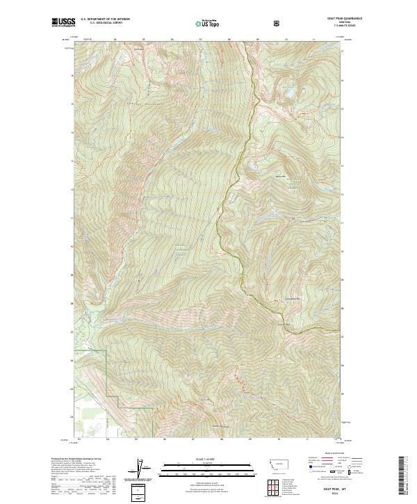
2024 Goat Peak
Sanders County, MT
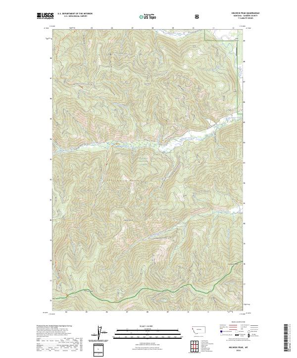
2024 Helwick Peak
Sanders County, MT
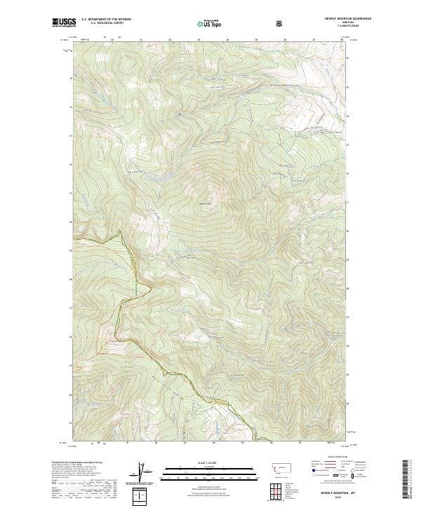
2024 Hewolf Mountain
Sanders County, MT
2024 Ibex Peak
Sanders County, MT
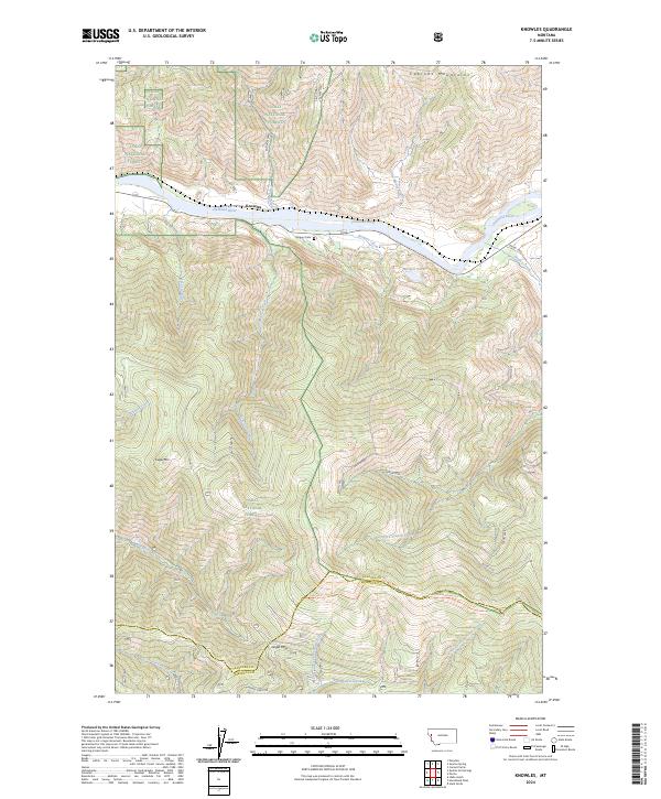
2024 Knowles
Sanders County, MT
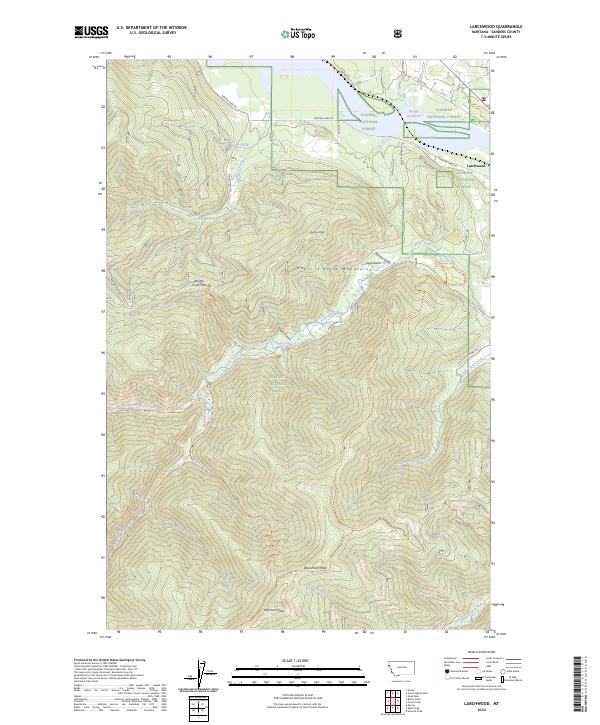
2024 Larchwood
Sanders County, MT
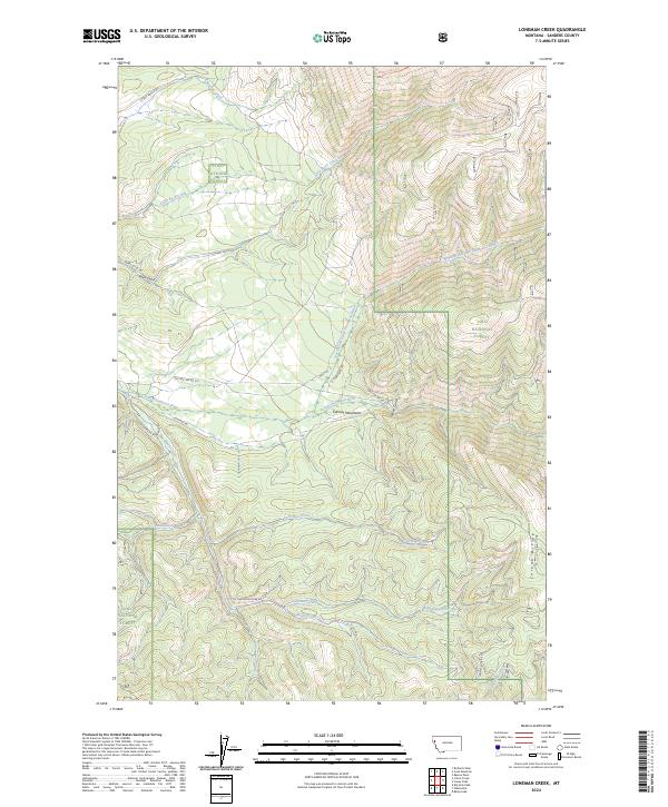
2024 Loneman Creek
Sanders County, MT
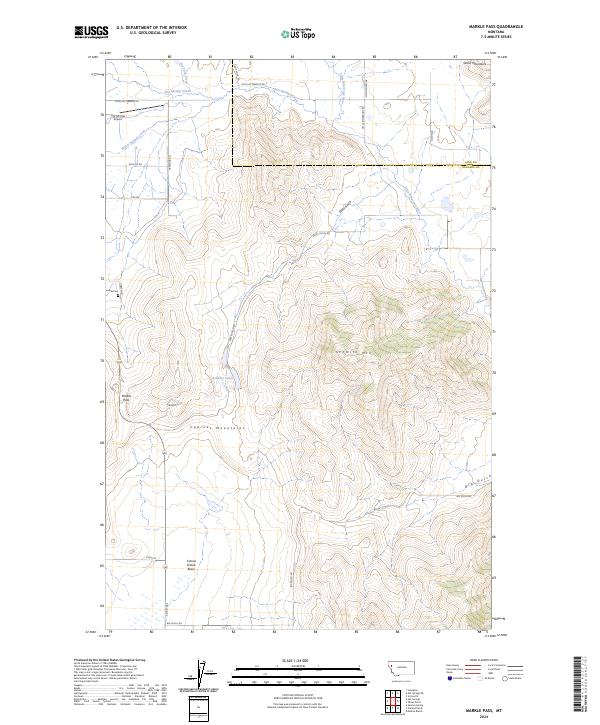
2024 Markle Pass
Sanders County, MT
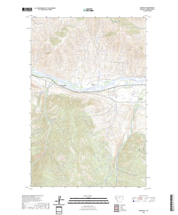
2024 McDonald
Sanders County, MT
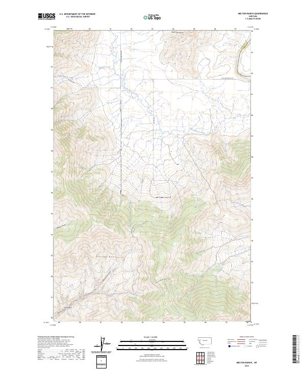
2024 Melton Ranch
Sanders County, MT
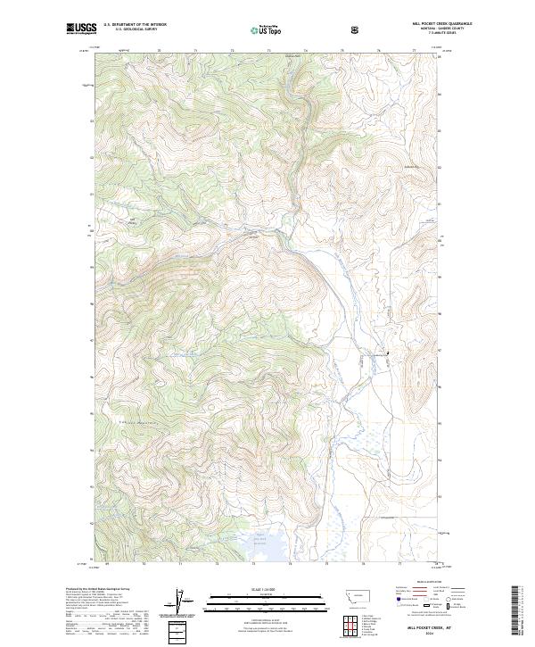
2024 Mill Pocket Creek
Sanders County, MT
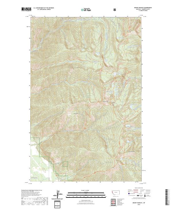
2024 Mount Headley
Sanders County, MT
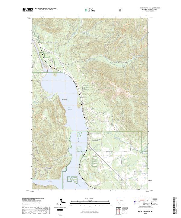
2024 Noxon Rapids Dam
Sanders County, MT
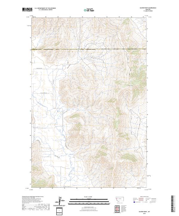
2024 Oliver Point
Sanders County, MT
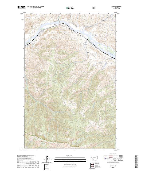
2024 Perma
Sanders County, MT

2024 Priscilla Peak
Sanders County, MT
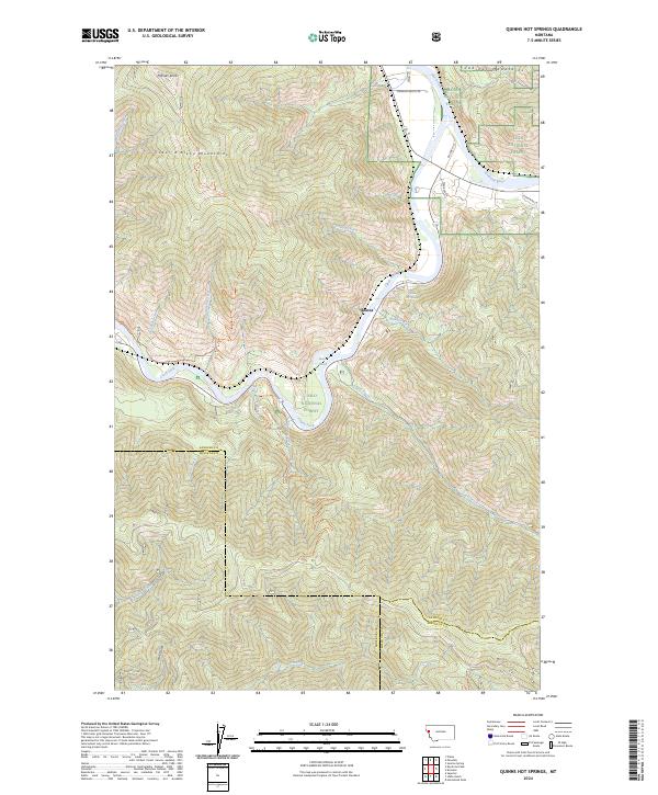
2024 Quinns Hot Springs
Sanders County, MT
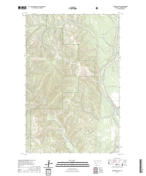
2024 Richards Peak
Sanders County, MT
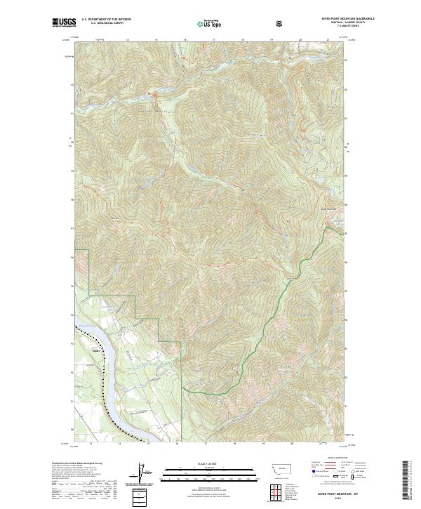
2024 Seven Point Mountain
Sanders County, MT
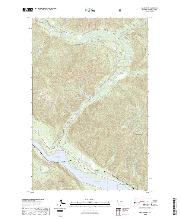
2024 Smeads Bench
Sanders County, MT

2024 Sunrise Spring
Sanders County, MT
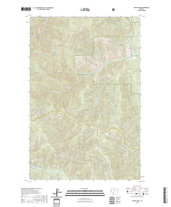
2024 Sunset Peak
Sanders County, MT
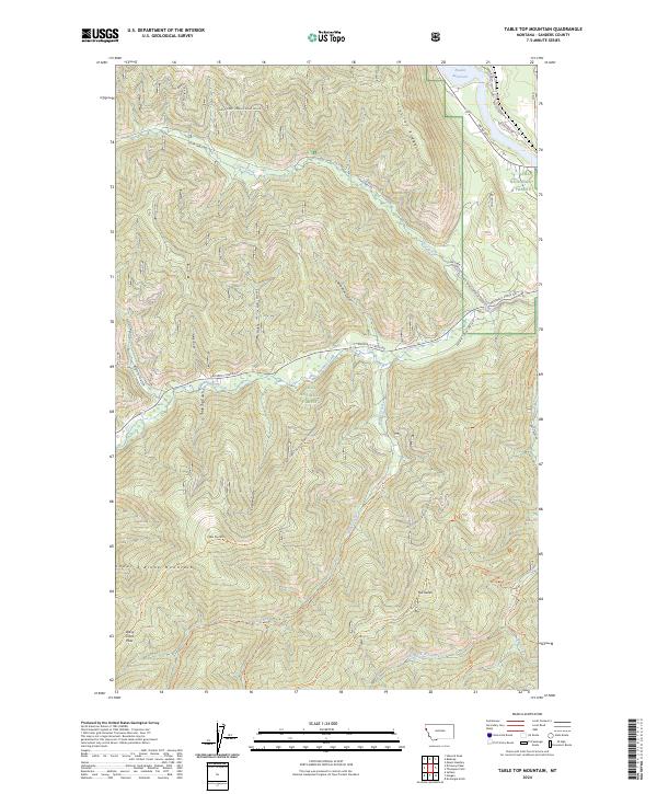
2024 Table Top Mountain
Sanders County, MT
2024 Thompson Pass
Sanders County, MT
2024 Vermilion Peak
Sanders County, MT