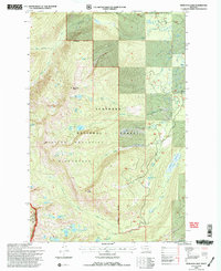
1994 Map of Hemlock Lake
USGS Topo · Published 1996About this map
Mission Mountains Wilderness dominates this corner of the Flathead National Forest, a landscape defined by sharp alpine ridgelines and a concentrated network of high-elevation glacial basins. The topographic detail highlights a series of significant peaks including Hemlock Point and Red Butte, which overlook a dense concentration of named water bodies. To the south, a cluster of alpine waters—Island Lake, Cheff Lake, Crescent Lake, and Heart Lake—drains through Crazy Horse Creek, while the eastern drainage is funneled through Glacier Creek and the Glacier Slough. The intricate contouring of the North Fork Hemlock Creek and Windfall Creek canyons illustrates the sheer verticality and complex hydrology of the Mission Range before the establishment of modern trail infrastructures. This record preserves the precise location of backcountry landmarks such as Conko Lake and Spider Lake during a period of active Forest Service management and revision.
Find a feature on this map
30 named features on this map. Tap any name to fly to it.
Don’t see what you’re looking for? This feature index may not catch every label — zoom into the map to look around manually.
Map Details
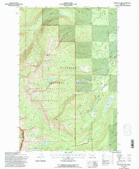
Editions of this 1994 Hemlock Lake Map
2 editions found
Other maps of this area

1921 · Elbow Lake
USGS Topo · 1:125,000

1955 · Choteau
USGS Topo · 1:250,000

1957 · Choteau
USGS Topo · 1:250,000

1958 · Choteau
USGS Topo · 1:250,000

1962 · Choteau
USGS Topo · 1:250,000

1965 · Peck Lake
USGS Topo · 1:24,000

1965 · Condon
USGS Topo · 1:24,000

1965 · Gray Wolf Lake
USGS Topo · 1:24,000

1965 · Lake Marshall
USGS Topo · 1:24,000
1965 · St Marys Lake
USGS Topo · 1:24,000