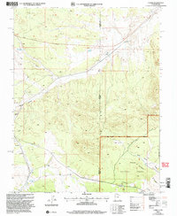
2002 Map of Uvada
USGS Topo · Published 2005About this map
Uvada sits directly on the border between Utah and Nevada, serving as a distinct waypoint where the Union Pacific railroad cuts through the arid landscape of the Great Basin. This high-desert region is defined by a network of seasonal drainages and essential water management features like Uvada Reservoir and Old Highway Reservoir. To the south, the terrain rises into the Dixie National Forest, where the settlement of Crestline is located along the rail line near the headwaters of Clover Creek.
Find a feature on this map
19 named features on this map. Tap any name to fly to it.
Don’t see what you’re looking for? This feature index may not catch every label — zoom into the map to look around manually.
Map Details
Editions of this 2002 Uvada Map
This is the sole edition of this map. No revisions or reprints were ever made.
Other maps of this area

1885 · St. George
USGS Topo · 1:250,000

1885 · Pioche
USGS Topo · 1:250,000

1886 · Pioche
USGS Topo · 1:250,000

1891 · St. George
USGS Topo · 1:250,000

1953 · Cedar City
USGS Topo · 1:250,000

1954 · Caliente
USGS Topo · 1:250,000

1958 · Cedar City
USGS Topo · 1:250,000

1959 · Caliente
USGS Topo · 1:250,000

1962 · Cedar City
USGS Topo · 1:250,000
1972 · Panaca Summit
USGS Topo · 1:24,000