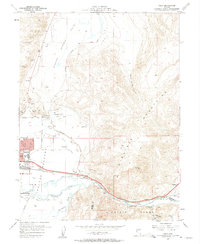
1957 Map of Vista
USGS Topo · Published 1959About this map
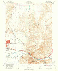
Spanish Springs Valley and the eastern edge of Sparks are defined by an intricate network of irrigation ditches and transportation corridors in the late 1950s. The Truckee River winds through the southern portion of the sheet, paralleled by the Southern Pacific railroad and early industrial developments like the Sewage Disposal plant and various gravel pits. The transition from the flat agricultural lands of the Meadows to the rising elevations of the Virginia Mountains and Virginia Range is punctuated by significant local landmarks, including the Dominican Brothers Monastery and the Radio Towers (KOH). This era captures the expansion of eastern Sparks with the Greenbrae Sch and Lincoln Park Sch, while smaller settlements such as Vista, Hafed, and Mustang maintain their identity along the river and rail lines. Notable water management features like Orr Ditch and the North Truckee Irrigation Ditch illustrate the region's reliance on engineered water for valley development.
Find a feature on this map
41 named features on this map. Tap any name to fly to it.
Don’t see what you’re looking for? This feature index may not catch every label — zoom into the map to look around manually.
Map Details
Editions of this 1957 Vista Map
2 editions found
Other maps of this area

1891 · Carson
USGS Topo · 1:125,000

1891 · Reno
USGS Topo · 1:125,000

1893 · Carson
USGS Topo · 1:125,000

1893 · Reno
USGS Topo · 1:125,000

1950 · Virginia City
USGS Topo · 1:62,500

1950 · Mt. Rose
USGS Topo · 1:62,500

1950 · Reno
USGS Topo · 1:62,500

1951 · Reno
USGS Topo · 1:62,500

1952 · Mt. Rose
USGS Topo · 1:62,500

1952 · Virginia City
USGS Topo · 1:62,500