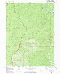
1983 Map of Holter Ridge
USGS Topo · Published 1983About this map
The Klamath River flows through the northeastern corner of this coastal California landscape, where the Hoopa Valley Indian Reservation meets a complex network of ridges and drainages. The topography is dominated by the spine of Holter Ridge, which serves as a dividing line between the densely forested tracts of Redwood National Park and the interior valleys. To the west, the ancient groves of Prairie Creek Redwoods State Park are accessed by primitive tracks like Johnson Road, illustrating the intersection of conservation and resource management in the late twentieth century.
Find a feature on this map
32 named features on this map. Tap any name to fly to it.
Don’t see what you’re looking for? This feature index may not catch every label — zoom into the map to look around manually.
Map Details
Editions of this 1983 Holter Ridge Map
This is the sole edition of this map. No revisions or reprints were ever made.
Other maps of this area

1925 · Hoopa
USGS Topo · 1:125,000

1945 · Orick
USGS Topo · 1:62,500

1945 · Trinidad
USGS Topo · 1:62,500

1945 · Coyote Peak
USGS Topo · 1:62,500

1945 · Tectah Creek
USGS Topo · 1:62,500

1948 · Weed
USGS Topo · 1:250,000

1949 · Eureka
USGS Topo · 1:250,000

1950 · Weed
USGS Topo · 1:250,000
1952 · Orick
USGS Topo · 1:62,500

1952 · Coyote Peak
USGS Topo · 1:62,500