
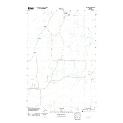
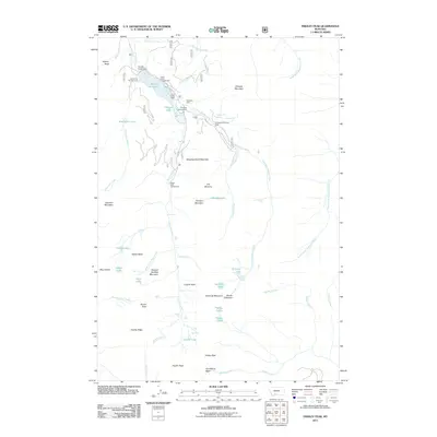
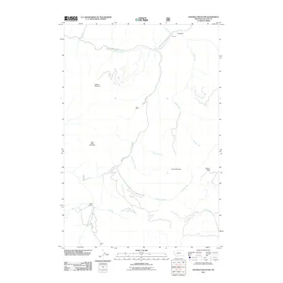
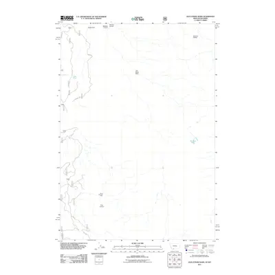
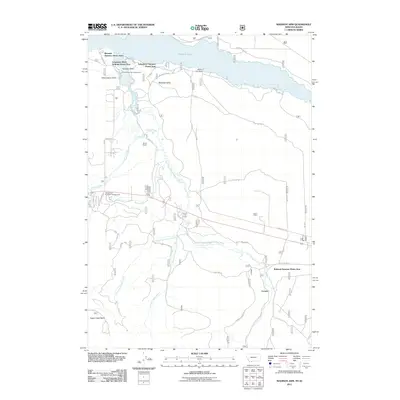
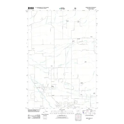
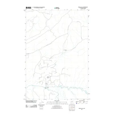
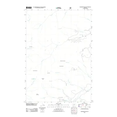
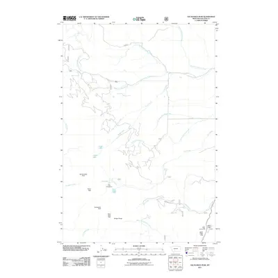
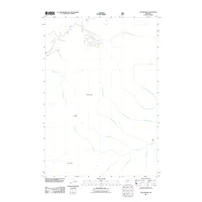
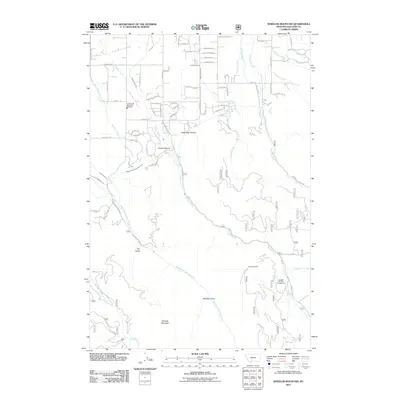
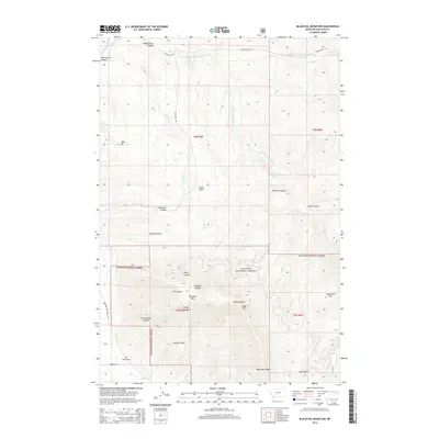
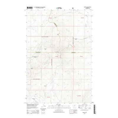
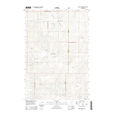
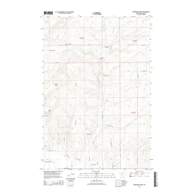
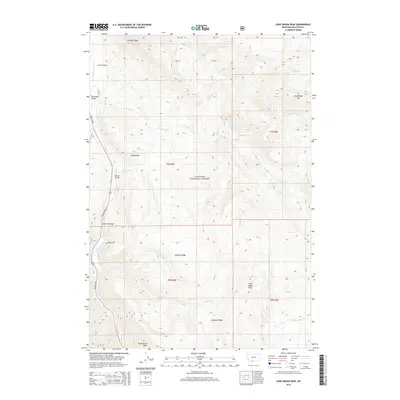
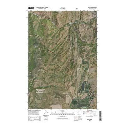
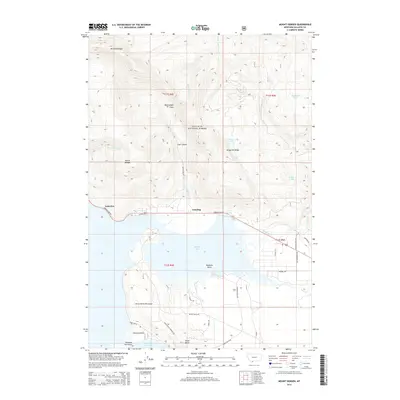
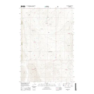
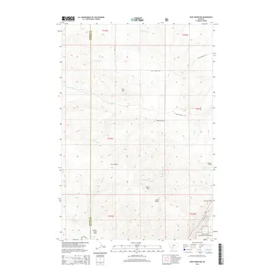
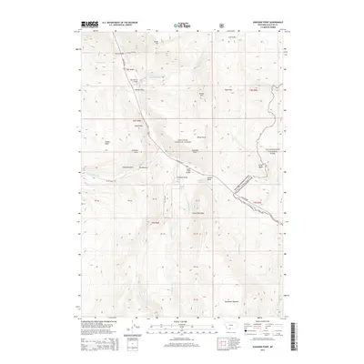
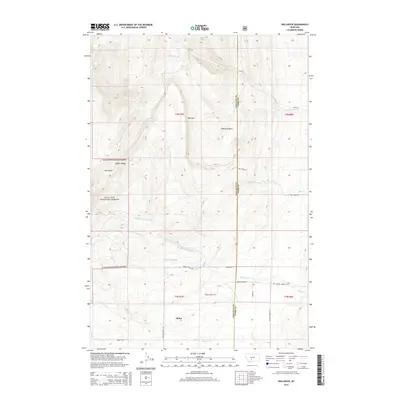
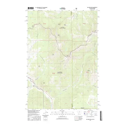
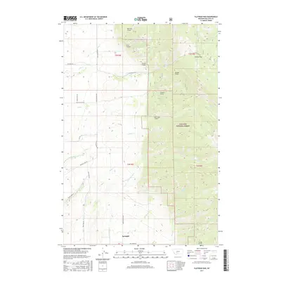
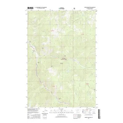
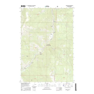
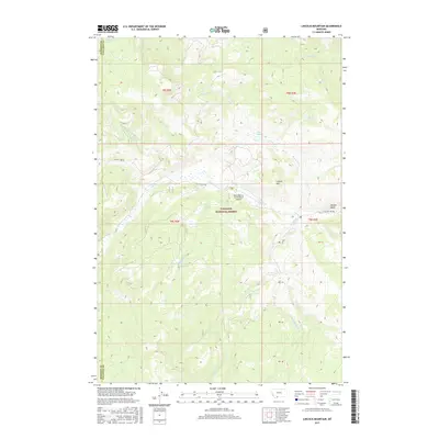
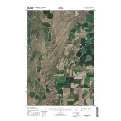
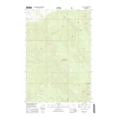
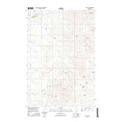
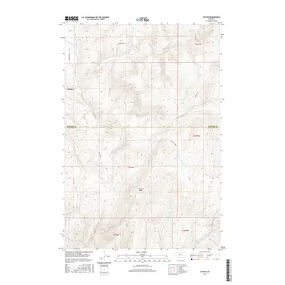
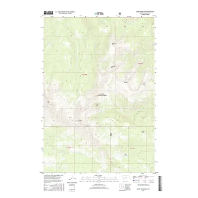
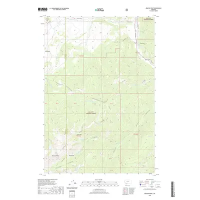
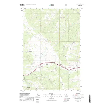
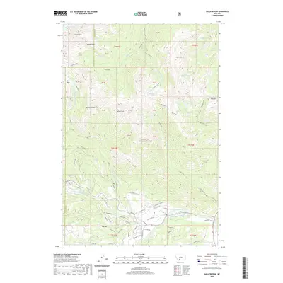
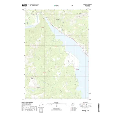
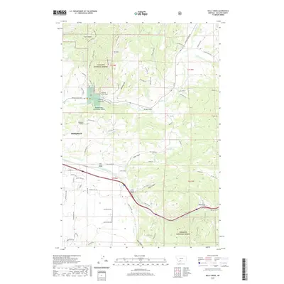
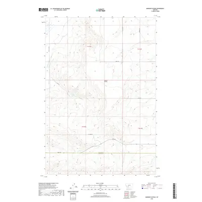
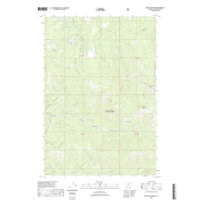
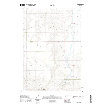
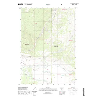
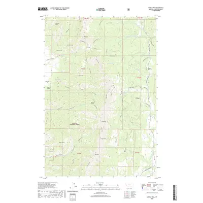
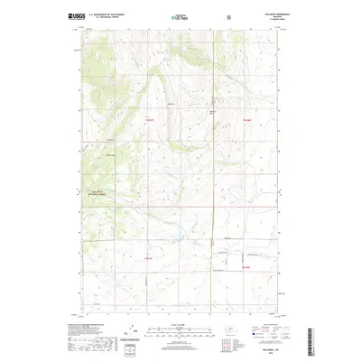
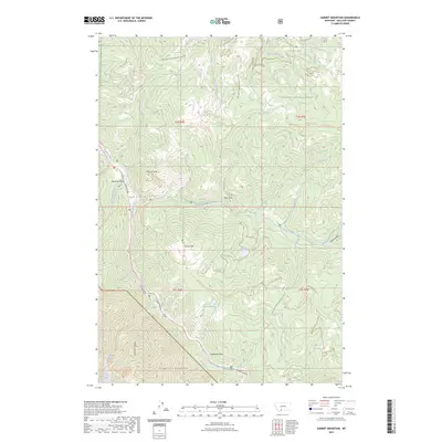
2000 Map of Hatfield Mountain
USGS Topo · Published 2005About this map
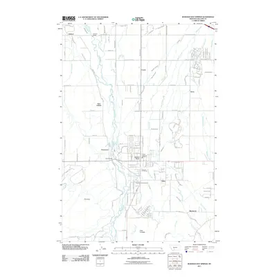
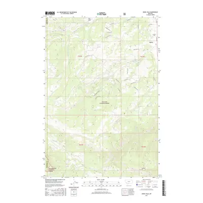
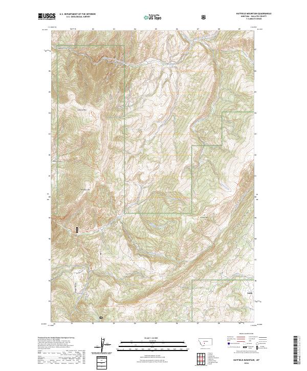
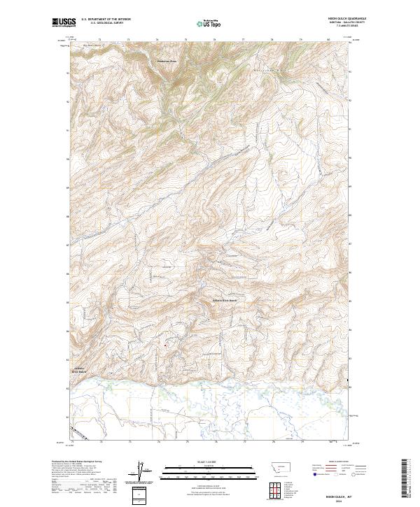
Gallatin National Forest encompasses the vast majority of this high-altitude landscape, where the Bozeman District boundary bisects deep drainages and sharp ridgelines. The topography is defined by the massive presence of Hatfield Mountain and Red Rock Mountain, overlooking a network of named gulches and seasonal headwaters. In the northern sections, Sixteenmile Creek draws water from tributaries like Coal Gulch and Fleming Creek, while the southern slopes descend toward Dry Creek and Snowslide Creek. This area remains largely undeveloped, centered on land management and ranching. The Miller Ranch stands as a rare namesake settlement footprint in a terrain otherwise occupied by complex forest service tracks and 4WD routes. The naming of features like Sacajawea Gulch and Elkhorn Ridge speaks to the region's enduring connection to local fauna and Western exploration history.
Find a feature on this map
21 named features on this map. Tap any name to fly to it.
Don’t see what you’re looking for? This feature index may not catch every label — zoom into the map to look around manually.
Map Details
Editions of this 2000 Hatfield Mountain Map
This is the sole edition of this map. No revisions or reprints were ever made.
Historical Maps of Gallatin County Through Time
311 maps found

1948 Sixteen
Gallatin County, MT

1949 Anceney
Gallatin County, MT

1949 Maudlow
Gallatin County, MT

1950 Hebgen Dam
Gallatin County, MT

1951 Bozeman Pass
Gallatin County, MT

1951 Hatfield Mountain
Gallatin County, MT

1951 Wallrock
Gallatin County, MT

1955 Crown Butte
Gallatin County, MT

1955 Garnet Mountain
Gallatin County, MT

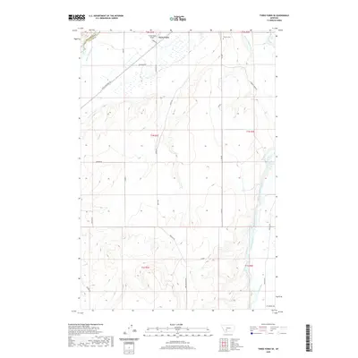
1958 Tepee Creek
Gallatin County, MT

1986 Big Horn Peak
Gallatin County, MT

1986 Blacktail Mountain
Gallatin County, MT

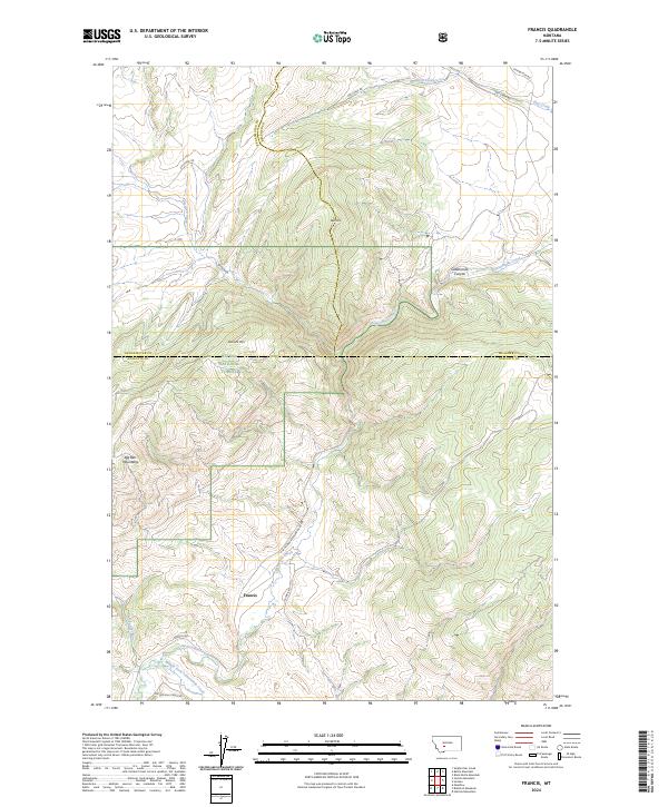
1986 Francis
Gallatin County, MT

1986 Jack Straw Basin
Gallatin County, MT

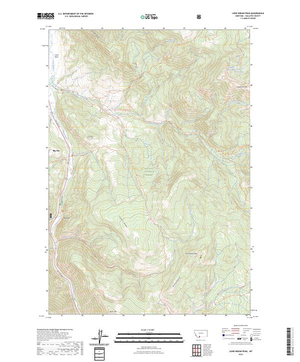
1986 Lone Indian Peak
Gallatin County, MT

1986 Madison Arm
Gallatin County, MT

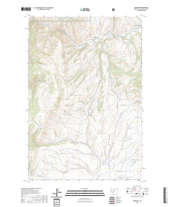
1986 Maudlow
Gallatin County, MT

1986 Mount Hebgen
Gallatin County, MT

1986 Ramshorn Peak
Gallatin County, MT

1986 Richards Creek
Gallatin County, MT

1986 Roy Gulch
Gallatin County, MT

1986 Sunshine Point
Gallatin County, MT

1986 Upper Tepee Basin
Gallatin County, MT

1987 Bozeman Hot Springs
Gallatin County, MT

1987 Bozeman Pass
Gallatin County, MT

1987 Flathead Pass
Gallatin County, MT

1987 Grassy Mountain
Gallatin County, MT

1987 Horseshoe Creek
Gallatin County, MT

1987 Kelly Creek
Gallatin County, MT

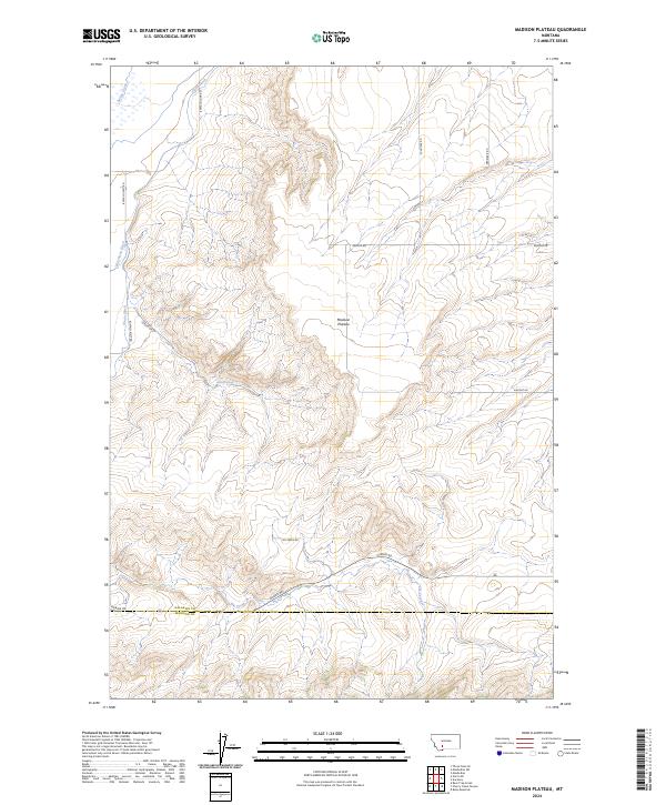
1987 Madison Plateau
Gallatin County, MT

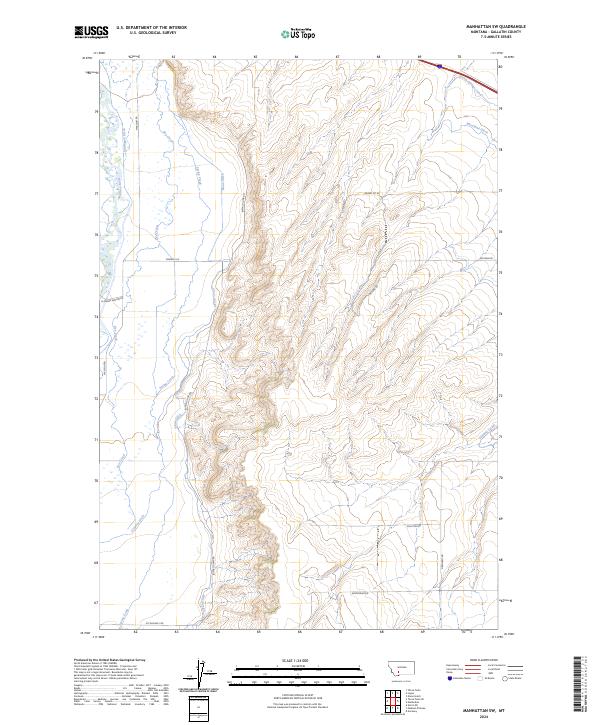
1987 Manhattan SW
Gallatin County, MT

1987 Miser Creek
Gallatin County, MT

1987 Mount Ellis
Gallatin County, MT

1987 Nixon Gulch
Gallatin County, MT

1987 Norris NE
Gallatin County, MT

1987 Ruby Mountain
Gallatin County, MT

1987 Sacagawea Peak
Gallatin County, MT

1987 Saddle Peak
Gallatin County, MT

1987 Three Forks SE
Gallatin County, MT

1987 Wheeler Mountain
Gallatin County, MT

1988 Anceney
Gallatin County, MT

1988 Beacon Point
Gallatin County, MT

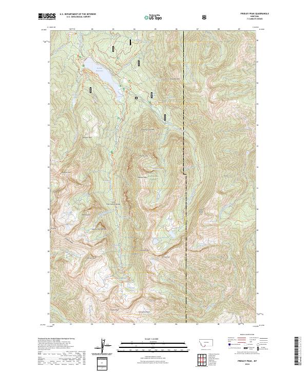
1988 Fridley Peak
Gallatin County, MT

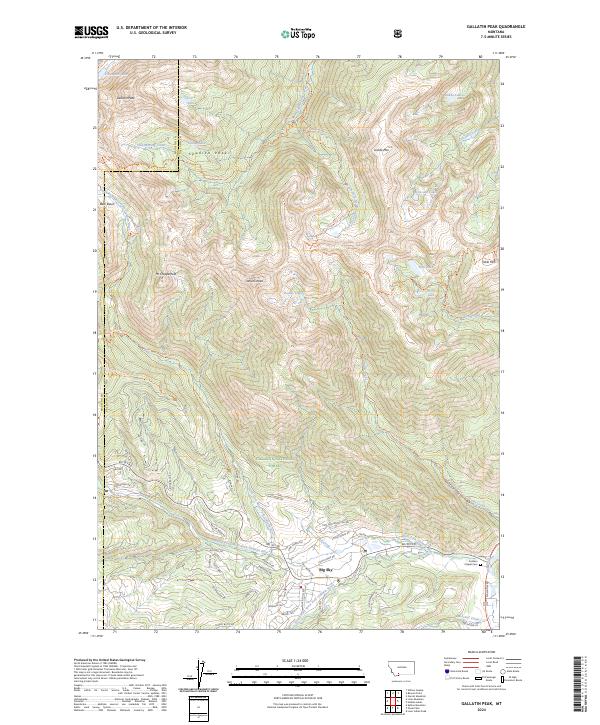
1988 Gallatin Peak
Gallatin County, MT

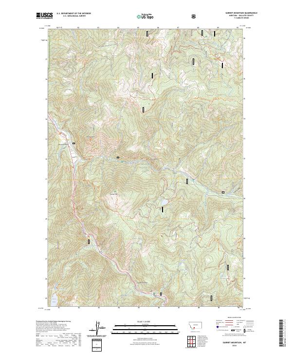
1988 Garnet Mountain
Gallatin County, MT

1988 Hebgen Dam
Gallatin County, MT

1988 Hidden Lake
Gallatin County, MT

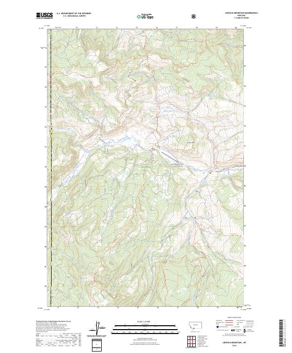
1988 Lincoln Mountain
Gallatin County, MT

1988 Mount Blackmore
Gallatin County, MT

1988 Ousel Falls
Gallatin County, MT

1988 Pika Point
Gallatin County, MT

1988 The Sentinel
Gallatin County, MT

2000 Beacon Point
Gallatin County, MT

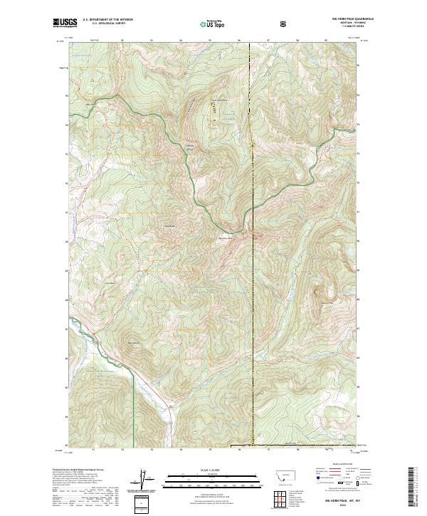
2000 Big Horn Peak
Gallatin County, MT

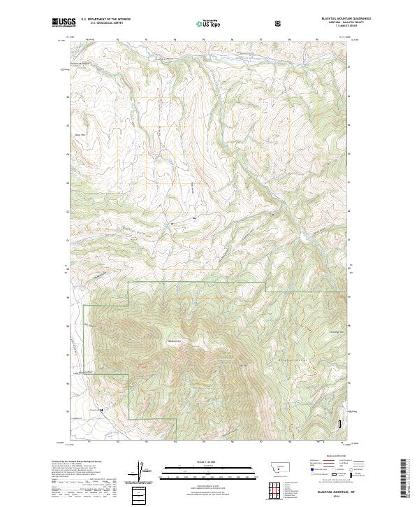
2000 Blacktail Mountain
Gallatin County, MT

2000 Bozeman Pass
Gallatin County, MT

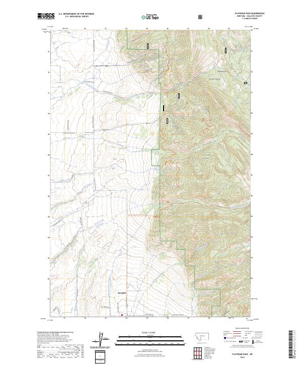
2000 Flathead Pass
Gallatin County, MT

2000 Fridley Peak
Gallatin County, MT

2000 Garnet Mountain
Gallatin County, MT

2000 Grassy Mountain
Gallatin County, MT
2000 Hatfield Mountain
Gallatin County, MT

2000 Hebgen Dam
Gallatin County, MT

2000 Hidden Lakes
Gallatin County, MT

2000 Jack Straw Basin
Gallatin County, MT

2000 Kelly Creek
Gallatin County, MT

2000 Lincoln Mountain
Gallatin County, MT

2000 Lone Indian Peak
Gallatin County, MT

2000 Madison Arm
Gallatin County, MT

2000 Miser Creek
Gallatin County, MT

2000 Mount Blackmore
Gallatin County, MT

2000 Mount Ellis
Gallatin County, MT

2000 Mount Hebgen
Gallatin County, MT

2000 Ousel Falls
Gallatin County, MT

2000 Pika Point
Gallatin County, MT

2000 Ramshorn Peak
Gallatin County, MT

2000 Richards Creek
Gallatin County, MT

2000 Ruby Mountain
Gallatin County, MT

2000 Sacagawea Peak
Gallatin County, MT

2000 Saddle Peak
Gallatin County, MT

2000 Sunshine Point
Gallatin County, MT

2000 The Sentinel
Gallatin County, MT

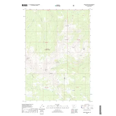
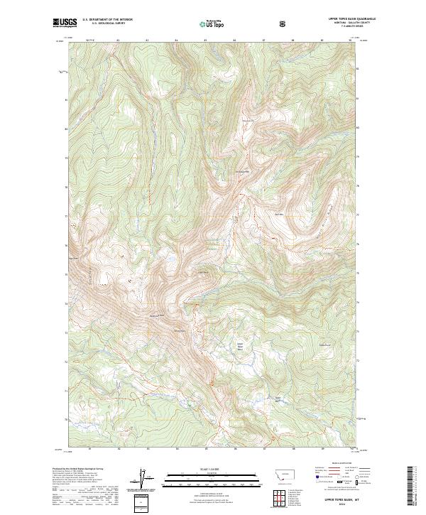
2000 Upper Tepee Basin
Gallatin County, MT

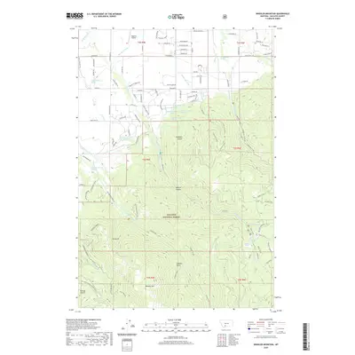
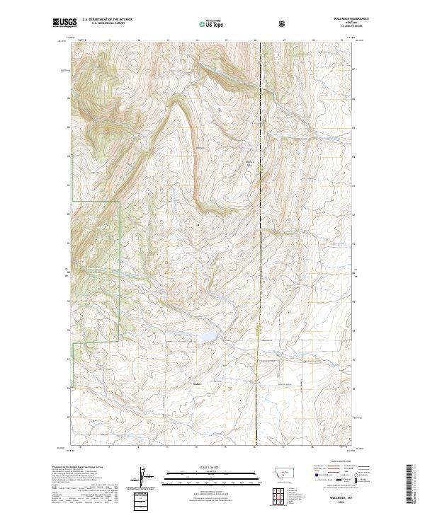
2000 Wallrock
Gallatin County, MT

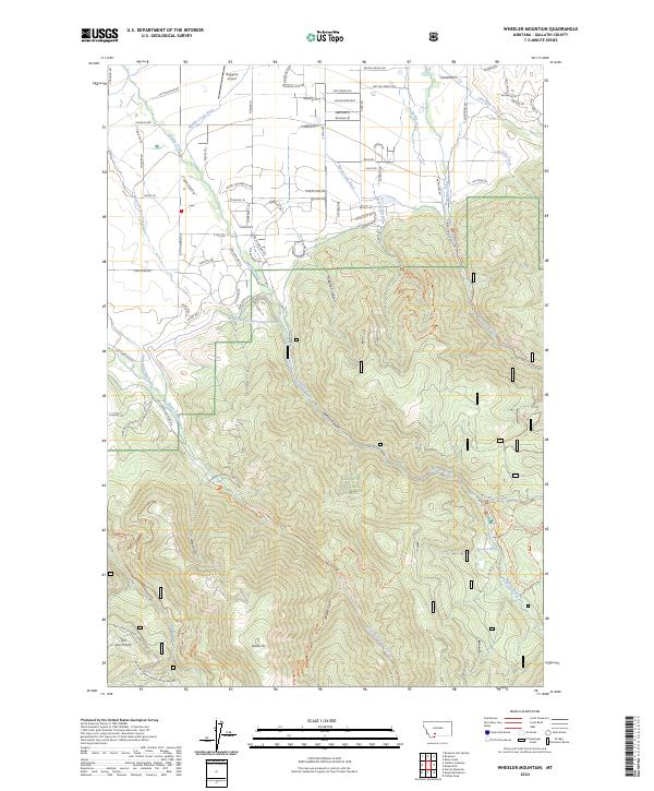
2000 Wheeler Mountain
Gallatin County, MT
2011 Anceney
Gallatin County, MT
2011 Beacon Point
Gallatin County, MT
2011 Big Horn Peak
Gallatin County, MT
2011 Blacktail Mountain
Gallatin County, MT
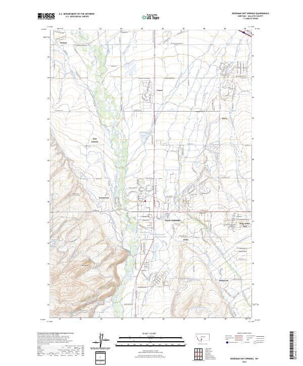
2011 Bozeman Hot Springs
Gallatin County, MT
2011 Bozeman Pass
Gallatin County, MT
2011 Flathead Pass
Gallatin County, MT
2011 Francis
Gallatin County, MT
2011 Fridley Peak
Gallatin County, MT
2011 Gallatin Peak
Gallatin County, MT
2011 Garnet Mountain
Gallatin County, MT
2011 Grassy Mountain
Gallatin County, MT
2011 Hatfield Mountain
Gallatin County, MT
2011 Hebgen Dam
Gallatin County, MT
2011 Hidden Lakes
Gallatin County, MT
2011 Horseshoe Creek
Gallatin County, MT
2011 Jack Straw Basin
Gallatin County, MT
2011 Kelly Creek
Gallatin County, MT
2011 Lincoln Mountain
Gallatin County, MT
2011 Lone Indian Peak
Gallatin County, MT
2011 Madison Arm
Gallatin County, MT
2011 Madison Plateau
Gallatin County, MT
2011 Manhattan SW
Gallatin County, MT
2011 Maudlow
Gallatin County, MT
2011 Miser Creek
Gallatin County, MT
2011 Mount Blackmore
Gallatin County, MT
2011 Mount Ellis
Gallatin County, MT
2011 Mount Hebgen
Gallatin County, MT
2011 Nixon Gulch
Gallatin County, MT
2011 Norris NE
Gallatin County, MT
2011 Ousel Falls
Gallatin County, MT
2011 Pika Point
Gallatin County, MT
2011 Ramshorn Peak
Gallatin County, MT
2011 Richards Creek
Gallatin County, MT
2011 Roy Gulch
Gallatin County, MT
2011 Ruby Mountain
Gallatin County, MT
2011 Sacagawea Peak
Gallatin County, MT
2011 Saddle Peak
Gallatin County, MT
2011 Sixteen
Gallatin County, MT
2011 Sunshine Point
Gallatin County, MT
2011 The Sentinel
Gallatin County, MT
2011 Three Forks SE
Gallatin County, MT
2011 Upper Tepee Basin
Gallatin County, MT
2011 Wallrock
Gallatin County, MT
2011 Wheeler Mountain
Gallatin County, MT
2014 Anceney
Gallatin County, MT
2014 Beacon Point
Gallatin County, MT
2014 Big Horn Peak
Gallatin County, MT
2014 Blacktail Mountain
Gallatin County, MT
2014 Bozeman Hot Springs
Gallatin County, MT
2014 Bozeman Pass
Gallatin County, MT
2014 Flathead Pass
Gallatin County, MT
2014 Francis
Gallatin County, MT
2014 Fridley Peak
Gallatin County, MT
2014 Gallatin Peak
Gallatin County, MT
2014 Garnet Mountain
Gallatin County, MT
2014 Grassy Mountain
Gallatin County, MT
2014 Hatfield Mountain
Gallatin County, MT
2014 Hebgen Dam
Gallatin County, MT
2014 Hidden Lakes
Gallatin County, MT
2014 Horseshoe Creek
Gallatin County, MT
2014 Jack Straw Basin
Gallatin County, MT
2014 Kelly Creek
Gallatin County, MT
2014 Lincoln Mountain
Gallatin County, MT
2014 Lone Indian Peak
Gallatin County, MT
2014 Madison Arm
Gallatin County, MT
2014 Madison Plateau
Gallatin County, MT
2014 Manhattan SW
Gallatin County, MT
2014 Maudlow
Gallatin County, MT
2014 Miser Creek
Gallatin County, MT
2014 Mount Blackmore
Gallatin County, MT
2014 Mount Ellis
Gallatin County, MT
2014 Mount Hebgen
Gallatin County, MT
2014 Nixon Gulch
Gallatin County, MT
2014 Norris NE
Gallatin County, MT
2014 Ousel Falls
Gallatin County, MT
2014 Pika Point
Gallatin County, MT
2014 Ramshorn Peak
Gallatin County, MT
2014 Richards Creek
Gallatin County, MT
2014 Roy Gulch
Gallatin County, MT
2014 Ruby Mountain
Gallatin County, MT
2014 Sacagawea Peak
Gallatin County, MT
2014 Saddle Peak
Gallatin County, MT
2014 Sixteen
Gallatin County, MT
2014 Sunshine Point
Gallatin County, MT
2014 The Sentinel
Gallatin County, MT
2014 Three Forks SE
Gallatin County, MT
2014 Upper Tepee Basin
Gallatin County, MT
2014 Wallrock
Gallatin County, MT
2014 Wheeler Mountain
Gallatin County, MT
2017 Anceney
Gallatin County, MT
2017 Beacon Point
Gallatin County, MT
2017 Big Horn Peak
Gallatin County, MT
2017 Blacktail Mountain
Gallatin County, MT
2017 Bozeman Hot Springs
Gallatin County, MT
2017 Bozeman Pass
Gallatin County, MT
2017 Flathead Pass
Gallatin County, MT
2017 Francis
Gallatin County, MT
2017 Fridley Peak
Gallatin County, MT
2017 Gallatin Peak
Gallatin County, MT
2017 Garnet Mountain
Gallatin County, MT
2017 Grassy Mountain
Gallatin County, MT
2017 Hatfield Mountain
Gallatin County, MT
2017 Hebgen Dam
Gallatin County, MT
2017 Hidden Lakes
Gallatin County, MT
2017 Horseshoe Creek
Gallatin County, MT
2017 Jack Straw Basin
Gallatin County, MT
2017 Kelly Creek
Gallatin County, MT
2017 Lincoln Mountain
Gallatin County, MT
2017 Lone Indian Peak
Gallatin County, MT
2017 Madison Arm
Gallatin County, MT
2017 Madison Plateau
Gallatin County, MT
2017 Manhattan SW
Gallatin County, MT
2017 Maudlow
Gallatin County, MT
2017 Miser Creek
Gallatin County, MT
2017 Mount Blackmore
Gallatin County, MT
2017 Mount Ellis
Gallatin County, MT
2017 Mount Hebgen
Gallatin County, MT
2017 Nixon Gulch
Gallatin County, MT
2017 Norris NE
Gallatin County, MT
2017 Ousel Falls
Gallatin County, MT
2017 Pika Point
Gallatin County, MT
2017 Ramshorn Peak
Gallatin County, MT
2017 Richards Creek
Gallatin County, MT
2017 Roy Gulch
Gallatin County, MT
2017 Ruby Mountain
Gallatin County, MT
2017 Sacagawea Peak
Gallatin County, MT
2017 Saddle Peak
Gallatin County, MT
2017 Sixteen
Gallatin County, MT
2017 Sunshine Point
Gallatin County, MT
2017 The Sentinel
Gallatin County, MT
2017 Three Forks SE
Gallatin County, MT
2017 Upper Tepee Basin
Gallatin County, MT
2017 Wallrock
Gallatin County, MT
2017 Wheeler Mountain
Gallatin County, MT
2020 Anceney
Gallatin County, MT
2020 Beacon Point
Gallatin County, MT
2020 Big Horn Peak
Gallatin County, MT
2020 Blacktail Mountain
Gallatin County, MT
2020 Bozeman Hot Springs
Gallatin County, MT
2020 Bozeman Pass
Gallatin County, MT
2020 Flathead Pass
Gallatin County, MT
2020 Francis
Gallatin County, MT
2020 Fridley Peak
Gallatin County, MT
2020 Gallatin Peak
Gallatin County, MT
2020 Garnet Mountain
Gallatin County, MT
2020 Grassy Mountain
Gallatin County, MT
2020 Hatfield Mountain
Gallatin County, MT
2020 Hebgen Dam
Gallatin County, MT
2020 Hidden Lakes
Gallatin County, MT
2020 Horseshoe Creek
Gallatin County, MT
2020 Jack Straw Basin
Gallatin County, MT
2020 Kelly Creek
Gallatin County, MT
2020 Lincoln Mountain
Gallatin County, MT
2020 Lone Indian Peak
Gallatin County, MT
2020 Madison Arm
Gallatin County, MT
2020 Madison Plateau
Gallatin County, MT
2020 Manhattan SW
Gallatin County, MT
2020 Maudlow
Gallatin County, MT
2020 Miser Creek
Gallatin County, MT
2020 Mount Blackmore
Gallatin County, MT
2020 Mount Ellis
Gallatin County, MT
2020 Mount Hebgen
Gallatin County, MT
2020 Nixon Gulch
Gallatin County, MT
2020 Norris NE
Gallatin County, MT
2020 Ousel Falls
Gallatin County, MT
2020 Pika Point
Gallatin County, MT
2020 Ramshorn Peak
Gallatin County, MT
2020 Richards Creek
Gallatin County, MT
2020 Roy Gulch
Gallatin County, MT
2020 Ruby Mountain
Gallatin County, MT
2020 Sacagawea Peak
Gallatin County, MT
2020 Saddle Peak
Gallatin County, MT
2020 Sixteen
Gallatin County, MT
2020 Sunshine Point
Gallatin County, MT
2020 The Sentinel
Gallatin County, MT
2020 Three Forks SE
Gallatin County, MT
2020 Upper Tepee Basin
Gallatin County, MT
2020 Wallrock
Gallatin County, MT
2020 Wheeler Mountain
Gallatin County, MT
2023 Garnet Mountain
Gallatin County, MT
2023 Mount Blackmore
Gallatin County, MT
2024 Anceney
Gallatin County, MT
2024 Beacon Point
Gallatin County, MT
2024 Big Horn Peak
Gallatin County, MT
2024 Blacktail Mountain
Gallatin County, MT
2024 Bozeman Hot Springs
Gallatin County, MT

2024 Bozeman Pass
Gallatin County, MT
2024 Flathead Pass
Gallatin County, MT
2024 Francis
Gallatin County, MT
2024 Fridley Peak
Gallatin County, MT
2024 Gallatin Peak
Gallatin County, MT
2024 Garnet Mountain
Gallatin County, MT

2024 Grassy Mountain
Gallatin County, MT
2024 Hatfield Mountain
Gallatin County, MT

2024 Hebgen Dam
Gallatin County, MT

2024 Hidden Lakes
Gallatin County, MT
2024 Horseshoe Creek
Gallatin County, MT
2024 Jack Straw Basin
Gallatin County, MT
2024 Kelly Creek
Gallatin County, MT
2024 Lincoln Mountain
Gallatin County, MT
2024 Lone Indian Peak
Gallatin County, MT

2024 Madison Arm
Gallatin County, MT
2024 Madison Plateau
Gallatin County, MT
2024 Manhattan SW
Gallatin County, MT
2024 Maudlow
Gallatin County, MT
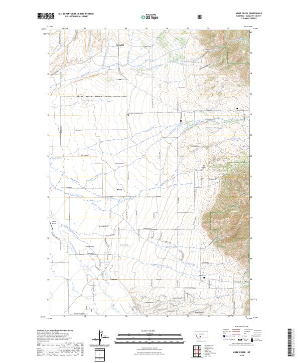
2024 Miser Creek
Gallatin County, MT
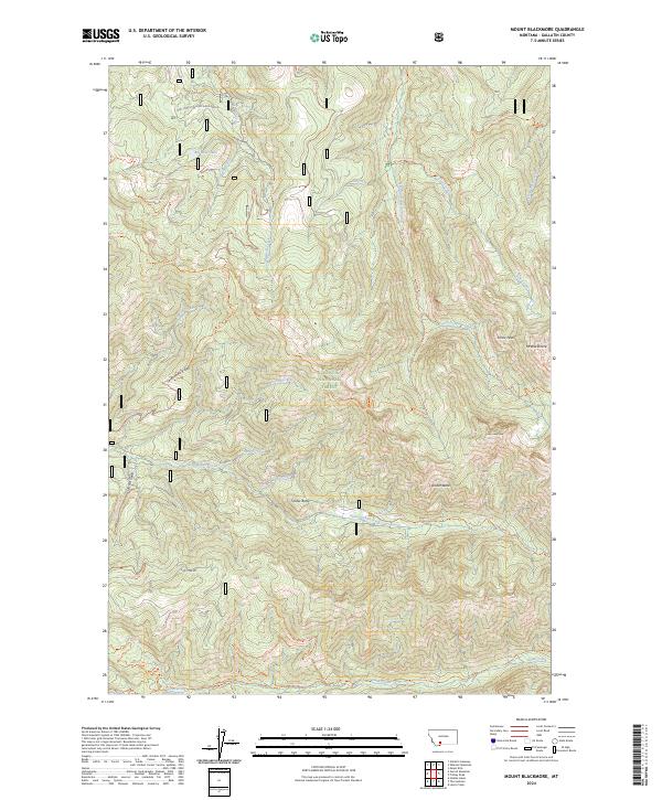
2024 Mount Blackmore
Gallatin County, MT
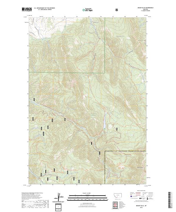
2024 Mount Ellis
Gallatin County, MT

2024 Mount Hebgen
Gallatin County, MT
2024 Nixon Gulch
Gallatin County, MT
2024 Norris NE
Gallatin County, MT
2024 Ousel Falls
Gallatin County, MT
2024 Pika Point
Gallatin County, MT
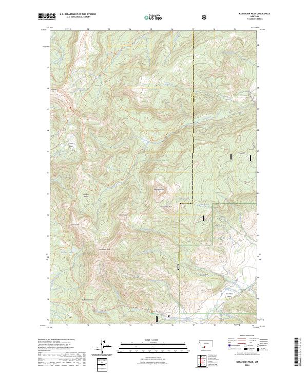
2024 Ramshorn Peak
Gallatin County, MT

2024 Richards Creek
Gallatin County, MT
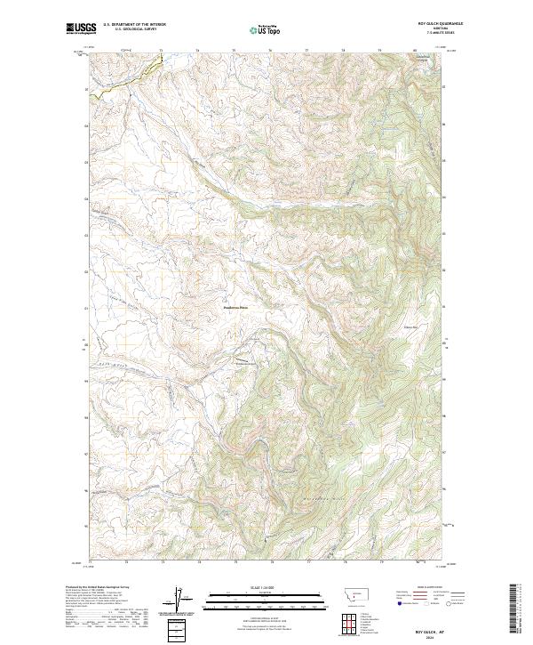
2024 Roy Gulch
Gallatin County, MT
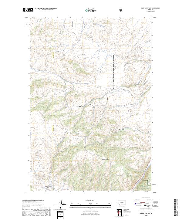
2024 Ruby Mountain
Gallatin County, MT
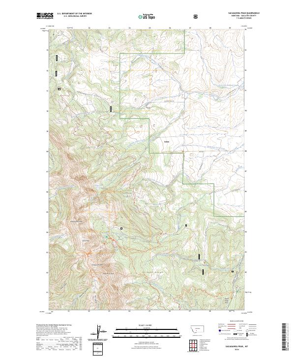
2024 Sacagawea Peak
Gallatin County, MT
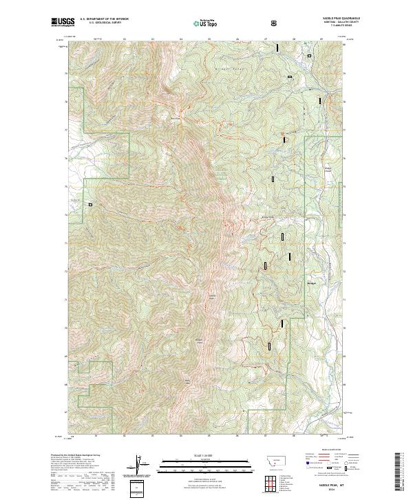
2024 Saddle Peak
Gallatin County, MT
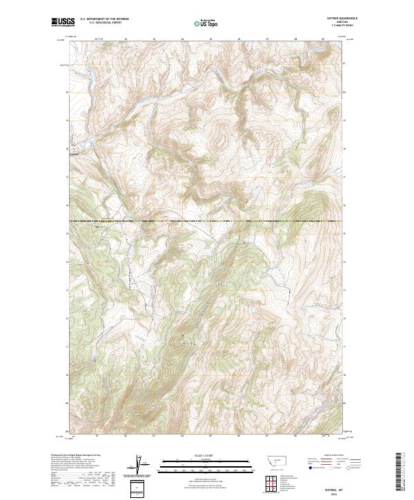
2024 Sixteen
Gallatin County, MT
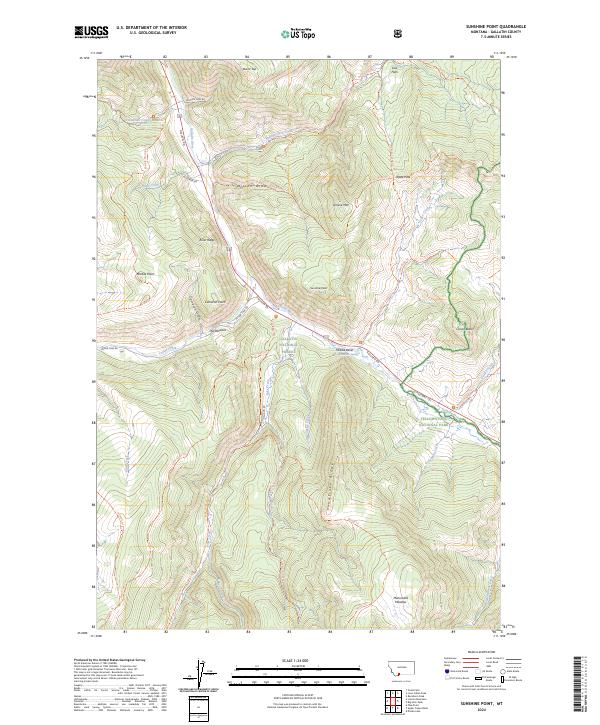
2024 Sunshine Point
Gallatin County, MT
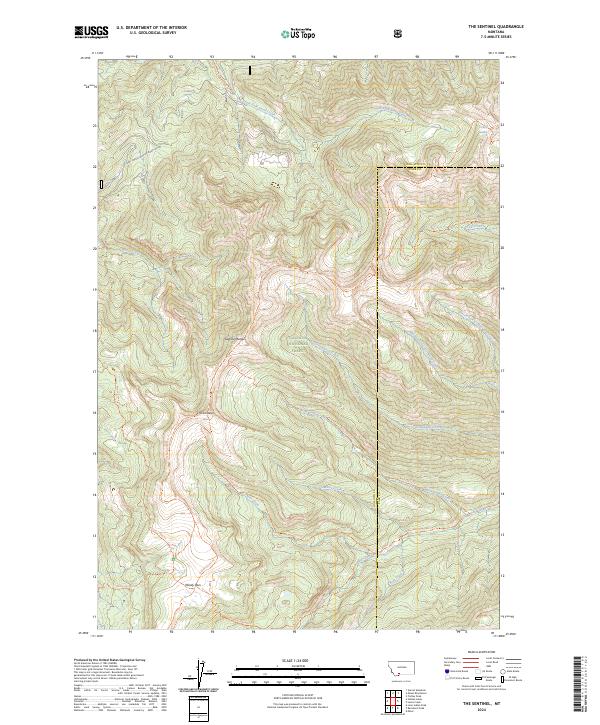
2024 The Sentinel
Gallatin County, MT

2024 Three Forks SE
Gallatin County, MT
2024 Upper Tepee Basin
Gallatin County, MT
2024 Wallrock
Gallatin County, MT
2024 Wheeler Mountain
Gallatin County, MT