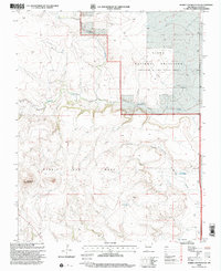
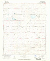
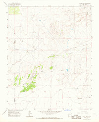
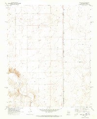
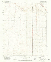
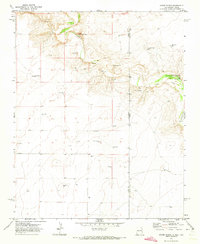
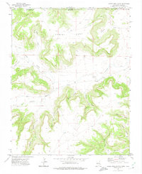
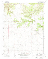
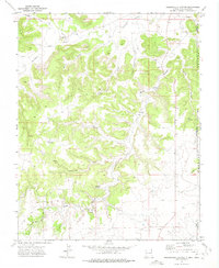
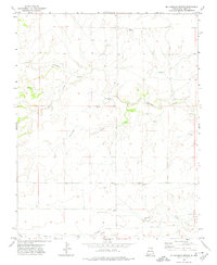
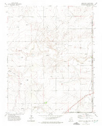
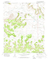
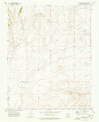
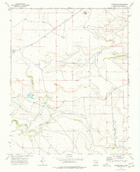
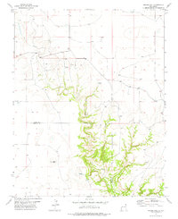
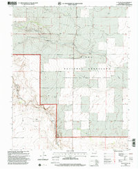
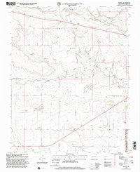
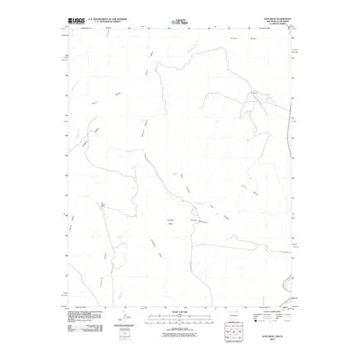
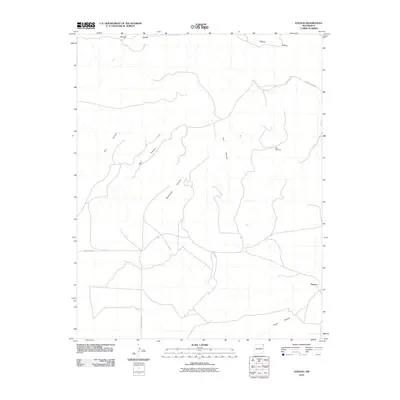
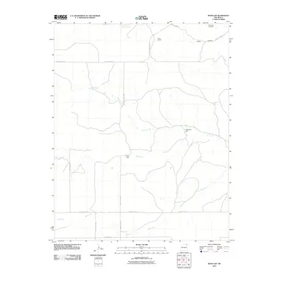
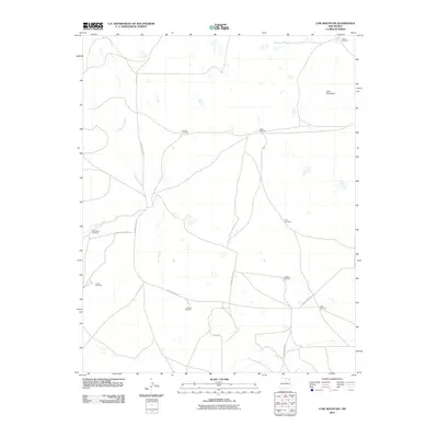
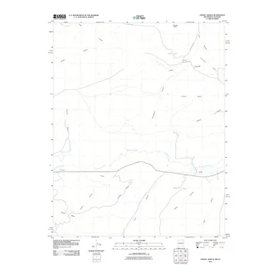
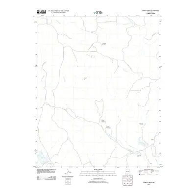
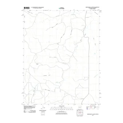
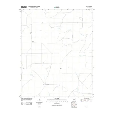
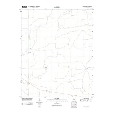
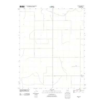
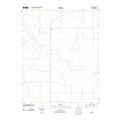
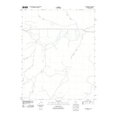
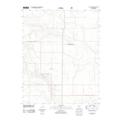
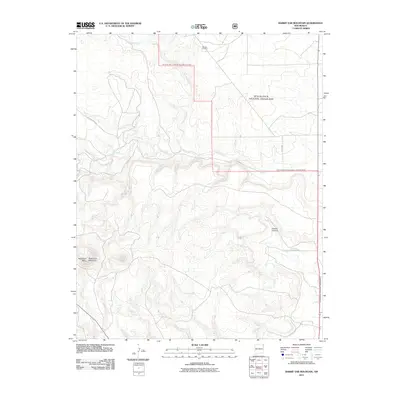
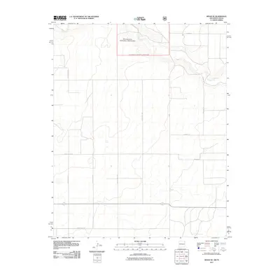
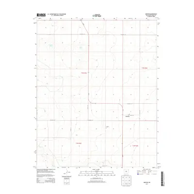
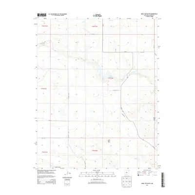
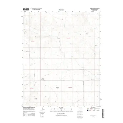
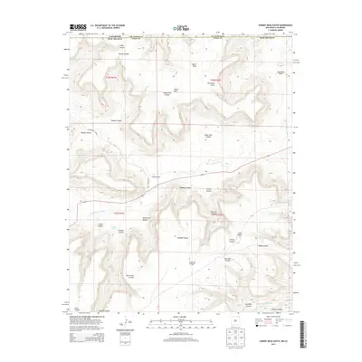
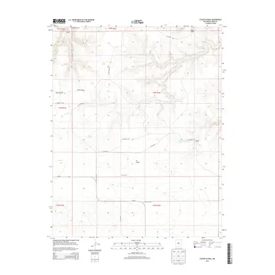
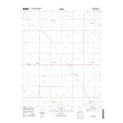
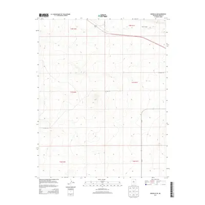
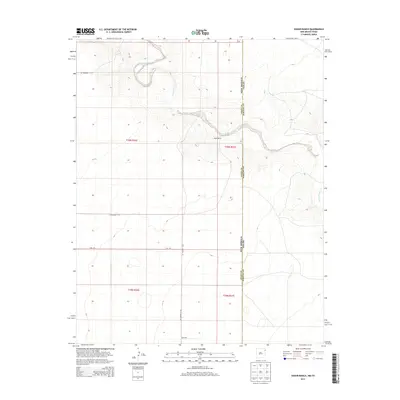
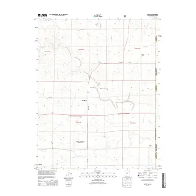
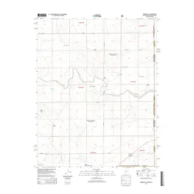
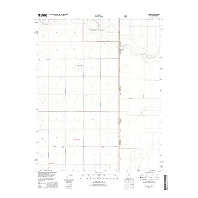
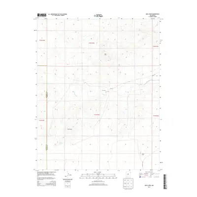
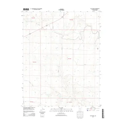
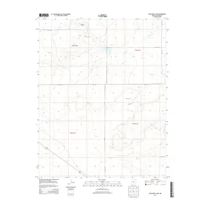
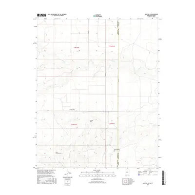
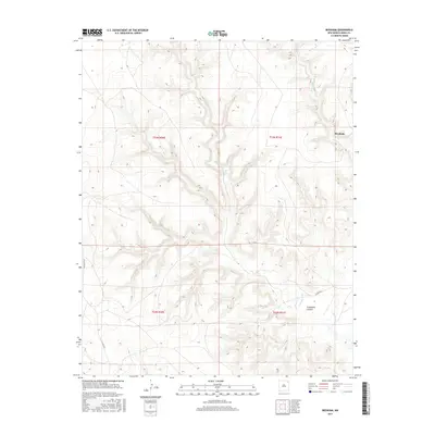
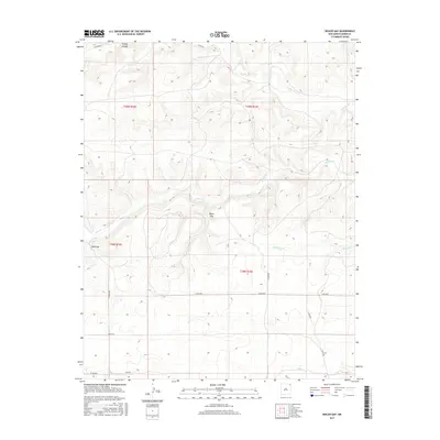
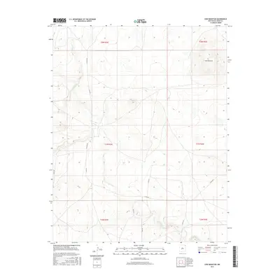
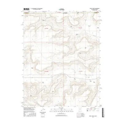
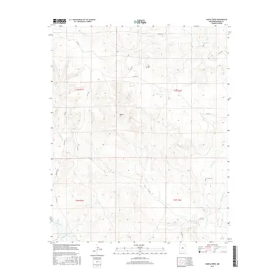
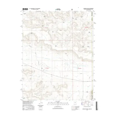
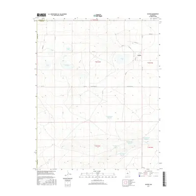
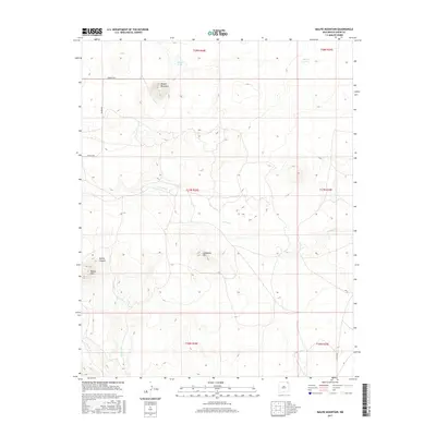
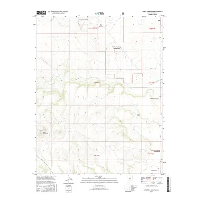
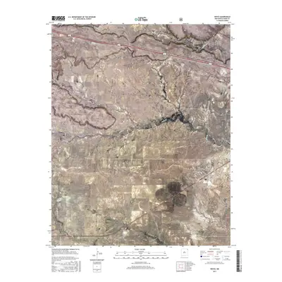
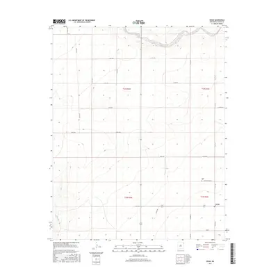
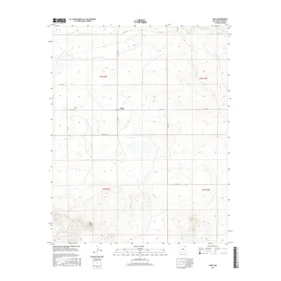
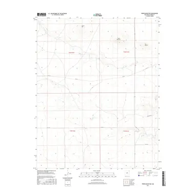
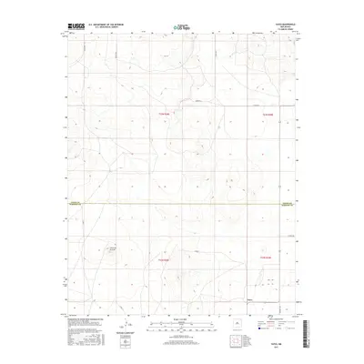
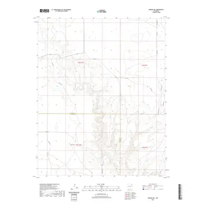
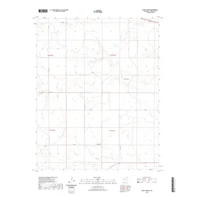
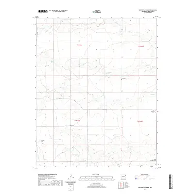
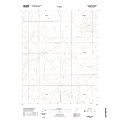
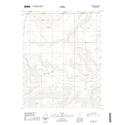
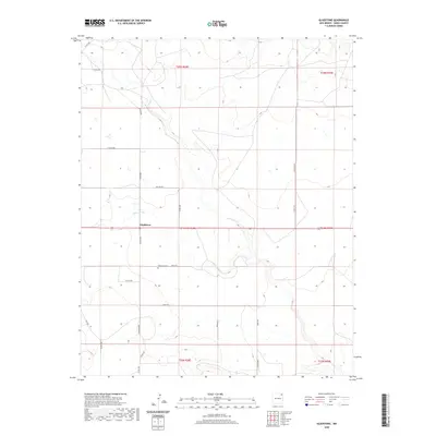
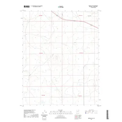
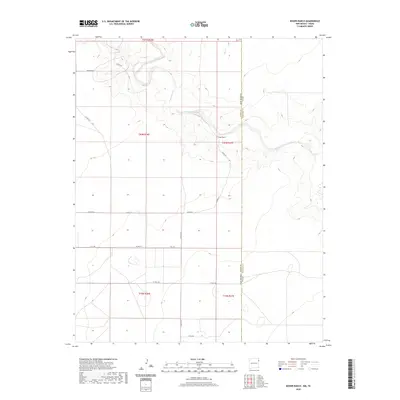
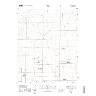
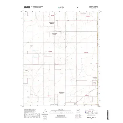
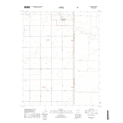
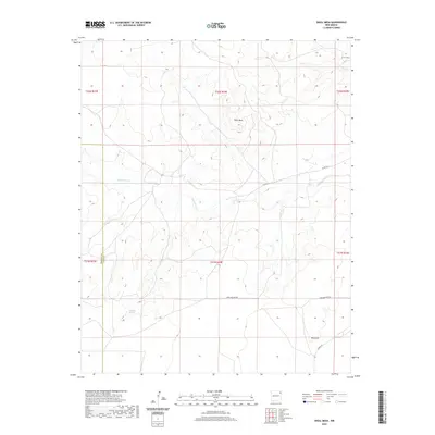
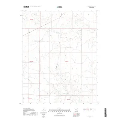
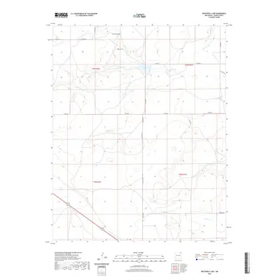
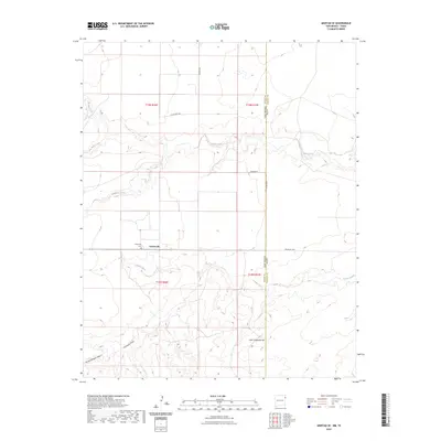
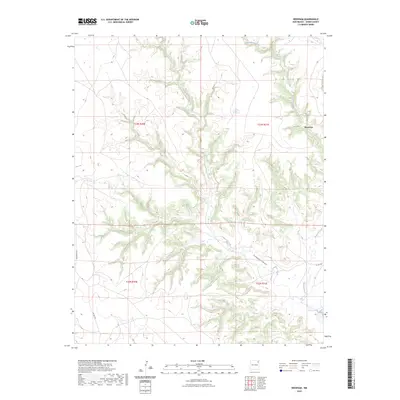
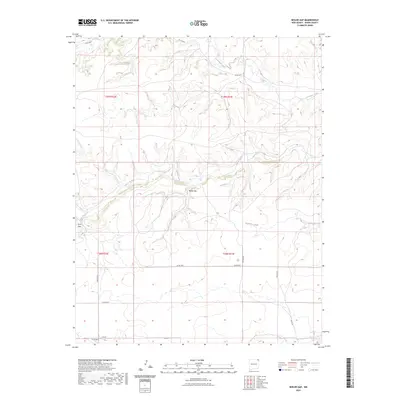
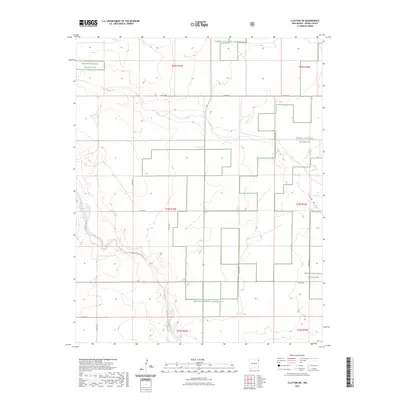
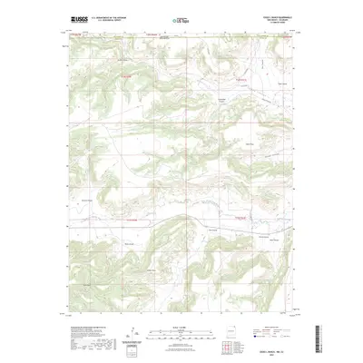
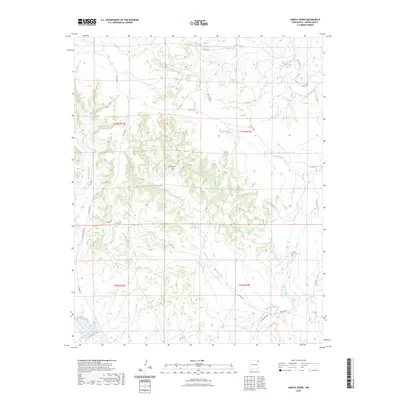
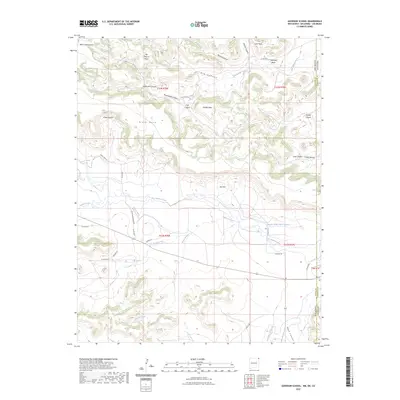
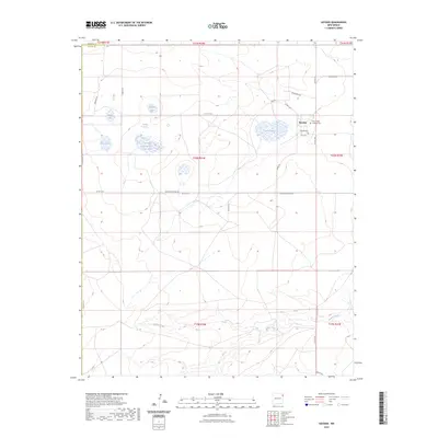
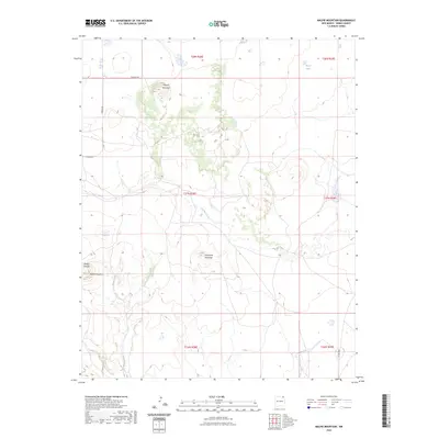
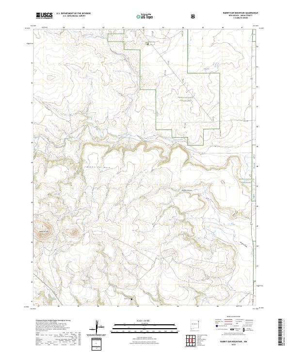
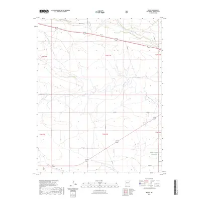
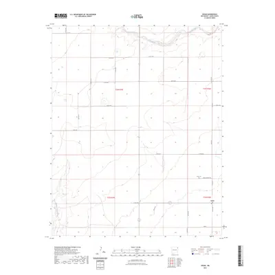
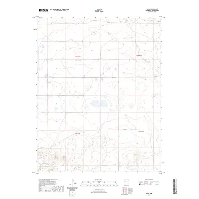
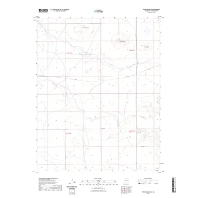
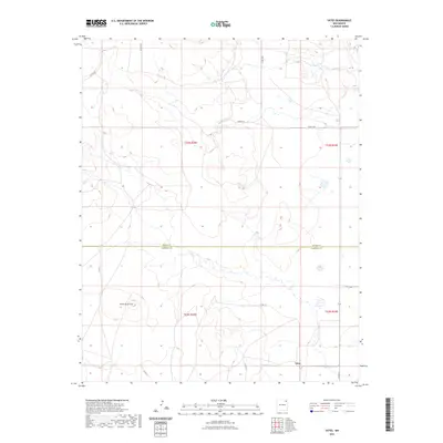
1998 Map of Rabbit Ear Mountain
USGS Topo · Published 2001About this map
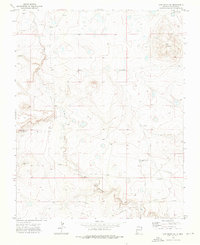
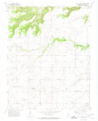
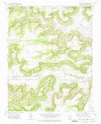
Rabbit Ear Mountain and the high, flat expanse of Rabbit Ear Mesa dominate this landscape in Union County, where the high plains meet the transition to the volcanic fields of northeastern New Mexico. The area is part of the Kiowa National Grassland, a region defined by its history of drought and subsequent land reclamation. Settlement traces are sparse but significant for genealogical research, notably the Wanette Cem in the north and cattle-ranching infrastructure like Forty Acre Well and Eklund Well. Seasonal drainages including Seneca Creek and Goodin Canyon cut through the terrain, illustrating the critical nature of water management in this arid environment during the late 20th century. The presence of a Gravel Pit and a prominent Pipeline reflect the local economy's reliance on land resources and utility infrastructure.
Find a feature on this map
15 named features on this map. Tap any name to fly to it.
Don’t see what you’re looking for? This feature index may not catch every label — zoom into the map to look around manually.
Map Details
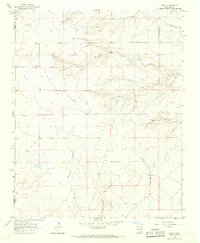
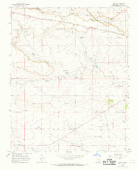
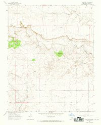
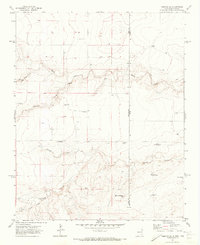
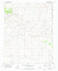
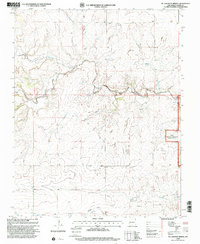
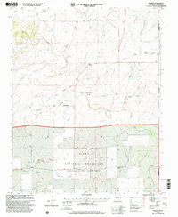
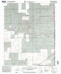
Editions of this 1998 Rabbit Ear Mountain Map
This is the sole edition of this map. No revisions or reprints were ever made.
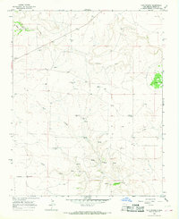
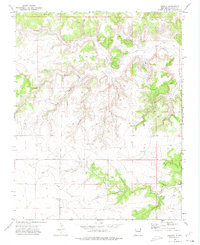
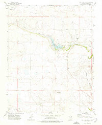
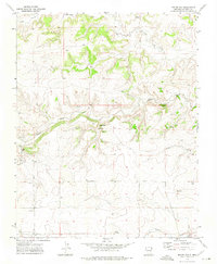
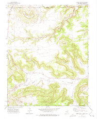
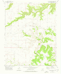
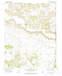
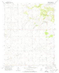
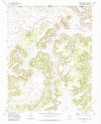
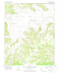
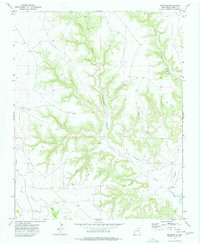
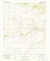
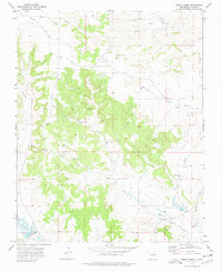
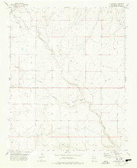
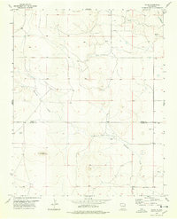
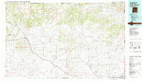
Historical Maps of Union County Through Time
359 maps found
1966 Black Canyon
Union County, NM
1966 Car Top Butte
Union County, NM
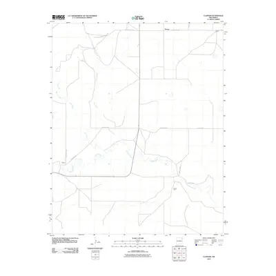
1966 Clapham
Union County, NM
1966 Hayden
Union County, NM
1966 Ione
Union County, NM
1966 Royce
Union County, NM
1966 Sand Hill
Union County, NM
1966 Skull Mesa
Union County, NM
1966 Tate School
Union County, NM
1970 Clayton SW
Union County, NM
1970 Sedan NE
Union County, NM
1970 Sedan SE
Union County, NM
1970 Sedan
Union County, NM
1970 Stead
Union County, NM
1970 Texline North
Union County, NM
1970 Texline South
Union County, NM
1971 Amistad SE
Union County, NM
1971 Amistad
Union County, NM
1971 Centerville Corner
Union County, NM
1971 Koger Ranch
Union County, NM
1972 Atencio
Union County, NM
1972 Bible Top Butte
Union County, NM
1972 Boiler Gap
Union County, NM
1972 Cobert Mesa South
Union County, NM
1972 Cow Mountain
Union County, NM
1972 Cross L Ranch SW
Union County, NM
1972 Cross L Ranch
Union County, NM
1972 Cuates School
Union County, NM
1972 Emery Peak
Union County, NM
1972 Fiddler Springs
Union County, NM
1972 Goodson School
Union County, NM
1972 Greendailey Canyon
Union County, NM
1972 Guy
Union County, NM
1972 Little Grande
Union County, NM
1972 Malpie Mountain
Union County, NM
1972 Mc Laughlin Bridge
Union County, NM
1972 Moses
Union County, NM
1972 Mount Dora
Union County, NM
1972 Rabbit Ear Mountain
Union County, NM
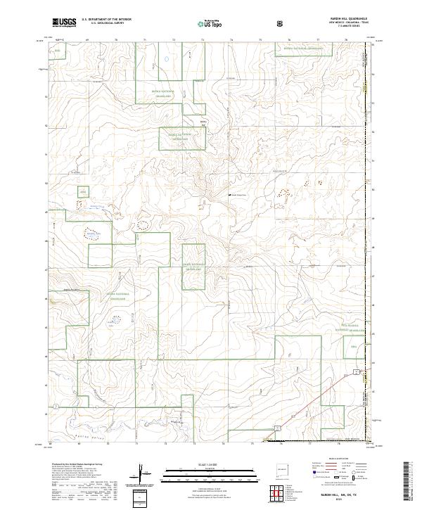
1972 Rardin Hill
Union County, NM
1972 Seneca
Union County, NM
1972 Travesser Park
Union County, NM
1972 Tub Spring
Union County, NM
1972 Wedding Cake Butte
Union County, NM
1973 Beenham
Union County, NM
1973 Blind Gap
Union County, NM
1973 Garcia Creek
Union County, NM
1973 Gladstone NW
Union County, NM
1973 Goat Canyon
Union County, NM
1973 Grenville SW
Union County, NM

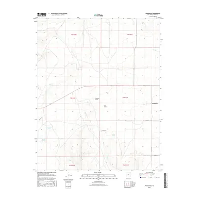
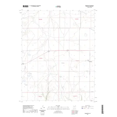
1973 Pennington
Union County, NM
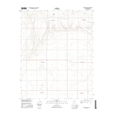
1973 Romero Spring
Union County, NM
1973 Snyder Lake
Union County, NM
1973 Sofia
Union County, NM
1973 Tripod Mountain
Union County, NM
1973 Wetherly Lake
Union County, NM
1977 Aragon Hill
Union County, NM
1977 Gladstone
Union County, NM
1977 Yates
Union County, NM
1982 Capulin Mountain
Union County, NM
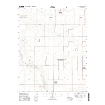
1998 Clayton SW
Union County, NM
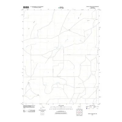
1998 Mc Laughlin Bridge
Union County, NM
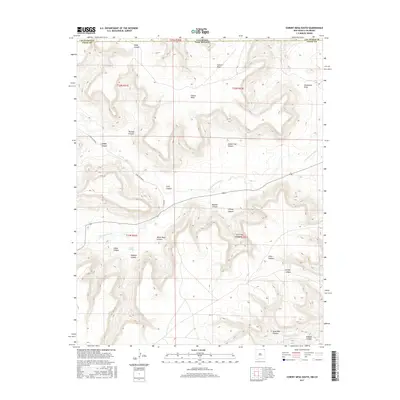
1998 Moses
Union County, NM
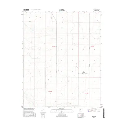
1998 Rabbit Ear Mountain
Union County, NM
1998 Rardin Hill
Union County, NM
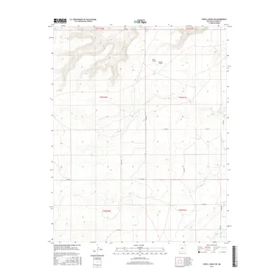
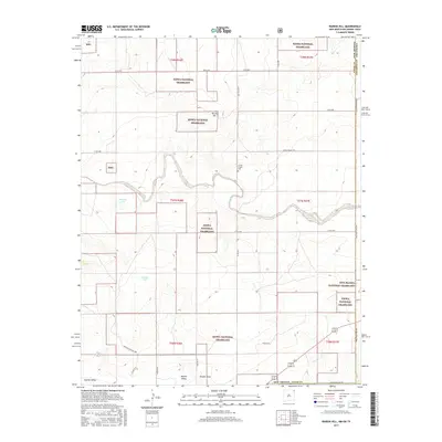
1998 Royce
Union County, NM
1998 Sand Hill
Union County, NM
1998 Sedan NE
Union County, NM
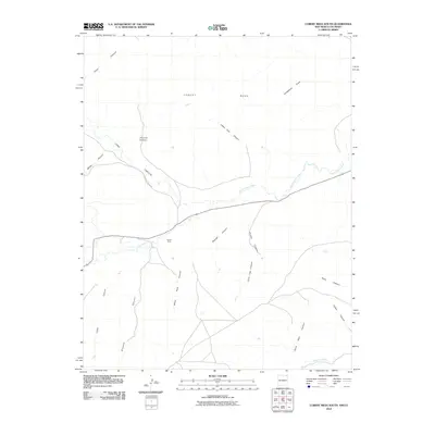
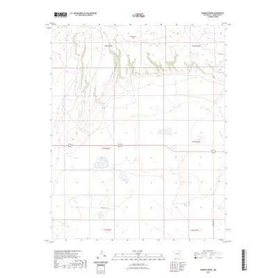
1998 Seneca
Union County, NM
2010 Alps Mesa
Union County, NM
2010 Amistad SE
Union County, NM
2010 Amistad
Union County, NM
2010 Aragon Hill
Union County, NM
2010 Atencio
Union County, NM
2010 Beenham
Union County, NM
2010 Bible Top Butte
Union County, NM
2010 Black Canyon
Union County, NM
2010 Blind Gap
Union County, NM
2010 Boiler Gap
Union County, NM
2010 Car Top Butte
Union County, NM
2010 Centerville Corner
Union County, NM
2010 Clapham
Union County, NM
2010 Cobert Mesa South
Union County, NM
2010 Cow Mountain
Union County, NM
2010 Cross L Ranch SW
Union County, NM
2010 Cross L Ranch
Union County, NM
2010 Cuates School
Union County, NM
2010 Emery Peak
Union County, NM
2010 Fiddler Springs
Union County, NM
2010 Garcia Creek
Union County, NM
2010 Gladstone NW
Union County, NM
2010 Gladstone
Union County, NM
2010 Goat Canyon
Union County, NM
2010 Greendailey Canyon
Union County, NM
2010 Grenville SW
Union County, NM
2010 Guy
Union County, NM
2010 Hayden
Union County, NM
2010 Ione
Union County, NM
2010 Koger Ranch
Union County, NM
2010 Little Grande
Union County, NM
2010 Malpie Mountain
Union County, NM
2010 Mount Dora
Union County, NM
2010 Pennington
Union County, NM
2010 Romero Spring
Union County, NM
2010 Sedan SE
Union County, NM
2010 Sedan
Union County, NM
2010 Skull Mesa
Union County, NM
2010 Snyder Lake
Union County, NM
2010 Sofia
Union County, NM
2010 Stead
Union County, NM
2010 Tate School
Union County, NM
2010 Travesser Park
Union County, NM
2010 Tripod Mountain
Union County, NM
2010 Tub Spring
Union County, NM
2010 Weatherly Lake
Union County, NM
2010 Wedding Cake Butte
Union County, NM
2010 Yates
Union County, NM
2011 Clayton SW
Union County, NM
2011 Goodson School
Union County, NM
2011 McLaughlin Bridge
Union County, NM
2011 Moses
Union County, NM
2011 Rabbit Ear Mountain
Union County, NM
2011 Rardin Hill
Union County, NM
2011 Royce
Union County, NM
2011 Sand Hill
Union County, NM
2011 Sedan NE
Union County, NM
2011 Seneca
Union County, NM
2013 Alps Mesa
Union County, NM
2013 Amistad SE
Union County, NM
2013 Amistad
Union County, NM
2013 Aragon Hill
Union County, NM
2013 Atencio
Union County, NM
2013 Beenham
Union County, NM
2013 Bible Top Butte
Union County, NM
2013 Black Canyon
Union County, NM
2013 Blind Gap
Union County, NM
2013 Boiler Gap
Union County, NM
2013 Car Top Butte
Union County, NM
2013 Centerville Corner
Union County, NM
2013 Clapham
Union County, NM
2013 Clayton SW
Union County, NM
2013 Cobert Mesa South
Union County, NM
2013 Cow Mountain
Union County, NM
2013 Cross L Ranch SW
Union County, NM
2013 Cross L Ranch
Union County, NM
2013 Cuates School
Union County, NM
2013 Emery Peak
Union County, NM

2013 Fiddler Springs
Union County, NM
2013 Garcia Creek
Union County, NM
2013 Gladstone NW
Union County, NM
2013 Gladstone
Union County, NM
2013 Goat Canyon
Union County, NM
2013 Goodson School
Union County, NM
2013 Greendailey Canyon
Union County, NM
2013 Grenville SW
Union County, NM
2013 Guy
Union County, NM
2013 Hayden
Union County, NM
2013 Ione
Union County, NM
2013 Koger Ranch
Union County, NM
2013 Little Grande
Union County, NM
2013 Malpie Mountain
Union County, NM
2013 McLaughlin Bridge
Union County, NM
2013 Moses
Union County, NM
2013 Mount Dora
Union County, NM
2013 Pennington
Union County, NM
2013 Rabbit Ear Mountain
Union County, NM
2013 Rardin Hill
Union County, NM
2013 Romero Spring
Union County, NM
2013 Royce
Union County, NM
2013 Sand Hill
Union County, NM
2013 Sedan NE
Union County, NM
2013 Sedan SE
Union County, NM
2013 Sedan
Union County, NM
2013 Seneca
Union County, NM
2013 Skull Mesa
Union County, NM
2013 Snyder Lake
Union County, NM
2013 Sofia
Union County, NM
2013 Stead
Union County, NM
2013 Tate School
Union County, NM
2013 Travesser Park
Union County, NM
2013 Tripod Mountain
Union County, NM
2013 Tub Spring
Union County, NM
2013 Weatherly Lake
Union County, NM
2013 Wedding Cake Butte
Union County, NM
2013 Yates
Union County, NM
2017 Alps Mesa
Union County, NM
2017 Amistad SE
Union County, NM
2017 Amistad
Union County, NM
2017 Aragon Hill
Union County, NM
2017 Atencio
Union County, NM
2017 Beenham
Union County, NM
2017 Bible Top Butte
Union County, NM
2017 Black Canyon
Union County, NM
2017 Blind Gap
Union County, NM
2017 Boiler Gap
Union County, NM
2017 Car Top Butte
Union County, NM
2017 Centerville Corner
Union County, NM
2017 Clapham
Union County, NM
2017 Clayton SW
Union County, NM
2017 Cobert Mesa South
Union County, NM
2017 Cow Mountain
Union County, NM
2017 Cross L Ranch SW
Union County, NM
2017 Cross L Ranch
Union County, NM
2017 Cuates School
Union County, NM
2017 Emery Peak
Union County, NM
2017 Fiddler Springs
Union County, NM
2017 Garcia Creek
Union County, NM
2017 Gladstone NW
Union County, NM
2017 Gladstone
Union County, NM
2017 Goat Canyon
Union County, NM
2017 Goodson School
Union County, NM
2017 Greendailey Canyon
Union County, NM
2017 Grenville SW
Union County, NM
2017 Guy
Union County, NM
2017 Hayden
Union County, NM
2017 Ione
Union County, NM
2017 Koger Ranch
Union County, NM
2017 Little Grande
Union County, NM
2017 Malpie Mountain
Union County, NM
2017 McLaughlin Bridge
Union County, NM
2017 Moses
Union County, NM
2017 Mount Dora
Union County, NM
2017 Pennington
Union County, NM
2017 Rabbit Ear Mountain
Union County, NM
2017 Rardin Hill
Union County, NM
2017 Romero Spring
Union County, NM
2017 Royce
Union County, NM
2017 Sand Hill
Union County, NM
2017 Sedan NE
Union County, NM
2017 Sedan SE
Union County, NM
2017 Sedan
Union County, NM
2017 Seneca
Union County, NM
2017 Skull Mesa
Union County, NM
2017 Snyder Lake
Union County, NM
2017 Sofia
Union County, NM
2017 Stead
Union County, NM
2017 Tate School
Union County, NM
2017 Travesser Park
Union County, NM
2017 Tripod Mountain
Union County, NM
2017 Tub Spring
Union County, NM
2017 Weatherly Lake
Union County, NM
2017 Wedding Cake Butte
Union County, NM
2017 Yates
Union County, NM
2020 Alps Mesa
Union County, NM
2020 Amistad SE
Union County, NM
2020 Amistad
Union County, NM
2020 Aragon Hill
Union County, NM
2020 Atencio
Union County, NM
2020 Beenham
Union County, NM
2020 Bible Top Butte
Union County, NM
2020 Black Canyon
Union County, NM
2020 Blind Gap
Union County, NM
2020 Boiler Gap
Union County, NM
2020 Car Top Butte
Union County, NM
2020 Centerville Corner
Union County, NM
2020 Clapham
Union County, NM
2020 Clayton SW
Union County, NM
2020 Cobert Mesa South
Union County, NM
2020 Cow Mountain
Union County, NM
2020 Cross L Ranch SW
Union County, NM
2020 Cross L Ranch
Union County, NM
2020 Cuates School
Union County, NM
2020 Emery Peak
Union County, NM
2020 Fiddler Springs
Union County, NM
2020 Garcia Creek
Union County, NM
2020 Gladstone NW
Union County, NM
2020 Gladstone
Union County, NM
2020 Goat Canyon
Union County, NM
2020 Goodson School
Union County, NM
2020 Greendailey Canyon
Union County, NM
2020 Grenville SW
Union County, NM
2020 Guy
Union County, NM
2020 Hayden
Union County, NM
2020 Ione
Union County, NM
2020 Koger Ranch
Union County, NM
2020 Little Grande
Union County, NM
2020 Malpie Mountain
Union County, NM
2020 McLaughlin Bridge
Union County, NM
2020 Moses
Union County, NM
2020 Mount Dora
Union County, NM
2020 Pennington
Union County, NM
2020 Rabbit Ear Mountain
Union County, NM
2020 Rardin Hill
Union County, NM
2020 Romero Spring
Union County, NM
2020 Royce
Union County, NM
2020 Sand Hill
Union County, NM
2020 Sedan NE
Union County, NM
2020 Sedan SE
Union County, NM
2020 Sedan
Union County, NM
2020 Seneca
Union County, NM
2020 Skull Mesa
Union County, NM
2020 Snyder Lake
Union County, NM
2020 Sofia
Union County, NM
2020 Stead
Union County, NM
2020 Tate School
Union County, NM
2020 Travesser Park
Union County, NM
2020 Tripod Mountain
Union County, NM
2020 Tub Spring
Union County, NM
2020 Weatherly Lake
Union County, NM
2020 Wedding Cake Butte
Union County, NM
2020 Yates
Union County, NM
2023 Alps Mesa
Union County, NM
2023 Amistad SE
Union County, NM
2023 Amistad
Union County, NM
2023 Aragon Hill
Union County, NM
2023 Atencio
Union County, NM
2023 Beenham
Union County, NM
2023 Bible Top Butte
Union County, NM
2023 Black Canyon
Union County, NM
2023 Blind Gap
Union County, NM
2023 Boiler Gap
Union County, NM
2023 Car Top Butte
Union County, NM
2023 Centerville Corner
Union County, NM
2023 Clapham
Union County, NM
2023 Clayton SW
Union County, NM
2023 Cobert Mesa South
Union County, NM
2023 Cow Mountain
Union County, NM
2023 Cross L Ranch SW
Union County, NM
2023 Cross L Ranch
Union County, NM
2023 Cuates School
Union County, NM
2023 Emery Peak
Union County, NM
2023 Fiddler Springs
Union County, NM
2023 Garcia Creek
Union County, NM
2023 Gladstone NW
Union County, NM
2023 Gladstone
Union County, NM
2023 Goat Canyon
Union County, NM
2023 Goodson School
Union County, NM
2023 Greendailey Canyon
Union County, NM
2023 Grenville SW
Union County, NM
2023 Guy
Union County, NM
2023 Hayden
Union County, NM
2023 Ione
Union County, NM
2023 Koger Ranch
Union County, NM
2023 Little Grande
Union County, NM
2023 Malpie Mountain
Union County, NM
2023 McLaughlin Bridge
Union County, NM
2023 Moses
Union County, NM
2023 Mount Dora
Union County, NM
2023 Pennington
Union County, NM
2023 Rabbit Ear Mountain
Union County, NM
2023 Rardin Hill
Union County, NM
2023 Romero Spring
Union County, NM
2023 Royce
Union County, NM
2023 Sand Hill
Union County, NM
2023 Sedan NE
Union County, NM
2023 Sedan SE
Union County, NM
2023 Sedan
Union County, NM
2023 Seneca
Union County, NM
2023 Skull Mesa
Union County, NM
2023 Snyder Lake
Union County, NM
2023 Sofia
Union County, NM
2023 Stead
Union County, NM
2023 Tate School
Union County, NM
2023 Travesser Park
Union County, NM
2023 Tripod Mountain
Union County, NM
2023 Tub Spring
Union County, NM
2023 Weatherly Lake
Union County, NM
2023 Wedding Cake Butte
Union County, NM
2023 Yates
Union County, NM