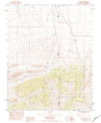
1984 Map of Hen Spring
USGS Topo · Published 1984About this map
The Virgin Mountains dominate this high-desert terrain where the borders of Nevada and Arizona meet near the division of Clark and Mohave Counties. In 1984, this landscape was defined by its complex drainage network and elevated ridgelines, specifically Bunkerville Ridge which cuts across the northwestern portion of the map. The elevation culminates at Virgin Peak, providing a dramatic backdrop to the various canyons that carve through the limestone and desert soil.
Find a feature on this map
15 named features on this map. Tap any name to fly to it.
Don’t see what you’re looking for? This feature index may not catch every label — zoom into the map to look around manually.
Map Details
Editions of this 1984 Hen Spring Map
This is the sole edition of this map. No revisions or reprints were ever made.
Other maps of this area

1886 · Saint Thomas
USGS Topo · 1:250,000

1886 · Mt. Trumbull
USGS Topo · 1:250,000

1892 · Mt. Trumbull
USGS Topo · 1:250,000

1893 · Saint Thomas
USGS Topo · 1:250,000

1953 · Grand Canyon
USGS Topo · 1:250,000

1954 · Las Vegas
USGS Topo · 1:250,000

1954 · Littlefield 3 SW
USGS Topo · 1:24,000

1954 · Littlefield
USGS Topo · 1:62,500

1954 · Cane Springs
USGS Topo · 1:62,500

1957 · Las Vegas
USGS Topo · 1:250,000