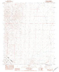
1984 Map of Hopps Well
USGS Topo · Published 1984About this map
New York Mountains and the Piute Valley dominate this high-desert landscape along the border of Nevada and California during the mid-1980s. A significant historical marker is the Von Schmidt Line (1873), reflecting the complex surveying history of the state boundary. Water sources are critical identifiers in this arid environment, with Hopps Well, Clarks Well, and Talc Spring serving as essential landmarks for navigation and survival. The map also documents intensive prospecting history, particularly in the mountain foothills where numerous Mine Shafts and a Prospect Shaft indicate past mineral extraction efforts. Much of the southern portion is managed as part of the East Mojave National Scenic Area, where several instances of a Guzzler—human-made water collection points for wildlife—appear among the drainage patterns of the Castle Mountains.
Find a feature on this map
19 named features on this map. Tap any name to fly to it.
Don’t see what you’re looking for? This feature index may not catch every label — zoom into the map to look around manually.
Map Details
Editions of this 1984 Hopps Well Map
This is the sole edition of this map. No revisions or reprints were ever made.
Other maps of this area

1886 · Camp Mohave
USGS Topo · 1:250,000

1892 · Camp Mohave
USGS Topo · 1:250,000

1910 · Ivanpah
USGS Topo · 1:250,000

1912 · Ivanpah
USGS Topo · 1:250,000

1926 · Nelson
USGS Topo · 1:96,000

1926 · Mohave City
USGS Topo · 1:96,000

1942 · Camp Mohave
USGS Topo · 1:250,000

1942 · Ivanpah
USGS Topo · 1:250,000

1947 · Kingman
USGS Topo · 1:250,000

1948 · Kingman
USGS Topo · 1:250,000