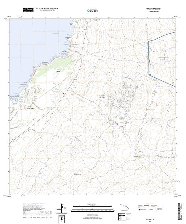
2024 Map of Puu Hinai
USGS Topo · Published 2024About this map
The Kanikū Lava Flow and the massive Lava Flow of 1859 dominate the Kohala Coast landscape, illustrating the raw volcanic foundations of the Island of Hawai‘i. This modern topographic study shows the concentrated development of Waikoloa Village inland, contrasted with the luxury coastal developments at Waikoloa Beach Resort and the older shoreline settlement of Puako. A significant cultural and historical thread runs along the coast via the Ala Kahakai Trail (Hāpuna-Puakō Sector), which connects a series of traditional Hawaiian water features. Notable among these are the Waipuhi Fishpond, Hopeaia Fishpond, and Manoku Fishpond, which represent indigenous aquaculture preserved amidst modern tourism. The map also delineates the transition from the sandy reaches of Hāpuna Beach and Waialea Beach to the steep, erosional features of the interior, such as Kamakōa Gulch and Popoo Gulch.
Find a feature on this map
73 named features on this map. Tap any name to fly to it.
Don’t see what you’re looking for? This feature index may not catch every label — zoom into the map to look around manually.
Map Details
Editions of this 2024 Puu Hinai Map
This is the sole edition of this map. No revisions or reprints were ever made.
Other maps of this area

1913 · Kohala
USGS Topo · 1:62,500

1916 · Kohala
USGS Topo · 1:62,500

1916 · Waipio
USGS Topo · 1:62,500

1928 · Puako
USGS Topo · 1:62,500

1954 · Hawaii North
USGS Topo · 1:250,000

1956 · Puu Hinai
USGS Topo · 1:24,000

1956 · Kamuela
USGS Topo · 1:24,000

1956 · Keamuku
USGS Topo · 1:24,000

1956 · Nohonaohae
USGS Topo · 1:24,000

1956 · Kawaihae
USGS Topo · 1:24,000