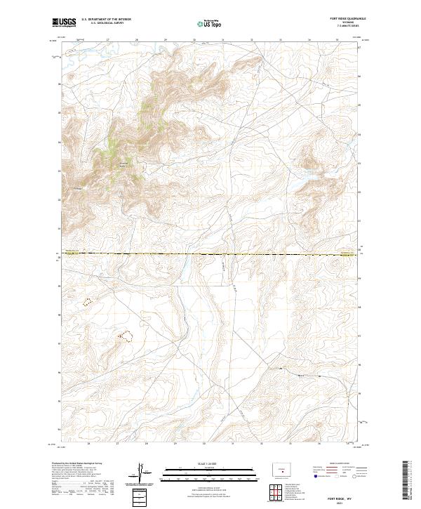
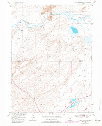
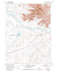
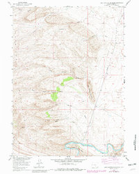
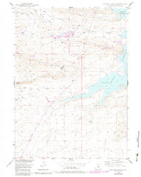
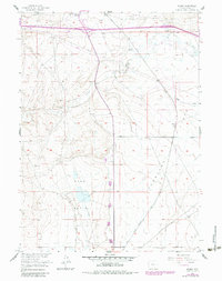
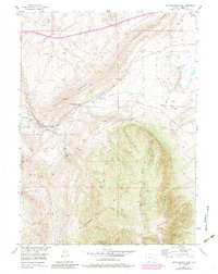
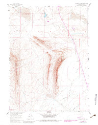
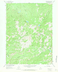
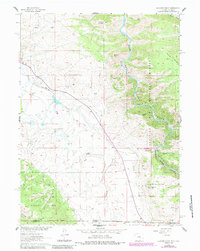
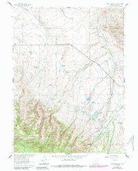
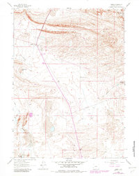
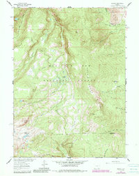
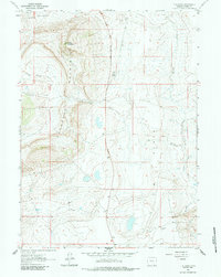
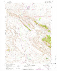
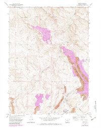
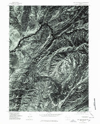
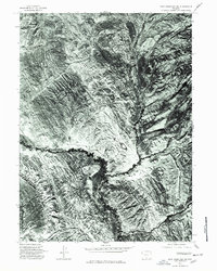
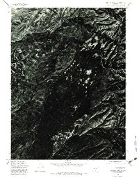
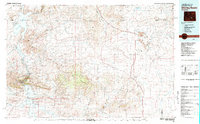
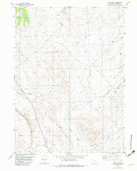
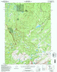
2021 Map of Fort Ridge
USGS Topo · Published 2021About this map
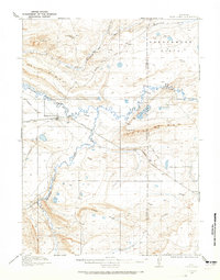
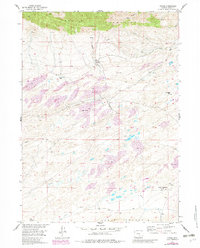
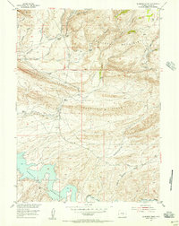
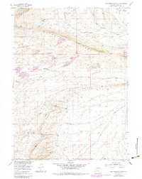
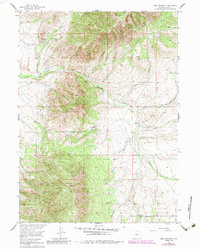
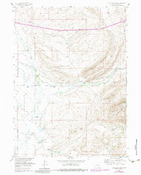
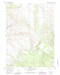
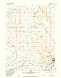
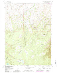
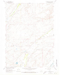
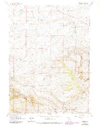
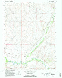
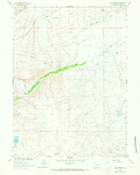
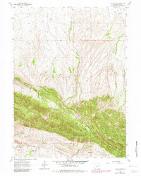
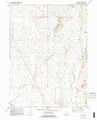
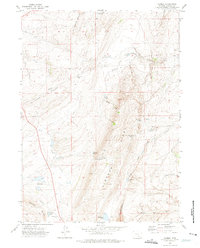
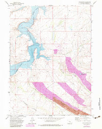
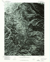
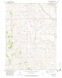
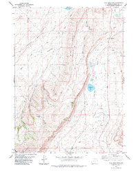
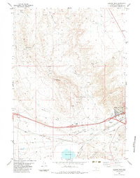
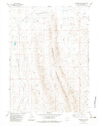
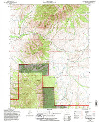
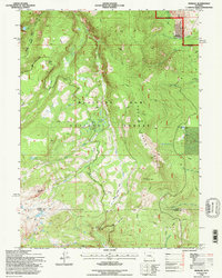
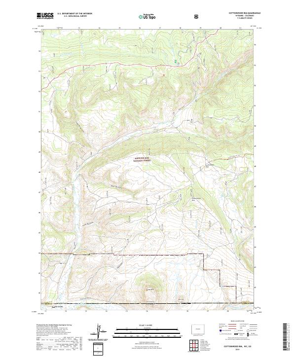
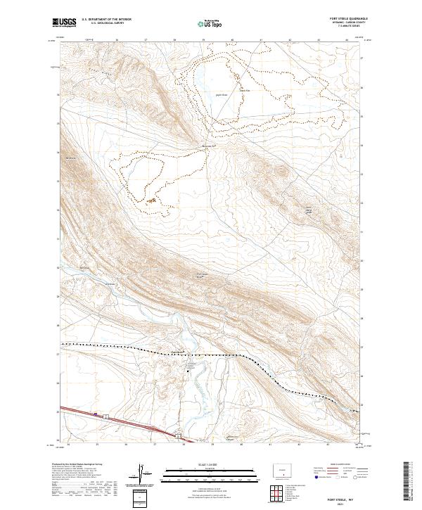
Sentinel Rocks and the namesake Ft Ridge dominate the landscape of the northern High Plains where Natrona and Carbon Counties meet. The rugged topography is defined by the drainage basins of Arkansas Cr and E Arkansas Cr, which flow southward away from the prominent central ridges. Along the northern edge, the Sweetwater River cuts through the terrain near Co RD 319, marking a significant historical corridor for western travel. The presence of Annis Reservoir and remote routes like Annis Trl and Buzzard Rd reflect a landscape shaped by ranching and resource management. This survey provides a precise view of the section lines and township boundaries, such as t29n r86w, that have organized this high-altitude Wyoming backcountry since the late nineteenth century.
Find a feature on this map
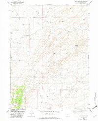
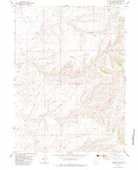
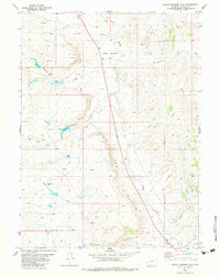
17 named features on this map. Tap any name to fly to it.
Don’t see what you’re looking for? This feature index may not catch every label — zoom into the map to look around manually.
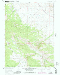
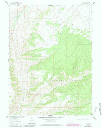
Map Details
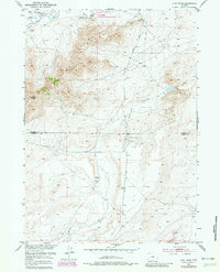
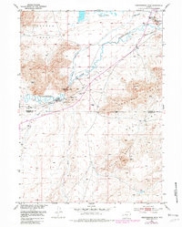
Editions of this 2021 Fort Ridge Map
This is the sole edition of this map. No revisions or reprints were ever made.
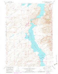
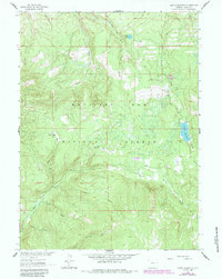
Historical Maps of Natrona County Through Time
281 maps found
1893 Fort Steele
Carbon County, WY
1914 Saddleback Hills
Carbon County, WY
1914 Walcott
Carbon County, WY
1915 Como Ridge
Carbon County, WY
1918 Como Ridge
Carbon County, WY
1921 Saddleback Hills
Carbon County, WY
1932 Savery
Carbon County, WY

1940 Savery
Carbon County, WY
1951 Bucklin Reservoirs
Carbon County, WY
1951 Fort Ridge
Carbon County, WY
1951 Independence Rock
Carbon County, WY
1951 Pathfinder Reservoir NW
Carbon County, WY
1951 Savage Peak
Carbon County, WY
1953 Beaver Creek
Carbon County, WY
1953 Bradley Peak
Carbon County, WY
1953 Buzzard Ranch
Carbon County, WY
1953 Ferris
Carbon County, WY
1953 Fourmile Point
Carbon County, WY
1953 Fourmile Ridge
Carbon County, WY
1953 Leo
Carbon County, WY
1953 Lone Haystack Mountain
Carbon County, WY
1953 Pathfinder Reservoir SW
Carbon County, WY
1953 Rawlins NW
Carbon County, WY
1953 Riddle Cut
Carbon County, WY
1953 Schneider Ridge
Carbon County, WY
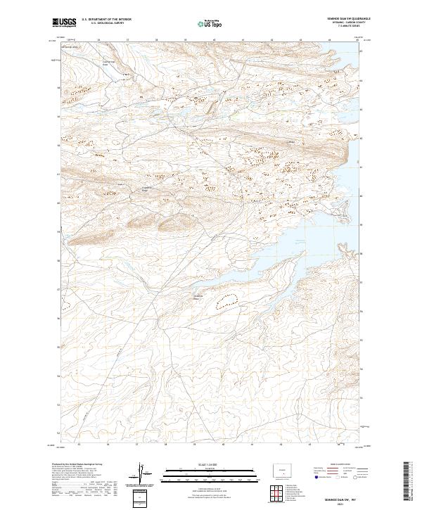
1953 Seminoe Dam
Carbon County, WY
1953 Seminoe Dam NE
Carbon County, WY
1953 Seminoe Dam SE
Carbon County, WY
1953 Seminoe Dam SW
Carbon County, WY
1953 Spanish Mine
Carbon County, WY
1953 T E Ranch
Carbon County, WY
1953 The Q Ranch
Carbon County, WY
1953 Wild Horse Mountain
Carbon County, WY
1955 Coad Mountain
Carbon County, WY
1955 Coal Bank Basin
Carbon County, WY
1955 Elk Mountain SW
Carbon County, WY
1955 Meads
Carbon County, WY
1955 Oberg Ranch
Carbon County, WY
1955 Overland
Carbon County, WY
1955 Overland Crossing
Carbon County, WY
1955 Rattlesnake Pass
Carbon County, WY
1955 Savage Ranch
Carbon County, WY
1956 Bolten Ranch
Carbon County, WY
1956 Bridger Pass
Carbon County, WY
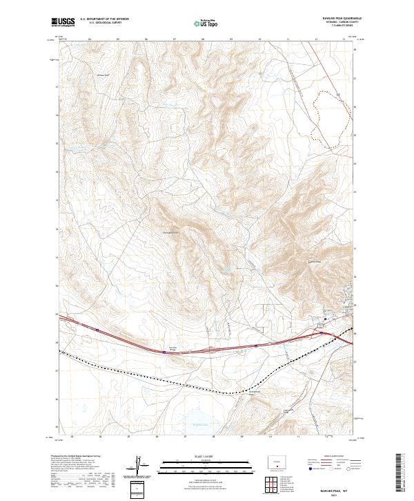
1956 Rawlins Peak
Carbon County, WY
1957 Doty Mountain
Carbon County, WY
1958 Mc Fadden
Carbon County, WY
1958 T L Ranch
Carbon County, WY
1958 White Rock Canyon
Carbon County, WY
1959 Moss Agate Reservoir
Carbon County, WY
1960 Boggy Meadows
Carbon County, WY
1960 Measel Spring Reservoir
Carbon County, WY
1960 Separation Rim
Carbon County, WY
1960 Wild Irish Reservoir
Carbon County, WY
1961 Barcus Peak
Carbon County, WY
1961 Blackhall Mountain
Carbon County, WY
1961 Bridger Peak
Carbon County, WY
1961 Browns Hill
Carbon County, WY
1961 Cameron Creek
Carbon County, WY
1961 Cow Creek
Carbon County, WY
1961 Cow Creek Ranch
Carbon County, WY
1961 Difficulty
Carbon County, WY
1961 Divide Peak
Carbon County, WY
1961 Dudley Creek
Carbon County, WY
1961 Elkhorn Point
Carbon County, WY
1961 Finley Reservoir
Carbon County, WY
1961 Fletcher Peak
Carbon County, WY
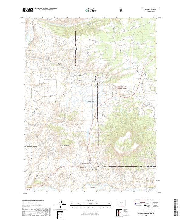
1961 Grieve Reservoir
Carbon County, WY
1961 Gunst Reservoir
Carbon County, WY

1961 Indian Rocks
Carbon County, WY
1961 Jack Creek Reservoir
Carbon County, WY
1961 Kennaday Peak
Carbon County, WY
1961 Ketchum Buttes
Carbon County, WY
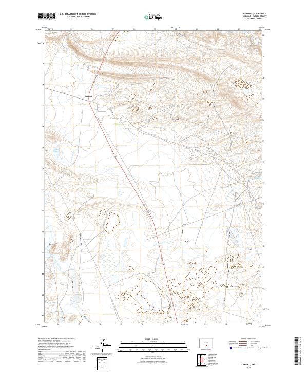
1961 Lamont
Carbon County, WY
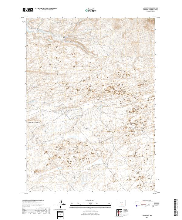
1961 Lamont NE
Carbon County, WY
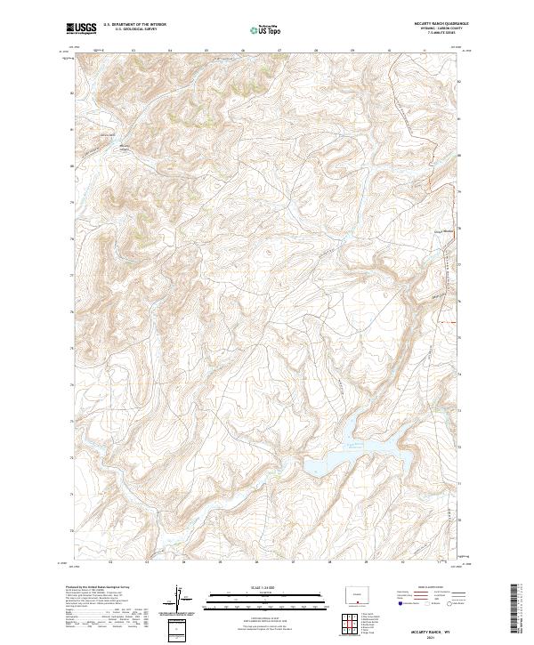
1961 Mc Carty Ranch
Carbon County, WY
1961 Middlewood Hill
Carbon County, WY
1961 Morgan
Carbon County, WY
1961 Overlook Hill
Carbon County, WY
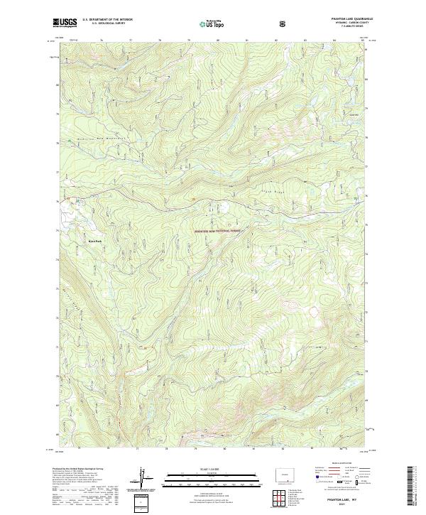
1961 Phantom Lake
Carbon County, WY
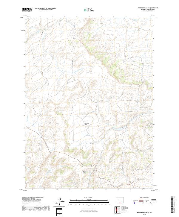
1961 Pine Grove Ranch
Carbon County, WY
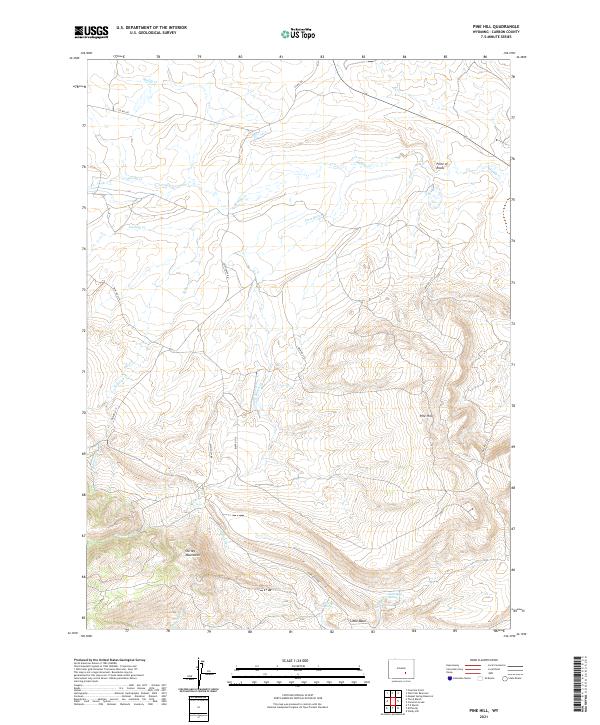
1961 Pine Hill
Carbon County, WY
1961 Pole Gulch
Carbon County, WY
1961 Red Mountain
Carbon County, WY
1961 Sand Lake
Carbon County, WY
1961 Savery
Carbon County, WY
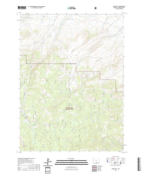
1961 Sharp Hill
Carbon County, WY
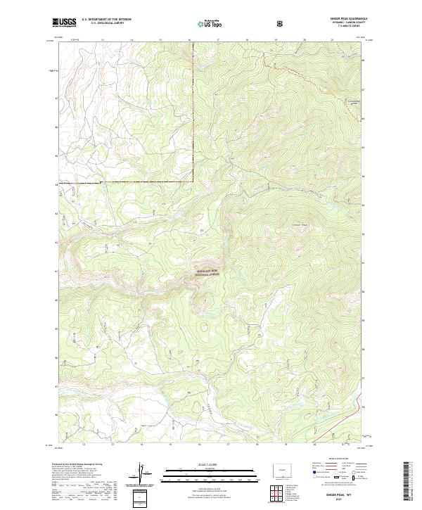
1961 Singer Peak
Carbon County, WY
1961 Solomon Creek
Carbon County, WY
1961 T B Ranch
Carbon County, WY
1961 Trent Creek
Carbon County, WY
1961 Tullis
Carbon County, WY
1961 Turpin Reservoir
Carbon County, WY
1961 Walck Ranch
Carbon County, WY
1961 Walker Draw NW
Carbon County, WY
1961 Windy Hill
Carbon County, WY
1962 Cottonwood Rim
Carbon County, WY
1962 Muddy Gap
Carbon County, WY
1962 Youngs Pass
Carbon County, WY

1966 Fillmore Ranch
Carbon County, WY
1966 High Point
Carbon County, WY
1966 Seaverson Reservoir
Carbon County, WY
1970 Duck Lake
Carbon County, WY
1970 Flat Top Mountain
Carbon County, WY
1970 Mexican Flats
Carbon County, WY
1970 Poison Basin
Carbon County, WY
1971 Carbon
Carbon County, WY
1971 Como East
Carbon County, WY
1971 Como West
Carbon County, WY
1971 Dana
Carbon County, WY
1971 Elmo
Carbon County, WY
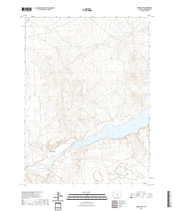
1971 Ferris Lake
Carbon County, WY
1971 Fort Steele
Carbon County, WY
1971 Halfway Hill
Carbon County, WY
1971 Pats Bottom
Carbon County, WY
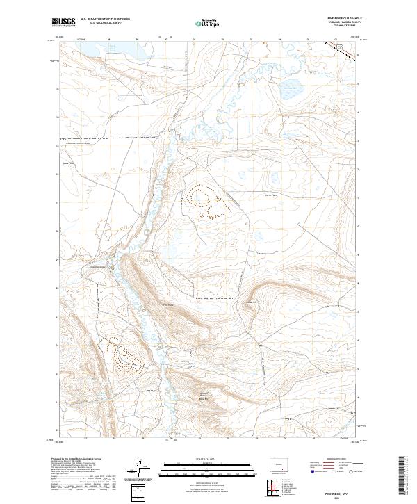
1971 Pine Ridge
Carbon County, WY
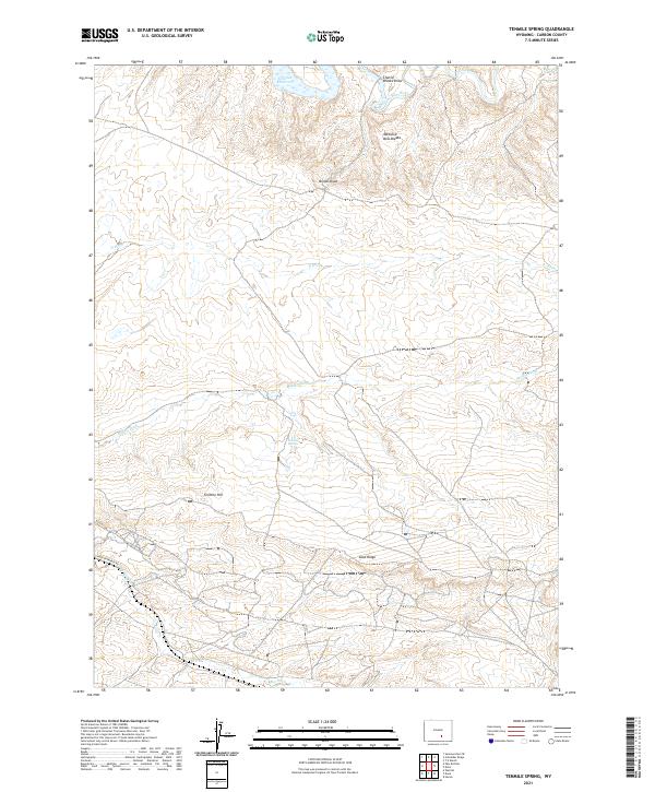
1971 Tenmile Spring
Carbon County, WY
1971 Walcott
Carbon County, WY
1975 Baggs NE
Carbon County, WY
1975 Baggs NW
Carbon County, WY
1975 Baggs SE
Carbon County, WY
1975 Baggs SW
Carbon County, WY
1975 Doty Mountain NW
Carbon County, WY
1975 Doty Mountain SW
Carbon County, WY
1975 Sulphur Springs
Carbon County, WY
1981 Shirley Basin
Carbon County, WY
1982 Blue Gap
Carbon County, WY
1982 Doty Mountain
Carbon County, WY
1982 Garden Gulch
Carbon County, WY
1982 Peach Orchard Flat
Carbon County, WY
1982 Smiley Draw
Carbon County, WY
1982 Sulphur Springs
Carbon County, WY
1983 Bridger Pass
Carbon County, WY
1983 Bridger Peak
Carbon County, WY
1983 Coal Mine Ridge
Carbon County, WY
1983 Kindt Reservoir
Carbon County, WY
1983 La Marsh Creek East
Carbon County, WY
1983 La Marsh Creek West
Carbon County, WY
1983 Rawlins Peak
Carbon County, WY
1983 Rawlins Peak SW
Carbon County, WY
1983 Rendle Hill
Carbon County, WY
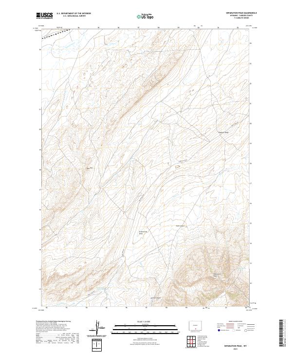
1983 Separation Peak
Carbon County, WY
1983 Shamrock Hills
Carbon County, WY
1983 Smith Draw East
Carbon County, WY
1983 Smith Draw West
Carbon County, WY
1992 Barcus Peak
Carbon County, WY
1992 Coad Mountain
Carbon County, WY
1992 Elk Mountain SW
Carbon County, WY
1992 Finley Reservoir
Carbon County, WY
1992 Kennaday Peak
Carbon County, WY
1992 Morgan
Carbon County, WY
1992 Oberg Ranch
Carbon County, WY
1992 Overlook Hill
Carbon County, WY
1992 Phantom Lake
Carbon County, WY
1992 Sand Lake
Carbon County, WY
1992 Turpin Reservoir
Carbon County, WY
1992 White Rock Canyon
Carbon County, WY
2021 Barcus Peak
Carbon County, WY
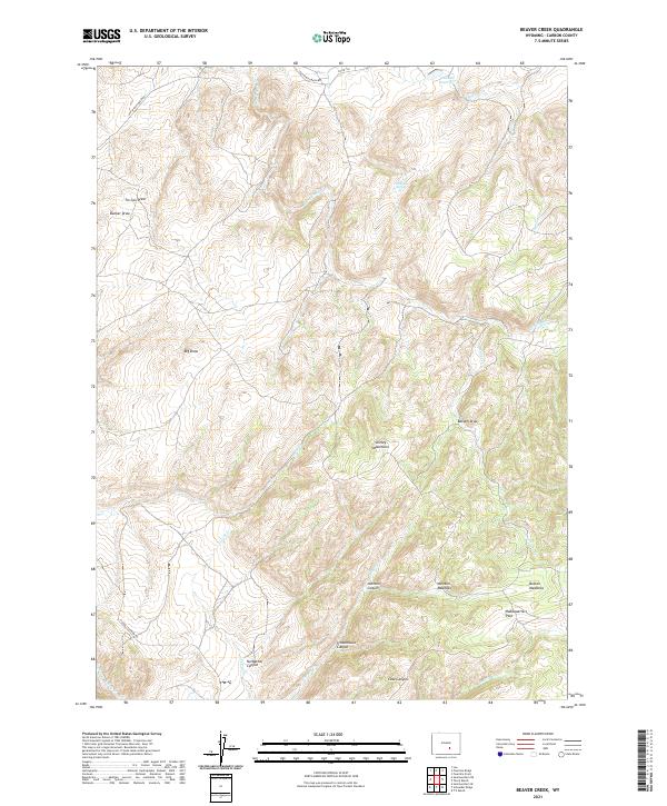
2021 Beaver Creek
Carbon County, WY
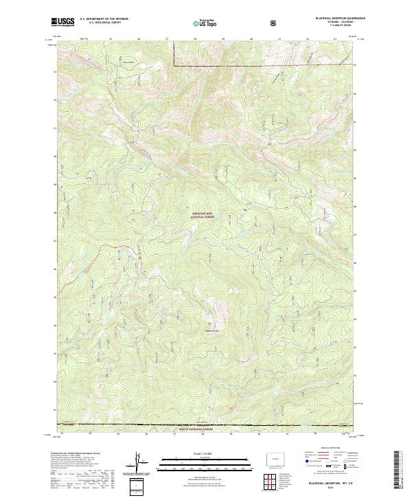
2021 Blackhall Mountain
Carbon County, WY
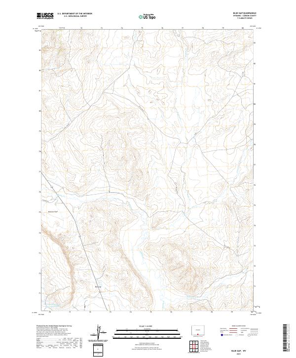
2021 Blue Gap
Carbon County, WY
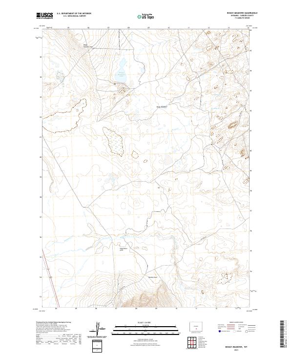
2021 Boggy Meadows
Carbon County, WY
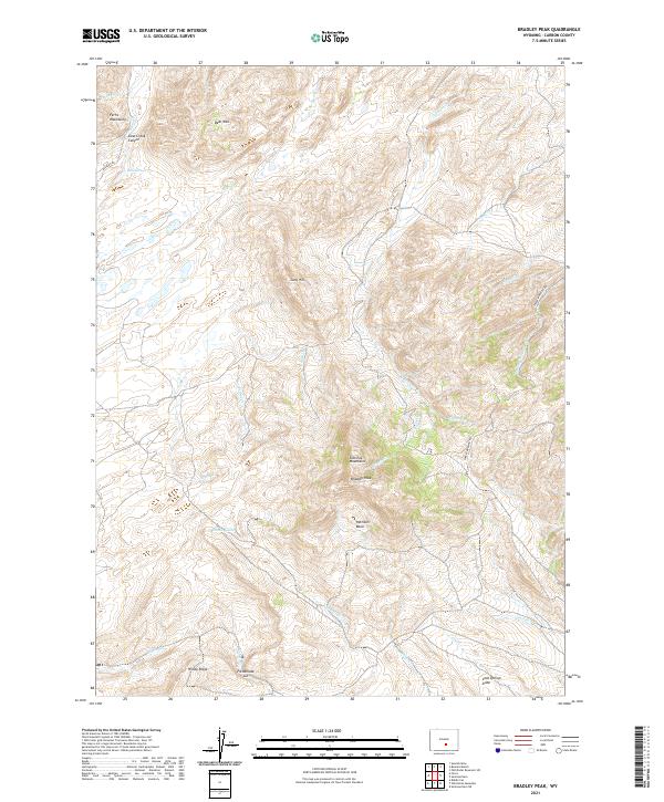
2021 Bradley Peak
Carbon County, WY
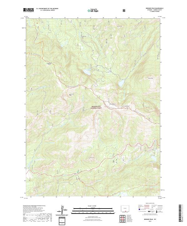
2021 Bridger Peak
Carbon County, WY
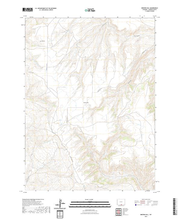
2021 Browns Hill
Carbon County, WY
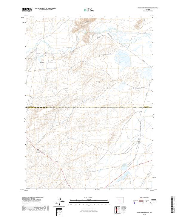
2021 Bucklin Reservoirs
Carbon County, WY
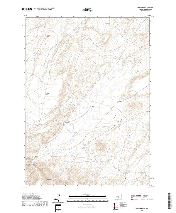
2021 Buzzard Ranch
Carbon County, WY
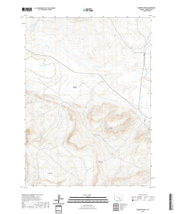
2021 Cameron Creek
Carbon County, WY
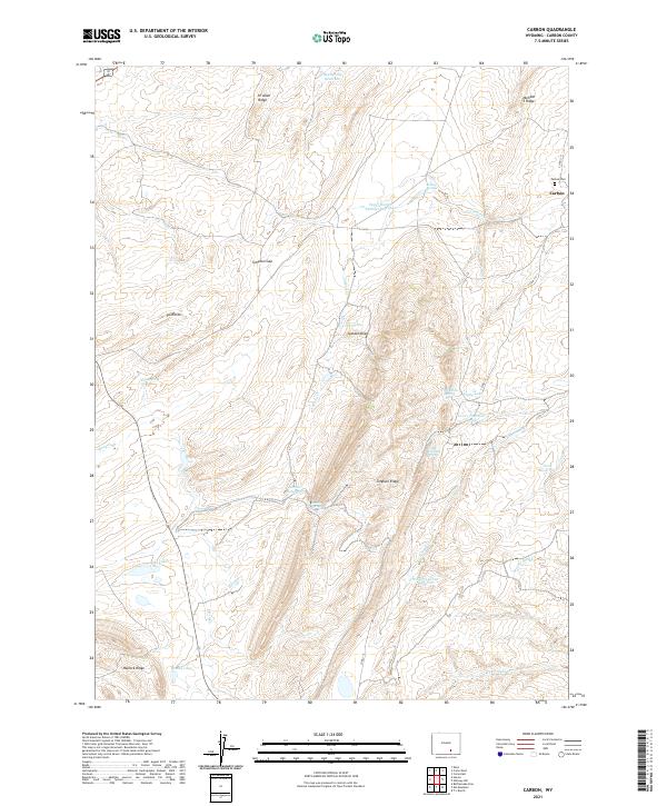
2021 Carbon
Carbon County, WY
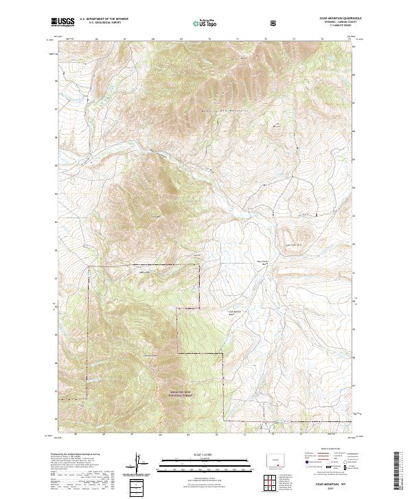
2021 Coad Mountain
Carbon County, WY
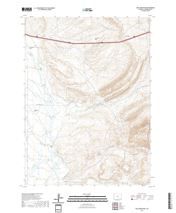
2021 Coal Bank Basin
Carbon County, WY
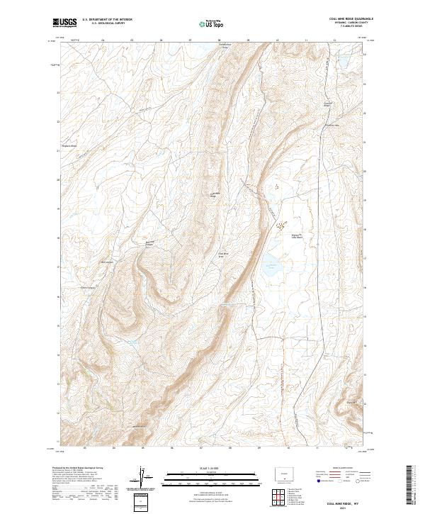
2021 Coal Mine Ridge
Carbon County, WY
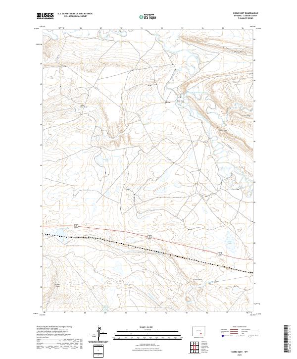
2021 Como East
Carbon County, WY
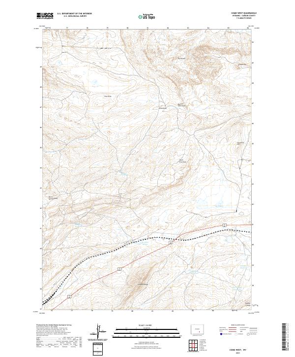
2021 Como West
Carbon County, WY
2021 Cottonwood Rim
Carbon County, WY
2021 Cow Creek
Carbon County, WY
2021 Cow Creek Ranch
Carbon County, WY
2021 Dana
Carbon County, WY
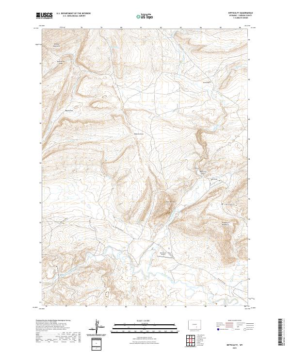
2021 Difficulty
Carbon County, WY
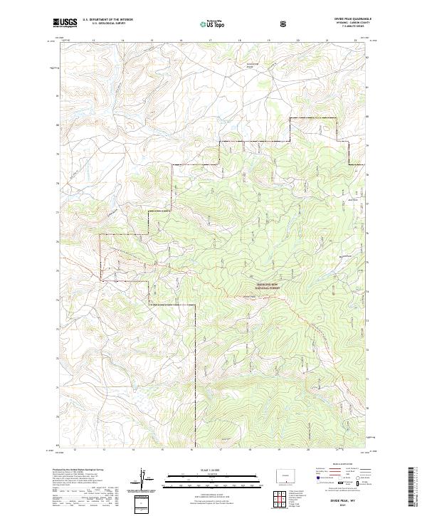
2021 Divide Peak
Carbon County, WY
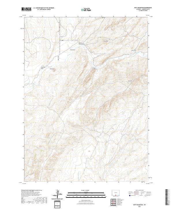
2021 Doty Mountain
Carbon County, WY

2021 Duck Lake
Carbon County, WY
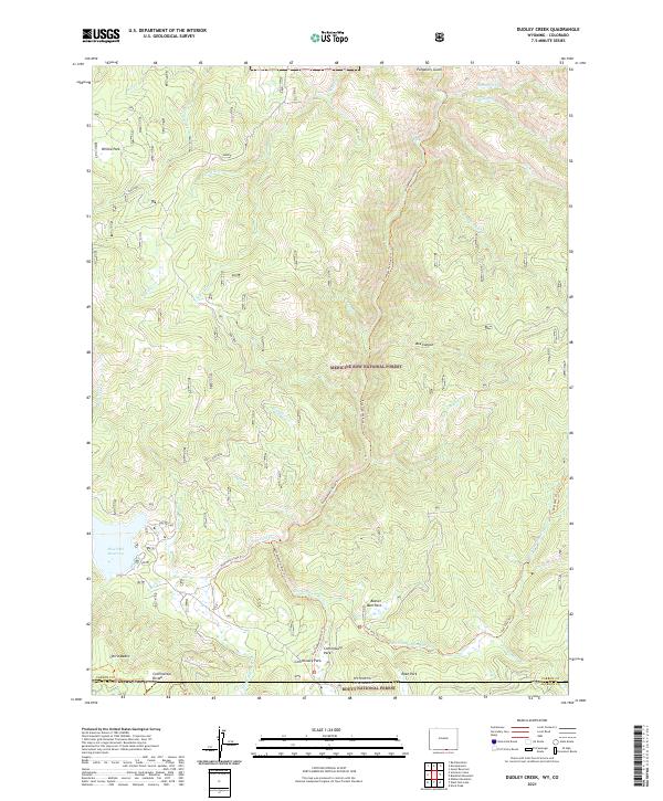
2021 Dudley Creek
Carbon County, WY
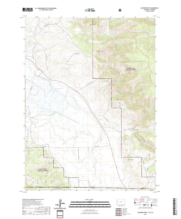
2021 Elkhorn Point
Carbon County, WY
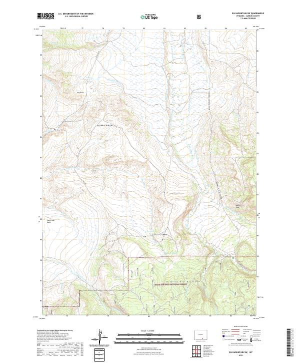
2021 Elk Mountain SW
Carbon County, WY
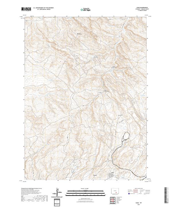
2021 Elmo
Carbon County, WY
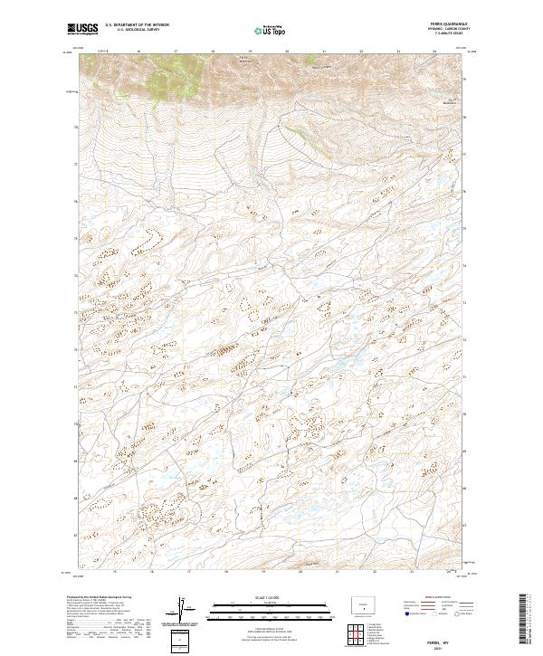
2021 Ferris
Carbon County, WY
2021 Ferris Lake
Carbon County, WY
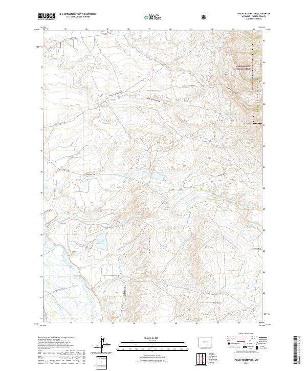
2021 Finley Reservoir
Carbon County, WY
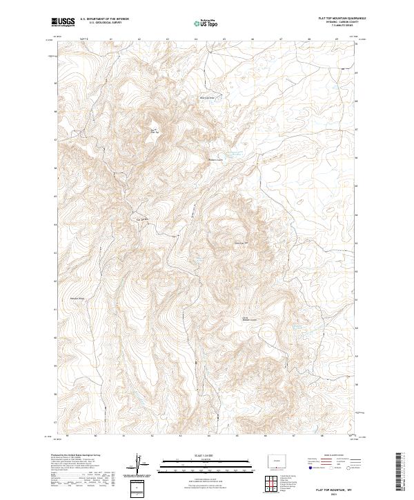
2021 Flat Top Mountain
Carbon County, WY
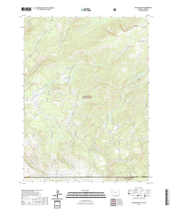
2021 Fletcher Peak
Carbon County, WY
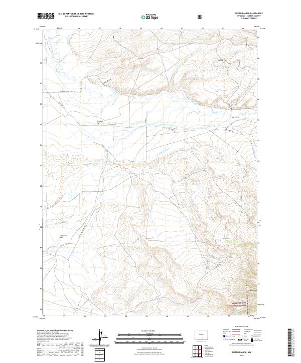
2021 Fort Ridge
Carbon County, WY
2021 Fort Steele
Carbon County, WY
2021 Fourmile Point
Carbon County, WY
2021 Fourmile Ridge
Carbon County, WY
2021 Garden Gulch
Carbon County, WY
2021 Grieve Reservoir
Carbon County, WY
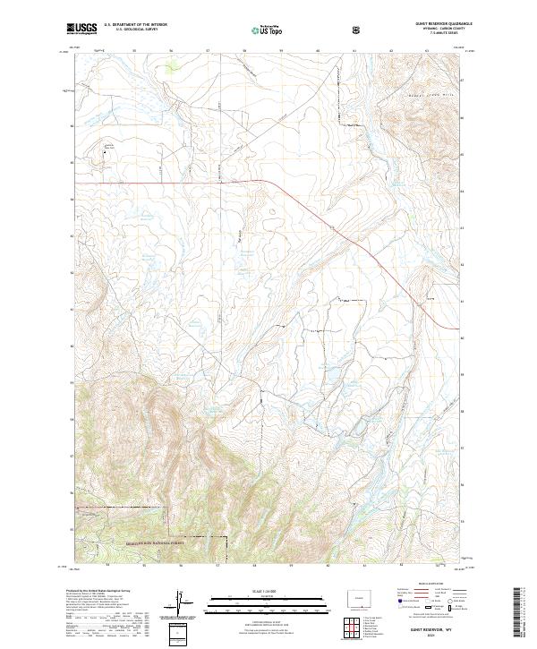
2021 Gunst Reservoir
Carbon County, WY
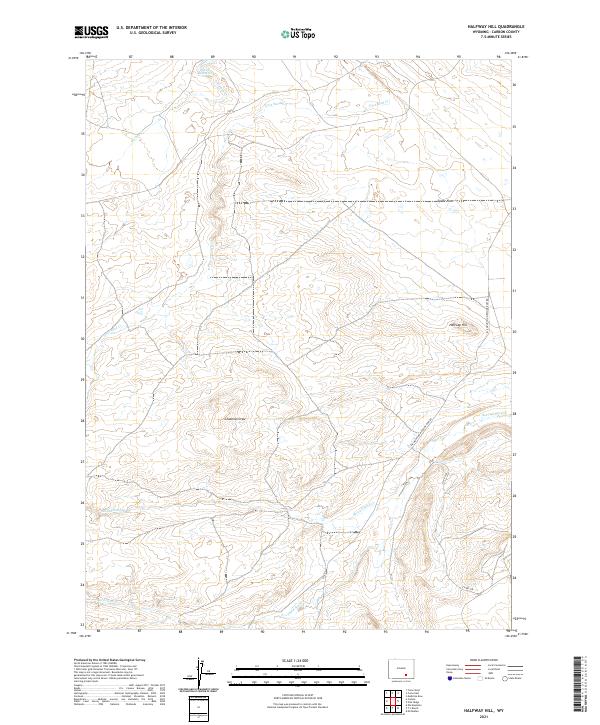
2021 Halfway Hill
Carbon County, WY
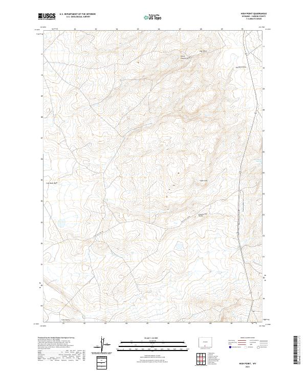
2021 High Point
Carbon County, WY
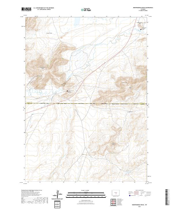
2021 Independence Rock
Carbon County, WY
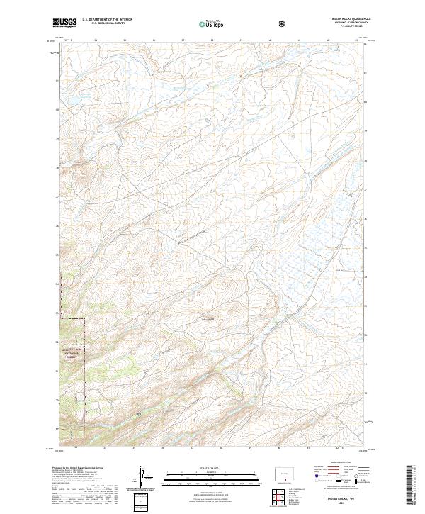
2021 Indian Rocks
Carbon County, WY
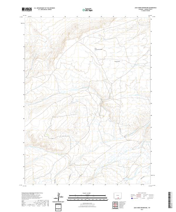
2021 Jack Creek Reservoir
Carbon County, WY
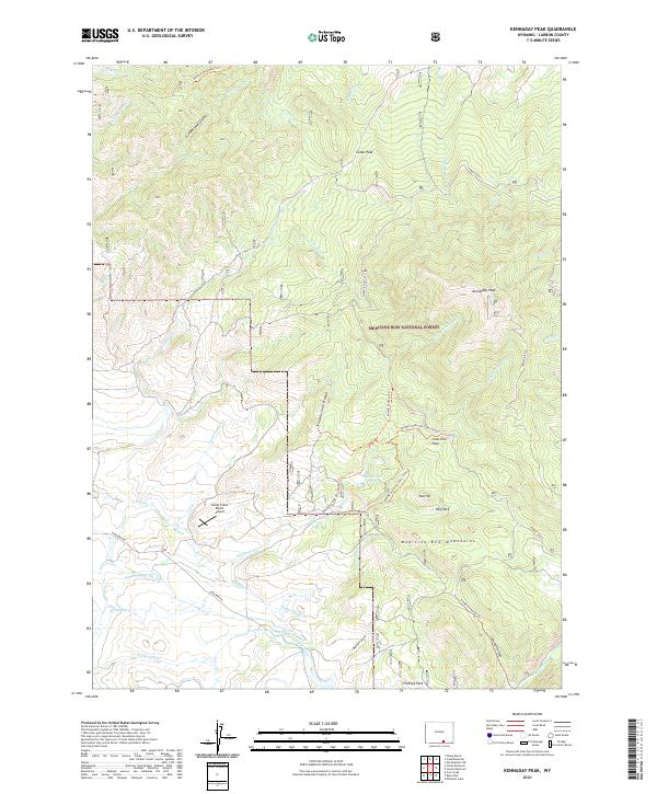
2021 Kennaday Peak
Carbon County, WY
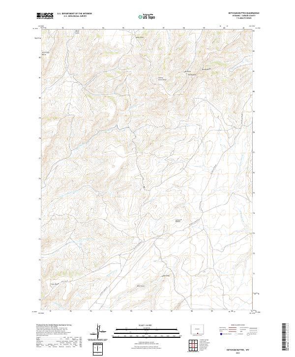
2021 Ketchum Buttes
Carbon County, WY
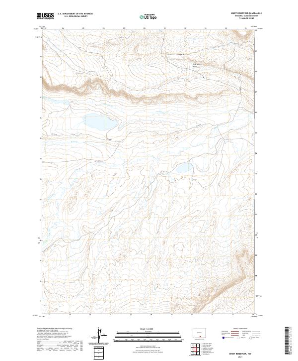
2021 Kindt Reservoir
Carbon County, WY
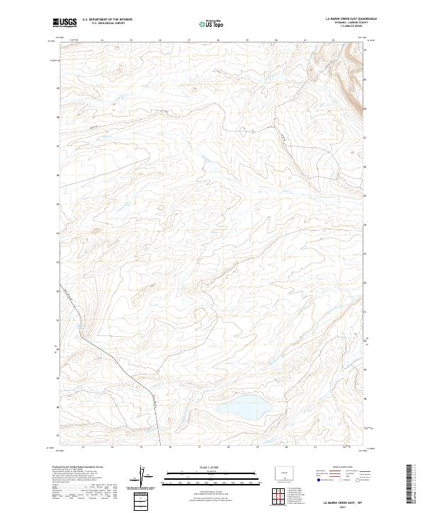
2021 La Marsh Creek East
Carbon County, WY
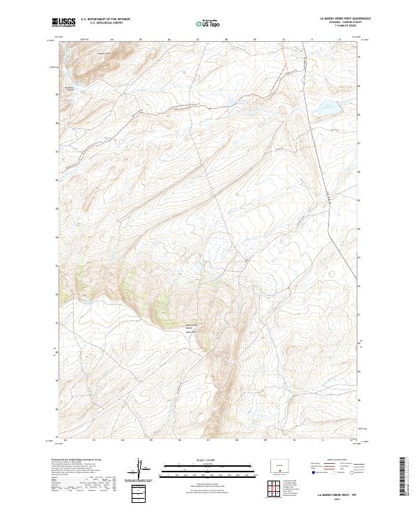
2021 La Marsh Creek West
Carbon County, WY
2021 Lamont
Carbon County, WY
2021 Lamont NE
Carbon County, WY
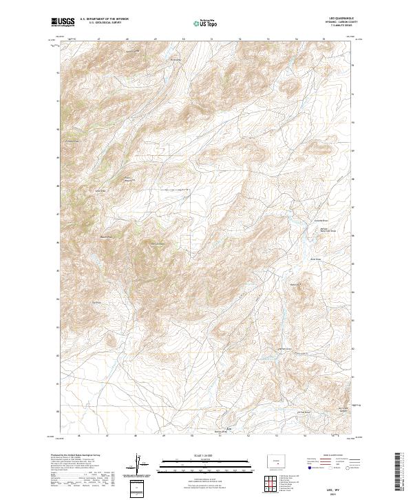
2021 Leo
Carbon County, WY
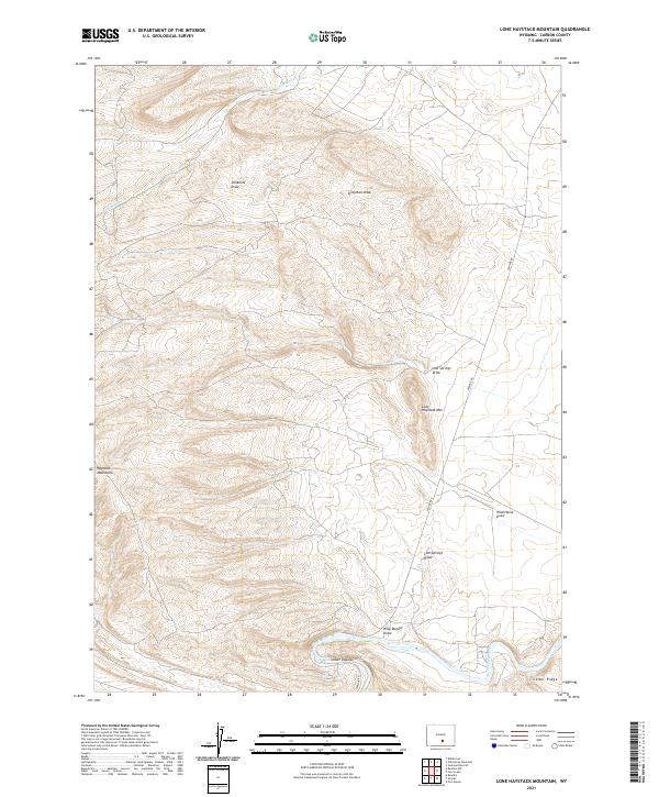
2021 Lone Haystack Mountain
Carbon County, WY
2021 McCarty Ranch
Carbon County, WY
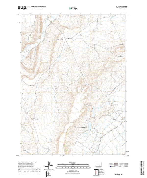
2021 McFadden
Carbon County, WY
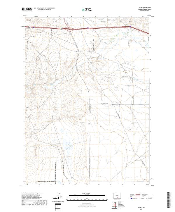
2021 Meads
Carbon County, WY
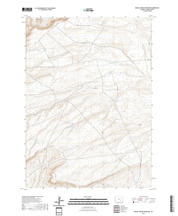
2021 Measel Spring Reservoir
Carbon County, WY
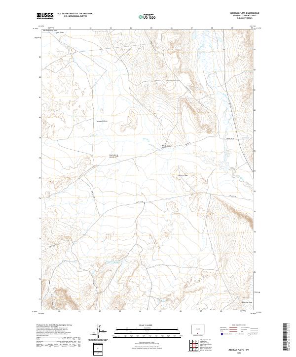
2021 Mexican Flats
Carbon County, WY
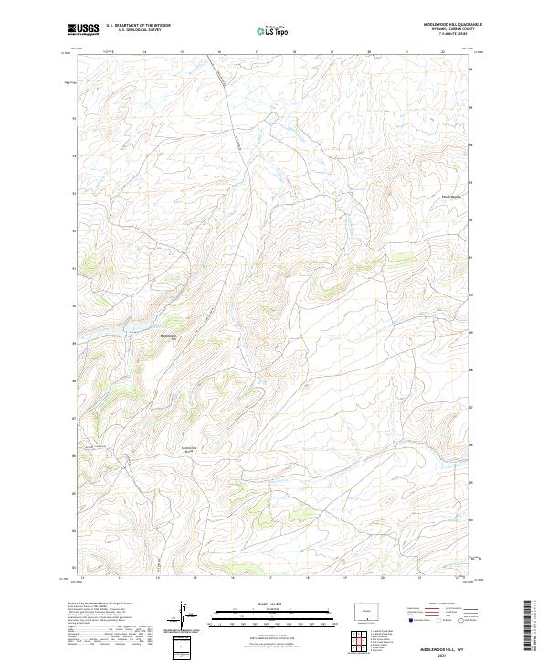
2021 Middlewood Hill
Carbon County, WY
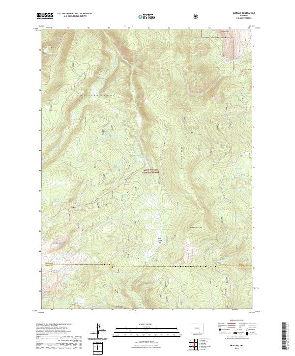
2021 Morgan
Carbon County, WY
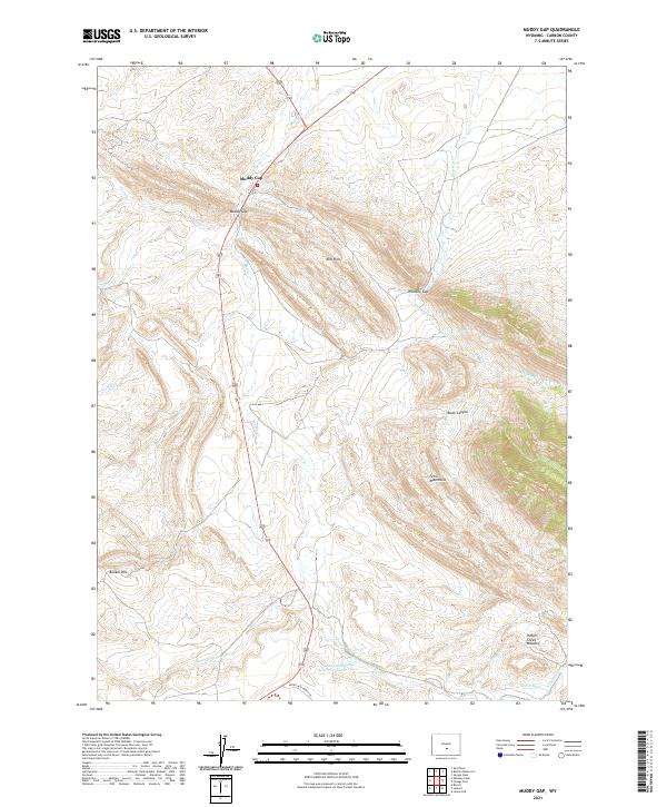
2021 Muddy Gap
Carbon County, WY
2021 Oberg Ranch
Carbon County, WY
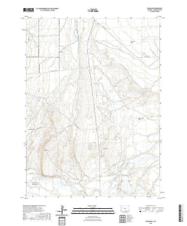
2021 Overland
Carbon County, WY
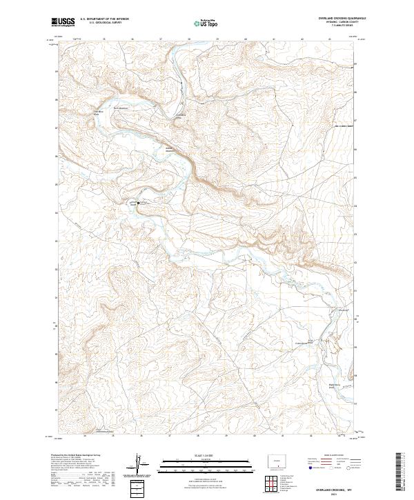
2021 Overland Crossing
Carbon County, WY
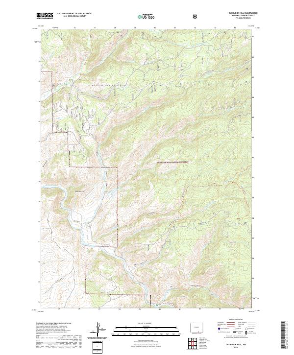
2021 Overlook Hill
Carbon County, WY
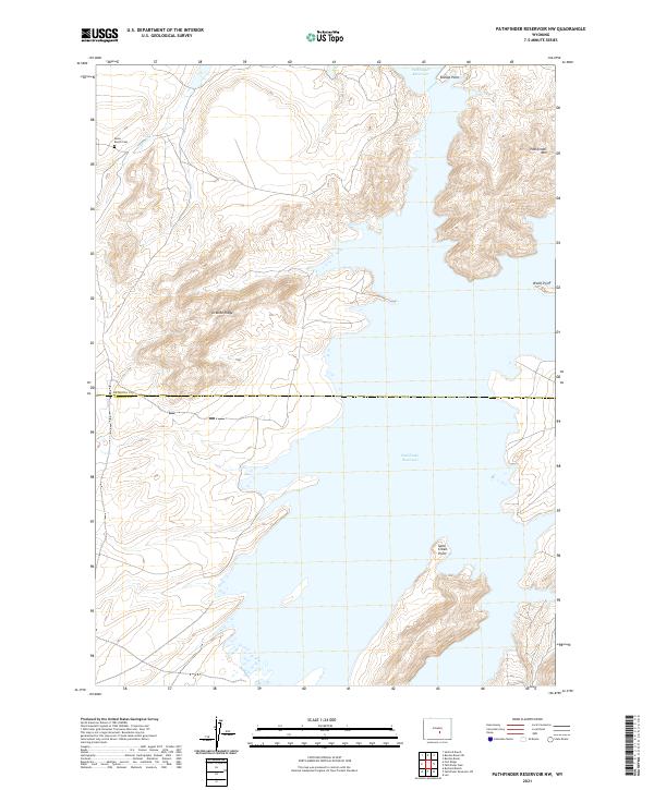
2021 Pathfinder Reservoir NW
Carbon County, WY
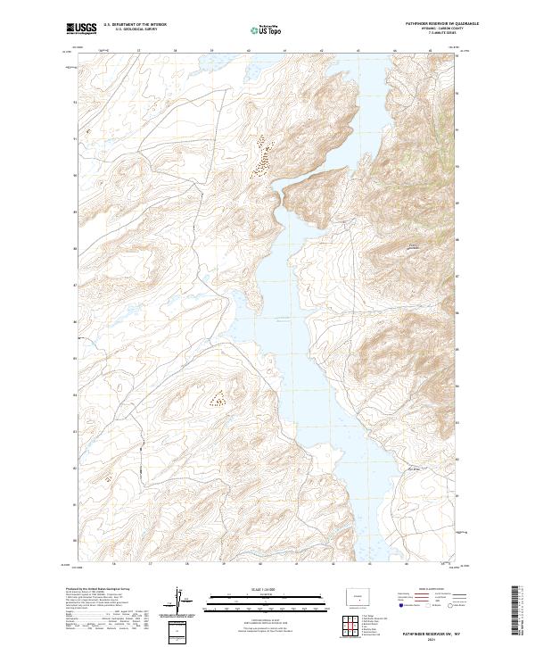
2021 Pathfinder Reservoir SW
Carbon County, WY
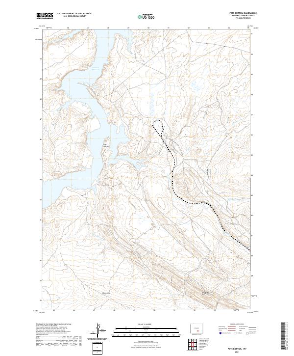
2021 Pats Bottom
Carbon County, WY
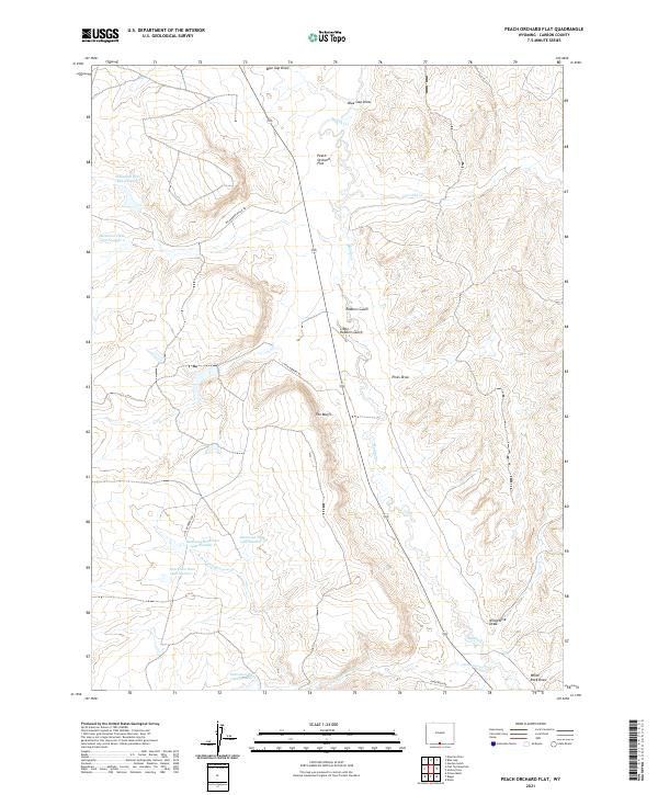
2021 Peach Orchard Flat
Carbon County, WY
2021 Phantom Lake
Carbon County, WY
2021 Pine Grove Ranch
Carbon County, WY
2021 Pine Hill
Carbon County, WY
2021 Pine Ridge
Carbon County, WY
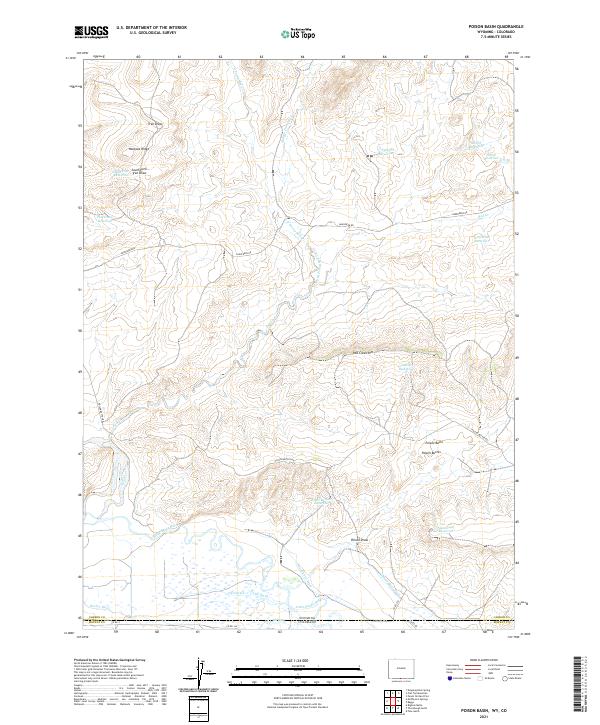
2021 Poison Basin
Carbon County, WY
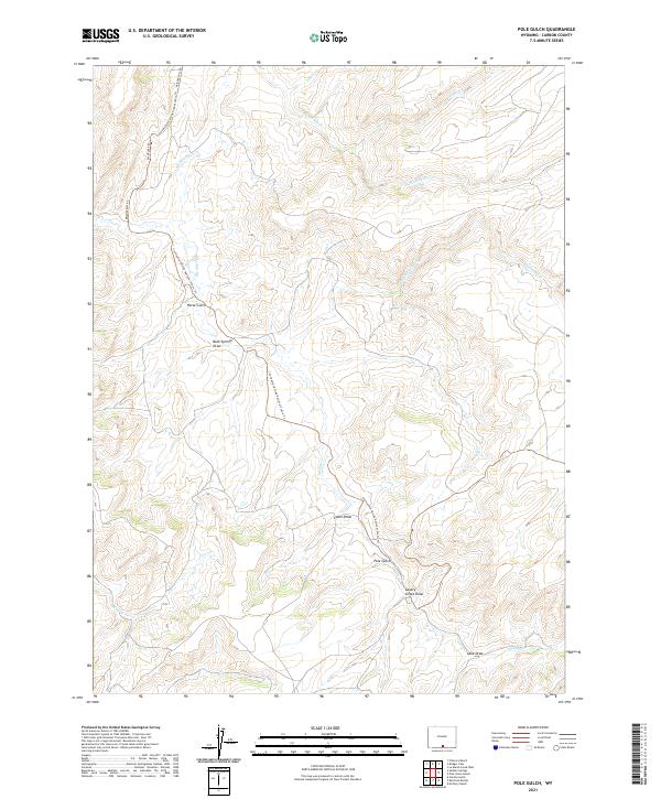
2021 Pole Gulch
Carbon County, WY
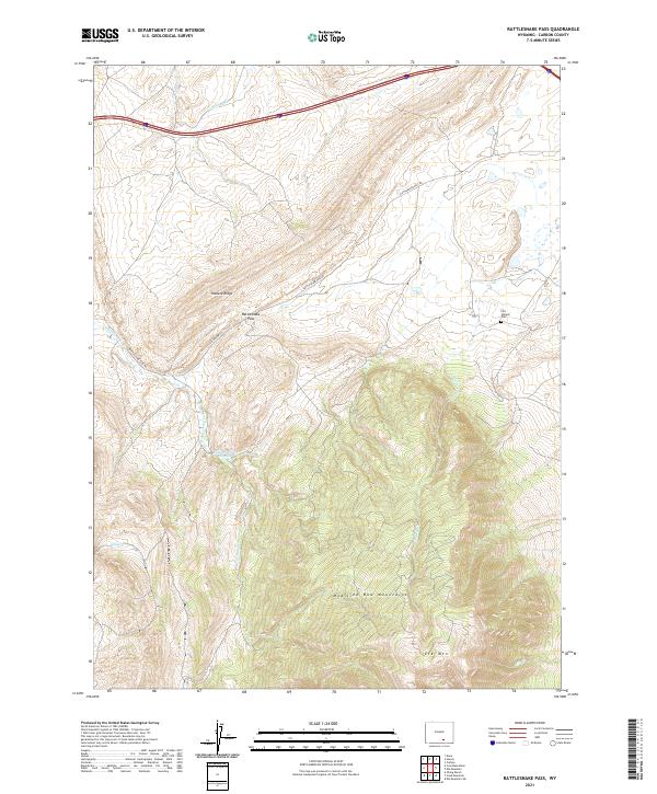
2021 Rattlesnake Pass
Carbon County, WY
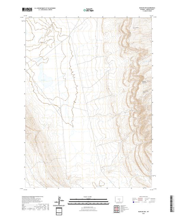
2021 Rawlins NW
Carbon County, WY
2021 Rawlins Peak
Carbon County, WY
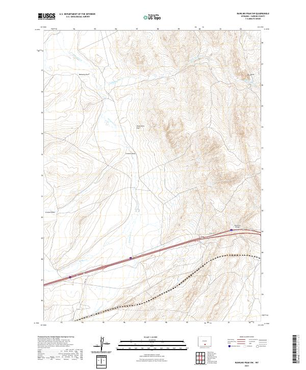
2021 Rawlins Peak SW
Carbon County, WY
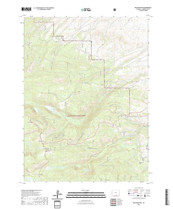
2021 Red Mountain
Carbon County, WY

2021 Rendle Hill
Carbon County, WY
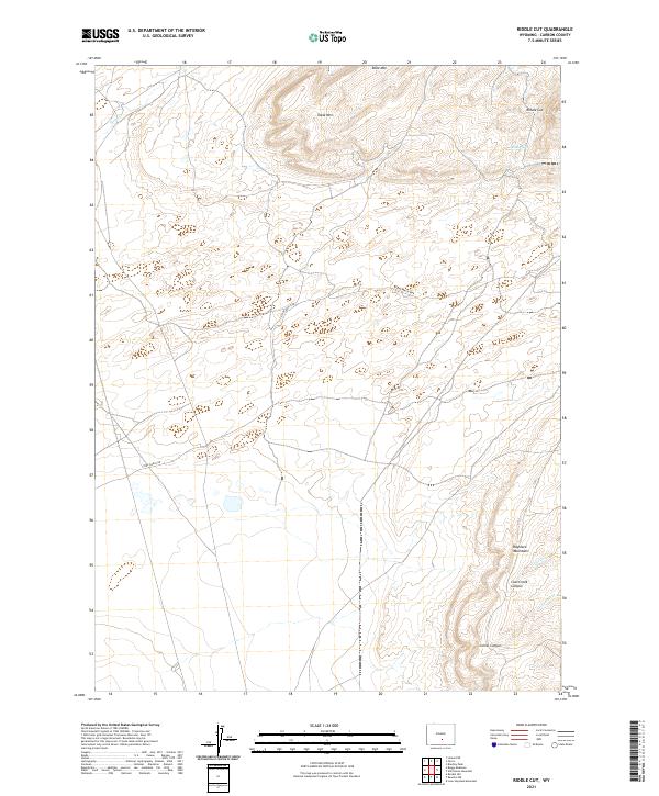
2021 Riddle Cut
Carbon County, WY
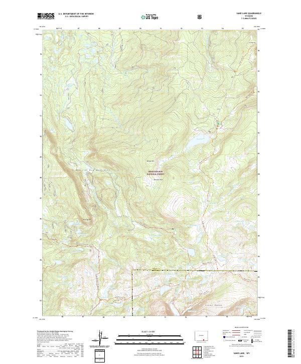
2021 Sand Lake
Carbon County, WY
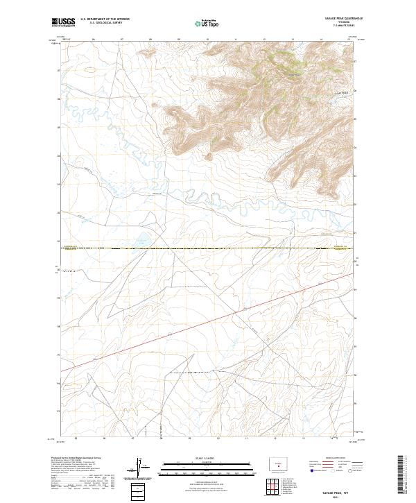
2021 Savage Peak
Carbon County, WY
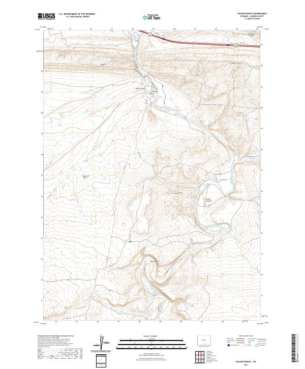
2021 Savage Ranch
Carbon County, WY

2021 Savery
Carbon County, WY
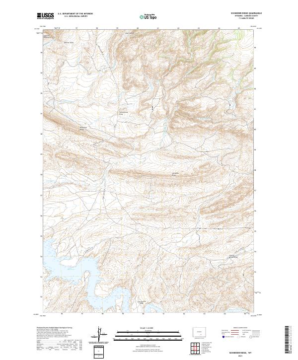
2021 Schneider Ridge
Carbon County, WY
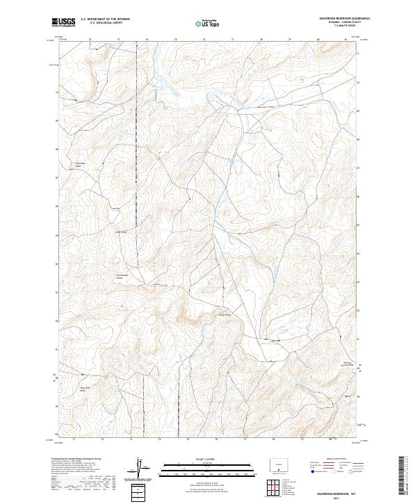
2021 Seaverson Reservoir
Carbon County, WY
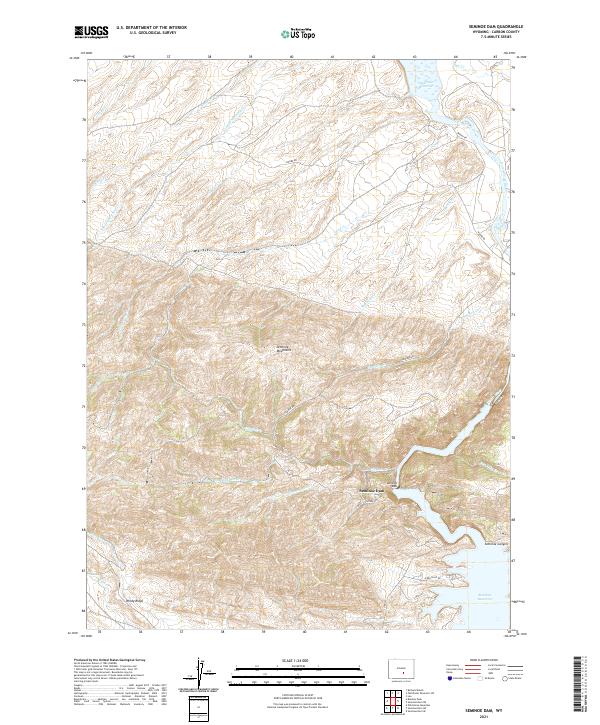
2021 Seminoe Dam
Carbon County, WY
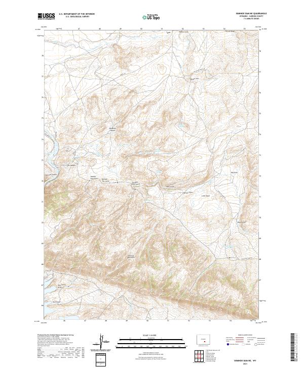
2021 Seminoe Dam NE
Carbon County, WY
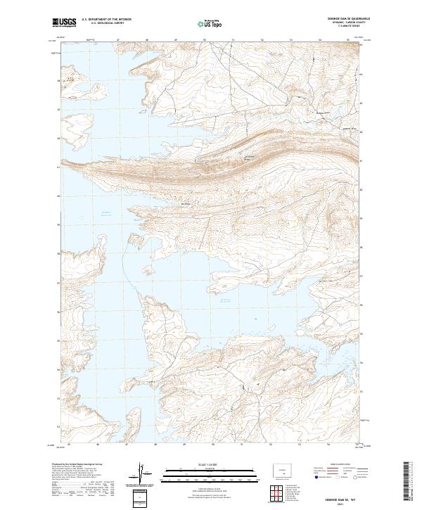
2021 Seminoe Dam SE
Carbon County, WY
2021 Seminoe Dam SW
Carbon County, WY
2021 Separation Peak
Carbon County, WY
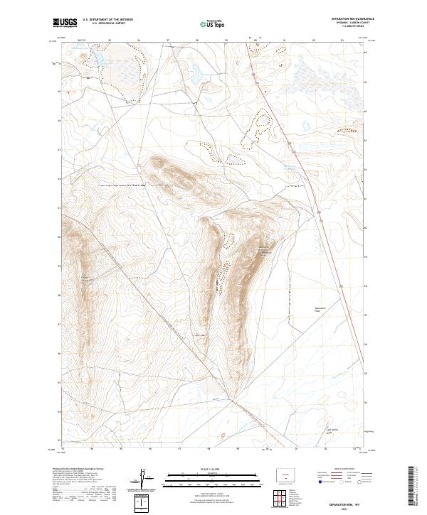
2021 Separation Rim
Carbon County, WY
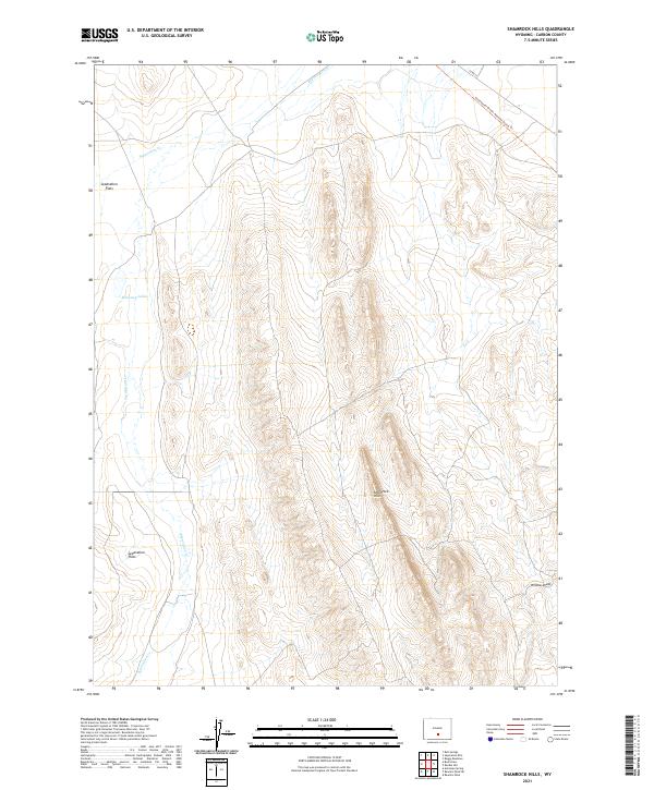
2021 Shamrock Hills
Carbon County, WY
2021 Sharp Hill
Carbon County, WY
2021 Singer Peak
Carbon County, WY
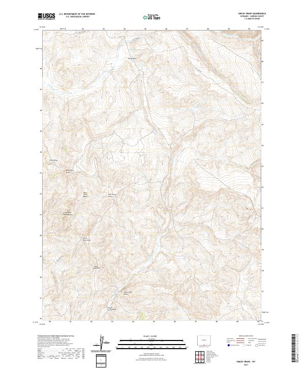
2021 Smiley Draw
Carbon County, WY

2021 Smith Draw East
Carbon County, WY
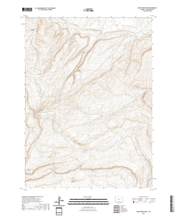
2021 Smith Draw West
Carbon County, WY
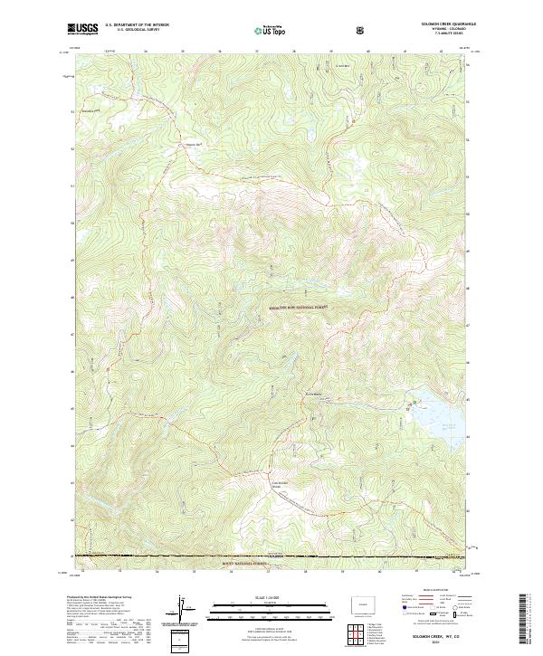
2021 Solomon Creek
Carbon County, WY
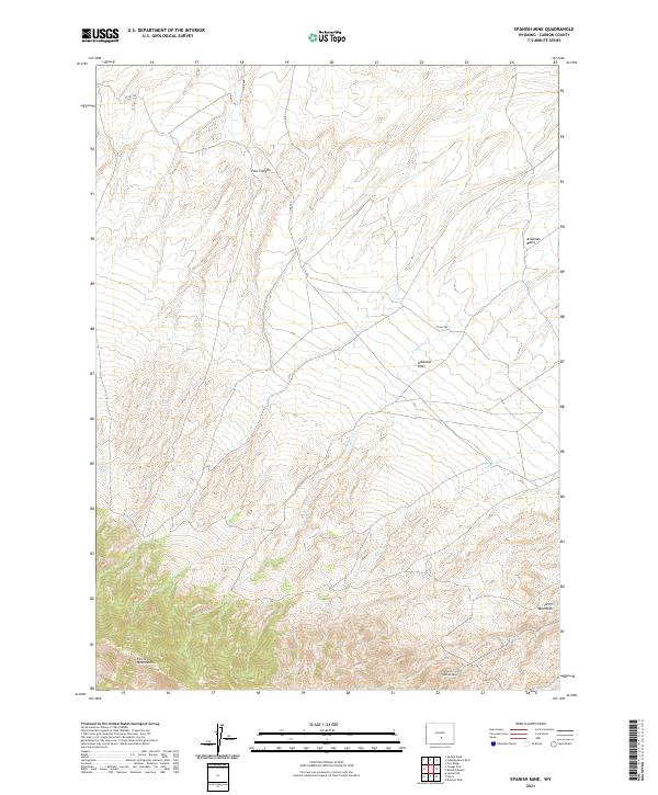
2021 Spanish Mine
Carbon County, WY
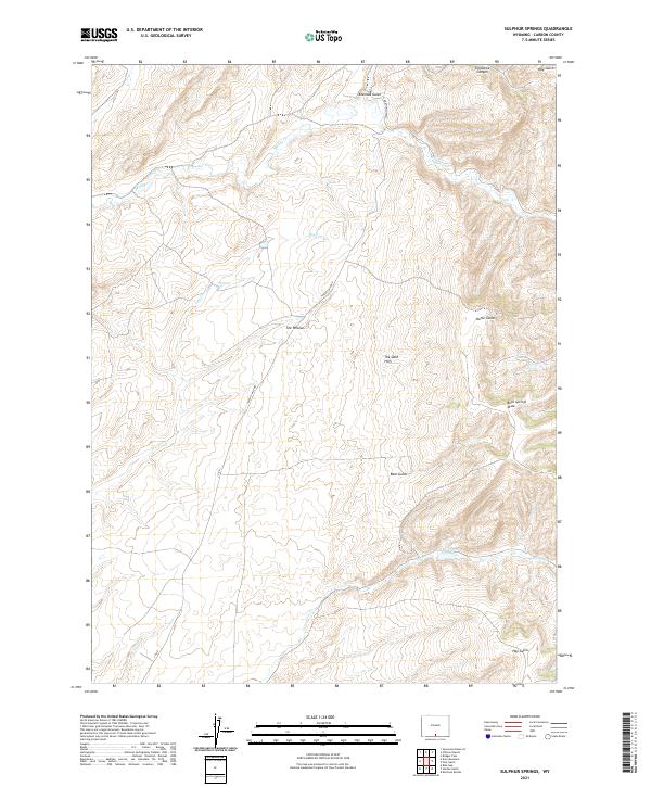
2021 Sulphur Springs
Carbon County, WY
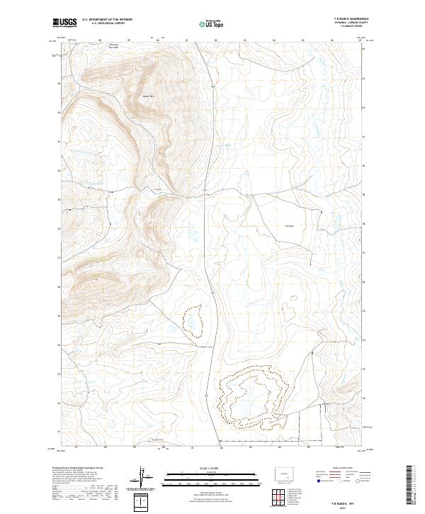
2021 T B Ranch
Carbon County, WY
2021 Tenmile Spring
Carbon County, WY
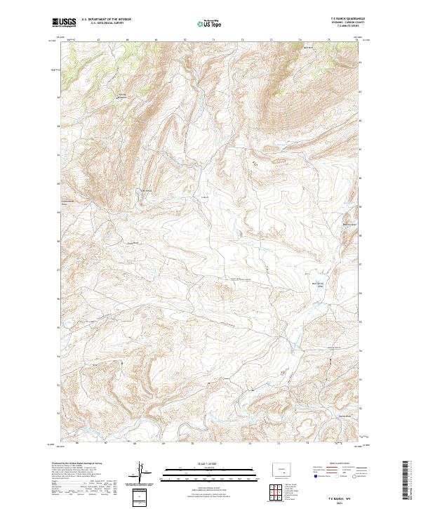
2021 T E Ranch
Carbon County, WY
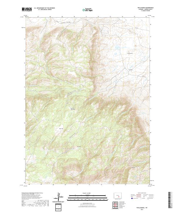
2021 The Q Ranch
Carbon County, WY
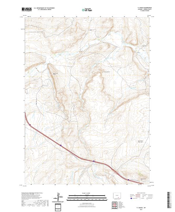
2021 T L Ranch
Carbon County, WY
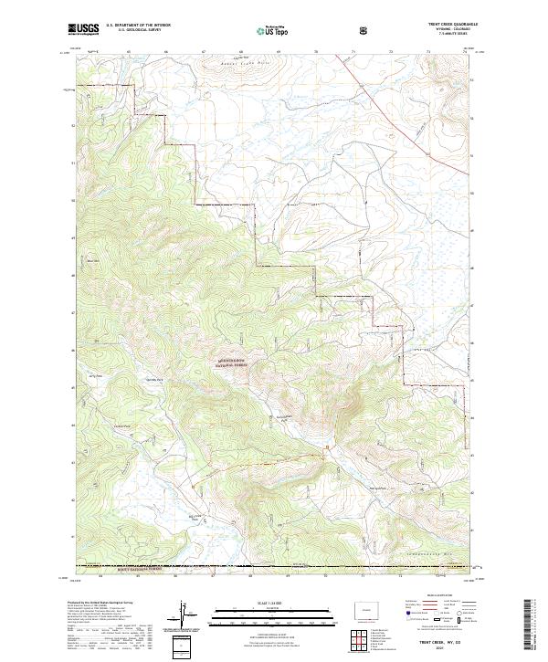
2021 Trent Creek
Carbon County, WY
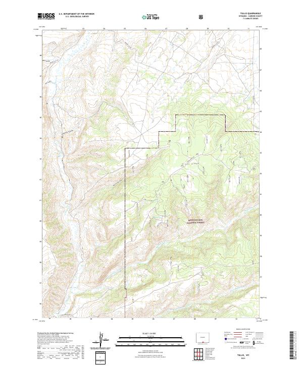
2021 Tullis
Carbon County, WY
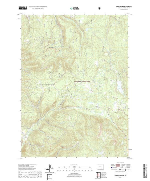
2021 Turpin Reservoir
Carbon County, WY
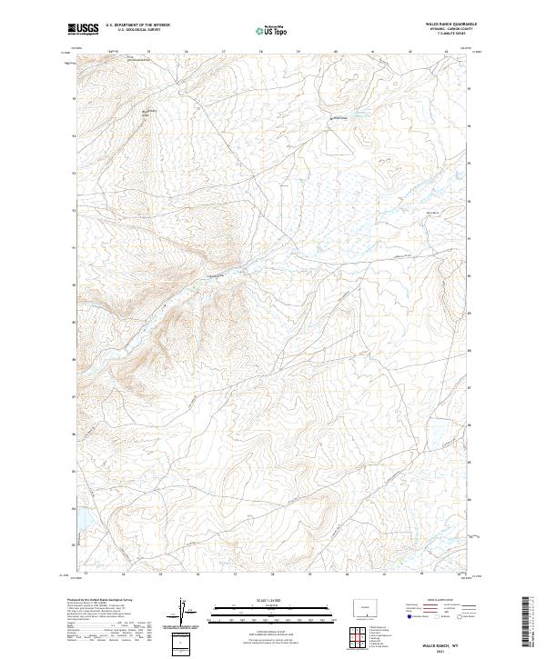
2021 Walck Ranch
Carbon County, WY
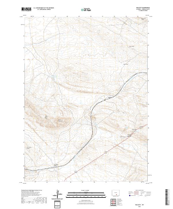
2021 Walcott
Carbon County, WY
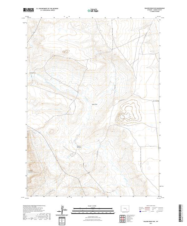
2021 Walker Draw NW
Carbon County, WY
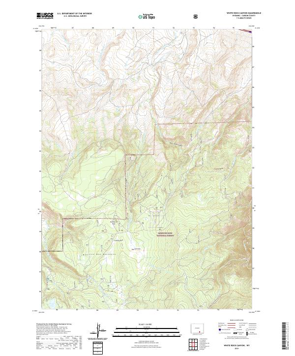
2021 White Rock Canyon
Carbon County, WY
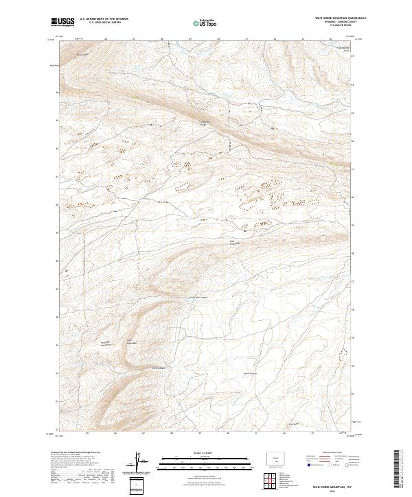
2021 Wild Horse Mountain
Carbon County, WY
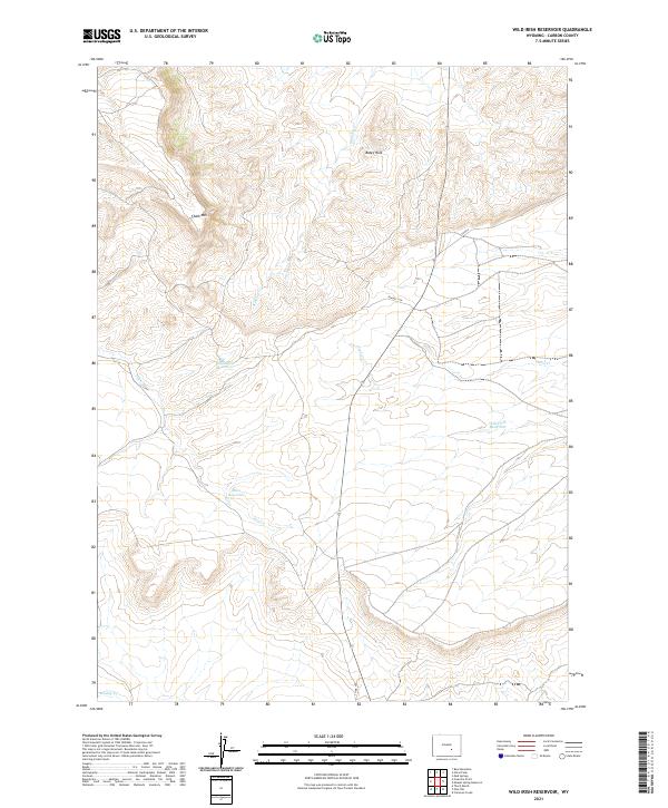
2021 Wild Irish Reservoir
Carbon County, WY
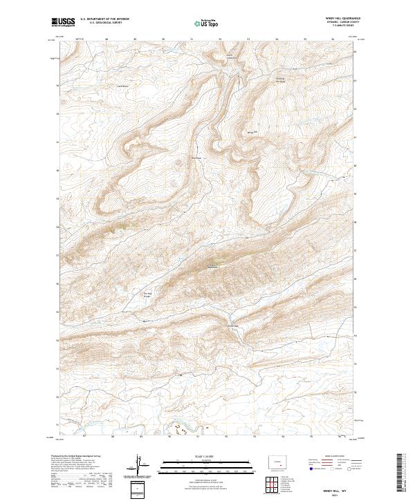
2021 Windy Hill
Carbon County, WY
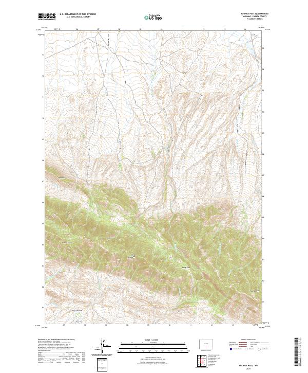
2021 Youngs Pass
Carbon County, WY
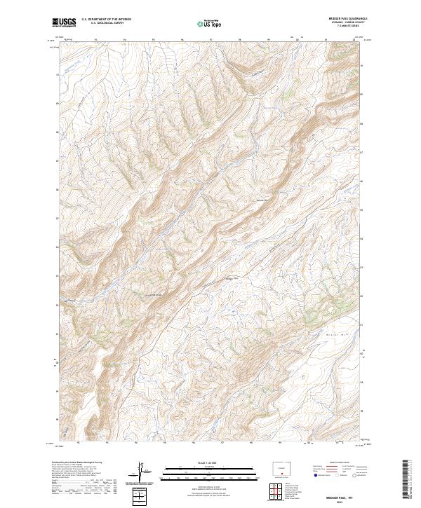
2023 Bridger Pass
Carbon County, WY
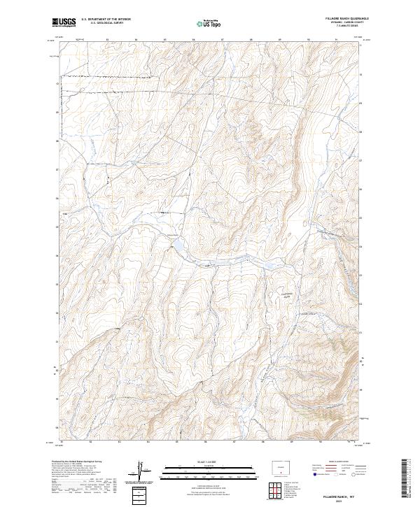
2023 Fillmore Ranch
Carbon County, WY
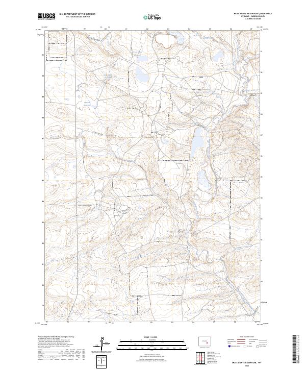
2023 Moss Agate Reservoir
Carbon County, WY