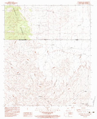
1983 Map of Guadalupe Pass
USGS Topo · Published 1983About this map
The Guadalupe Mountains dominate the high-altitude landscape of this international borderlands survey, where Hidalgo County, New Mexico, meets Sonora, Mexico. The topography is defined by the historic Guadalupe Pass and a series of drainage systems including Cajón Bonito and the Agua Blanca wash. This region's ranching character is evident through several named settlements and outposts such as Rancho Nuevo, La Vibora, and Franco, alongside several watering points like Clark Tank and Garcia Tank. The map provides a detailed view of the terrain on both sides of the border, featuring prominent peaks such as C. Buenavista and the high ridges of Las Barras. At the southern edge, small clusters of activity like El Chiltepin and La Chimenea mark the transition toward the Mexican interior.
Find a feature on this map
30 named features on this map. Tap any name to fly to it.
Don’t see what you’re looking for? This feature index may not catch every label — zoom into the map to look around manually.
Map Details
Editions of this 1983 Guadalupe Pass Map
This is the sole edition of this map. No revisions or reprints were ever made.
Other maps of this area

1918 · Cienega Springs
USGS Topo · 1:62,500

1919 · Perilla
USGS Topo · 1:125,000

1922 · McDonald
USGS Topo · 1:62,500

1955 · Douglas
USGS Topo · 1:250,000

1958 · Guadalupe Canyon
USGS Topo · 1:62,500

1959 · Douglas
USGS Topo · 1:250,000

1961 · Douglas
USGS Topo · 1:250,000

1964 · Douglas
USGS Topo · 1:250,000
1982 · Fitzpatricks
USGS Topo · 1:24,000
1982 · Black Point
USGS Topo · 1:24,000