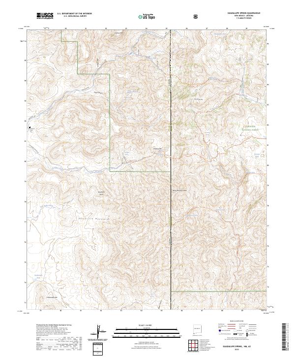
2023 Map of Guadalupe Spring
USGS Topo · Published 2023About this map
Peloncillo Mountains dominate this high-desert terrain where the Arizona-New Mexico state line meets the international border region. This landscape is defined by its network of springs and canyons, crucial for survival in the arid Southwest. Named peaks like Outlaw Mtn and Bunk Robinson Peak rise above a complex system of drainage washes, including Hay Hollow Wash and Seventysix Gulch. The presence of the Cottonwood Creek Cem near Cottonwood Creek provides a tangible link to the early ranching families who managed this territory. Human movement through the area follows established paths such as Geronimo Trl and various backcountry routes within the Coronado National Forest. This modern survey details the vital water sources that have sustained inhabitants for generations, from the Guadalupe Spring to the remote Pickhandle Tank.
Find a feature on this map
52 named features on this map. Tap any name to fly to it.
Don’t see what you’re looking for? This feature index may not catch every label — zoom into the map to look around manually.
Map Details
Editions of this 2023 Guadalupe Spring Map
This is the sole edition of this map. No revisions or reprints were ever made.
Other maps of this area

1917 · Chiricahua
USGS Topo · 1:125,000

1918 · Cienega Springs
USGS Topo · 1:62,500

1918 · Animas Peak
USGS Topo · 1:62,500

1919 · Perilla
USGS Topo · 1:125,000

1919 · Chiricahua
USGS Topo · 1:125,000

1920 · Animas Peak
USGS Topo · 1:62,500

1922 · McDonald
USGS Topo · 1:62,500

1940 · Apache
USGS Topo · 1:62,500

1955 · Douglas
USGS Topo · 1:250,000

1958 · Apache
USGS Topo · 1:62,500