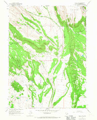
1965 Map of Neola NW
USGS Topo · Published 1967About this map
The Uintah and Ouray Indian Reservation dominates this 1960s landscape, showcasing a complex water management system vital to the arid environment. The map details an extensive network of irrigation infrastructure, including the Yellowstone Extension Canal, Yellowstone Feeder Canal, and the Lateral Canal. These man-made watercourses cut through the terrain alongside natural features like Timothy Creek and Cottonwood Wash, indicating the significant engineering efforts required to sustain local agriculture and ranching during this period.
Find a feature on this map
37 named features on this map. Tap any name to fly to it.
Don’t see what you’re looking for? This feature index may not catch every label — zoom into the map to look around manually.
Map Details
Editions of this 1965 Neola NW Map
This is the sole edition of this map. No revisions or reprints were ever made.
Other maps of this area

1885 · Uinta
USGS Topo · 1:250,000

1905 · Gilbert Peak
USGS Topo · 1:125,000

1906 · Gilbert Peak
USGS Topo · 1:125,000

1939 · Duchesne
USGS Topo · 1:125,000

1954 · Salt Lake City
USGS Topo · 1:250,000

1958 · Salt Lake City
USGS Topo · 1:250,000

1960 · Salt Lake City
USGS Topo · 1:250,000
1965 · Bluebell
USGS Topo · 1:24,000
1965 · Neola
USGS Topo · 1:24,000
1965 · Pole Creek Cave
USGS Topo · 1:24,000