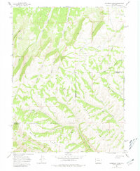
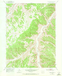
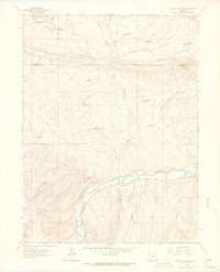
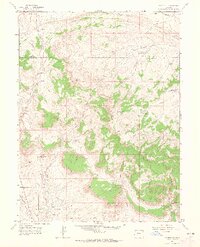
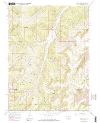
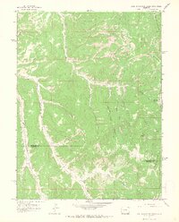
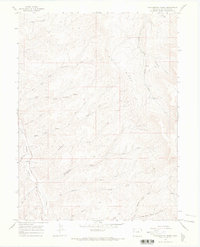
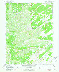
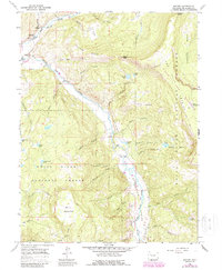
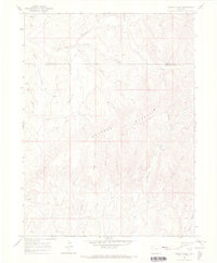
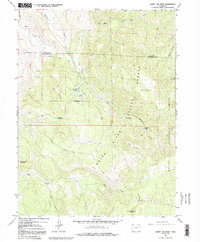
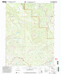
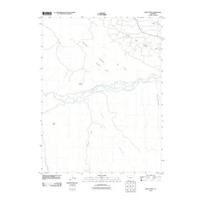
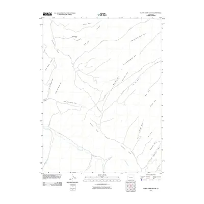
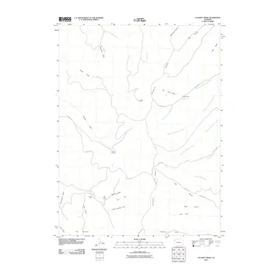
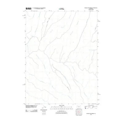
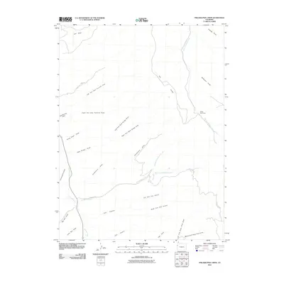
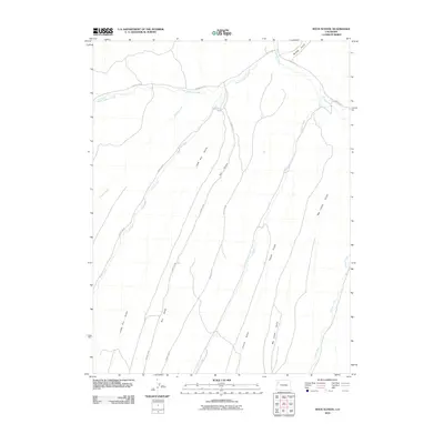
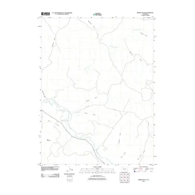
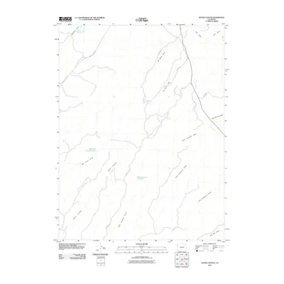
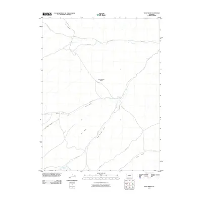
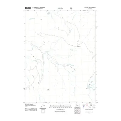
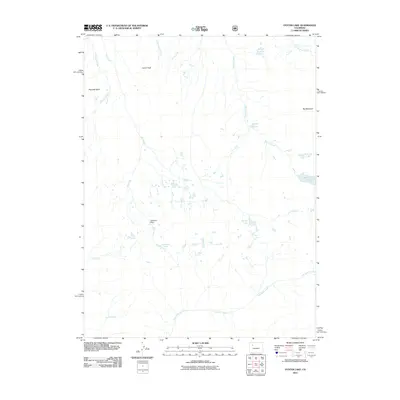
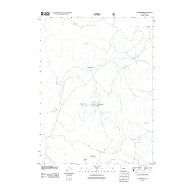
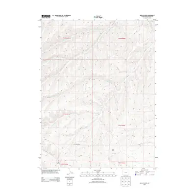
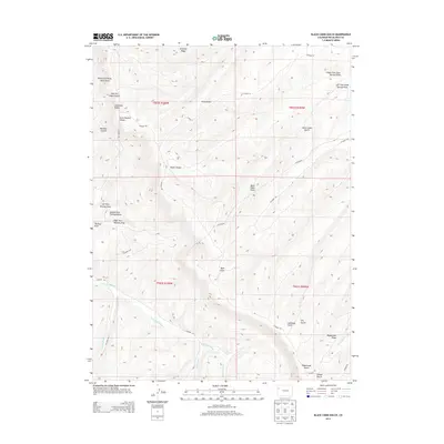
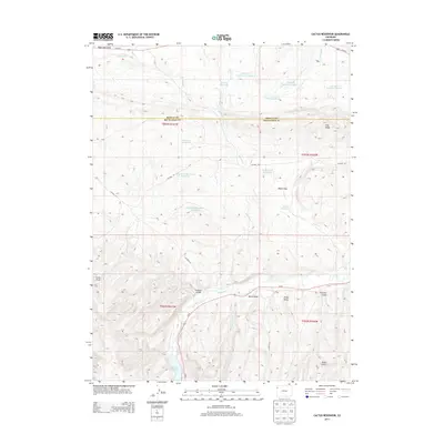
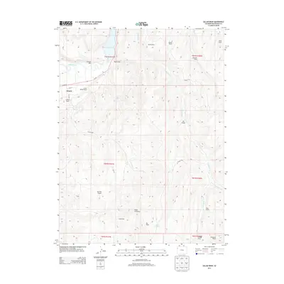
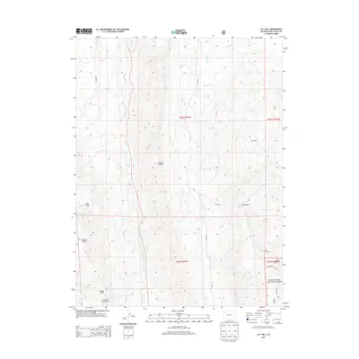
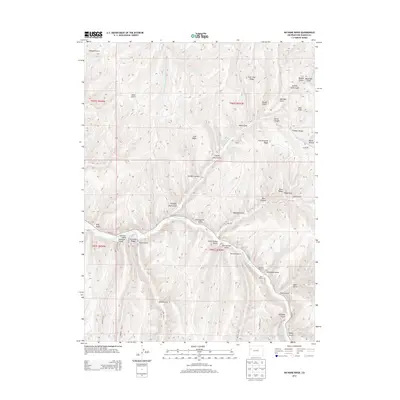
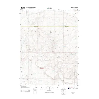
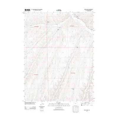
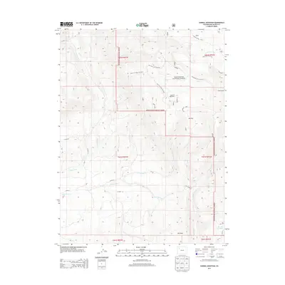
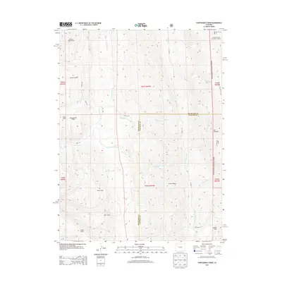
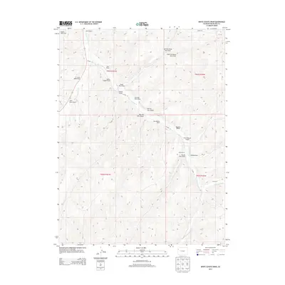
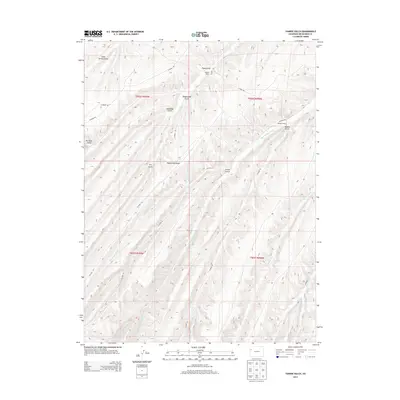
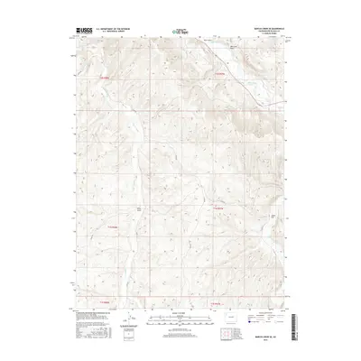
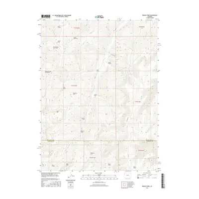
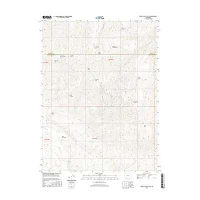
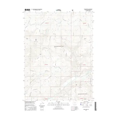
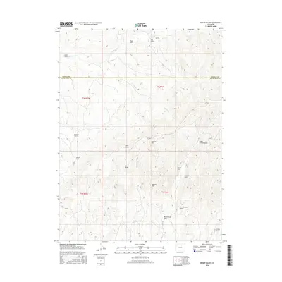
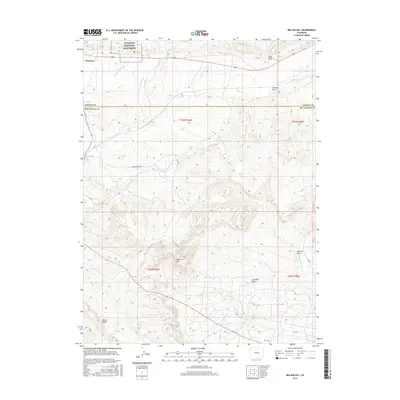
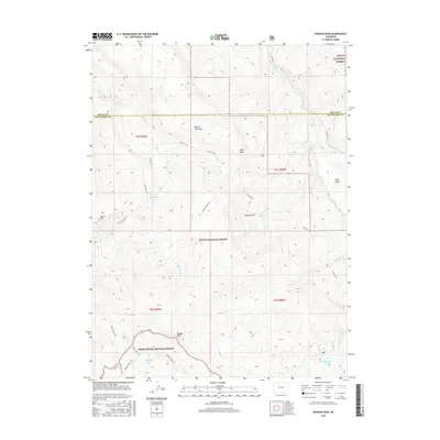
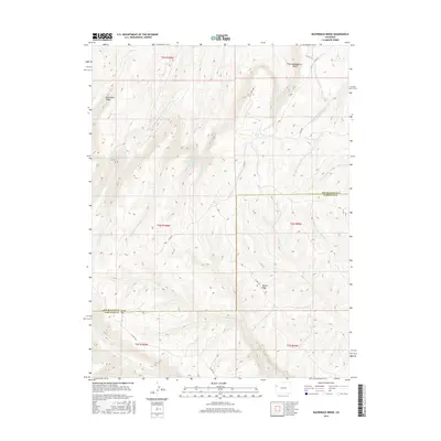
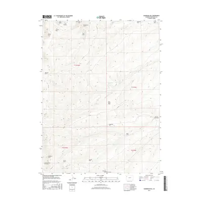
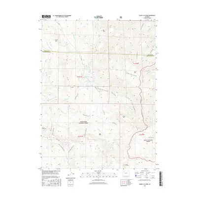
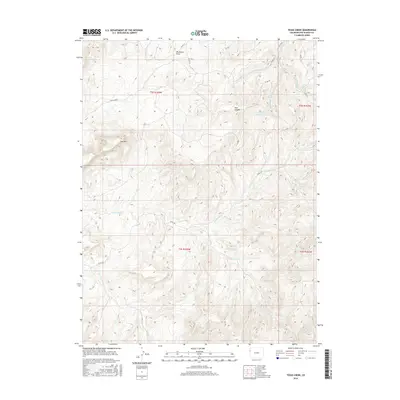
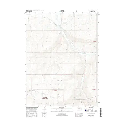
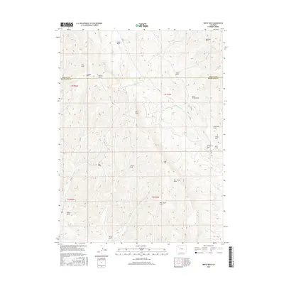
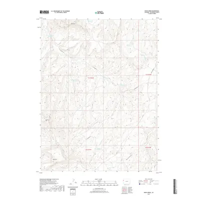
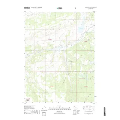
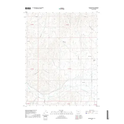
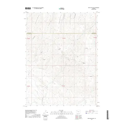
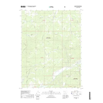
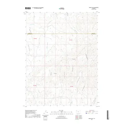
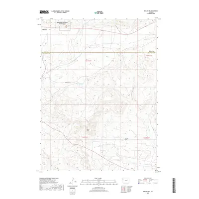
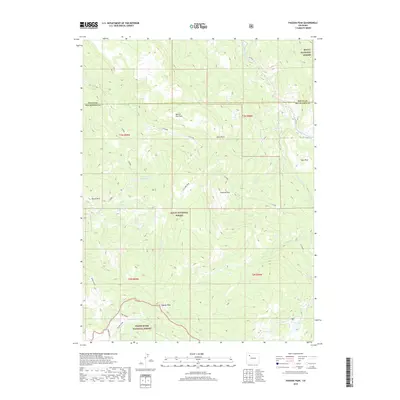
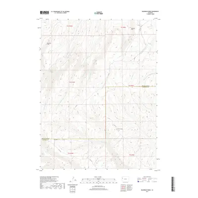
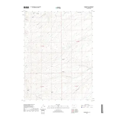
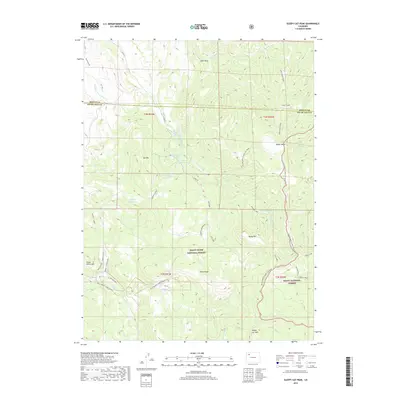
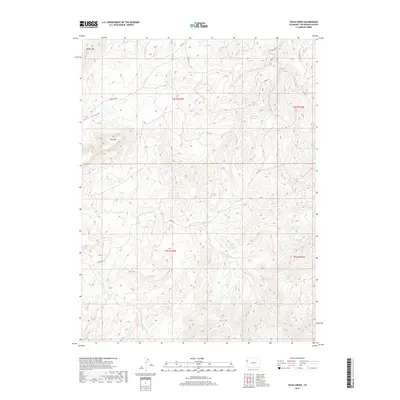
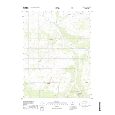
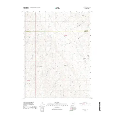
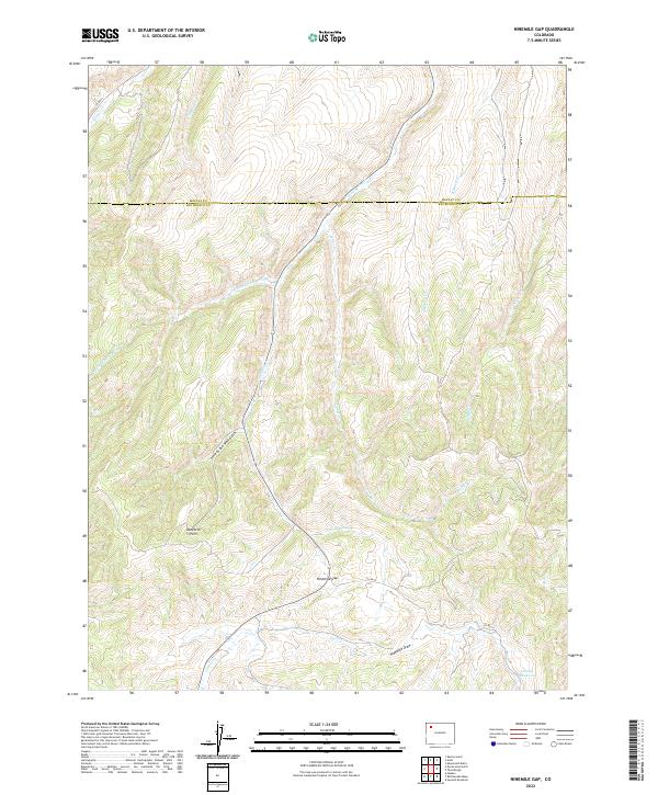
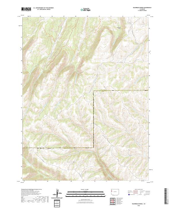
1964 Map of Razorback Ridge
USGS Topo · Published 1980About this map
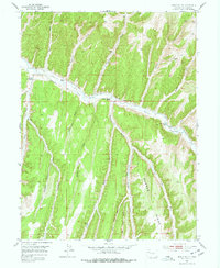
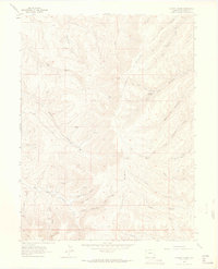
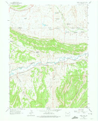
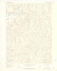
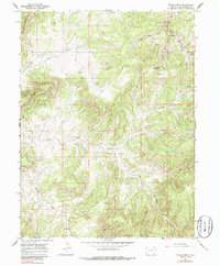
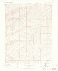
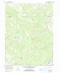
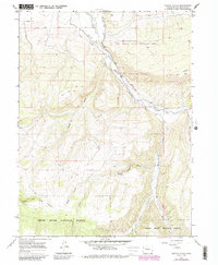
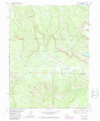
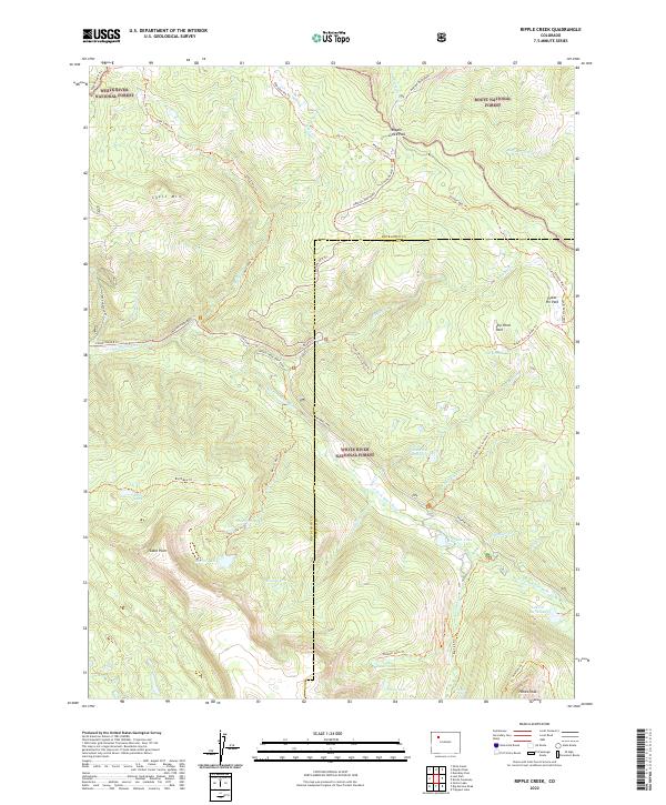
Brush Mountain and Skinner Ridge dominate this mid-century western Colorado landscape, marking a topographically complex area along the Rio Blanco Co Garfield Co boundary. The 1963 aerial photography captured a rugged wilderness defined by its dendritic drainage systems, including Cathedral Creek, Brush Creek, and Carr Creek. Human presence is sparse, limited to a single Jeep Trail and the isolated Atencio Cabin, suggesting a region primarily utilized for ranching, resource exploration, or seasonal transit. Notable landforms such as Razorback Ridge and the unusually named The Lake—located on a high ridge rather than a valley floor—highlight the unique geological character of this high-elevation terrain. A solitary Drill Hole in the northeast quadrant points to the era's subterranean exploration, while the network of named forks like the Middle Fork and Right Fork provide a precise record of the watershed's intricate geography.
Find a feature on this map
23 named features on this map. Tap any name to fly to it.
Don’t see what you’re looking for? This feature index may not catch every label — zoom into the map to look around manually.
Map Details
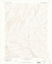
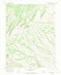
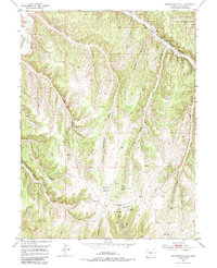
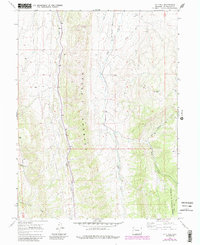
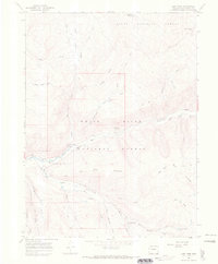
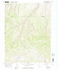
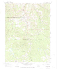
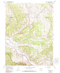
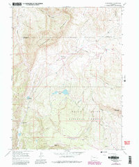
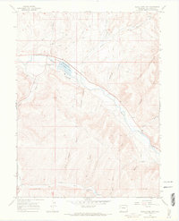
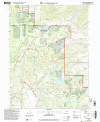
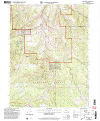
Editions of this 1964 Razorback Ridge Map
3 editions found
Historical Maps of Garfield County Through Time
335 maps found
1952 Greasewood Gulch
Rio Blanco County, CO
1952 Jessup Gulch
Rio Blanco County, CO
1952 No Name Ridge
Rio Blanco County, CO
1952 Rock School
Rio Blanco County, CO
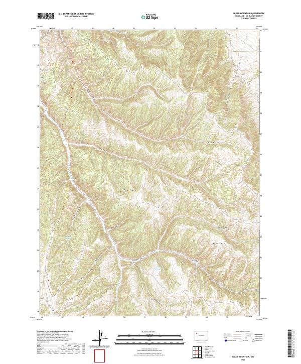
1952 Segar Mountain
Rio Blanco County, CO
1952 Square S Ranch
Rio Blanco County, CO
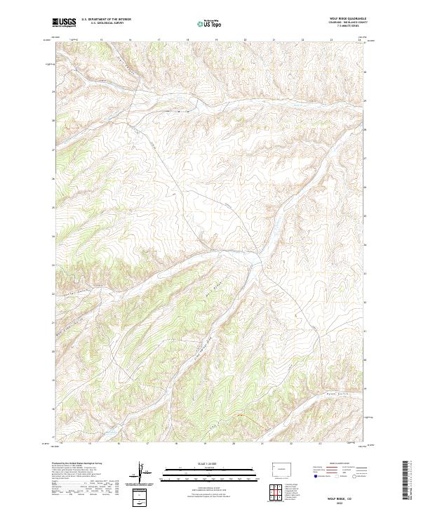
1952 Wolf Ridge
Rio Blanco County, CO
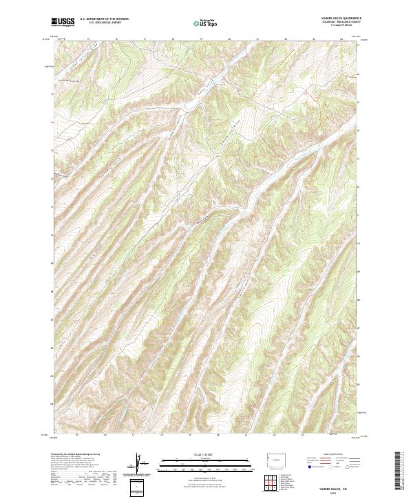
1952 Yankee Gulch
Rio Blanco County, CO
1962 Banty Point
Rio Blanco County, CO
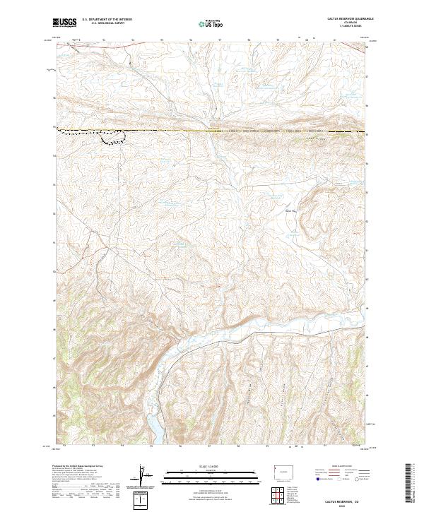
1962 Cactus Reservoir
Rio Blanco County, CO
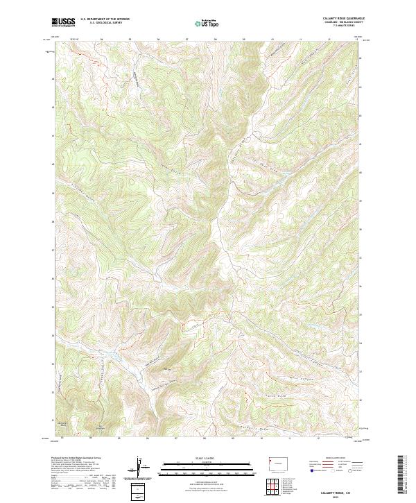
1962 Calamity Ridge
Rio Blanco County, CO
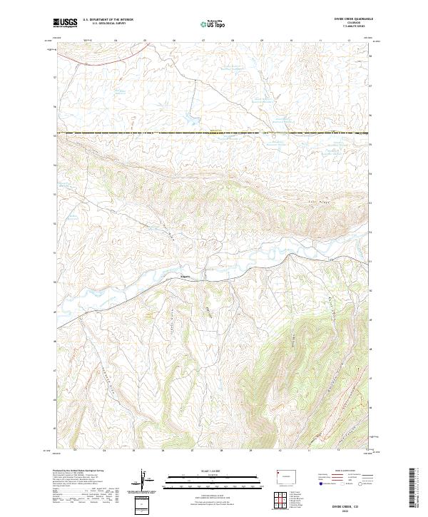
1962 Divide Creek
Rio Blanco County, CO
1962 Gillam Draw
Rio Blanco County, CO

1962 Mellen Hill
Rio Blanco County, CO
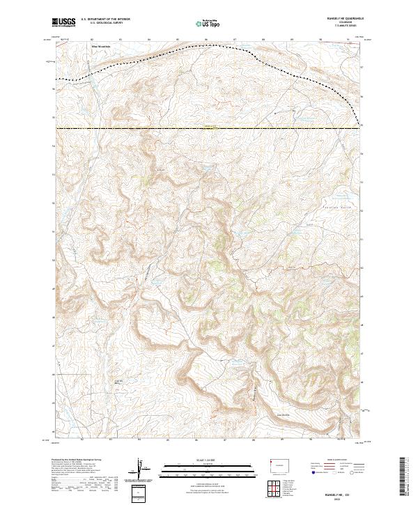
1962 Rangely NE
Rio Blanco County, CO
1964 Banta Ridge
Rio Blanco County, CO
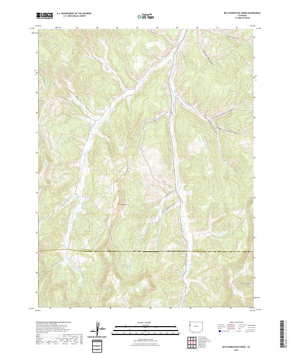
1964 Big Foundation Creek
Rio Blanco County, CO
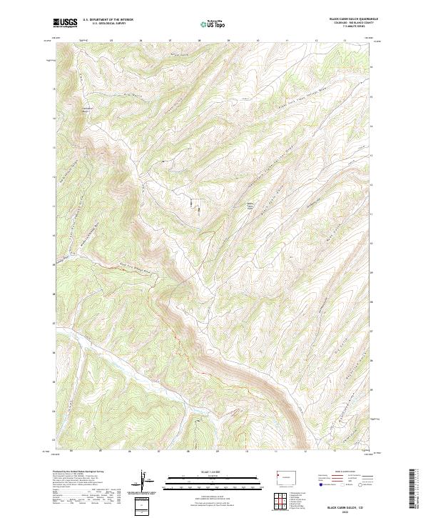
1964 Black Cabin Gulch
Rio Blanco County, CO
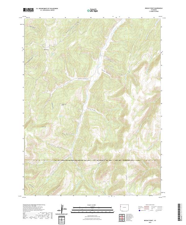
1964 Brushy Point
Rio Blanco County, CO
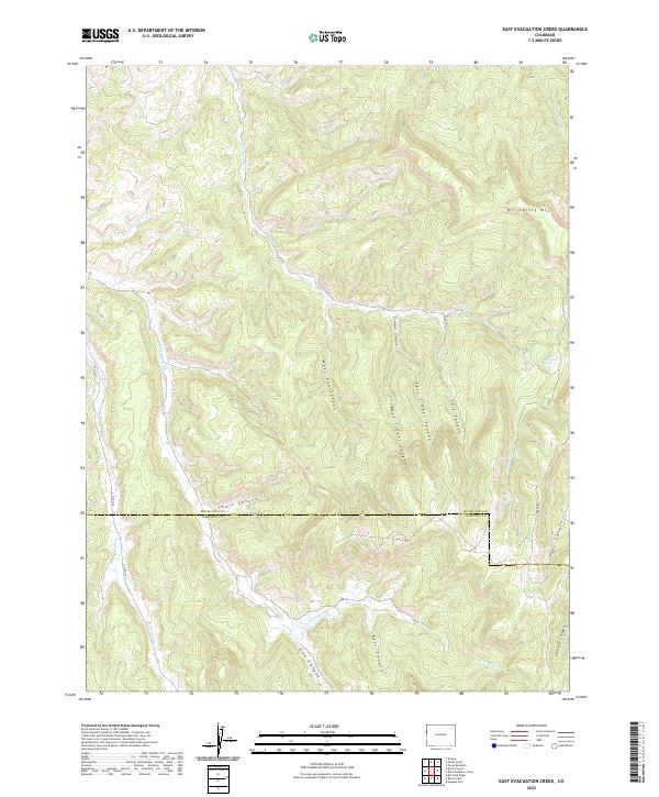
1964 East Evacuation Creek
Rio Blanco County, CO
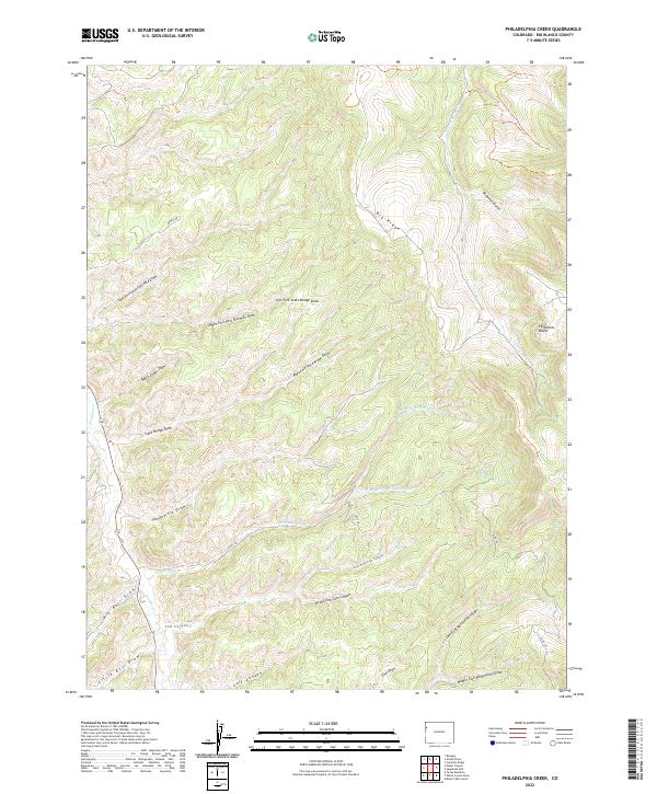
1964 Philadelphia Creek
Rio Blanco County, CO
1964 Razorback Ridge
Rio Blanco County, CO
1964 Sagebrush Hill
Rio Blanco County, CO
1964 Texas Creek
Rio Blanco County, CO
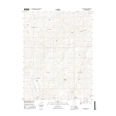
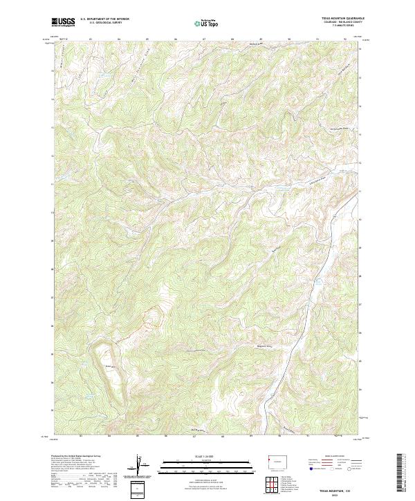
1964 Texas Mountain
Rio Blanco County, CO
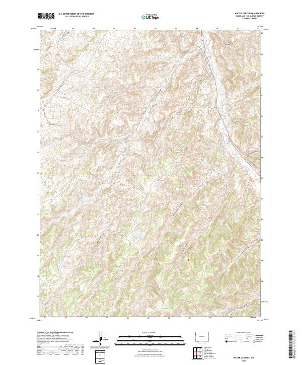
1964 Water Canyon
Rio Blanco County, CO
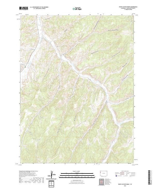
1964 White Coyote Draw
Rio Blanco County, CO
1966 Barcus Creek
Rio Blanco County, CO
1966 Barcus Creek SE
Rio Blanco County, CO
1966 Big Beaver Reservoir
Rio Blanco County, CO
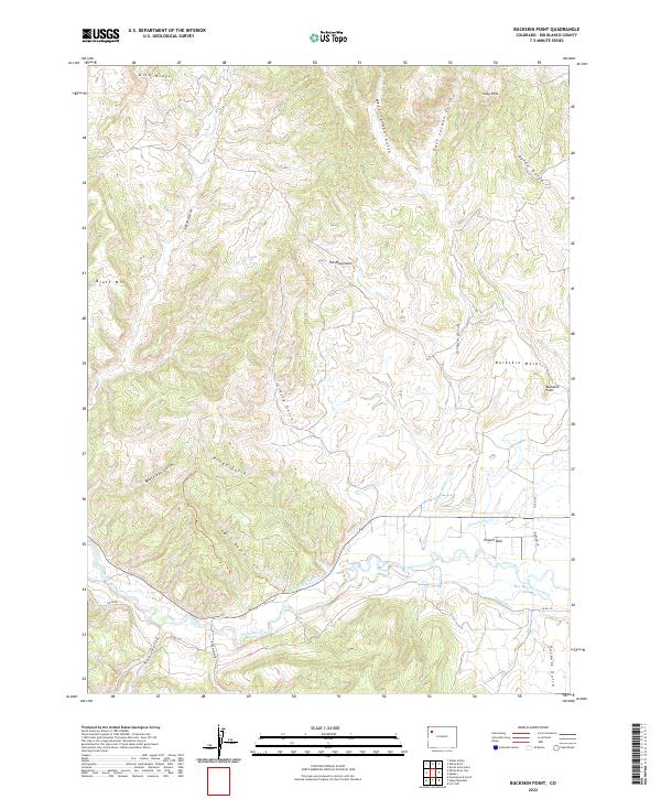
1966 Buckskin Point
Rio Blanco County, CO
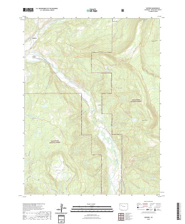
1966 Buford
Rio Blanco County, CO
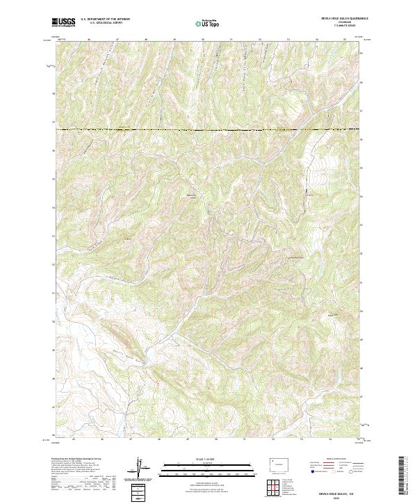
1966 Devils Hole Gulch
Rio Blanco County, CO
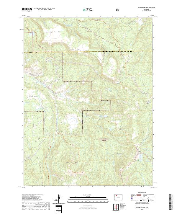
1966 Dunckley Pass
Rio Blanco County, CO
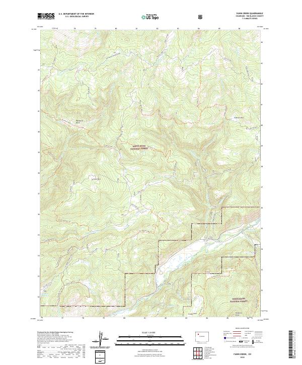
1966 Fawn Creek
Rio Blanco County, CO
1966 Indian Valley
Rio Blanco County, CO
1966 Lo 7 Hill
Rio Blanco County, CO
1966 Lost Park
Rio Blanco County, CO
1966 Ninemile Gap
Rio Blanco County, CO
1966 Pagoda Peak
Rio Blanco County, CO
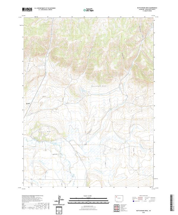
1966 Rattlesnake Mesa
Rio Blanco County, CO

1966 Rough Gulch
Rio Blanco County, CO
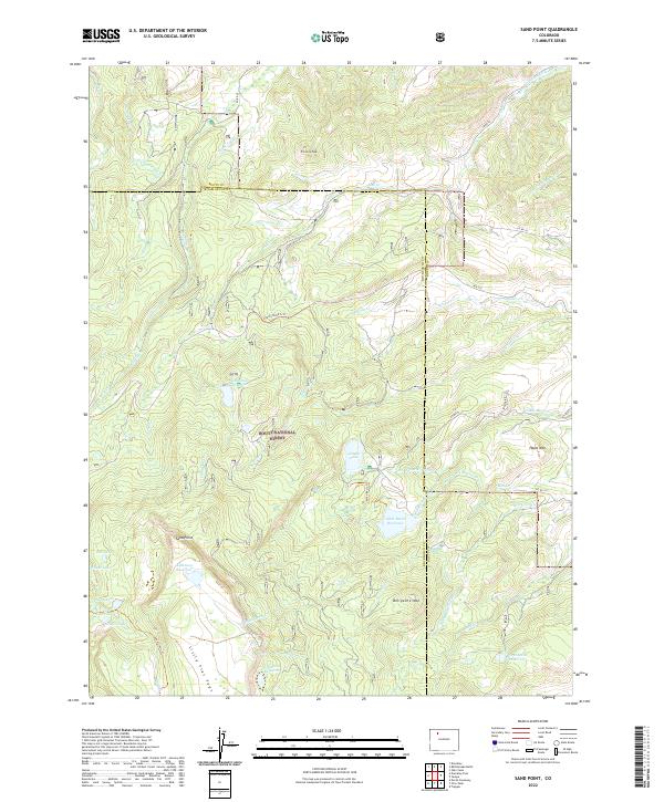
1966 Sand Point
Rio Blanco County, CO
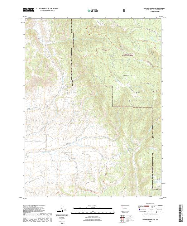
1966 Sawmill Mountain
Rio Blanco County, CO
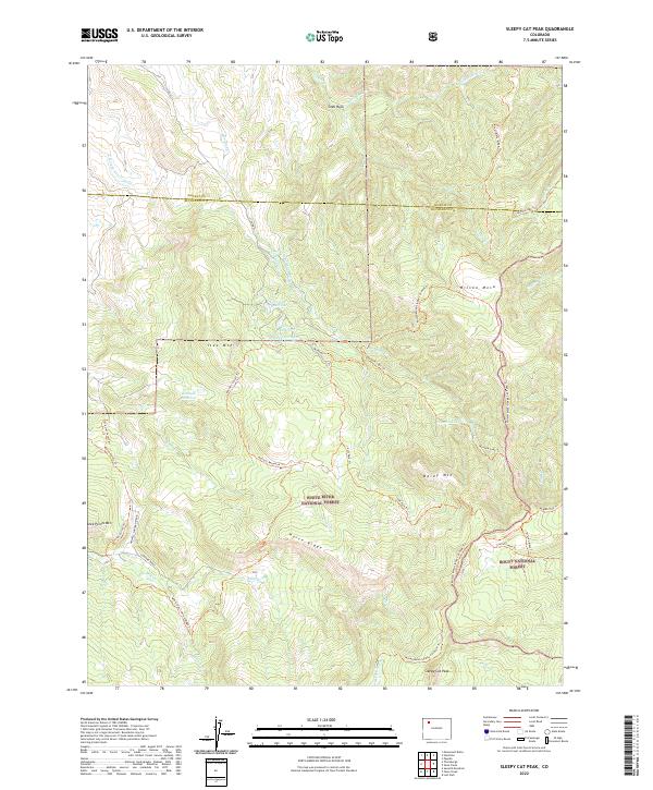
1966 Sleepy Cat Peak
Rio Blanco County, CO
1966 Slide Creek
Rio Blanco County, CO
1966 Smizer Gulch
Rio Blanco County, CO

1966 Thirteenmile Creek
Rio Blanco County, CO
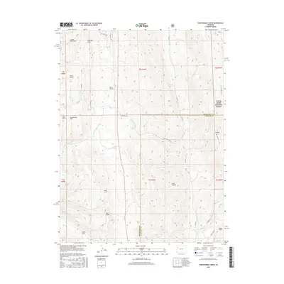
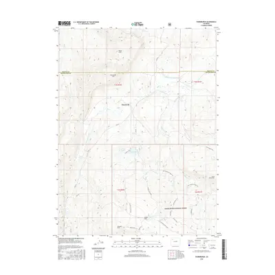
1966 Thornburgh
Rio Blanco County, CO
1966 Veatch Gulch
Rio Blanco County, CO
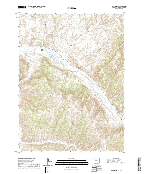
1966 White River City
Rio Blanco County, CO
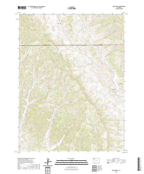
1966 White Rock
Rio Blanco County, CO
1971 Figure Four Spring
Rio Blanco County, CO
1977 Oyster Lake
Rio Blanco County, CO
1977 Ripple Creek
Rio Blanco County, CO
1981 Douglas Pass
Rio Blanco County, CO
2000 Dunckley Pass
Rio Blanco County, CO
2000 Pagoda Peak
Rio Blanco County, CO
2000 Sand Point
Rio Blanco County, CO
2000 Slide Creek
Rio Blanco County, CO
2010 Banta Ridge
Rio Blanco County, CO
2010 Banty Point
Rio Blanco County, CO
2010 Barcus Creek
Rio Blanco County, CO
2010 Barcus Creek SE
Rio Blanco County, CO
2010 Big Foundation Creek
Rio Blanco County, CO
2010 Black Cabin Gulch
Rio Blanco County, CO
2010 Brushy Point
Rio Blanco County, CO
2010 Buckskin Point
Rio Blanco County, CO
2010 Cactus Reservoir
Rio Blanco County, CO
2010 Calamity Ridge
Rio Blanco County, CO
2010 Devils Hole Gulch
Rio Blanco County, CO
2010 Divide Creek
Rio Blanco County, CO
2010 East Evacuation Creek
Rio Blanco County, CO
2010 Figure Four Spring
Rio Blanco County, CO
2010 Gillam Draw
Rio Blanco County, CO
2010 Greasewood Gulch
Rio Blanco County, CO
2010 Indian Valley
Rio Blanco County, CO
2010 Jessup Gulch
Rio Blanco County, CO
2010 Mellen Hill
Rio Blanco County, CO
2010 Ninemile Gap
Rio Blanco County, CO
2010 No Name Ridge
Rio Blanco County, CO
2010 Philadelphia Creek
Rio Blanco County, CO
2010 Rangely NE
Rio Blanco County, CO
2010 Rattlesnake Mesa
Rio Blanco County, CO
2010 Razorback Ridge
Rio Blanco County, CO
2010 Rock School
Rio Blanco County, CO
2010 Rough Gulch
Rio Blanco County, CO
2010 Sagebrush Hill
Rio Blanco County, CO
2010 Segar Mountain
Rio Blanco County, CO
2010 Smizer Gulch
Rio Blanco County, CO
2010 Square S Ranch
Rio Blanco County, CO
2010 Texas Creek
Rio Blanco County, CO
2010 Texas Mountain
Rio Blanco County, CO
2010 Water Canyon
Rio Blanco County, CO
2010 White Coyote Draw
Rio Blanco County, CO
2010 White River City
Rio Blanco County, CO
2010 White Rock
Rio Blanco County, CO
2010 Wolf Ridge
Rio Blanco County, CO
2010 Yankee Gulch
Rio Blanco County, CO
2011 Big Beaver Reservoir
Rio Blanco County, CO
2011 Buford
Rio Blanco County, CO
2011 Dunckley Pass
Rio Blanco County, CO
2011 Fawn Creek
Rio Blanco County, CO
2011 LO 7 Hill
Rio Blanco County, CO
2011 Lost Park
Rio Blanco County, CO
2011 Oyster Lake
Rio Blanco County, CO
2011 Pagoda Peak
Rio Blanco County, CO
2011 Ripple Creek
Rio Blanco County, CO
2011 Sand Point
Rio Blanco County, CO
2011 Sawmill Mountain
Rio Blanco County, CO
2011 Sleepy Cat Peak
Rio Blanco County, CO
2011 Slide Creek
Rio Blanco County, CO
2011 Thirteenmile Creek
Rio Blanco County, CO
2011 Thornburgh
Rio Blanco County, CO
2011 Veatch Gulch
Rio Blanco County, CO
2013 Banta Ridge
Rio Blanco County, CO
2013 Banty Point
Rio Blanco County, CO
2013 Barcus Creek
Rio Blanco County, CO
2013 Barcus Creek SE
Rio Blanco County, CO
2013 Big Beaver Reservoir
Rio Blanco County, CO
2013 Big Foundation Creek
Rio Blanco County, CO
2013 Black Cabin Gulch
Rio Blanco County, CO
2013 Brushy Point
Rio Blanco County, CO
2013 Buckskin Point
Rio Blanco County, CO
2013 Buford
Rio Blanco County, CO
2013 Cactus Reservoir
Rio Blanco County, CO
2013 Calamity Ridge
Rio Blanco County, CO
2013 Devils Hole Gulch
Rio Blanco County, CO
2013 Divide Creek
Rio Blanco County, CO
2013 Dunckley Pass
Rio Blanco County, CO
2013 East Evacuation Creek
Rio Blanco County, CO
2013 Fawn Creek
Rio Blanco County, CO
2013 Figure Four Spring
Rio Blanco County, CO
2013 Gillam Draw
Rio Blanco County, CO
2013 Greasewood Gulch
Rio Blanco County, CO
2013 Indian Valley
Rio Blanco County, CO
2013 Jessup Gulch
Rio Blanco County, CO
2013 LO 7 Hill
Rio Blanco County, CO
2013 Lost Park
Rio Blanco County, CO
2013 Mellen Hill
Rio Blanco County, CO
2013 Ninemile Gap
Rio Blanco County, CO
2013 No Name Ridge
Rio Blanco County, CO
2013 Oyster Lake
Rio Blanco County, CO
2013 Pagoda Peak
Rio Blanco County, CO
2013 Philadelphia Creek
Rio Blanco County, CO
2013 Rangely NE
Rio Blanco County, CO
2013 Rattlesnake Mesa
Rio Blanco County, CO
2013 Razorback Ridge
Rio Blanco County, CO
2013 Ripple Creek
Rio Blanco County, CO
2013 Rock School
Rio Blanco County, CO
2013 Rough Gulch
Rio Blanco County, CO
2013 Sagebrush Hill
Rio Blanco County, CO
2013 Sand Point
Rio Blanco County, CO
2013 Sawmill Mountain
Rio Blanco County, CO
2013 Segar Mountain
Rio Blanco County, CO
2013 Sleepy Cat Peak
Rio Blanco County, CO
2013 Slide Creek
Rio Blanco County, CO
2013 Smizer Gulch
Rio Blanco County, CO
2013 Square S Ranch
Rio Blanco County, CO
2013 Texas Creek
Rio Blanco County, CO
2013 Texas Mountain
Rio Blanco County, CO
2013 Thirteenmile Creek
Rio Blanco County, CO
2013 Thornburgh
Rio Blanco County, CO
2013 Veatch Gulch
Rio Blanco County, CO
2013 Water Canyon
Rio Blanco County, CO
2013 White Coyote Draw
Rio Blanco County, CO
2013 White River City
Rio Blanco County, CO
2013 White Rock
Rio Blanco County, CO
2013 Wolf Ridge
Rio Blanco County, CO
2013 Yankee Gulch
Rio Blanco County, CO
2016 Banta Ridge
Rio Blanco County, CO
2016 Banty Point
Rio Blanco County, CO
2016 Barcus Creek
Rio Blanco County, CO
2016 Barcus Creek SE
Rio Blanco County, CO
2016 Big Beaver Reservoir
Rio Blanco County, CO
2016 Big Foundation Creek
Rio Blanco County, CO
2016 Black Cabin Gulch
Rio Blanco County, CO
2016 Brushy Point
Rio Blanco County, CO
2016 Buford
Rio Blanco County, CO
2016 Cactus Reservoir
Rio Blanco County, CO
2016 Calamity Ridge
Rio Blanco County, CO
2016 Devils Hole Gulch
Rio Blanco County, CO
2016 Divide Creek
Rio Blanco County, CO
2016 Dunckley Pass
Rio Blanco County, CO
2016 East Evacuation Creek
Rio Blanco County, CO
2016 Fawn Creek
Rio Blanco County, CO
2016 Figure Four Spring
Rio Blanco County, CO
2016 Gillam Draw
Rio Blanco County, CO
2016 Greasewood Gulch
Rio Blanco County, CO
2016 Indian Valley
Rio Blanco County, CO
2016 Jessup Gulch
Rio Blanco County, CO
2016 LO 7 Hill
Rio Blanco County, CO
2016 Lost Park
Rio Blanco County, CO
2016 Mellen Hill
Rio Blanco County, CO
2016 Ninemile Gap
Rio Blanco County, CO
2016 No Name Ridge
Rio Blanco County, CO
2016 Oyster Lake
Rio Blanco County, CO
2016 Pagoda Peak
Rio Blanco County, CO
2016 Philadelphia Creek
Rio Blanco County, CO
2016 Rangely NE
Rio Blanco County, CO
2016 Rattlesnake Mesa
Rio Blanco County, CO
2016 Razorback Ridge
Rio Blanco County, CO
2016 Ripple Creek
Rio Blanco County, CO
2016 Rock School
Rio Blanco County, CO
2016 Rough Gulch
Rio Blanco County, CO
2016 Sagebrush Hill
Rio Blanco County, CO
2016 Sand Point
Rio Blanco County, CO
2016 Sawmill Mountain
Rio Blanco County, CO
2016 Segar Mountain
Rio Blanco County, CO
2016 Sleepy Cat Peak
Rio Blanco County, CO
2016 Slide Creek
Rio Blanco County, CO
2016 Smizer Gulch
Rio Blanco County, CO
2016 Square S Ranch
Rio Blanco County, CO
2016 Texas Creek
Rio Blanco County, CO
2016 Texas Mountain
Rio Blanco County, CO
2016 Thirteenmile Creek
Rio Blanco County, CO
2016 Thornburgh
Rio Blanco County, CO
2016 Veatch Gulch
Rio Blanco County, CO
2016 Water Canyon
Rio Blanco County, CO
2016 White Coyote Draw
Rio Blanco County, CO
2016 White River City
Rio Blanco County, CO
2016 White Rock
Rio Blanco County, CO
2016 Wolf Ridge
Rio Blanco County, CO
2016 Yankee Gulch
Rio Blanco County, CO
2017 Buckskin Point
Rio Blanco County, CO
2019 Banta Ridge
Rio Blanco County, CO
2019 Banty Point
Rio Blanco County, CO
2019 Barcus Creek
Rio Blanco County, CO
2019 Barcus Creek SE
Rio Blanco County, CO
2019 Big Beaver Reservoir
Rio Blanco County, CO
2019 Big Foundation Creek
Rio Blanco County, CO
2019 Black Cabin Gulch
Rio Blanco County, CO
2019 Brushy Point
Rio Blanco County, CO
2019 Buckskin Point
Rio Blanco County, CO
2019 Buford
Rio Blanco County, CO
2019 Cactus Reservoir
Rio Blanco County, CO
2019 Calamity Ridge
Rio Blanco County, CO
2019 Devils Hole Gulch
Rio Blanco County, CO
2019 Divide Creek
Rio Blanco County, CO
2019 Dunckley Pass
Rio Blanco County, CO
2019 East Evacuation Creek
Rio Blanco County, CO
2019 Fawn Creek
Rio Blanco County, CO
2019 Figure Four Spring
Rio Blanco County, CO
2019 Gillam Draw
Rio Blanco County, CO
2019 Greasewood Gulch
Rio Blanco County, CO
2019 Indian Valley
Rio Blanco County, CO
2019 Jessup Gulch
Rio Blanco County, CO
2019 LO 7 Hill
Rio Blanco County, CO
2019 Lost Park
Rio Blanco County, CO
2019 Mellen Hill
Rio Blanco County, CO
2019 Ninemile Gap
Rio Blanco County, CO
2019 No Name Ridge
Rio Blanco County, CO
2019 Oyster Lake
Rio Blanco County, CO
2019 Pagoda Peak
Rio Blanco County, CO
2019 Philadelphia Creek
Rio Blanco County, CO
2019 Rangely NE
Rio Blanco County, CO
2019 Rattlesnake Mesa
Rio Blanco County, CO
2019 Razorback Ridge
Rio Blanco County, CO
2019 Ripple Creek
Rio Blanco County, CO
2019 Rock School
Rio Blanco County, CO
2019 Rough Gulch
Rio Blanco County, CO
2019 Sagebrush Hill
Rio Blanco County, CO
2019 Sand Point
Rio Blanco County, CO
2019 Sawmill Mountain
Rio Blanco County, CO
2019 Segar Mountain
Rio Blanco County, CO
2019 Sleepy Cat Peak
Rio Blanco County, CO
2019 Slide Creek
Rio Blanco County, CO
2019 Smizer Gulch
Rio Blanco County, CO
2019 Square S Ranch
Rio Blanco County, CO
2019 Texas Creek
Rio Blanco County, CO
2019 Texas Mountain
Rio Blanco County, CO
2019 Thirteenmile Creek
Rio Blanco County, CO
2019 Thornburgh
Rio Blanco County, CO
2019 Veatch Gulch
Rio Blanco County, CO
2019 Water Canyon
Rio Blanco County, CO
2019 White Coyote Draw
Rio Blanco County, CO
2019 White River City
Rio Blanco County, CO
2019 White Rock
Rio Blanco County, CO
2019 Wolf Ridge
Rio Blanco County, CO
2019 Yankee Gulch
Rio Blanco County, CO
2022 Banta Ridge
Rio Blanco County, CO
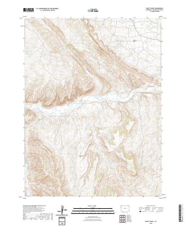
2022 Banty Point
Rio Blanco County, CO
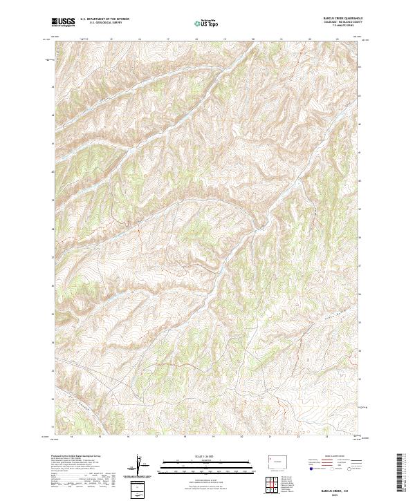
2022 Barcus Creek
Rio Blanco County, CO
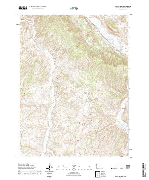
2022 Barcus Creek SE
Rio Blanco County, CO
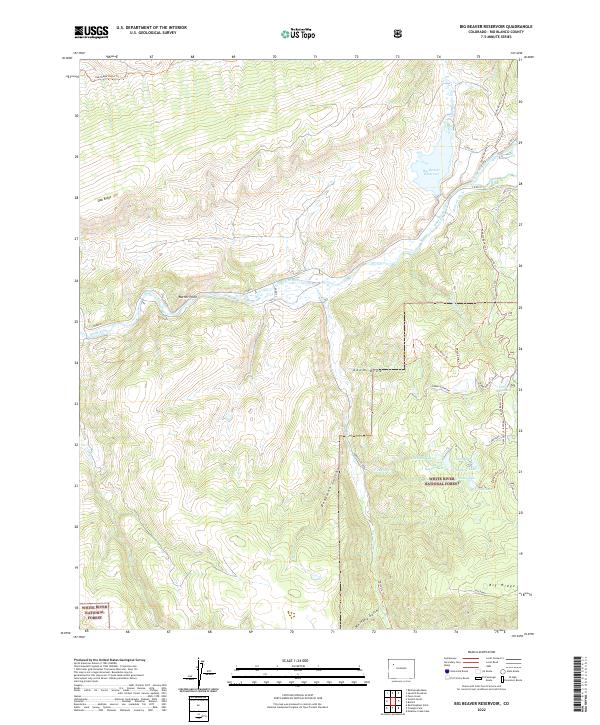
2022 Big Beaver Reservoir
Rio Blanco County, CO
2022 Big Foundation Creek
Rio Blanco County, CO
2022 Black Cabin Gulch
Rio Blanco County, CO
2022 Brushy Point
Rio Blanco County, CO
2022 Buckskin Point
Rio Blanco County, CO
2022 Buford
Rio Blanco County, CO
2022 Cactus Reservoir
Rio Blanco County, CO
2022 Calamity Ridge
Rio Blanco County, CO
2022 Devils Hole Gulch
Rio Blanco County, CO
2022 Divide Creek
Rio Blanco County, CO
2022 Dunckley Pass
Rio Blanco County, CO
2022 East Evacuation Creek
Rio Blanco County, CO
2022 Fawn Creek
Rio Blanco County, CO
2022 Figure Four Spring
Rio Blanco County, CO
2022 Gillam Draw
Rio Blanco County, CO
2022 Greasewood Gulch
Rio Blanco County, CO
2022 Indian Valley
Rio Blanco County, CO
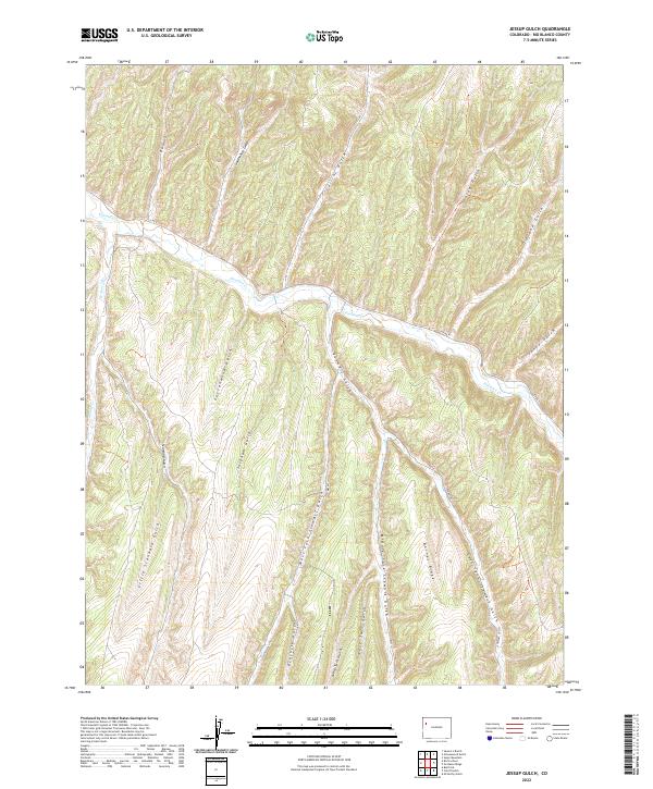
2022 Jessup Gulch
Rio Blanco County, CO
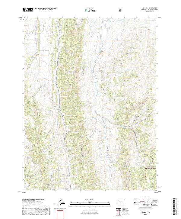
2022 LO 7 Hill
Rio Blanco County, CO
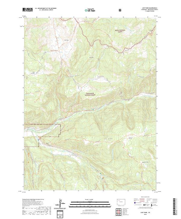
2022 Lost Park
Rio Blanco County, CO
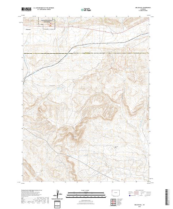
2022 Mellen Hill
Rio Blanco County, CO
2022 Ninemile Gap
Rio Blanco County, CO
2022 No Name Ridge
Rio Blanco County, CO
2022 Oyster Lake
Rio Blanco County, CO
2022 Pagoda Peak
Rio Blanco County, CO
2022 Philadelphia Creek
Rio Blanco County, CO
2022 Rangely NE
Rio Blanco County, CO
2022 Rattlesnake Mesa
Rio Blanco County, CO
2022 Razorback Ridge
Rio Blanco County, CO
2022 Ripple Creek
Rio Blanco County, CO
2022 Rock School
Rio Blanco County, CO
2022 Rough Gulch
Rio Blanco County, CO
2022 Sagebrush Hill
Rio Blanco County, CO
2022 Sand Point
Rio Blanco County, CO
2022 Sawmill Mountain
Rio Blanco County, CO
2022 Segar Mountain
Rio Blanco County, CO
2022 Sleepy Cat Peak
Rio Blanco County, CO
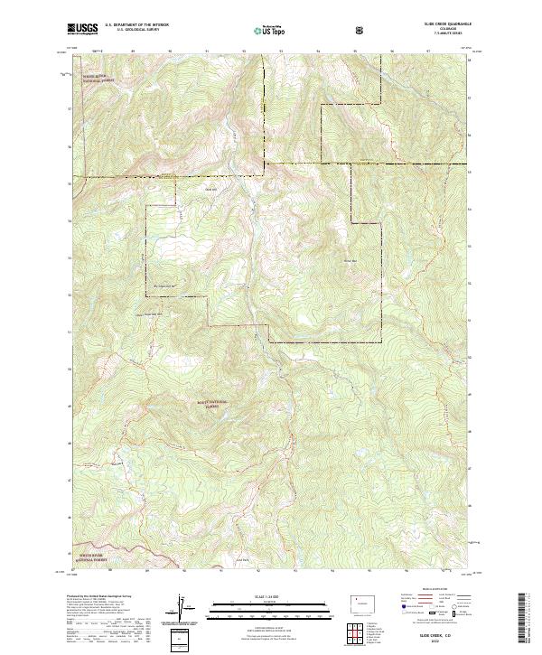
2022 Slide Creek
Rio Blanco County, CO
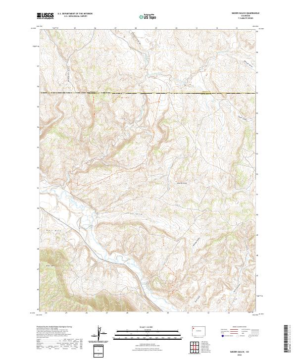
2022 Smizer Gulch
Rio Blanco County, CO
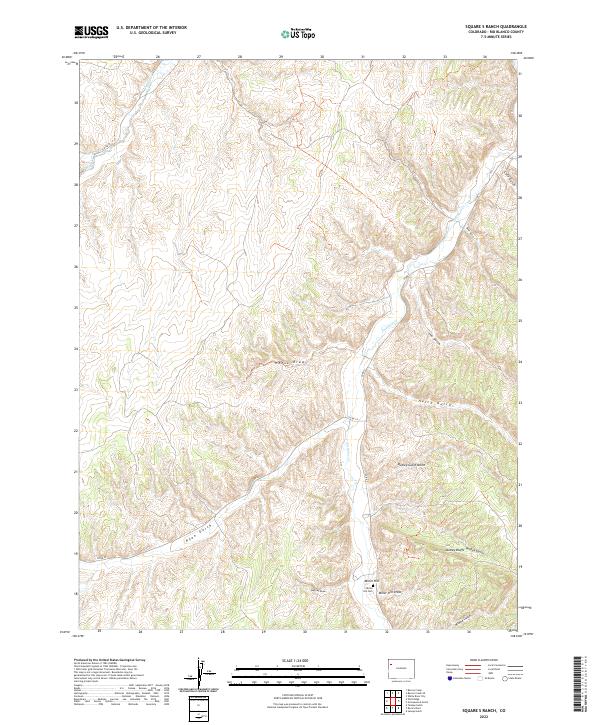
2022 Square S Ranch
Rio Blanco County, CO
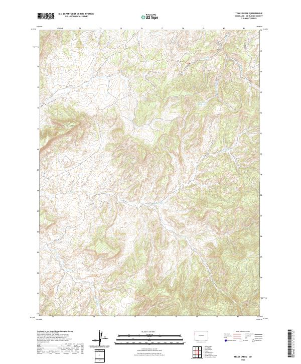
2022 Texas Creek
Rio Blanco County, CO
2022 Texas Mountain
Rio Blanco County, CO
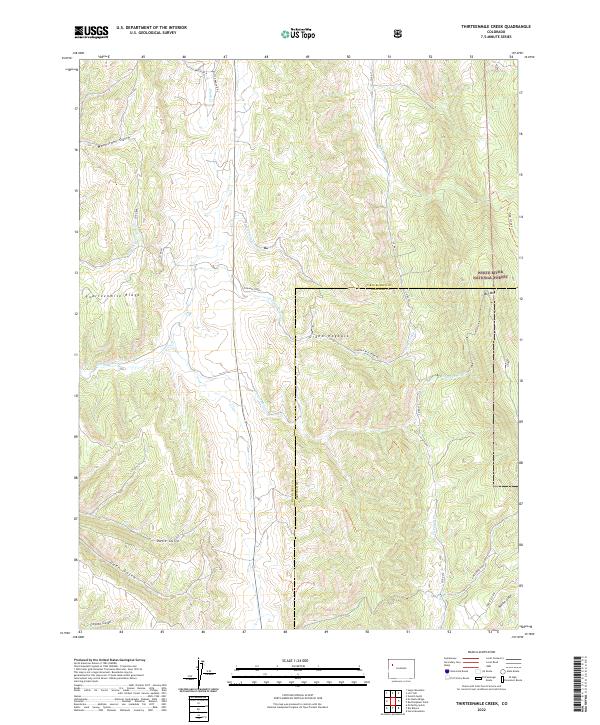
2022 Thirteenmile Creek
Rio Blanco County, CO
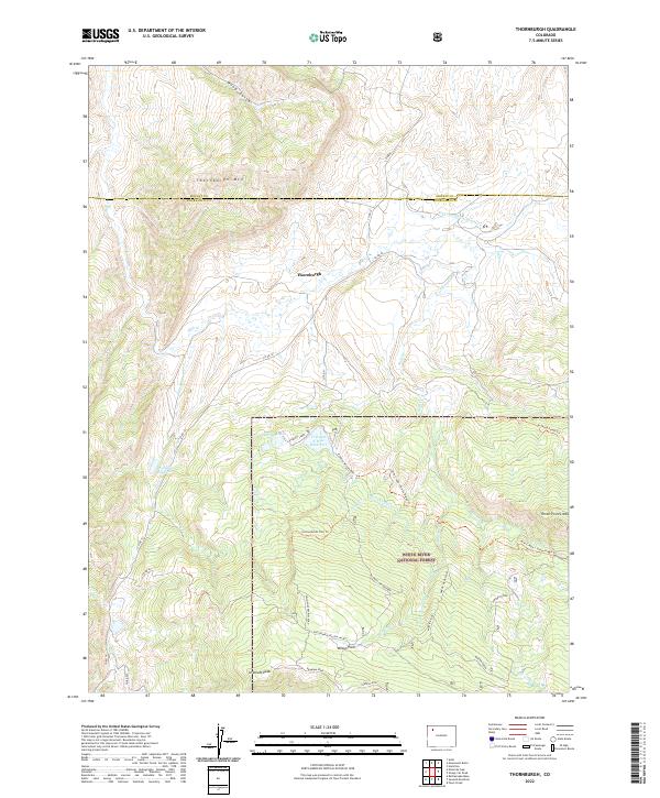
2022 Thornburgh
Rio Blanco County, CO
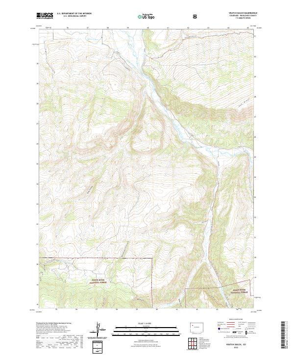
2022 Veatch Gulch
Rio Blanco County, CO
2022 Water Canyon
Rio Blanco County, CO
2022 White Coyote Draw
Rio Blanco County, CO
2022 White River City
Rio Blanco County, CO
2022 White Rock
Rio Blanco County, CO
2022 Wolf Ridge
Rio Blanco County, CO
2022 Yankee Gulch
Rio Blanco County, CO