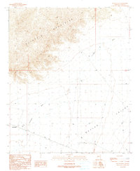
1990 Map of Butler Well
USGS Topo · Published 1990About this map
The Buckskin Mountains dominate the northern landscape of this La Paz County region, where steep ridgelines descend into the broad expanse of Butler Valley. This 1990 provisional map documents a transition from the rugged mountain terrain to the alluvial plains of the basin. Significant for its historical military associations, Camp Bouse is located on the western edge of the valley near Butler Well. The mapping of these remote sites, alongside water sources like North Tank and the seasonal path of Cunningham Wash, illustrates the sparse but critical infrastructure required for desert operations and habitation. Infrastructure such as Trans Lines cut across the valley floor, marking the modern human footprint against the older natural features of the Arizona desert.
Find a feature on this map
10 named features on this map. Tap any name to fly to it.
Don’t see what you’re looking for? This feature index may not catch every label — zoom into the map to look around manually.
Map Details
Editions of this 1990 Butler Well Map
This is the sole edition of this map. No revisions or reprints were ever made.
Other maps of this area

1923 · Signal
USGS Topo · 1:250,000

1942 · Signal
USGS Topo · 1:250,000

1942 · Vicksburg
USGS Topo · 1:250,000

1950 · Prescott
USGS Topo · 1:250,000

1954 · Prescott
USGS Topo · 1:250,000

1954 · Phoenix
USGS Topo · 1:250,000

1957 · Phoenix
USGS Topo · 1:250,000

1958 · Prescott
USGS Topo · 1:250,000

1958 · Phoenix
USGS Topo · 1:250,000

1959 · Prescott
USGS Topo · 1:250,000