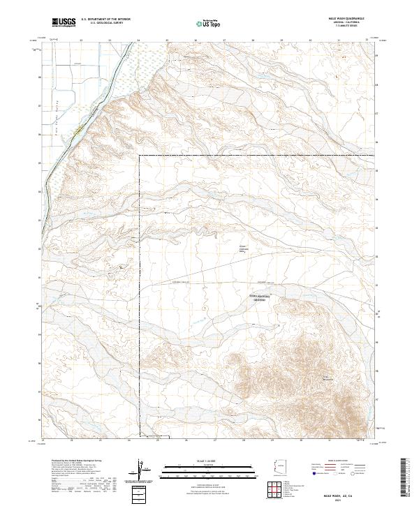
2021 Map of Mule Wash
USGS Topo · Published 2021About this map
The Colorado River defines the border between Arizona and California, cutting through a landscape of broad alluvial basins and arid mountain slopes. On the western bank, the Palo Verde Valley is marked by water management features like the D 23-1 Canal, Borrow Pit Drain, and D 23 Spill, reflecting the agricultural development of the region. To the east, the Great Colorado Valley gives way to the sharp elevations of the Trigo Mountains, where numerous ephemeral drainages such as Mule Wash, Mohave Wash, and the colorfully named Crazy Woman Wash carry runoff toward the river. This 2021 survey illustrates the contrast between the organized infrastructure along Levee Rd and the open desert terrain traversed by the Ehrenberg-Cibola Rd, documenting the intersection of modern hydrology and the natural topography of the Lower Colorado River valley.
Find a feature on this map
25 named features on this map. Tap any name to fly to it.
Don’t see what you’re looking for? This feature index may not catch every label — zoom into the map to look around manually.
Map Details
Editions of this 2021 Mule Wash Map
This is the sole edition of this map. No revisions or reprints were ever made.
Other maps of this area

1933 · Cunningham Mtn
USGS Topo · 1:48,000

1934 · Trigo Peaks
USGS Topo · 1:48,000

1939 · Trigo Peaks
USGS Topo · 1:62,500

1940 · Dome Rock Mts
USGS Topo · 1:62,500

1942 · Blythe
USGS Topo · 1:250,000

1945 · Cibola
USGS Topo · 1:62,500

1951 · Blythe
USGS Topo · 1:24,000

1951 · Cibola
USGS Topo · 1:62,500

1952 · Mule Wash
USGS Topo · 1:24,000

1952 · Palo Verde
USGS Topo · 1:24,000