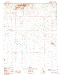
1990 Map of Socorro Mine
USGS Topo · Published 1990About this map
Harquahala Mountains dominate the northern portion of this arid Arizona landscape, where mining activity defined the local economy through much of the 20th century. The Socorro Mine sits at the heart of an intensive mineral district, surrounded by numerous Adits, Prospects, and Mine Shaft locations. To the south, the terrain transitions into the broad Harquahala Plain, where water management becomes the primary feature. A complex system of Check Dams and a prominent Road On Levee manage the flow of the Centennial Wash as it moves across the desert floor. Distinctive landforms like the Red Hills and the oddly named Sore Fingers provide clear landmarks for researchers and hikers navigating this corner of La Paz County.
Find a feature on this map
20 named features on this map. Tap any name to fly to it.
Don’t see what you’re looking for? This feature index may not catch every label — zoom into the map to look around manually.
Map Details
Editions of this 1990 Socorro Mine Map
This is the sole edition of this map. No revisions or reprints were ever made.
Other maps of this area

1942 · Vicksburg
USGS Topo · 1:250,000

1954 · Phoenix
USGS Topo · 1:250,000

1957 · Phoenix
USGS Topo · 1:250,000

1958 · Phoenix
USGS Topo · 1:250,000

1960 · Phoenix
USGS Topo · 1:250,000

1961 · Salome
USGS Topo · 1:62,500

1961 · Hope
USGS Topo · 1:62,500

1961 · Lone Mountain
USGS Topo · 1:62,500

1961 · Gladden
USGS Topo · 1:62,500

1969 · Phoenix
USGS Topo · 1:250,000