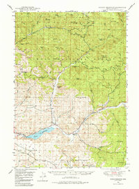
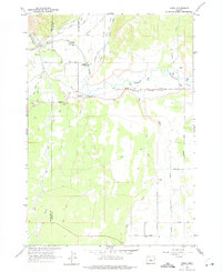
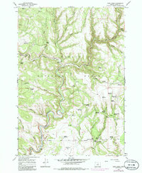
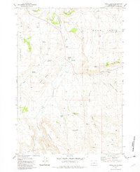
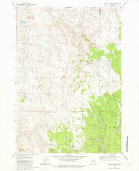
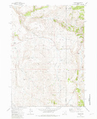
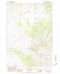
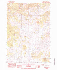
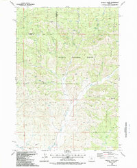
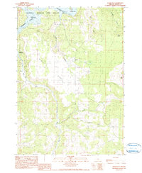
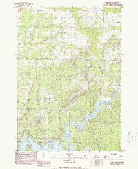
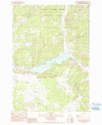
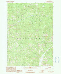
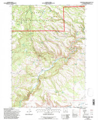
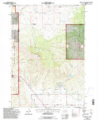
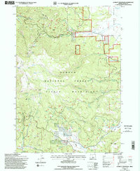
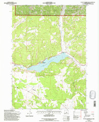
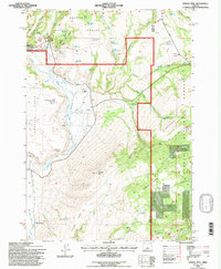
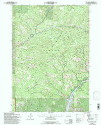
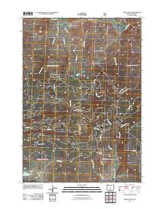
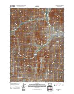
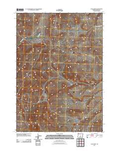
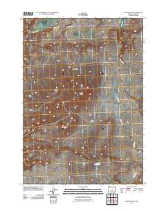
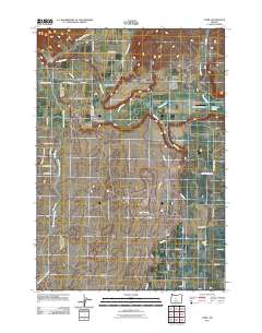
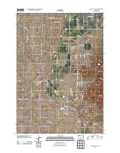
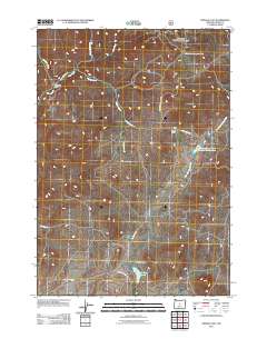
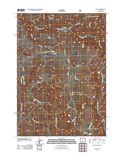
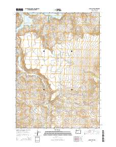
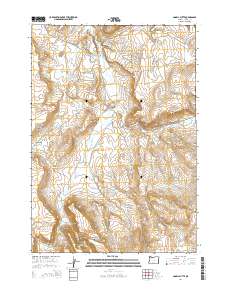
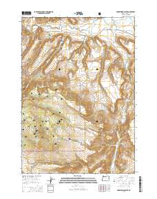
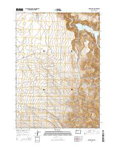
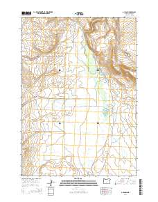
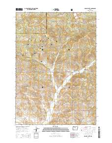
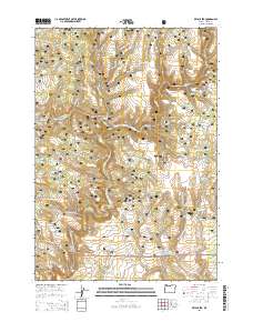
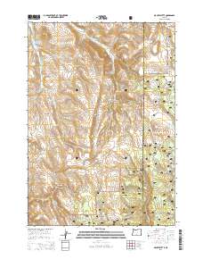
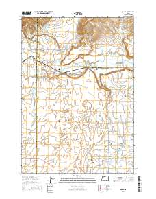
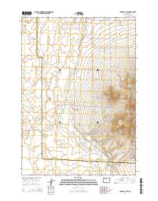
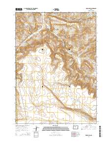
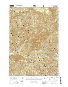
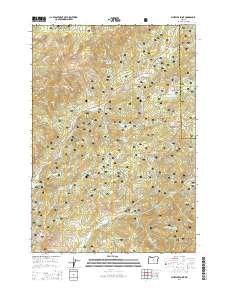
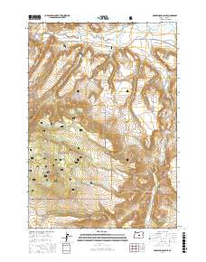
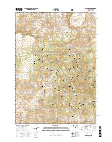
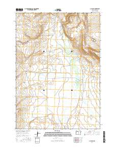
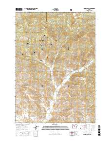
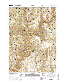
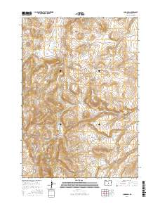
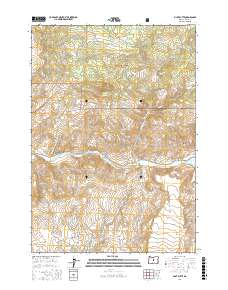
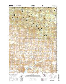
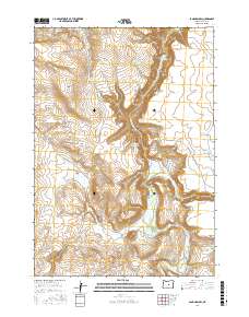
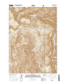
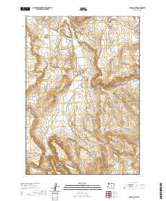
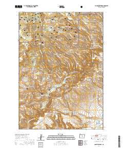
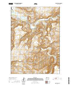
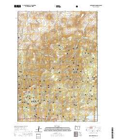
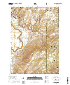
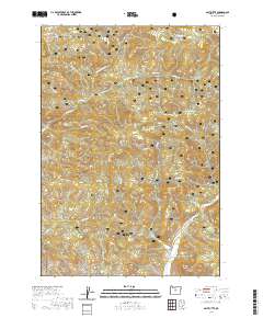
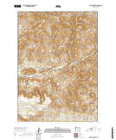
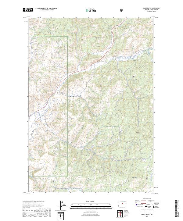
1992 Map of Cadle Butte
USGS Topo · Published 1997About this map
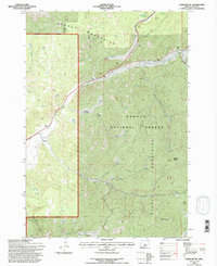
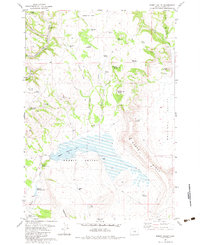
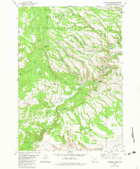
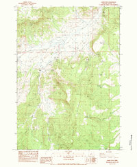
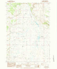
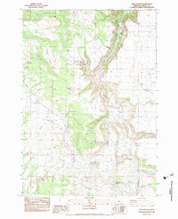
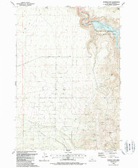
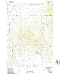
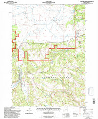
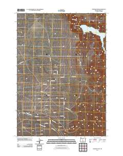
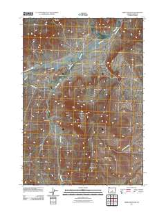
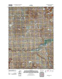
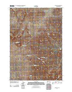
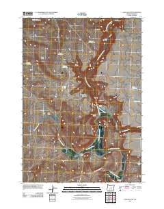
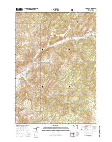
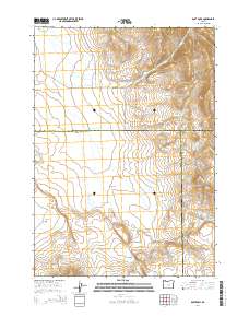
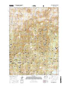
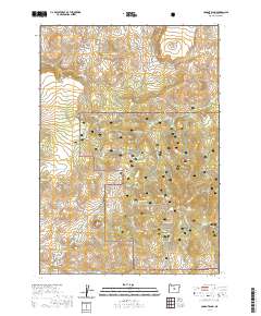
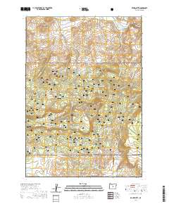
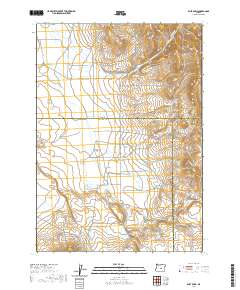
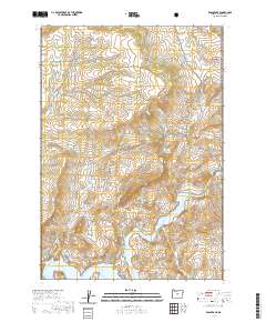
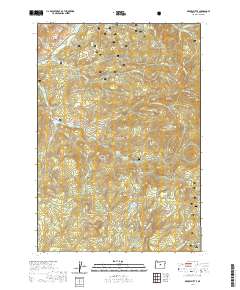
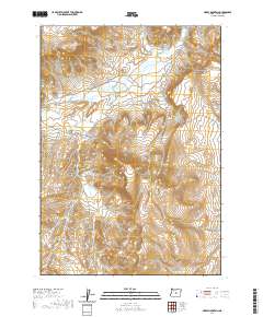
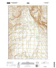
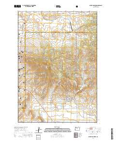
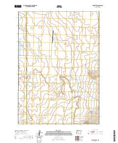
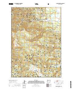
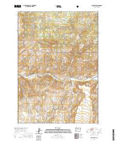
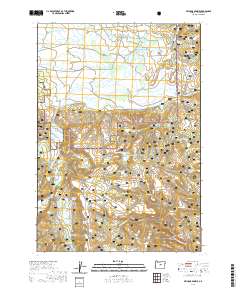
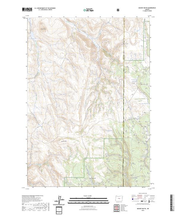
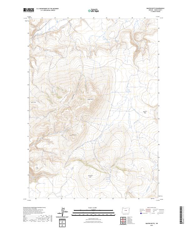
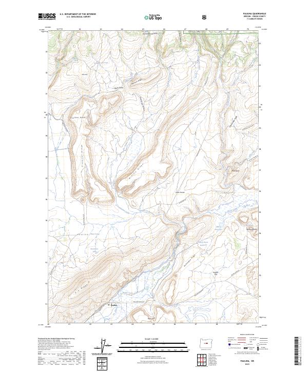
Ochoco Mountains topography dominates this 1990s forest service study, revealing a landscape defined by high-elevation drainage systems and scattered grazing operations. The Ochoco National Forest land is marked by significant hydrological features including the headwaters of Ochoco Creek, Peterson Creek, and the grazing lands at Lawson Creek Meadows. Notable for local history and land-use researchers are the isolated locations of Howard School and the Keystone Ranch, which indicate the sparse but persistent settlement patterns in this area of Crook County. Several prospects and a gravel pit are scattered along the creek beds, highlighting the small-scale mineral extraction and resource management typical of the era. The primary transit route through this terrain is the Prineville Big Summit Rd, which connects the high peaks and valleys.
Find a feature on this map
31 named features on this map. Tap any name to fly to it.
Don’t see what you’re looking for? This feature index may not catch every label — zoom into the map to look around manually.
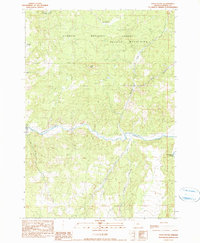
Map Details
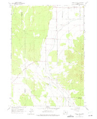
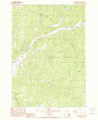
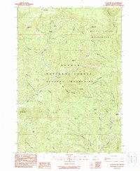
Editions of this 1992 Cadle Butte Map
This is the sole edition of this map. No revisions or reprints were ever made.
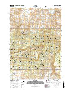
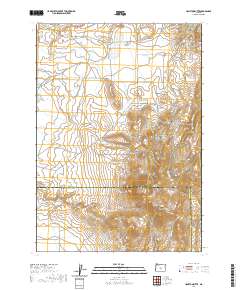
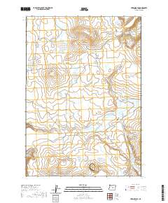
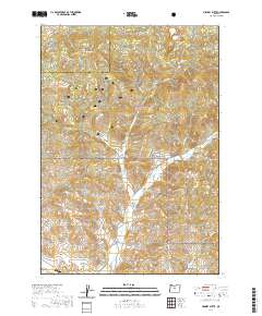
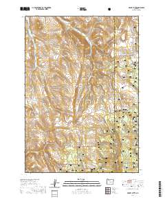
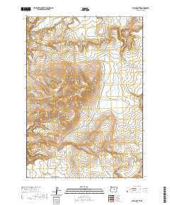
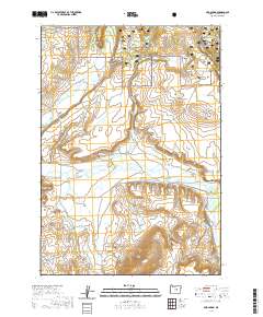
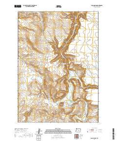
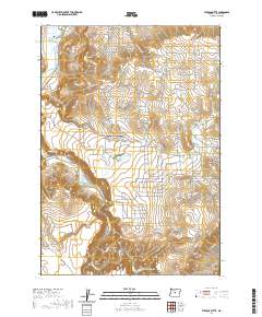
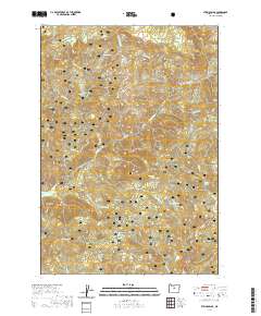
Historical Maps of Crook County Through Time
341 maps found
1946 Eagle Rock
Crook County, OR
1948 Eagle Rock
Crook County, OR
1948 Ochoco Reservoir
Crook County, OR
1950 Ochoco Reservoir
Crook County, OR
1951 Lookout Mtn
Crook County, OR
1951 Post
Crook County, OR
1962 Huston Lake
Crook County, OR
1962 Oneil
Crook County, OR
1962 Powell Butte
Crook County, OR
1962 Powell Buttes
Crook County, OR
1965 Williams Prairie
Crook County, OR
1966 Keys Creek
Crook County, OR
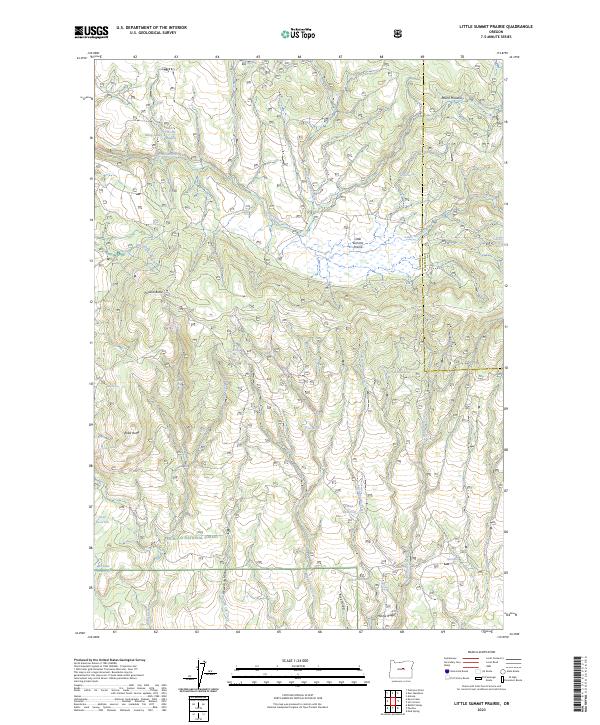
1966 Little Summit Prairie
Crook County, OR
1967 Brothers NW
Crook County, OR
1967 Sugarloaf Butte
Crook County, OR
1981 Angell Butte
Crook County, OR
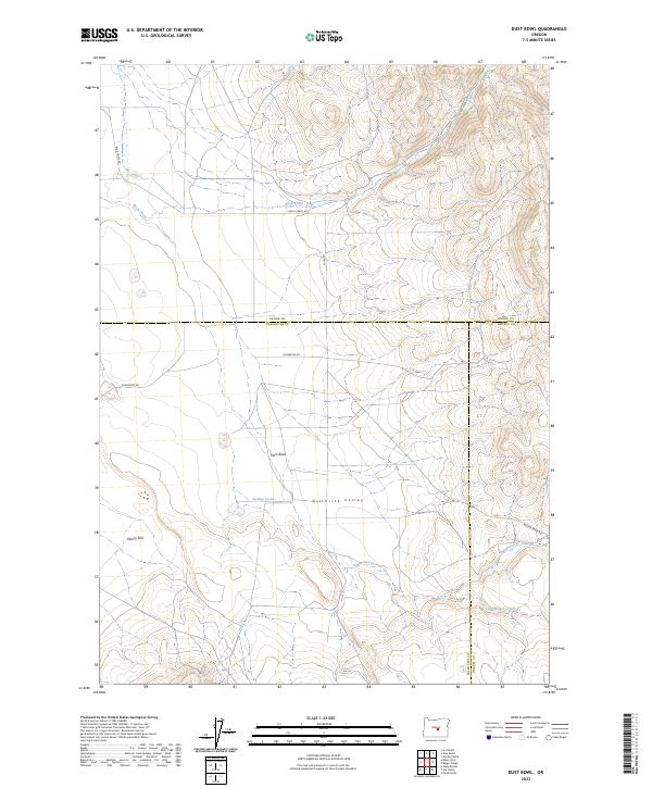
1981 Dust Bowl
Crook County, OR
1981 Hardin Ranch
Crook County, OR
1981 Ibex Butte
Crook County, OR
1981 Mackey Butte
Crook County, OR
1981 Maupin Butte
Crook County, OR
1981 Paulina
Crook County, OR
1981 Powell Mtn
Crook County, OR
1981 Suplee
Crook County, OR
1981 Twelvemile Reservoir
Crook County, OR
1982 Arrowwood Point
Crook County, OR
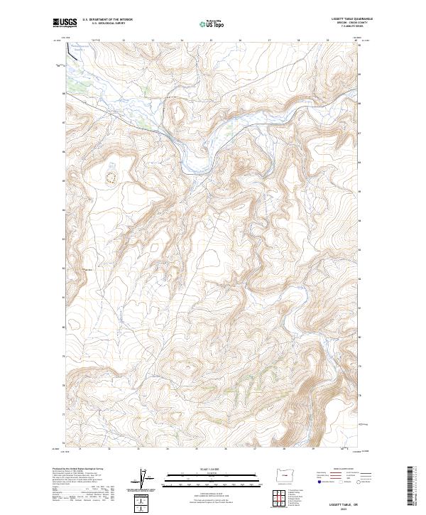
1982 Liggett Table
Crook County, OR
1982 Rabbit Valley
Crook County, OR
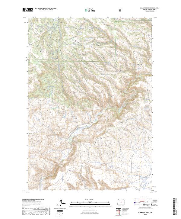
1983 Committee Creek
Crook County, OR
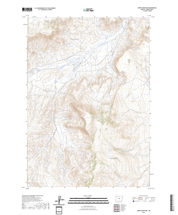
1983 Gerry Mtn
Crook County, OR
1983 G.I. Ranch
Crook County, OR
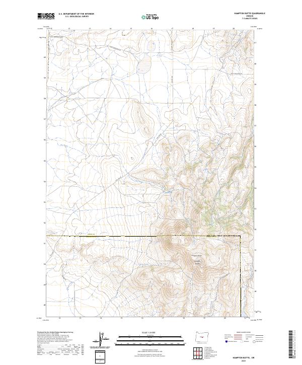
1983 Hampton Butte
Crook County, OR
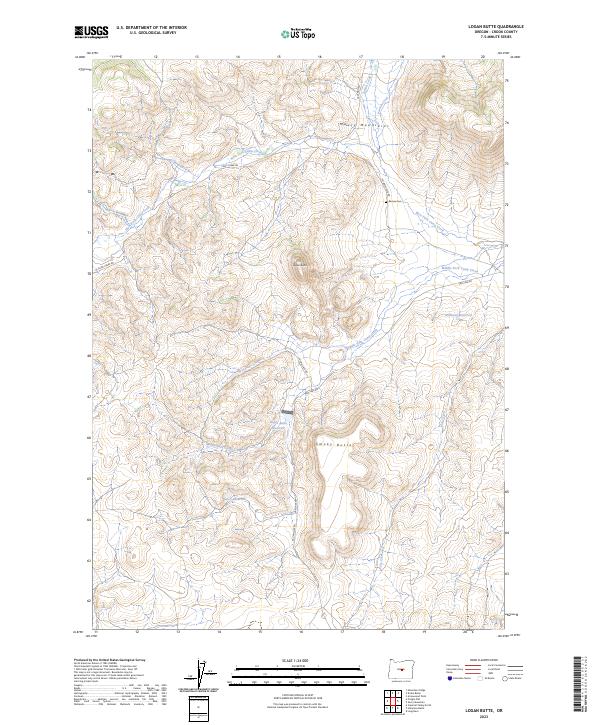
1983 Logan Butte
Crook County, OR
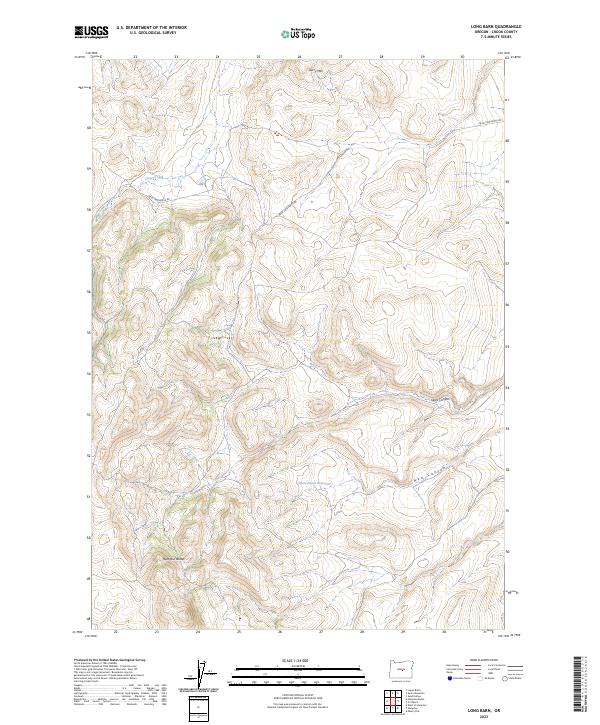
1983 Long Barn
Crook County, OR
1983 Mud Spring
Crook County, OR
1983 Pringle Flat
Crook County, OR
1983 Sand Hollow
Crook County, OR
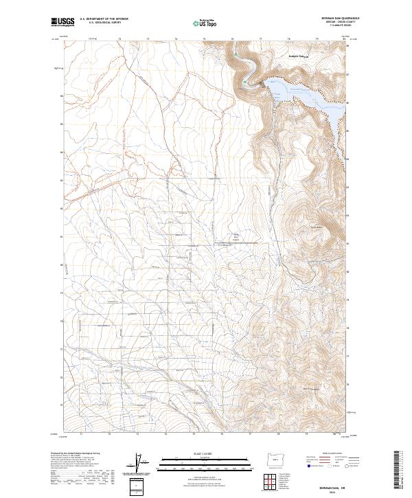
1988 Bowman Dam
Crook County, OR
1988 Grizzly Mtn
Crook County, OR
1988 Hensley Butte
Crook County, OR
1988 Horse Butte
Crook County, OR
1988 Powell Buttes
Crook County, OR
1988 Stearns Butte
Crook County, OR
1990 Alkali Flat
Crook County, OR
1990 Cadle Butte
Crook County, OR
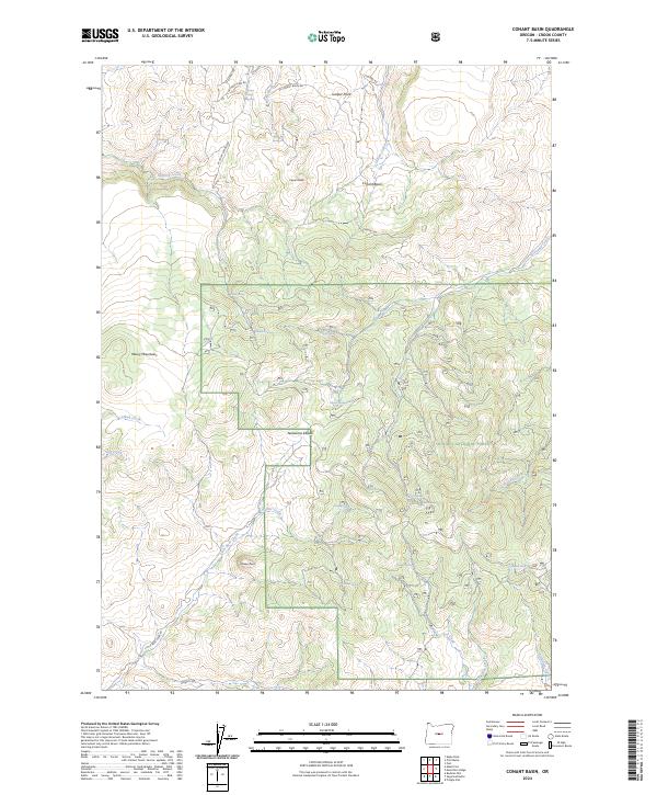
1990 Conant Basin
Crook County, OR
1990 Drake Butte
Crook County, OR
1990 Eagle Rock
Crook County, OR
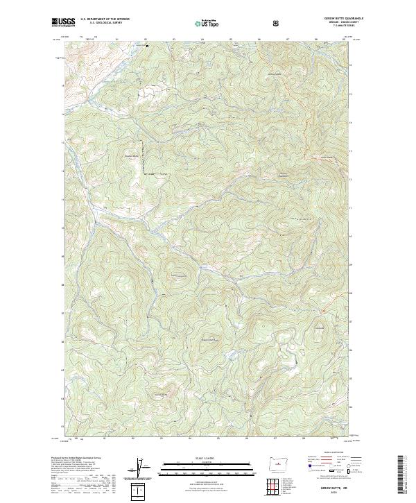
1990 Gerow Butte
Crook County, OR
1990 Lookout Mountain
Crook County, OR
1990 Mule Deer Ridge
Crook County, OR
1990 Ochoco Reservoir
Crook County, OR
1990 Pilot Butte
Crook County, OR
1990 Post
Crook County, OR
1990 Prairie Hill
Crook County, OR
1990 Salt Butte
Crook County, OR
1990 Steins Pillar
Crook County, OR
1990 Whistler Point
Crook County, OR
1992 Arrowwood Point
Crook County, OR
1992 Cadle Butte
Crook County, OR
1992 Committee Creek
Crook County, OR
1992 Conant Basin
Crook County, OR
1992 Drake Butte
Crook County, OR
1992 Gerow Butte
Crook County, OR
1992 Grizzly Mtn
Crook County, OR
1992 Hensley Butte
Crook County, OR
1992 Keys Creek
Crook County, OR
1992 Little Summit Prairie
Crook County, OR
1992 Lookout Mountain
Crook County, OR
1992 Mackey Butte
Crook County, OR
1992 Mud Spring
Crook County, OR
1992 Mule Deer Ridge
Crook County, OR
1992 Ochoco Reservoir
Crook County, OR
1992 Paulina
Crook County, OR
1992 Pilot Butte
Crook County, OR
1992 Post
Crook County, OR
1992 Powell Mtn
Crook County, OR
1992 Prairie Hill
Crook County, OR
1992 Pringle Flat
Crook County, OR
1992 Rabbit Valley
Crook County, OR
1992 Salt Butte
Crook County, OR
1992 Steins Pillar
Crook County, OR

1992 Sugarloaf Butte
Crook County, OR
1992 Suplee
Crook County, OR
1992 Whistler Point
Crook County, OR
1992 Williams Prairie
Crook County, OR
2011 Alkali Flat
Crook County, OR
2011 Angell Butte
Crook County, OR
2011 Arrowwood Point
Crook County, OR
2011 Bowman Dam
Crook County, OR
2011 Cadle Butte
Crook County, OR
2011 Committee Creek
Crook County, OR
2011 Conant Basin
Crook County, OR
2011 Drake Butte
Crook County, OR
2011 Dust Bowl
Crook County, OR
2011 Eagle Rock
Crook County, OR
2011 Gerow Butte
Crook County, OR
2011 Gerry Mountain
Crook County, OR
2011 G I Ranch
Crook County, OR
2011 Grizzly Mountain
Crook County, OR
2011 Hampton Butte
Crook County, OR
2011 Hardin Ranch
Crook County, OR
2011 Hensley Butte
Crook County, OR
2011 Horse Butte
Crook County, OR
2011 Houston Lake
Crook County, OR
2011 Ibex Butte
Crook County, OR
2011 Keys Creek
Crook County, OR
2011 Liggett Table
Crook County, OR
2011 Little Summit Prairie
Crook County, OR
2011 Logan Butte
Crook County, OR
2011 Long Barn
Crook County, OR
2011 Lookout Mountain
Crook County, OR
2011 Mackey Butte
Crook County, OR
2011 Maupin Butte
Crook County, OR
2011 Mud Spring
Crook County, OR
2011 Mule Deer Ridge
Crook County, OR
2011 Ochoco Reservoir
Crook County, OR
2011 O'Neil
Crook County, OR
2011 Paulina
Crook County, OR
2011 Pilot Butte
Crook County, OR
2011 Post
Crook County, OR
2011 Powell Butte
Crook County, OR
2011 Powell Buttes
Crook County, OR
2011 Powell Mountain
Crook County, OR
2011 Prairie Hill
Crook County, OR
2011 Pringle Flat
Crook County, OR
2011 Rabbit Valley
Crook County, OR
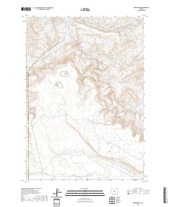
2011 Rodman Rim
Crook County, OR
2011 Salt Butte
Crook County, OR
2011 Sand Hollow
Crook County, OR
2011 Stearns Butte
Crook County, OR
2011 Steins Pillar
Crook County, OR
2011 Sugarloaf Butte
Crook County, OR
2011 Suplee
Crook County, OR
2011 Twelvemile Reservoir
Crook County, OR
2011 Whistler Point
Crook County, OR
2011 Williams Prairie
Crook County, OR
2014 Alkali Flat
Crook County, OR
2014 Angell Butte
Crook County, OR
2014 Arrowwood Point
Crook County, OR
2014 Bowman Dam
Crook County, OR
2014 Cadle Butte
Crook County, OR
2014 Committee Creek
Crook County, OR
2014 Conant Basin
Crook County, OR
2014 Drake Butte
Crook County, OR
2014 Dust Bowl
Crook County, OR
2014 Eagle Rock
Crook County, OR
2014 Gerow Butte
Crook County, OR
2014 Gerry Mountain
Crook County, OR
2014 G I Ranch
Crook County, OR
2014 Grizzly Mountain
Crook County, OR
2014 Hampton Butte
Crook County, OR
2014 Hardin Ranch
Crook County, OR
2014 Hensley Butte
Crook County, OR
2014 Horse Butte
Crook County, OR
2014 Houston Lake
Crook County, OR
2014 Ibex Butte
Crook County, OR
2014 Keys Creek
Crook County, OR
2014 Liggett Table
Crook County, OR
2014 Little Summit Prairie
Crook County, OR

2014 Logan Butte
Crook County, OR

2014 Long Barn
Crook County, OR
2014 Lookout Mountain
Crook County, OR
2014 Mackey Butte
Crook County, OR
2014 Maupin Butte
Crook County, OR
2014 Mud Spring
Crook County, OR
2014 Mule Deer Ridge
Crook County, OR

2014 Ochoco Reservoir
Crook County, OR
2014 O'Neil
Crook County, OR
2014 Paulina
Crook County, OR
2014 Pilot Butte
Crook County, OR
2014 Post
Crook County, OR
2014 Powell Butte
Crook County, OR

2014 Powell Buttes
Crook County, OR
2014 Powell Mountain
Crook County, OR
2014 Prairie Hill
Crook County, OR

2014 Pringle Flat
Crook County, OR
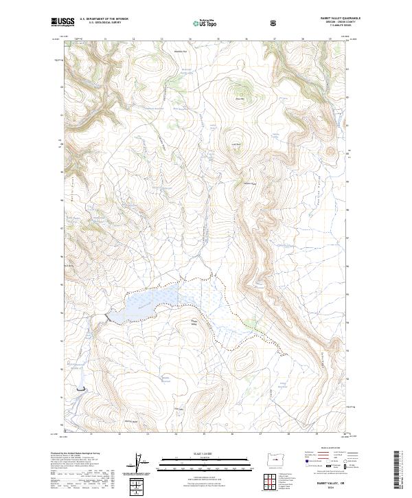
2014 Rabbit Valley
Crook County, OR
2014 Rodman Rim
Crook County, OR
2014 Salt Butte
Crook County, OR
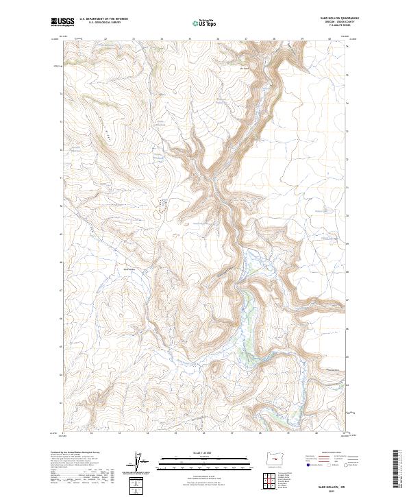
2014 Sand Hollow
Crook County, OR
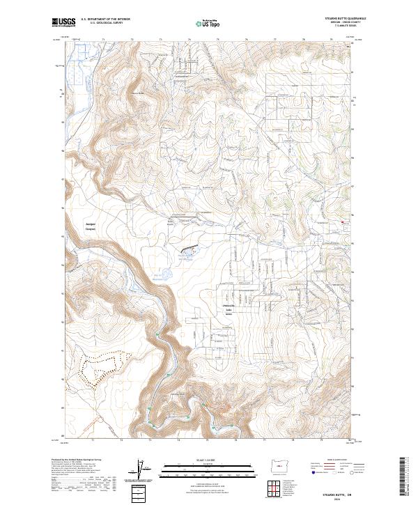
2014 Stearns Butte
Crook County, OR
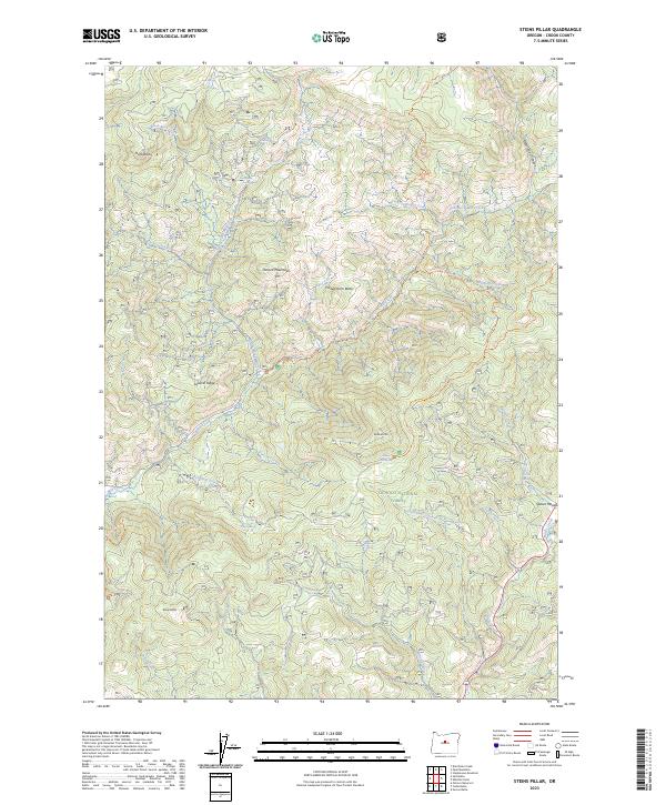
2014 Steins Pillar
Crook County, OR
2014 Sugarloaf Butte
Crook County, OR
2014 Suplee
Crook County, OR
2014 Twelvemile Reservoir
Crook County, OR
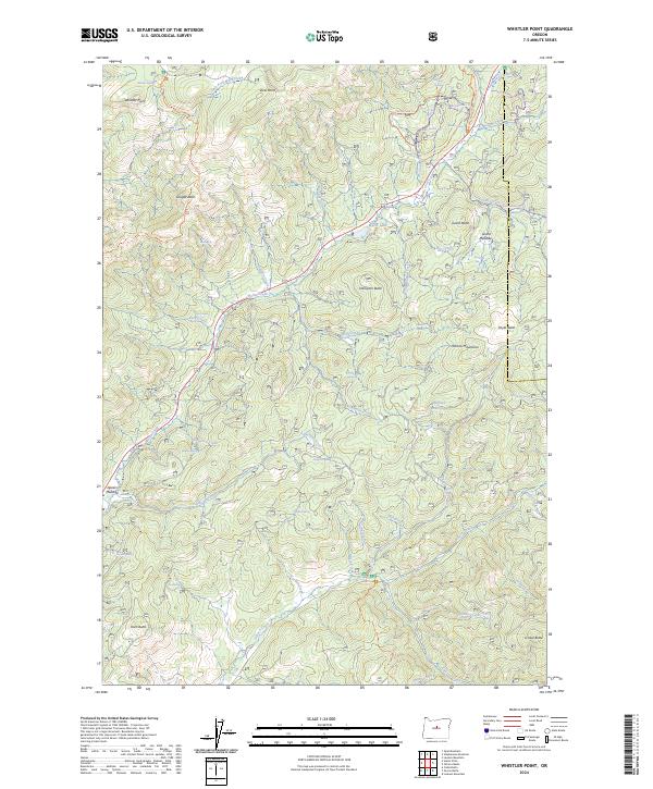
2014 Whistler Point
Crook County, OR
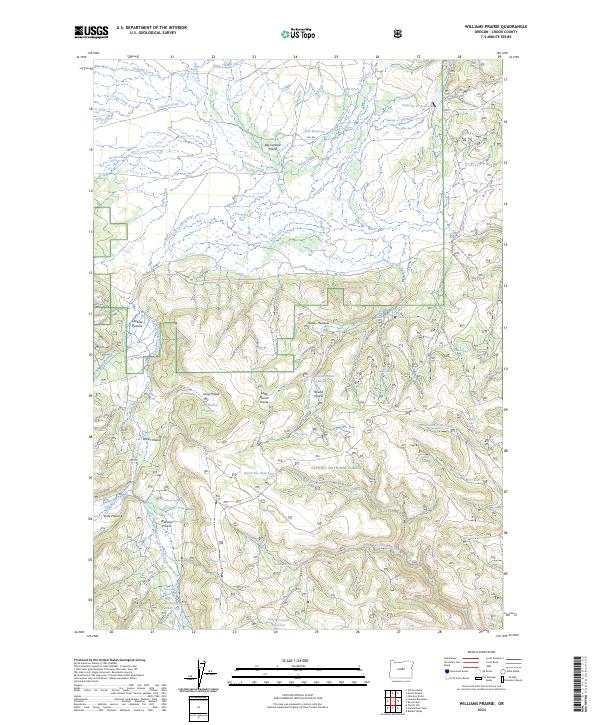
2014 Williams Prairie
Crook County, OR
2017 Alkali Flat
Crook County, OR
2017 Angell Butte
Crook County, OR
2017 Arrowwood Point
Crook County, OR
2017 Bowman Dam
Crook County, OR
2017 Cadle Butte
Crook County, OR
2017 Committee Creek
Crook County, OR
2017 Conant Basin
Crook County, OR
2017 Drake Butte
Crook County, OR
2017 Dust Bowl
Crook County, OR
2017 Eagle Rock
Crook County, OR

2017 Gerow Butte
Crook County, OR

2017 Gerry Mountain
Crook County, OR
2017 G I Ranch
Crook County, OR
2017 Grizzly Mountain
Crook County, OR
2017 Hampton Butte
Crook County, OR
2017 Hardin Ranch
Crook County, OR
2017 Hensley Butte
Crook County, OR
2017 Horse Butte
Crook County, OR
2017 Houston Lake
Crook County, OR
2017 Ibex Butte
Crook County, OR
2017 Keys Creek
Crook County, OR
2017 Liggett Table
Crook County, OR
2017 Little Summit Prairie
Crook County, OR
2017 Logan Butte
Crook County, OR
2017 Long Barn
Crook County, OR
2017 Lookout Mountain
Crook County, OR
2017 Mackey Butte
Crook County, OR

2017 Maupin Butte
Crook County, OR
2017 Mud Spring
Crook County, OR
2017 Mule Deer Ridge
Crook County, OR
2017 Ochoco Reservoir
Crook County, OR
2017 O'Neil
Crook County, OR
2017 Paulina
Crook County, OR
2017 Pilot Butte
Crook County, OR
2017 Post
Crook County, OR
2017 Powell Butte
Crook County, OR
2017 Powell Buttes
Crook County, OR

2017 Powell Mountain
Crook County, OR
2017 Prairie Hill
Crook County, OR
2017 Pringle Flat
Crook County, OR
2017 Rabbit Valley
Crook County, OR

2017 Rodman Rim
Crook County, OR
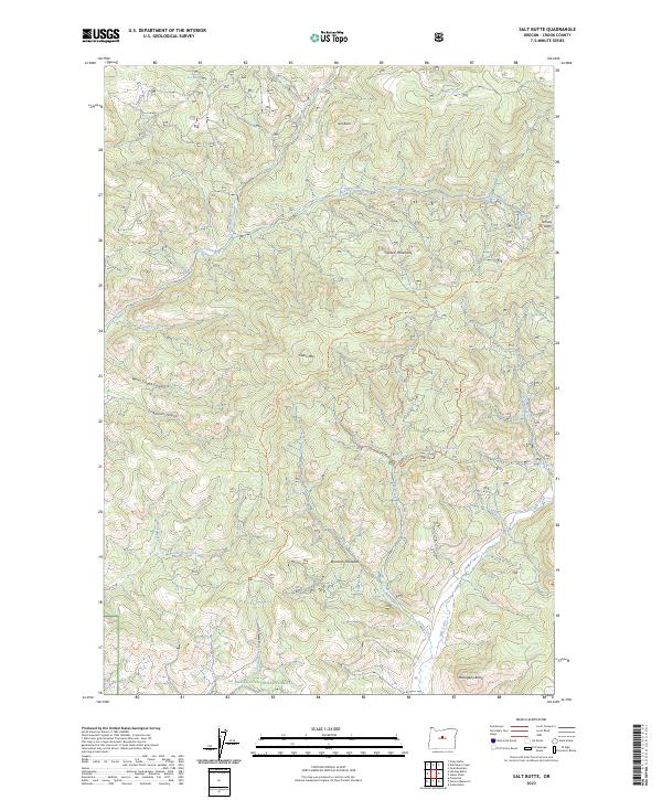
2017 Salt Butte
Crook County, OR
2017 Sand Hollow
Crook County, OR
2017 Stearns Butte
Crook County, OR
2017 Steins Pillar
Crook County, OR
2017 Sugarloaf Butte
Crook County, OR
2017 Suplee
Crook County, OR
2017 Twelvemile Reservoir
Crook County, OR
2017 Whistler Point
Crook County, OR

2017 Williams Prairie
Crook County, OR
2020 Alkali Flat
Crook County, OR
2020 Angell Butte
Crook County, OR
2020 Arrowwood Point
Crook County, OR
2020 Bowman Dam
Crook County, OR
2020 Cadle Butte
Crook County, OR
2020 Committee Creek
Crook County, OR
2020 Conant Basin
Crook County, OR
2020 Drake Butte
Crook County, OR
2020 Dust Bowl
Crook County, OR
2020 Eagle Rock
Crook County, OR
2020 Gerow Butte
Crook County, OR
2020 Gerry Mountain
Crook County, OR
2020 G I Ranch
Crook County, OR
2020 Grizzly Mountain
Crook County, OR
2020 Hampton Butte
Crook County, OR
2020 Hardin Ranch
Crook County, OR
2020 Hensley Butte
Crook County, OR
2020 Horse Butte
Crook County, OR
2020 Houston Lake
Crook County, OR
2020 Ibex Butte
Crook County, OR
2020 Keys Creek
Crook County, OR
2020 Liggett Table
Crook County, OR
2020 Little Summit Prairie
Crook County, OR
2020 Logan Butte
Crook County, OR
2020 Long Barn
Crook County, OR
2020 Lookout Mountain
Crook County, OR
2020 Mackey Butte
Crook County, OR
2020 Maupin Butte
Crook County, OR
2020 Mud Spring
Crook County, OR
2020 Mule Deer Ridge
Crook County, OR
2020 Ochoco Reservoir
Crook County, OR
2020 O'Neil
Crook County, OR
2020 Paulina
Crook County, OR
2020 Pilot Butte
Crook County, OR
2020 Post
Crook County, OR
2020 Powell Butte
Crook County, OR
2020 Powell Buttes
Crook County, OR
2020 Powell Mountain
Crook County, OR

2020 Prairie Hill
Crook County, OR
2020 Pringle Flat
Crook County, OR
2020 Rabbit Valley
Crook County, OR
2020 Rodman Rim
Crook County, OR
2020 Salt Butte
Crook County, OR
2020 Sand Hollow
Crook County, OR
2020 Stearns Butte
Crook County, OR
2020 Steins Pillar
Crook County, OR
2020 Sugarloaf Butte
Crook County, OR
2020 Suplee
Crook County, OR
2020 Twelvemile Reservoir
Crook County, OR
2020 Whistler Point
Crook County, OR
2020 Williams Prairie
Crook County, OR
2023 Angell Butte
Crook County, OR
2023 Arrowwood Point
Crook County, OR
2023 Drake Butte
Crook County, OR
2023 Dust Bowl
Crook County, OR
2023 Gerow Butte
Crook County, OR
2023 Gerry Mountain
Crook County, OR
2023 Hampton Butte
Crook County, OR
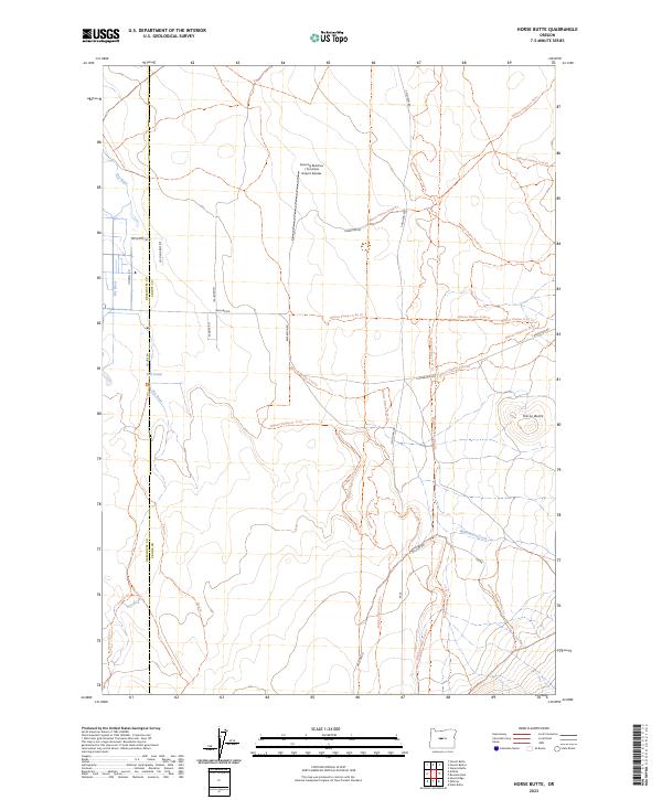
2023 Horse Butte
Crook County, OR
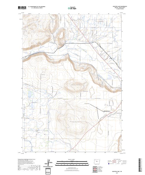
2023 Houston Lake
Crook County, OR
2023 Ibex Butte
Crook County, OR
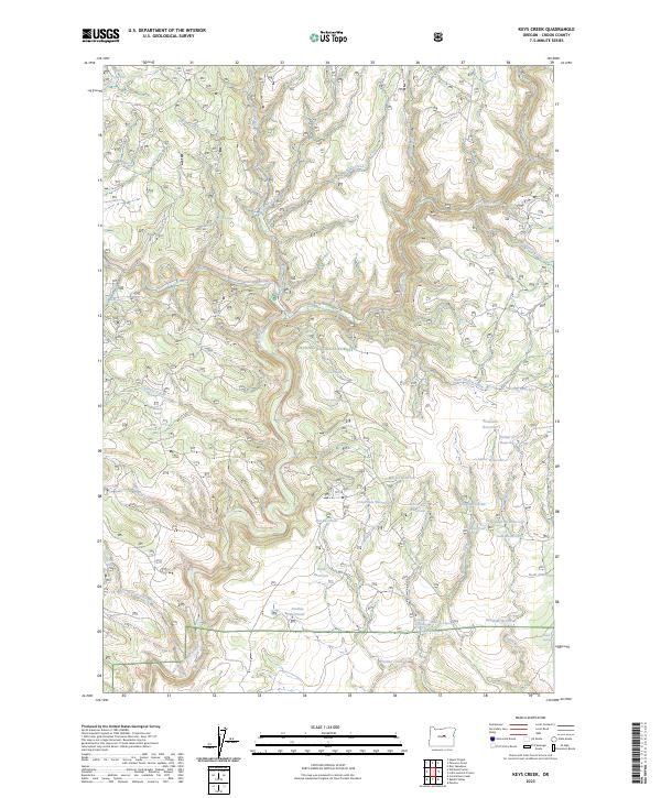
2023 Keys Creek
Crook County, OR
2023 Liggett Table
Crook County, OR
2023 Little Summit Prairie
Crook County, OR
2023 Logan Butte
Crook County, OR
2023 Long Barn
Crook County, OR
2023 Mackey Butte
Crook County, OR
2023 Maupin Butte
Crook County, OR
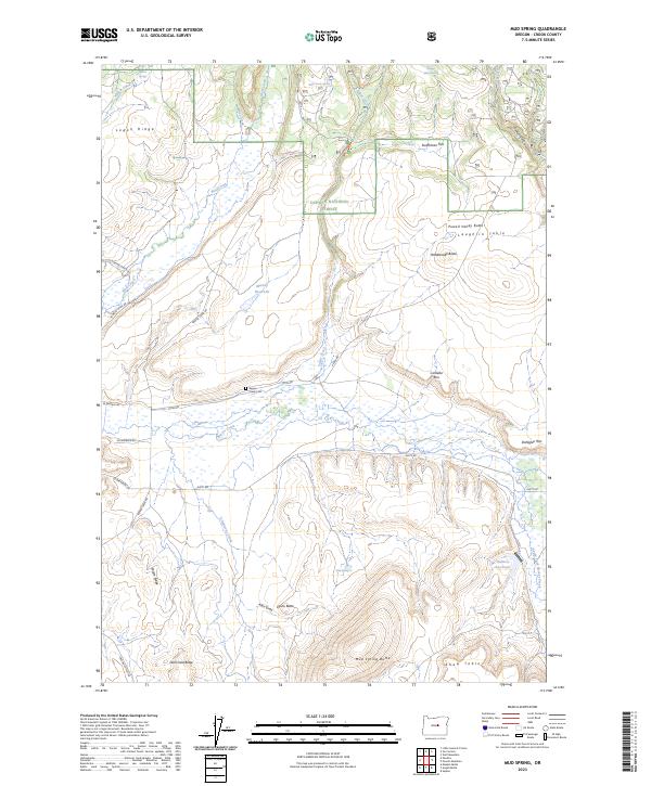
2023 Mud Spring
Crook County, OR
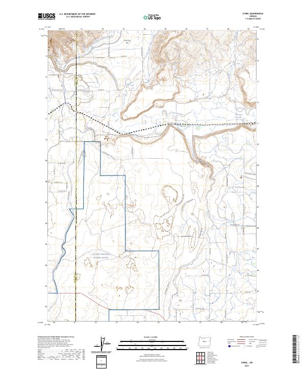
2023 O'Neil
Crook County, OR
2023 Paulina
Crook County, OR
2023 Powell Butte
Crook County, OR
2023 Powell Mountain
Crook County, OR
2023 Pringle Flat
Crook County, OR
2023 Rodman Rim
Crook County, OR
2023 Salt Butte
Crook County, OR
2023 Sand Hollow
Crook County, OR
2023 Steins Pillar
Crook County, OR
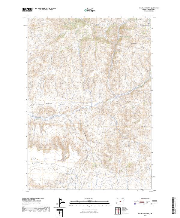
2023 Sugarloaf Butte
Crook County, OR
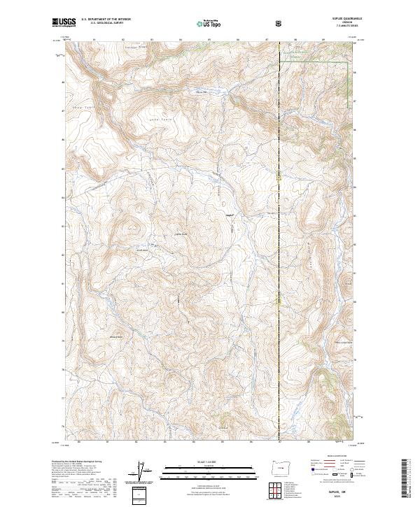
2023 Suplee
Crook County, OR
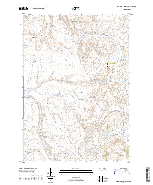
2023 Twelvemile Reservoir
Crook County, OR
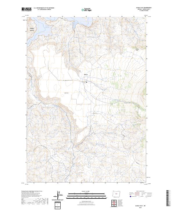
2024 Alkali Flat
Crook County, OR
2024 Bowman Dam
Crook County, OR
2024 Cadle Butte
Crook County, OR
2024 Committee Creek
Crook County, OR
2024 Conant Basin
Crook County, OR
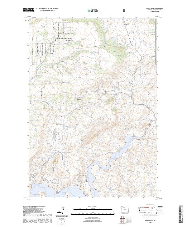
2024 Eagle Rock
Crook County, OR
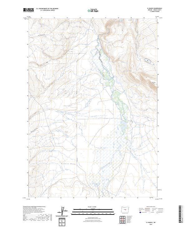
2024 G I Ranch
Crook County, OR
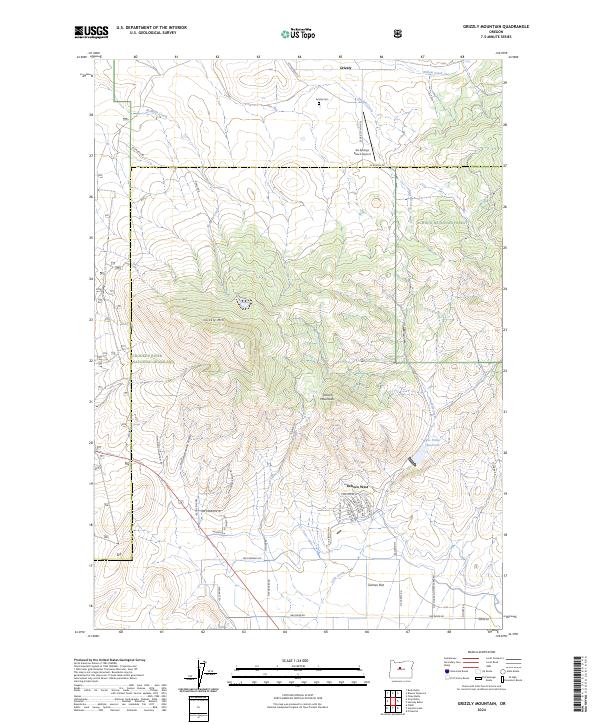
2024 Grizzly Mountain
Crook County, OR
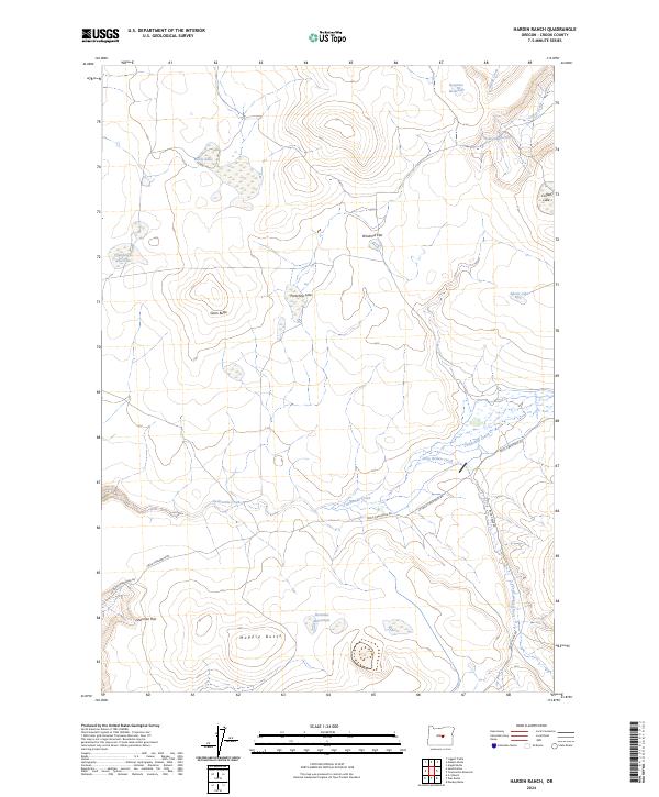
2024 Hardin Ranch
Crook County, OR
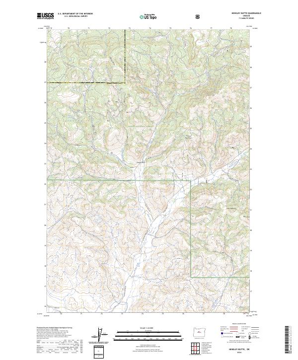
2024 Hensley Butte
Crook County, OR
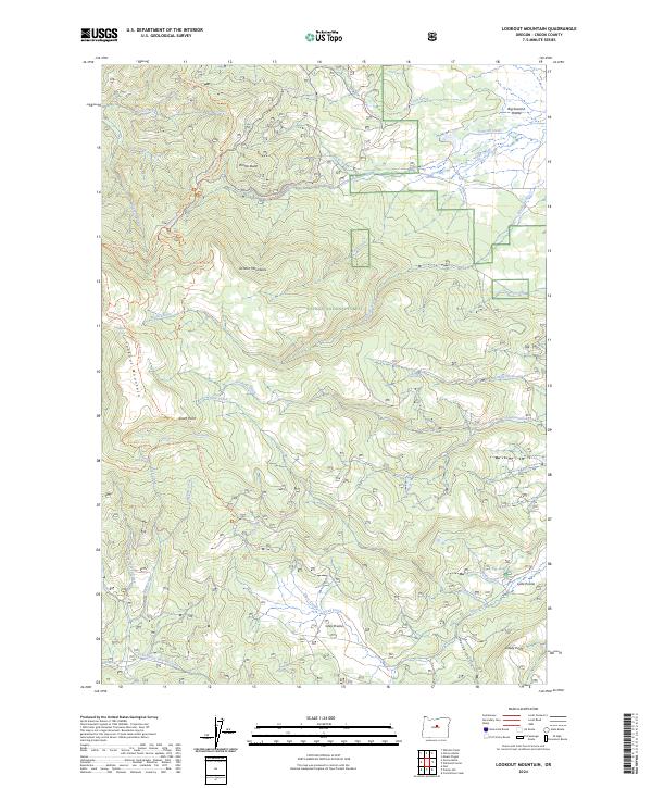
2024 Lookout Mountain
Crook County, OR
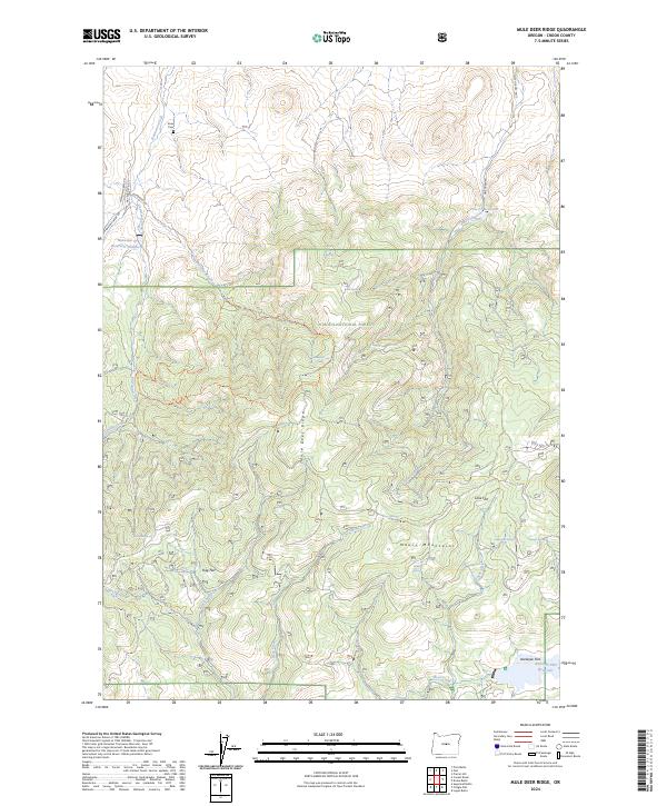
2024 Mule Deer Ridge
Crook County, OR
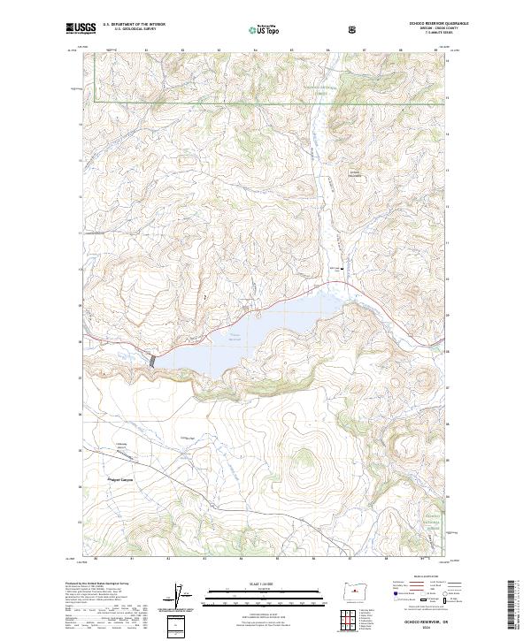
2024 Ochoco Reservoir
Crook County, OR
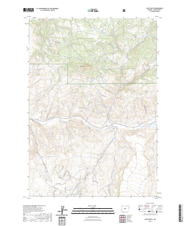
2024 Pilot Butte
Crook County, OR
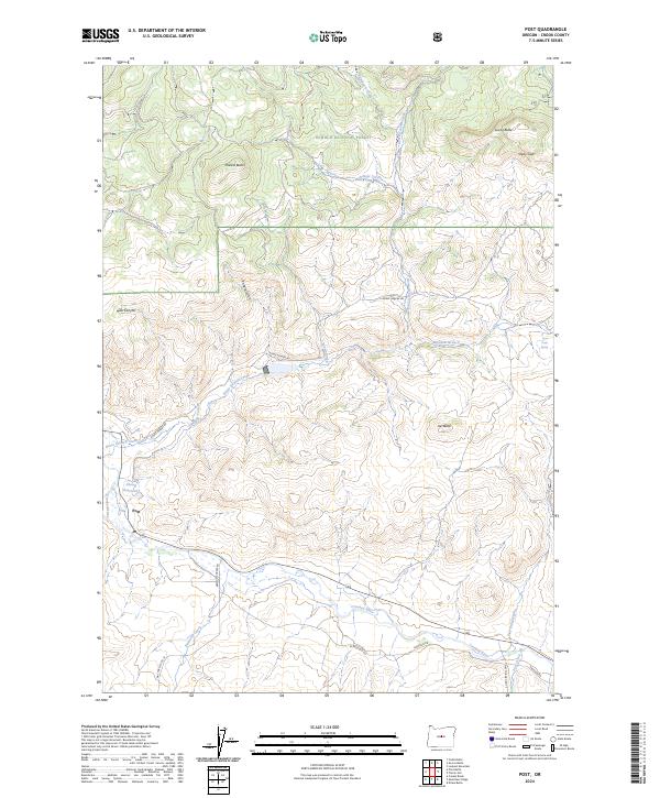
2024 Post
Crook County, OR
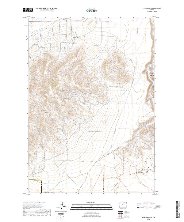
2024 Powell Buttes
Crook County, OR
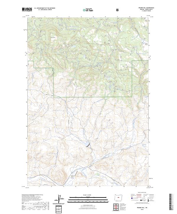
2024 Prairie Hill
Crook County, OR
2024 Rabbit Valley
Crook County, OR
2024 Stearns Butte
Crook County, OR
2024 Whistler Point
Crook County, OR
2024 Williams Prairie
Crook County, OR