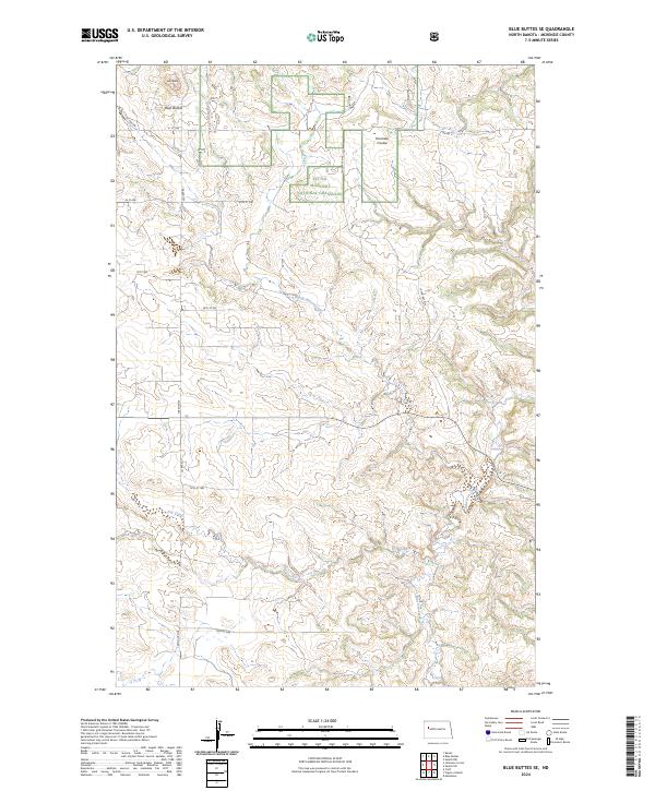
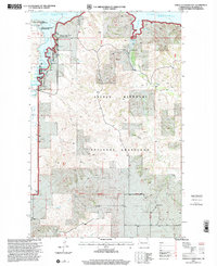
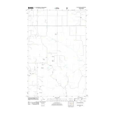
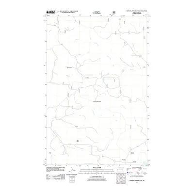
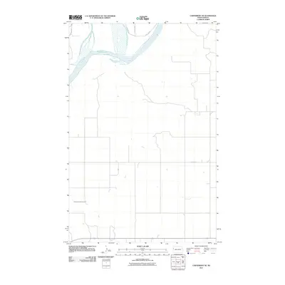
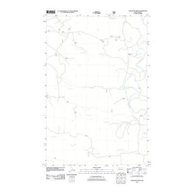
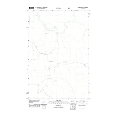
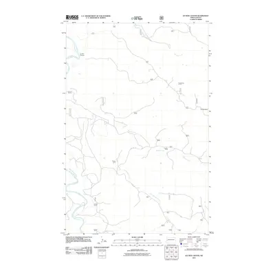
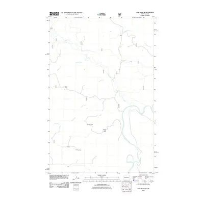
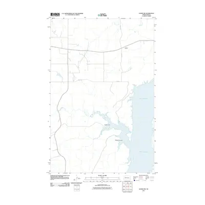
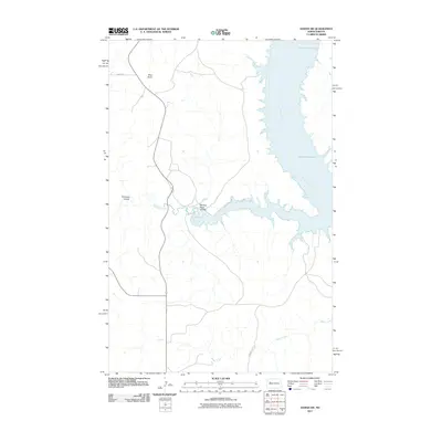
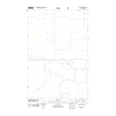
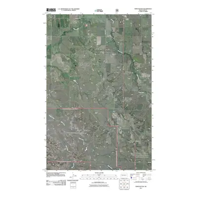
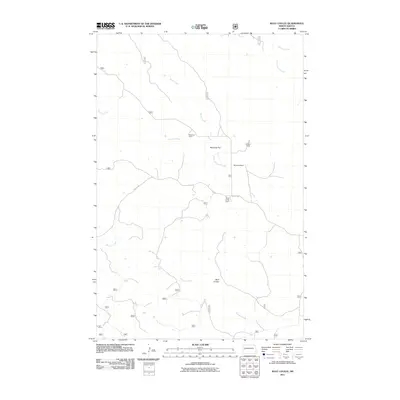
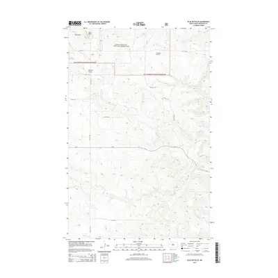
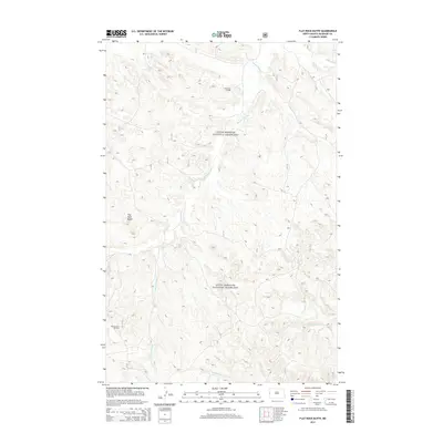
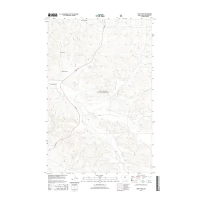
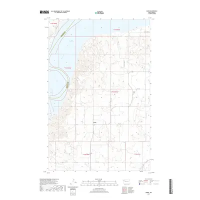
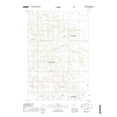
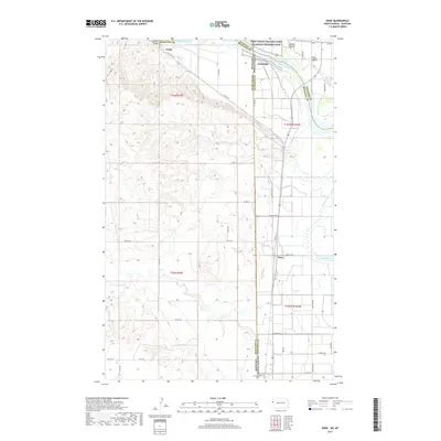
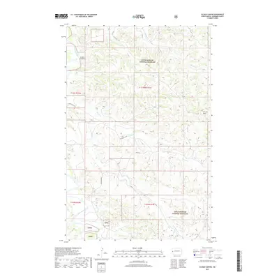
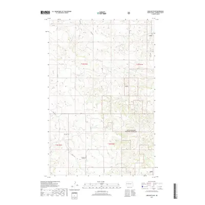
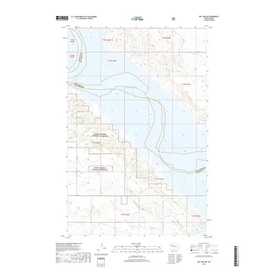
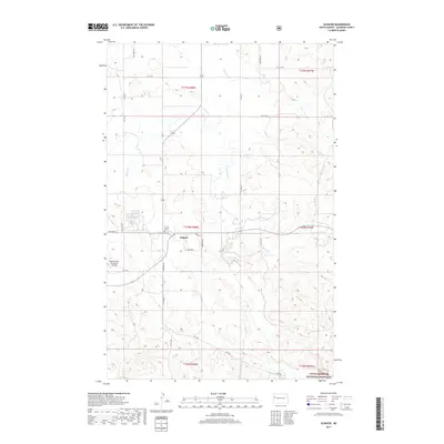
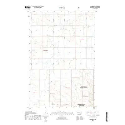
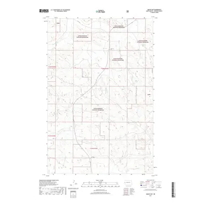
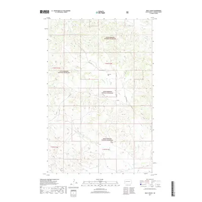
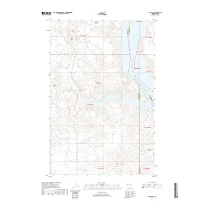
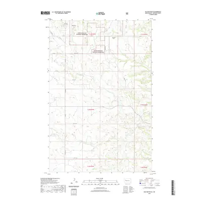
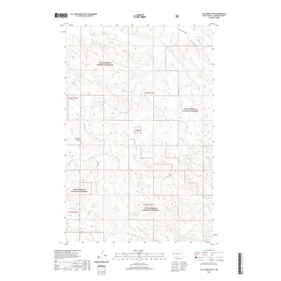
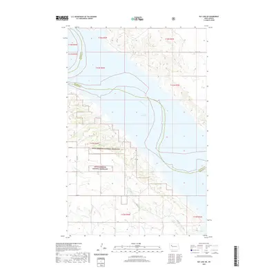
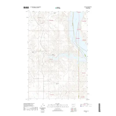
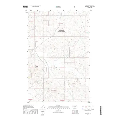
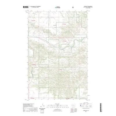
2024 Map of Blue Buttes SE
USGS Topo · Published 2024About this map
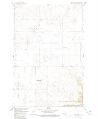
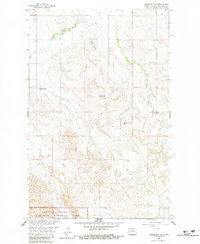
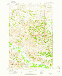
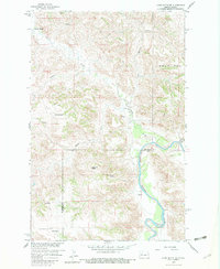
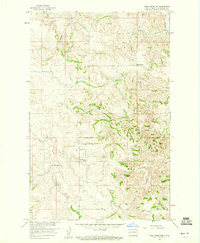
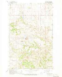
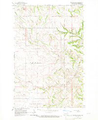
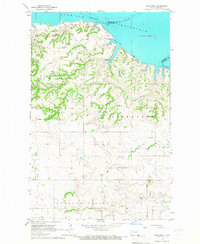
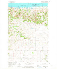
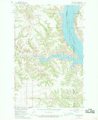
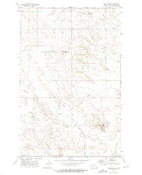
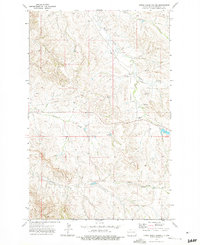
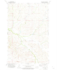
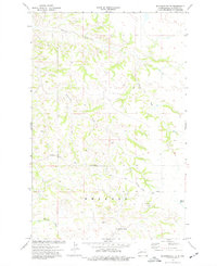
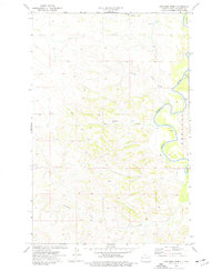
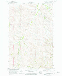
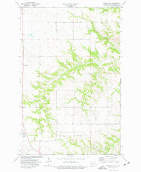
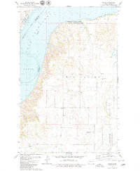
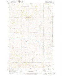
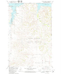
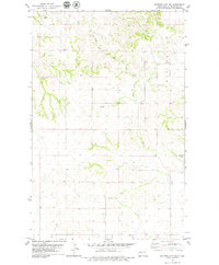
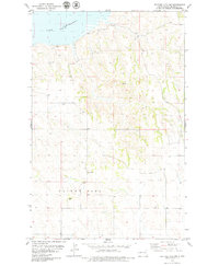
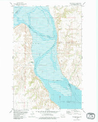
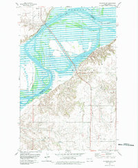
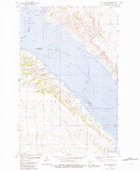
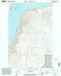
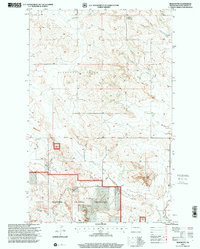
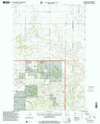
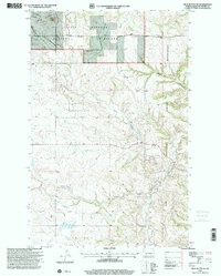
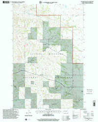
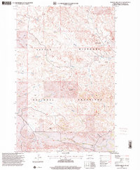
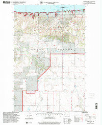
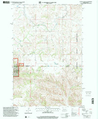
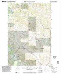
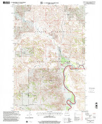
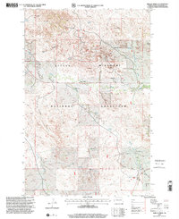
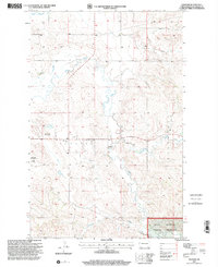
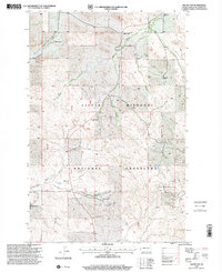
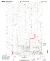
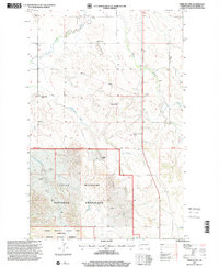
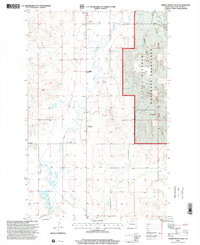
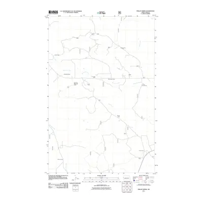
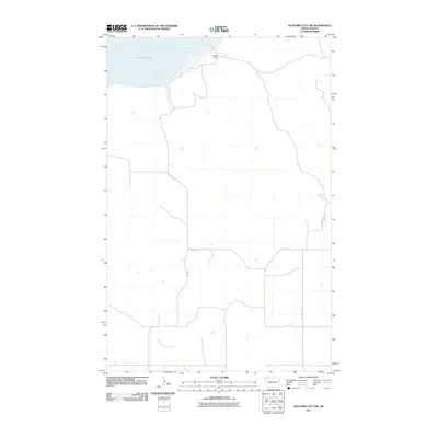
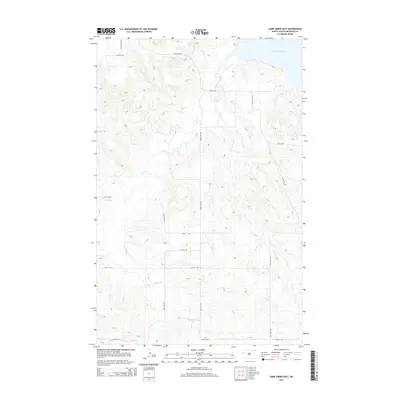
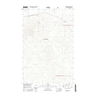
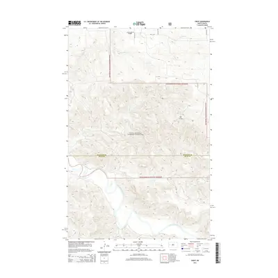
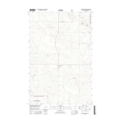
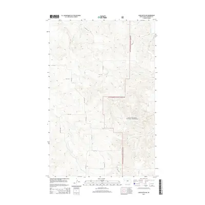
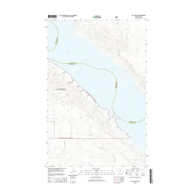
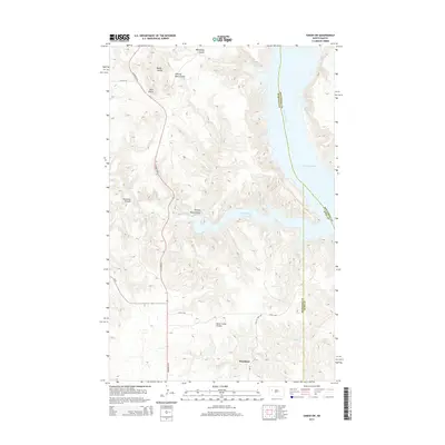
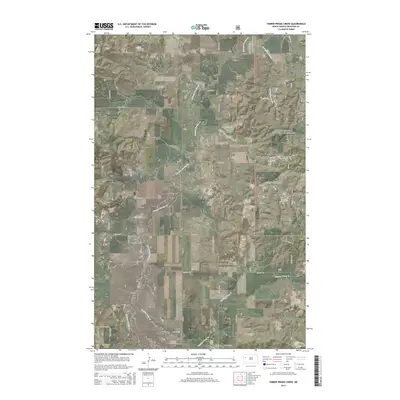
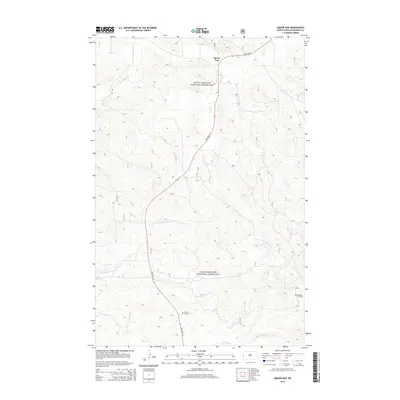
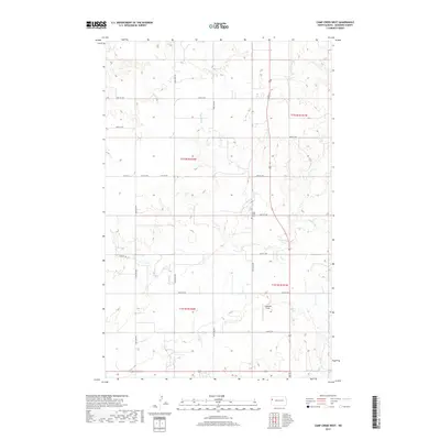
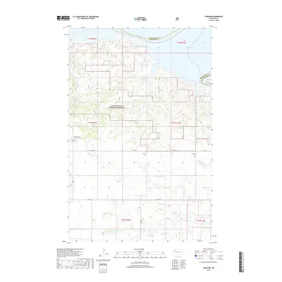
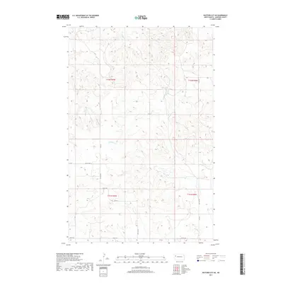
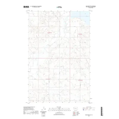
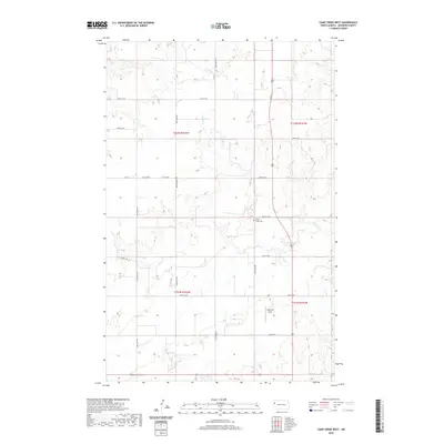
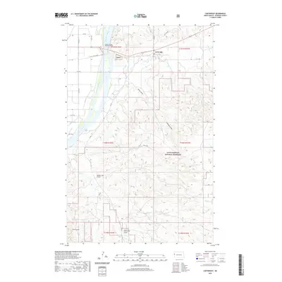
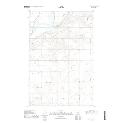
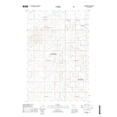
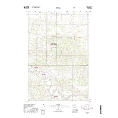
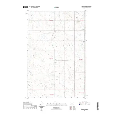
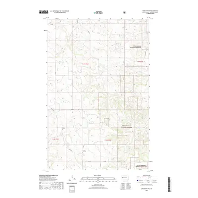
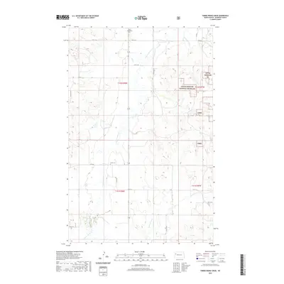
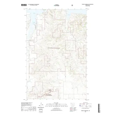
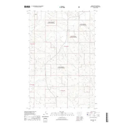
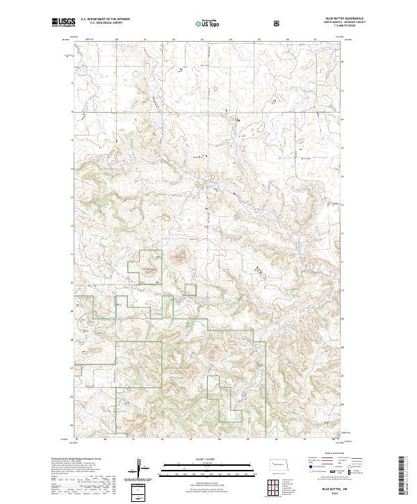
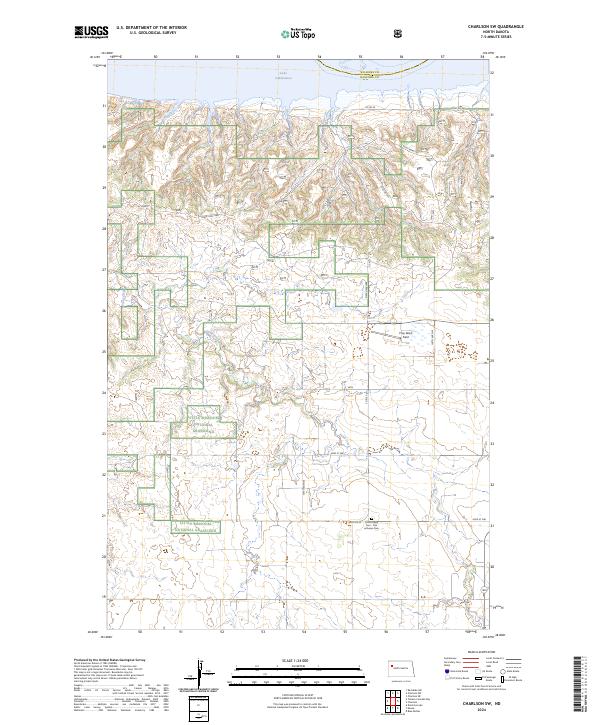
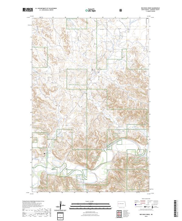
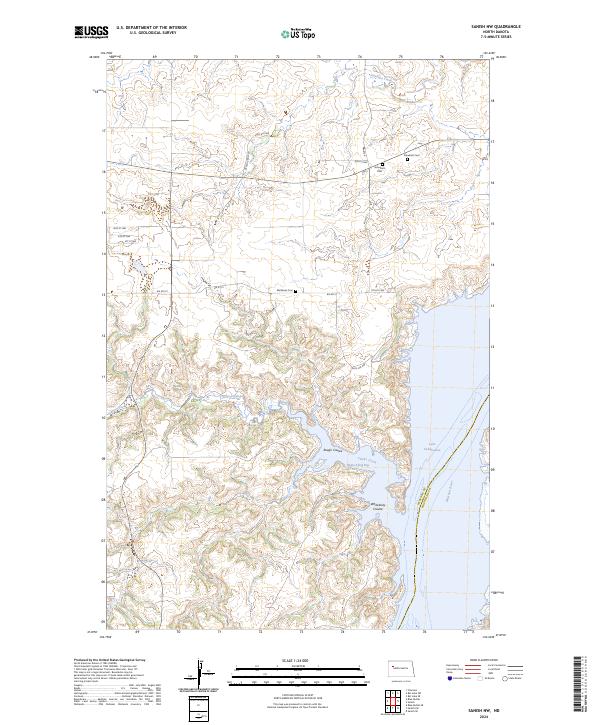
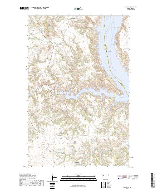
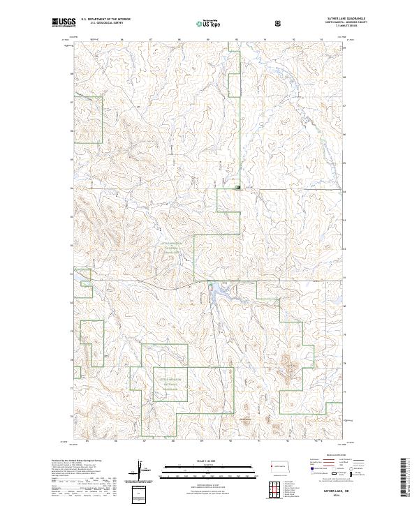
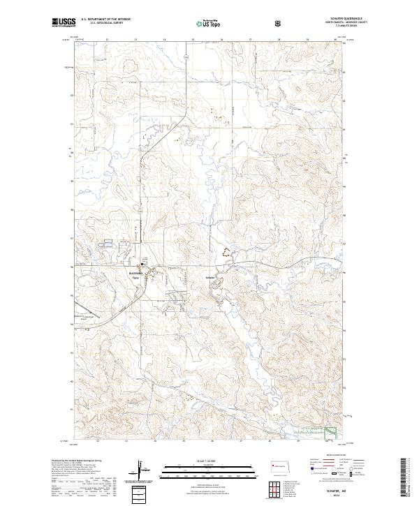
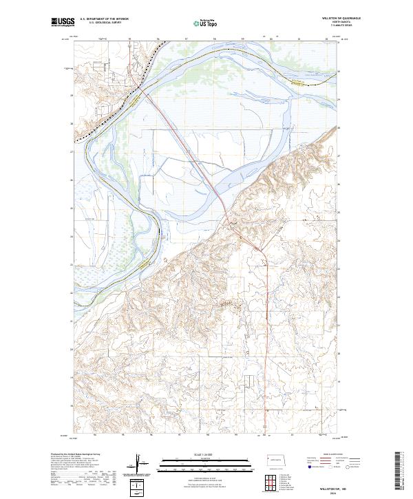
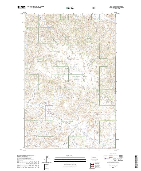
Little Missouri National Grassland encompasses a significant portion of this landscape, revealing a complex network of drainage systems and high-plains topography. The drainage patterns are dominated by Handy Water Creek and Bear Den Creek, which cut through the terrain alongside Foreman Coulee and multiple branches of Dry Creek. These watercourses have sculpted the earth around prominent elevations like Aura Butte and the namesake Blue Buttes in the northwestern sector. The map illustrates a contemporary grid of section lines and county infrastructure, including Co Rte 14 and Co Rte 57, which provide access to this ranching and conservation country. The presence of these named physical features alongside modern Bureau of Indian Affairs and county roads highlights the continued importance of land management and resource access in McKenzie County.
Find a feature on this map
28 named features on this map. Tap any name to fly to it.
Don’t see what you’re looking for? This feature index may not catch every label — zoom into the map to look around manually.
Map Details
Editions of this 2024 Blue Buttes SE Map
This is the sole edition of this map. No revisions or reprints were ever made.
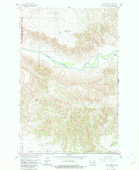
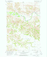
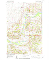
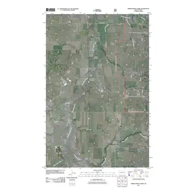
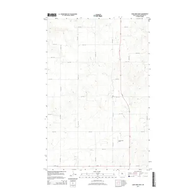
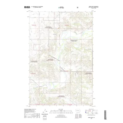
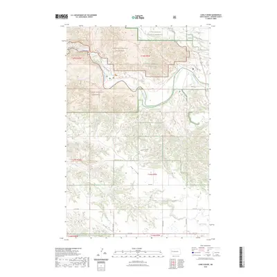
Historical Maps of Four Bears Segment Through Time
345 maps found
1958 Lone Butte
McKenzie County, ND
1958 Long X Divide
McKenzie County, ND
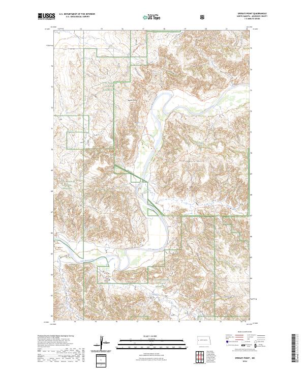
1958 Sperati Point
McKenzie County, ND
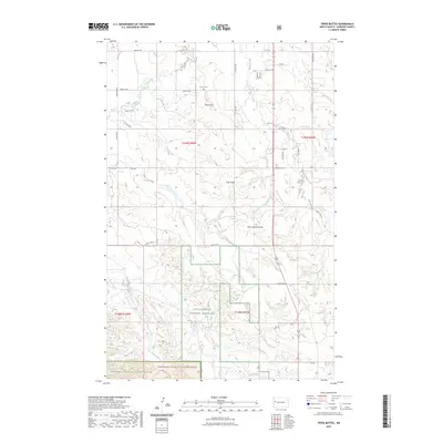
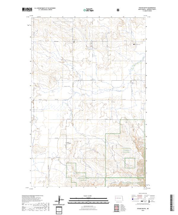
1958 Stocke Butte
McKenzie County, ND
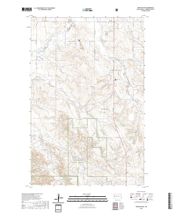
1958 Teepee Buttes
McKenzie County, ND
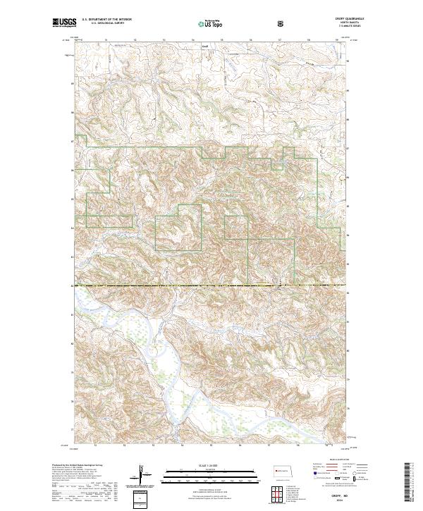
1959 Croff
McKenzie County, ND
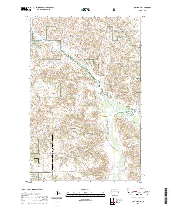
1959 Lone Butte NE
McKenzie County, ND
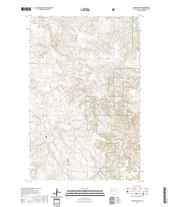
1959 Lone Butte NW
McKenzie County, ND
1965 Blue Buttes
McKenzie County, ND
1965 Blue Buttes SE
McKenzie County, ND
1965 Charlson
McKenzie County, ND
1965 Charlson SW
McKenzie County, ND
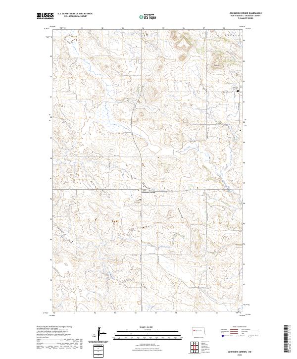
1965 Johnsons Corner
McKenzie County, ND
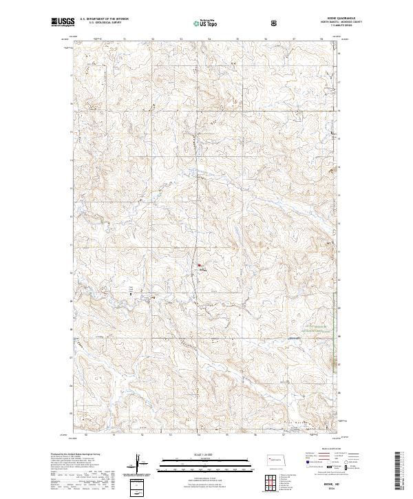
1965 Keene
McKenzie County, ND
1967 Sanish NW
McKenzie County, ND
1967 Sanish SW
McKenzie County, ND
1968 Buford
McKenzie County, ND
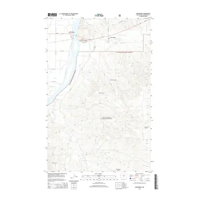
1969 Cartwright NE
McKenzie County, ND
1970 Figure 4 Ranch
McKenzie County, ND
1972 Bear Butte
McKenzie County, ND
1972 Burning Mine Butte
McKenzie County, ND
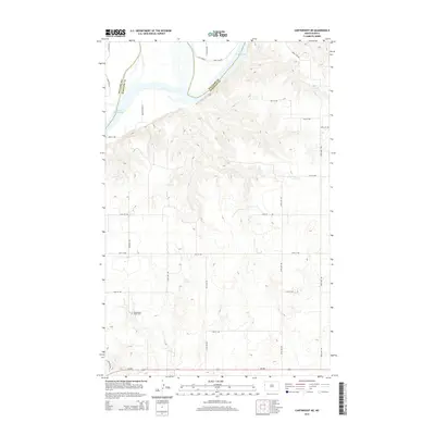
1972 Cartwright
McKenzie County, ND
1972 Charbonneau
McKenzie County, ND
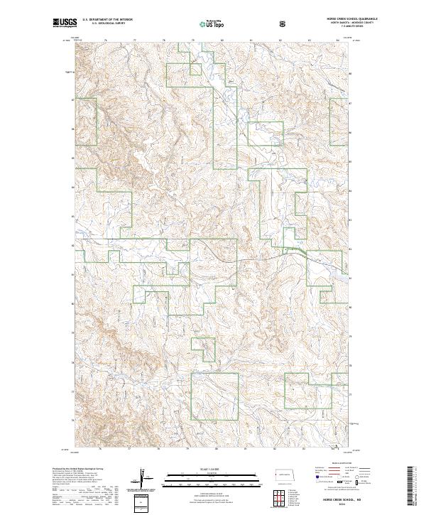
1972 Horse Creek School
McKenzie County, ND
1972 Moline School
McKenzie County, ND

1972 Phillip Spring
McKenzie County, ND
1972 Rawson
McKenzie County, ND
1972 Sather Lake
McKenzie County, ND
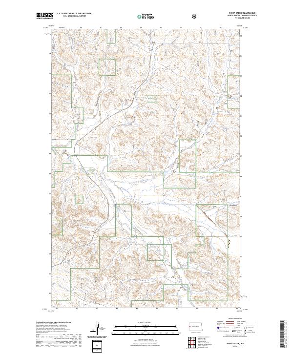
1972 Sheep Creek
McKenzie County, ND
1974 Buckskin Butte
McKenzie County, ND
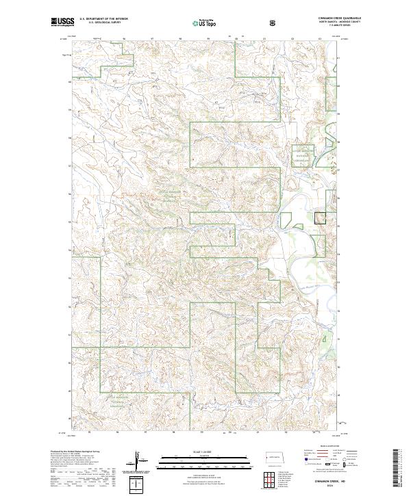
1974 Cinnamon Creek
McKenzie County, ND
1974 Flat Rock Butte
McKenzie County, ND
1974 Grassy Butte
McKenzie County, ND
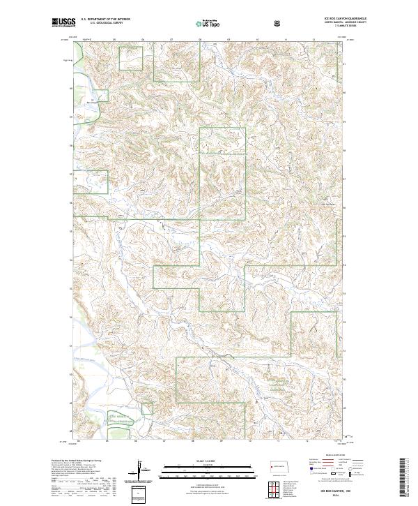
1974 Ice Box Canyon
McKenzie County, ND
1974 Squaw Gap
McKenzie County, ND
1974 Wolf Coulee
McKenzie County, ND
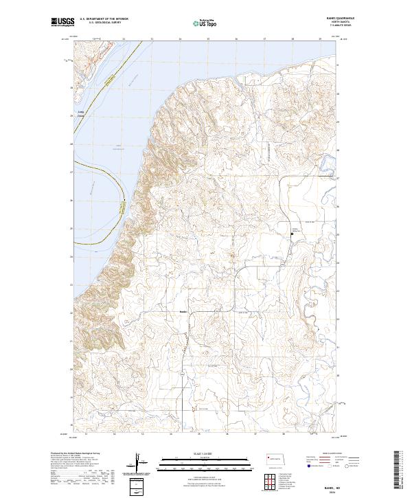
1978 Banks
McKenzie County, ND
1978 Camp Creek East
McKenzie County, ND
1978 Camp Creek West
McKenzie County, ND
1978 Schafer
McKenzie County, ND
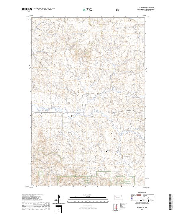
1978 Schafer SE
McKenzie County, ND
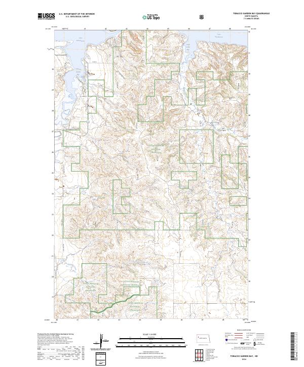
1978 Tobacco Garden Bay
McKenzie County, ND
1978 Watford City NE
McKenzie County, ND
1978 Watford City NW
McKenzie County, ND
1979 Williston SE
McKenzie County, ND
1979 Williston SW
McKenzie County, ND
1981 Rat Lake SW
McKenzie County, ND
1997 Banks
McKenzie County, ND
1997 Bear Butte
McKenzie County, ND
1997 Blue Buttes
McKenzie County, ND
1997 Blue Buttes SE
McKenzie County, ND
1997 Buckskin Butte
McKenzie County, ND
1997 Burning Mine Butte
McKenzie County, ND
1997 Cartwright
McKenzie County, ND
1997 Charbonneau
McKenzie County, ND
1997 Charlson
McKenzie County, ND
1997 Charlson SW
McKenzie County, ND
1997 Cinnamon Creek
McKenzie County, ND
1997 Croff
McKenzie County, ND
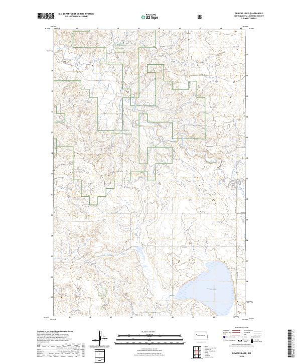
1997 Demicks Lake
McKenzie County, ND
1997 Figure 4 Ranch
McKenzie County, ND
1997 Flat Rock Butte
McKenzie County, ND
1997 Grassy Butte
McKenzie County, ND
1997 Horse Creek School
McKenzie County, ND
1997 Ice Box Canyon
McKenzie County, ND
1997 Johnsons Corner
McKenzie County, ND
1997 Keene
McKenzie County, ND
1997 Lone Butte
McKenzie County, ND
1997 Lone Butte NE
McKenzie County, ND
1997 Lone Butte NW
McKenzie County, ND
1997 Long X Divide
McKenzie County, ND
1997 Moline School
McKenzie County, ND
1997 Phillip Spring
McKenzie County, ND
1997 Rat Lake SW
McKenzie County, ND
1997 Red Wing Creek
McKenzie County, ND
1997 Sather Lake
McKenzie County, ND
1997 Schafer
McKenzie County, ND
1997 Schafer SE
McKenzie County, ND
1997 Sheep Creek
McKenzie County, ND
1997 Sperati Point
McKenzie County, ND
1997 Squaw Gap
McKenzie County, ND
1997 Stocke Butte
McKenzie County, ND
1997 Tepee Buttes
McKenzie County, ND
1997 Timber Prong Creek
McKenzie County, ND
1997 Tobacco Garden Bay
McKenzie County, ND
1997 Wolf Coulee
McKenzie County, ND
2011 Banks
McKenzie County, ND
2011 Bear Butte
McKenzie County, ND
2011 Blue Buttes
McKenzie County, ND
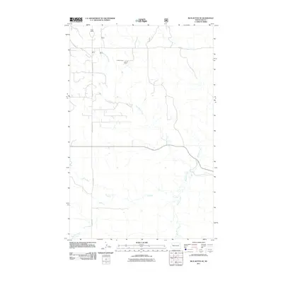
2011 Blue Buttes SE
McKenzie County, ND
2011 Buckskin Butte
McKenzie County, ND
2011 Buford
McKenzie County, ND
2011 Burning Mine Butte
McKenzie County, ND
2011 Camp Creek East
McKenzie County, ND
2011 Camp Creek West
McKenzie County, ND
2011 Cartwright
McKenzie County, ND
2011 Cartwright NE
McKenzie County, ND
2011 Charbonneau
McKenzie County, ND
2011 Charlson
McKenzie County, ND
2011 Charlson SW
McKenzie County, ND
2011 Cinnamon Creek
McKenzie County, ND
2011 Croff
McKenzie County, ND
2011 Demicks Lake
McKenzie County, ND
2011 Dore
McKenzie County, ND
2011 Figure 4 Ranch
McKenzie County, ND
2011 Flat Rock Butte
McKenzie County, ND
2011 Grassy Butte
McKenzie County, ND
2011 Horse Creek School
McKenzie County, ND
2011 Ice Box Canyon
McKenzie County, ND
2011 Johnsons Corner
McKenzie County, ND
2011 Keene
McKenzie County, ND
2011 Lone Butte
McKenzie County, ND
2011 Lone Butte NE
McKenzie County, ND
2011 Lone Butte NW
McKenzie County, ND
2011 Long X Divide
McKenzie County, ND
2011 Moline School
McKenzie County, ND
2011 Phillip Spring
McKenzie County, ND
2011 Rat Lake SW
McKenzie County, ND
2011 Rawson
McKenzie County, ND
2011 Red Wing Creek
McKenzie County, ND
2011 Sanish NW
McKenzie County, ND
2011 Sanish SW
McKenzie County, ND
2011 Sather Lake
McKenzie County, ND
2011 Schafer
McKenzie County, ND
2011 Schafer SE
McKenzie County, ND
2011 Sheep Creek
McKenzie County, ND
2011 Sperati Point
McKenzie County, ND
2011 Stocke Butte
McKenzie County, ND
2011 Tepee Buttes
McKenzie County, ND
2011 Timber Prong Creek
McKenzie County, ND
2011 Tobacco Garden Bay
McKenzie County, ND
2011 Watford City NE
McKenzie County, ND
2011 Watford City NW
McKenzie County, ND
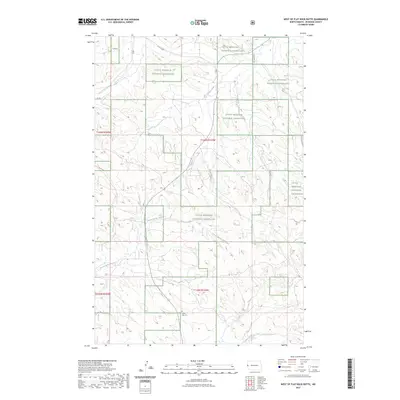
2011 West of Flat Rock Butte
McKenzie County, ND
2011 Williston SE
McKenzie County, ND
2011 Williston SW
McKenzie County, ND
2011 Wolf Coulee
McKenzie County, ND
2014 Banks
McKenzie County, ND
2014 Bear Butte
McKenzie County, ND
2014 Blue Buttes
McKenzie County, ND
2014 Blue Buttes SE
McKenzie County, ND
2014 Buckskin Butte
McKenzie County, ND
2014 Buford
McKenzie County, ND
2014 Burning Mine Butte
McKenzie County, ND
2014 Camp Creek East
McKenzie County, ND
2014 Camp Creek West
McKenzie County, ND
2014 Cartwright
McKenzie County, ND
2014 Cartwright NE
McKenzie County, ND
2014 Charbonneau
McKenzie County, ND
2014 Charlson
McKenzie County, ND
2014 Charlson SW
McKenzie County, ND
2014 Cinnamon Creek
McKenzie County, ND
2014 Croff
McKenzie County, ND
2014 Demicks Lake
McKenzie County, ND
2014 Dore
McKenzie County, ND
2014 Figure 4 Ranch
McKenzie County, ND
2014 Flat Rock Butte
McKenzie County, ND
2014 Grassy Butte
McKenzie County, ND
2014 Horse Creek School
McKenzie County, ND
2014 Ice Box Canyon
McKenzie County, ND
2014 Johnsons Corner
McKenzie County, ND
2014 Keene
McKenzie County, ND
2014 Lone Butte
McKenzie County, ND
2014 Lone Butte NE
McKenzie County, ND
2014 Lone Butte NW
McKenzie County, ND
2014 Long X Divide
McKenzie County, ND
2014 Moline School
McKenzie County, ND
2014 Phillip Spring
McKenzie County, ND
2014 Rat Lake SW
McKenzie County, ND
2014 Rawson
McKenzie County, ND
2014 Red Wing Creek
McKenzie County, ND
2014 Sanish NW
McKenzie County, ND
2014 Sanish SW
McKenzie County, ND
2014 Sather Lake
McKenzie County, ND
2014 Schafer
McKenzie County, ND
2014 Schafer SE
McKenzie County, ND
2014 Sheep Creek
McKenzie County, ND
2014 Sperati Point
McKenzie County, ND
2014 Stocke Butte
McKenzie County, ND
2014 Tepee Buttes
McKenzie County, ND
2014 Timber Prong Creek
McKenzie County, ND
2014 Tobacco Garden Bay
McKenzie County, ND
2014 Watford City NE
McKenzie County, ND
2014 Watford City NW
McKenzie County, ND
2014 West of Flat Rock Butte
McKenzie County, ND
2014 Williston SE
McKenzie County, ND
2014 Williston SW
McKenzie County, ND
2014 Wolf Coulee
McKenzie County, ND
2017 Banks
McKenzie County, ND
2017 Bear Butte
McKenzie County, ND
2017 Blue Buttes
McKenzie County, ND
2017 Blue Buttes SE
McKenzie County, ND
2017 Buckskin Butte
McKenzie County, ND
2017 Buford
McKenzie County, ND
2017 Burning Mine Butte
McKenzie County, ND
2017 Camp Creek East
McKenzie County, ND
2017 Camp Creek West
McKenzie County, ND
2017 Cartwright
McKenzie County, ND
2017 Cartwright NE
McKenzie County, ND
2017 Charbonneau
McKenzie County, ND
2017 Charlson
McKenzie County, ND
2017 Charlson SW
McKenzie County, ND
2017 Cinnamon Creek
McKenzie County, ND
2017 Demicks Lake
McKenzie County, ND
2017 Dore
McKenzie County, ND
2017 Flat Rock Butte
McKenzie County, ND
2017 Grassy Butte
McKenzie County, ND
2017 Horse Creek School
McKenzie County, ND
2017 Ice Box Canyon
McKenzie County, ND
2017 Johnsons Corner
McKenzie County, ND
2017 Lone Butte
McKenzie County, ND
2017 Lone Butte NE
McKenzie County, ND
2017 Lone Butte NW
McKenzie County, ND
2017 Long X Divide
McKenzie County, ND
2017 Moline School
McKenzie County, ND
2017 Phillip Spring
McKenzie County, ND
2017 Rat Lake SW
McKenzie County, ND
2017 Rawson
McKenzie County, ND
2017 Red Wing Creek
McKenzie County, ND
2017 Sanish NW
McKenzie County, ND

2017 Sather Lake
McKenzie County, ND
2017 Schafer
McKenzie County, ND
2017 Schafer SE
McKenzie County, ND
2017 Sheep Creek
McKenzie County, ND
2017 Sperati Point
McKenzie County, ND
2017 Stocke Butte
McKenzie County, ND
2017 Tepee Buttes
McKenzie County, ND
2017 Timber Prong Creek
McKenzie County, ND
2017 Tobacco Garden Bay
McKenzie County, ND
2017 Watford City NE
McKenzie County, ND

2017 Watford City NW
McKenzie County, ND
2017 West of Flat Rock Butte
McKenzie County, ND
2017 Williston SE
McKenzie County, ND
2017 Williston SW
McKenzie County, ND
2017 Wolf Coulee
McKenzie County, ND
2018 Croff
McKenzie County, ND
2018 Figure 4 Ranch
McKenzie County, ND
2018 Keene
McKenzie County, ND
2018 Sanish SW
McKenzie County, ND
2020 Banks
McKenzie County, ND
2020 Bear Butte
McKenzie County, ND
2020 Blue Buttes
McKenzie County, ND
2020 Blue Buttes SE
McKenzie County, ND
2020 Buckskin Butte
McKenzie County, ND
2020 Buford
McKenzie County, ND
2020 Burning Mine Butte
McKenzie County, ND
2020 Camp Creek East
McKenzie County, ND
2020 Camp Creek West
McKenzie County, ND
2020 Cartwright
McKenzie County, ND
2020 Cartwright NE
McKenzie County, ND
2020 Charbonneau
McKenzie County, ND
2020 Charlson
McKenzie County, ND
2020 Charlson SW
McKenzie County, ND
2020 Cinnamon Creek
McKenzie County, ND
2020 Croff
McKenzie County, ND
2020 Demicks Lake
McKenzie County, ND
2020 Dore
McKenzie County, ND
2020 Figure 4 Ranch
McKenzie County, ND
2020 Flat Rock Butte
McKenzie County, ND
2020 Grassy Butte
McKenzie County, ND
2020 Horse Creek School
McKenzie County, ND
2020 Ice Box Canyon
McKenzie County, ND
2020 Johnsons Corner
McKenzie County, ND
2020 Keene
McKenzie County, ND
2020 Lone Butte
McKenzie County, ND
2020 Lone Butte NE
McKenzie County, ND
2020 Lone Butte NW
McKenzie County, ND
2020 Long X Divide
McKenzie County, ND
2020 Moline School
McKenzie County, ND
2020 Phillip Spring
McKenzie County, ND
2020 Rat Lake SW
McKenzie County, ND
2020 Rawson
McKenzie County, ND
2020 Red Wing Creek
McKenzie County, ND
2020 Sanish NW
McKenzie County, ND
2020 Sanish SW
McKenzie County, ND
2020 Sather Lake
McKenzie County, ND
2020 Schafer
McKenzie County, ND
2020 Schafer SE
McKenzie County, ND
2020 Sheep Creek
McKenzie County, ND
2020 Sperati Point
McKenzie County, ND
2020 Stocke Butte
McKenzie County, ND
2020 Tepee Buttes
McKenzie County, ND
2020 Timber Prong Creek
McKenzie County, ND
2020 Tobacco Garden Bay
McKenzie County, ND
2020 Watford City NE
McKenzie County, ND
2020 Watford City NW
McKenzie County, ND
2020 West of Flat Rock Butte
McKenzie County, ND
2020 Williston SE
McKenzie County, ND
2020 Williston SW
McKenzie County, ND
2020 Wolf Coulee
McKenzie County, ND
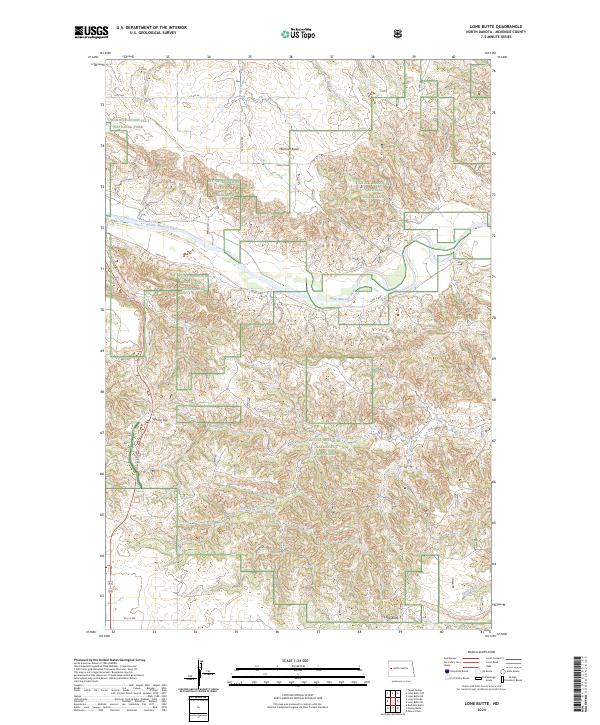
2023 Lone Butte
McKenzie County, ND
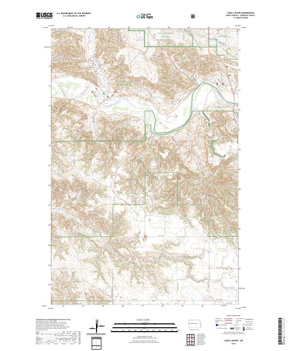
2023 Long X Divide
McKenzie County, ND
2023 Tepee Buttes
McKenzie County, ND
2023 West of Flat Rock Butte
McKenzie County, ND
2024 Banks
McKenzie County, ND
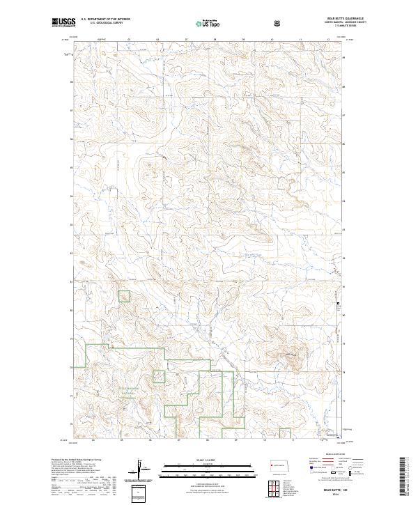
2024 Bear Butte
McKenzie County, ND
2024 Blue Buttes
McKenzie County, ND
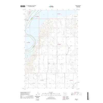
2024 Blue Buttes SE
McKenzie County, ND
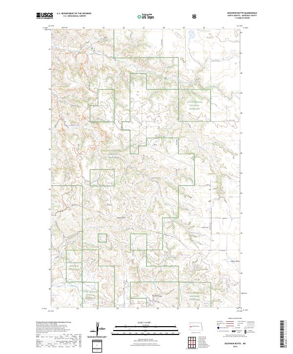
2024 Buckskin Butte
McKenzie County, ND
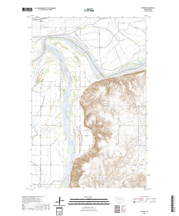
2024 Buford
McKenzie County, ND
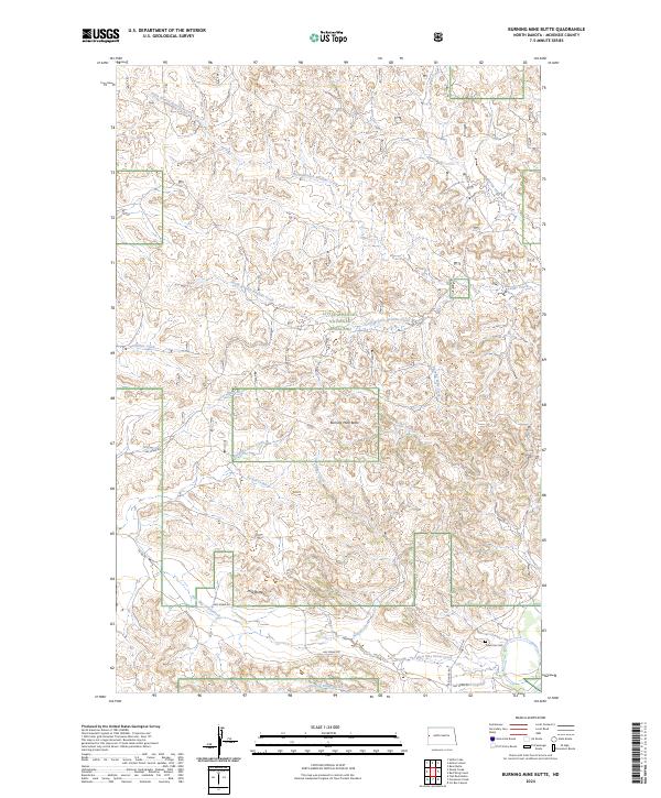
2024 Burning Mine Butte
McKenzie County, ND
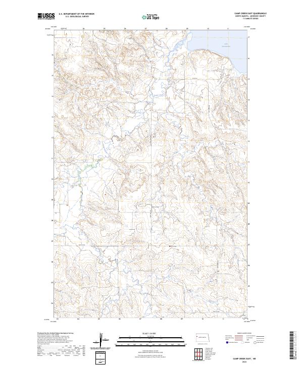
2024 Camp Creek East
McKenzie County, ND
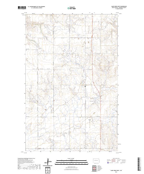
2024 Camp Creek West
McKenzie County, ND
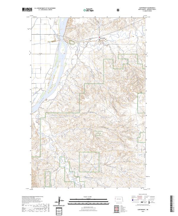
2024 Cartwright
McKenzie County, ND
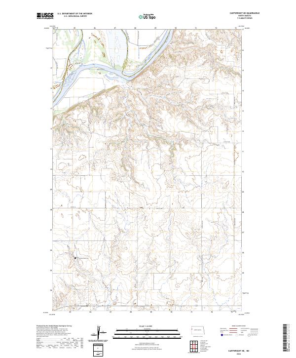
2024 Cartwright NE
McKenzie County, ND
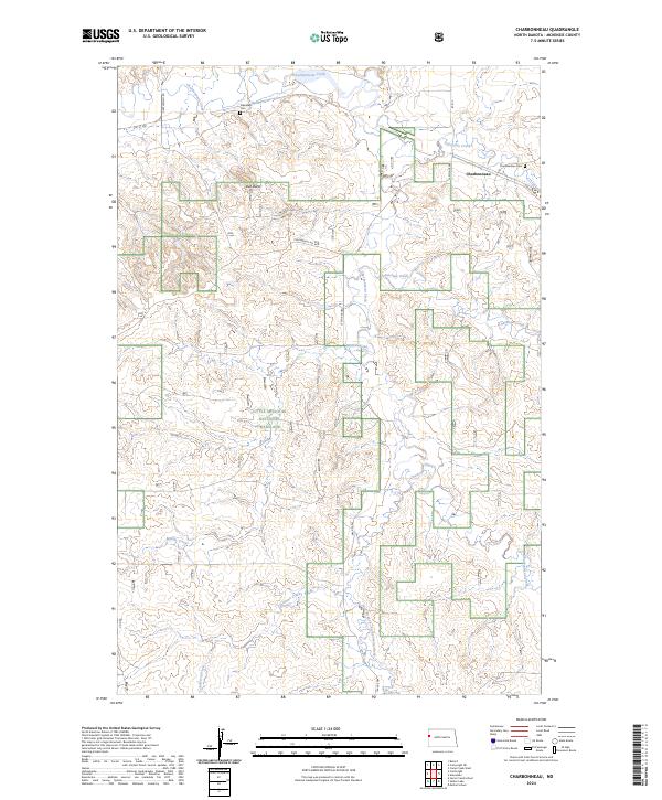
2024 Charbonneau
McKenzie County, ND
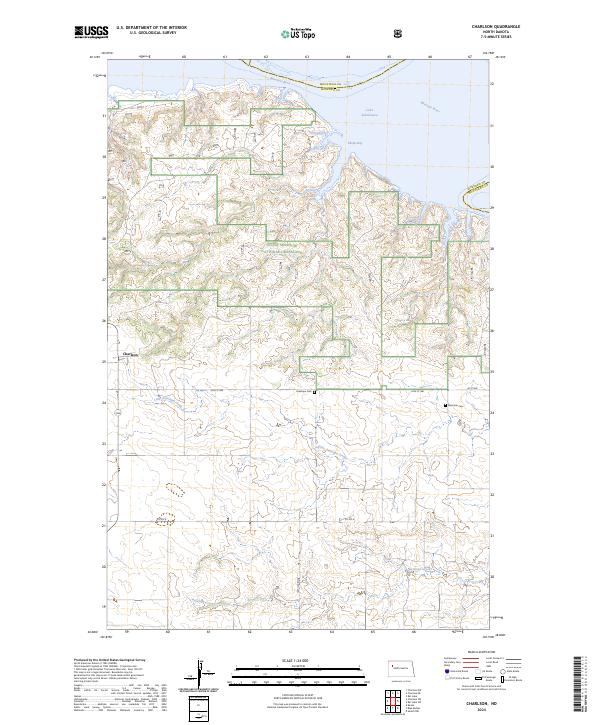
2024 Charlson
McKenzie County, ND
2024 Charlson SW
McKenzie County, ND
2024 Cinnamon Creek
McKenzie County, ND
2024 Croff
McKenzie County, ND
2024 Demicks Lake
McKenzie County, ND
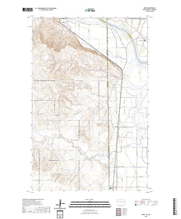
2024 Dore
McKenzie County, ND
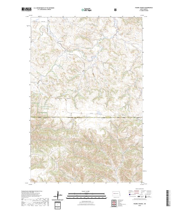
2024 Figure 4 Ranch
McKenzie County, ND
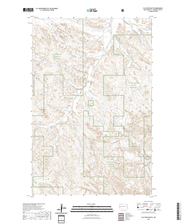
2024 Flat Rock Butte
McKenzie County, ND
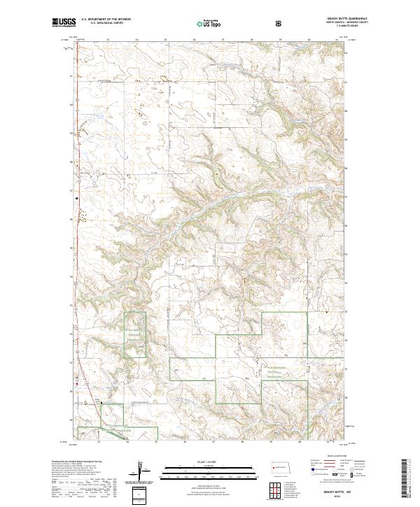
2024 Grassy Butte
McKenzie County, ND
2024 Horse Creek School
McKenzie County, ND
2024 Ice Box Canyon
McKenzie County, ND
2024 Johnsons Corner
McKenzie County, ND
2024 Keene
McKenzie County, ND
2024 Lone Butte
McKenzie County, ND
2024 Lone Butte NE
McKenzie County, ND
2024 Lone Butte NW
McKenzie County, ND
2024 Long X Divide
McKenzie County, ND
2024 Moline School
McKenzie County, ND
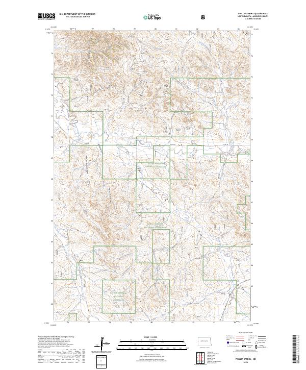
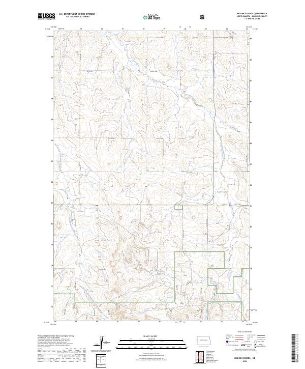
2024 Phillip Spring
McKenzie County, ND
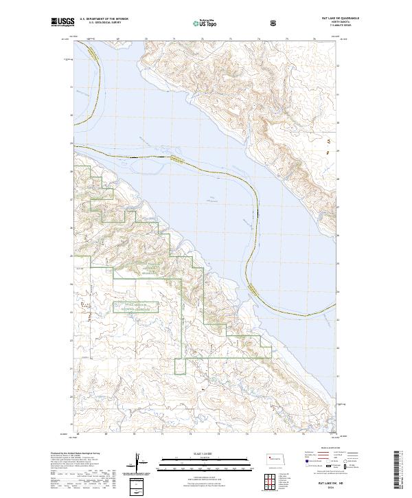
2024 Rat Lake SW
McKenzie County, ND
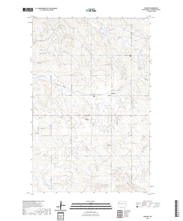
2024 Rawson
McKenzie County, ND
2024 Red Wing Creek
McKenzie County, ND
2024 Sanish NW
McKenzie County, ND
2024 Sanish SW
McKenzie County, ND
2024 Sather Lake
McKenzie County, ND
2024 Schafer
McKenzie County, ND
2024 Schafer SE
McKenzie County, ND
2024 Sheep Creek
McKenzie County, ND
2024 Sperati Point
McKenzie County, ND
2024 Stocke Butte
McKenzie County, ND
2024 Tepee Buttes
McKenzie County, ND
2024 Timber Prong Creek
McKenzie County, ND
2024 Tobacco Garden Bay
McKenzie County, ND
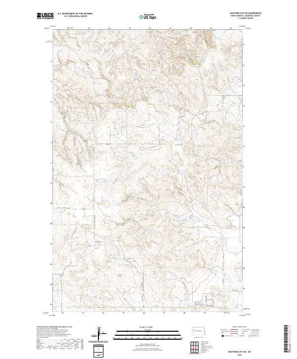
2024 Watford City NE
McKenzie County, ND
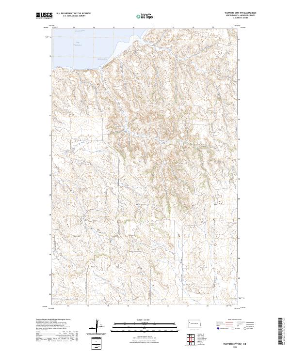
2024 Watford City NW
McKenzie County, ND
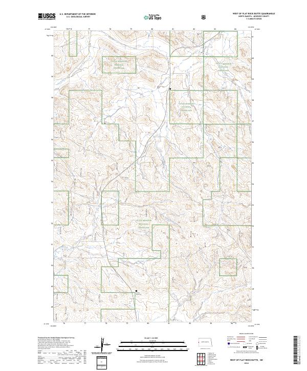
2024 West of Flat Rock Butte
McKenzie County, ND
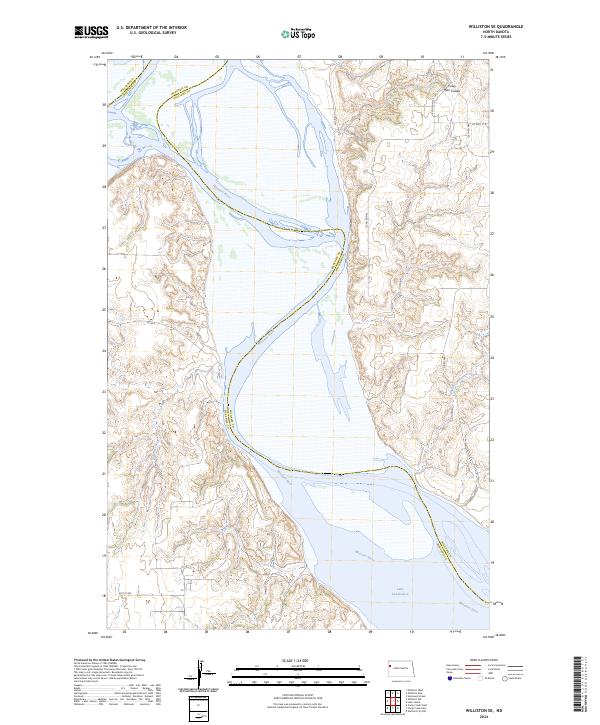
2024 Williston SE
McKenzie County, ND
2024 Williston SW
McKenzie County, ND
2024 Wolf Coulee
McKenzie County, ND