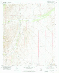
1972 Map of Telegraph Wash
USGS Topo · Published 1975About this map
The Santa Teresa Mountains dominate the western landscape of this mid-1970s survey, where the rugged terrain transitions into the wide drainage systems of the San Carlos Indian Reservation. This arid region in Graham County is defined by its water management and ranching history, evidenced by the isolated Y L Ranch and a network of remote water sources like Brimhall Well and Middle Point Tank. The map documents a complex system of seasonal waterways, including the prominent Telegraph Wash and Black Rock Wash, which carve through the high desert. A labyrinth of Jeep Trails provides the primary access through this territory, while the Old Mil Res Bdy in the northeast corner hints at the area's historical military jurisdictional legacy. The cartography provides a clear picture of the boundary lines and topographic shifts where the high peaks meet the broad alluvial fans.
Find a feature on this map
19 named features on this map. Tap any name to fly to it.
Don’t see what you’re looking for? This feature index may not catch every label — zoom into the map to look around manually.
Map Details
Editions of this 1972 Telegraph Wash Map
This is the sole edition of this map. No revisions or reprints were ever made.
Other maps of this area

1944 · Jackson Mtn.
USGS Topo · 1:62,500

1946 · Jackson Mtn.
USGS Topo · 1:62,500

1954 · Silver City
USGS Topo · 1:250,000

1954 · Clifton
USGS Topo · 1:250,000

1954 · Mesa
USGS Topo · 1:250,000

1956 · Tucson
USGS Topo · 1:250,000

1957 · Mesa
USGS Topo · 1:250,000

1957 · Clifton
USGS Topo · 1:250,000

1958 · Silver City
USGS Topo · 1:250,000

1958 · Clifton
USGS Topo · 1:250,000