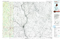
1993 Map of Houlton
USGS Topo · Published 1993About this map
The Meduxnekeag River flows through the heart of this international borderlands survey, where the dense woodlands of Aroostook County, Maine, meet Carleton County, New Brunswick. Centered on the regional hub of Houlton, the map illustrates a network of agricultural settlements and cross-border transit points, including the Houlton International Airport and the prominent U.S. Customs station. The geography is defined by a series of low ridges such as Collins Ridge and Chandler Ridge, interspersed with numerous glacial lakes like Nickerson Lake and Drews Lake. The settlement pattern reflects the area's rural character, marked by small clusters and intersections like Starkey Corners, Jewells Corner, and Carys Mills, as well as the linear development along Littleton Station. The eastern half of the sheet covers the Canadian side, featuring the town of Woodstock situated along the broad Saint John River.
Find a feature on this map
69 named features on this map. Tap any name to fly to it.
Don’t see what you’re looking for? This feature index may not catch every label — zoom into the map to look around manually.
Map Details
Editions of this 1993 Houlton Map
This is the sole edition of this map. No revisions or reprints were ever made.
Other maps of this area

1934 · Bridgewater
USGS Topo · 1:48,000

1935 · Howe Brook
USGS Topo · 1:48,000

1935 · Presque Isle
USGS Topo · 1:62,500

1936 · Mars Hill
USGS Topo · 1:48,000

1937 · Smyrna Mills
USGS Topo · 1:62,500

1938 · Bridgewater
USGS Topo · 1:62,500

1938 · Houlton
USGS Topo · 1:62,500

1939 · Howe Brook
USGS Topo · 1:62,500

1940 · Mars Hill
USGS Topo · 1:62,500

1940 · Amity
USGS Topo · 1:62,500