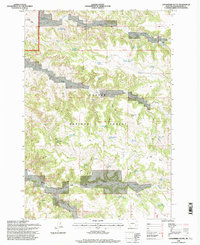
1995 Map of Goodspeed Butte
USGS Topo · Published 1998About this map
Custer National Forest lands dominate this mid-1990s landscape in Powder River County, where the terrain is defined by a dense network of draws and springs supporting local livestock and ranching infrastructure. Goodspeed Butte and Taylor Butte serve as primary landmarks in a region carved by Ash Draw, Goodspeed Draw, and Nedum Draw. The map documents a complex system of water management essential for high-plains agriculture, including numerous named catchments such as Dry Gulch Reservoir, Hawks Reservoir, and Stewart Reservoir No 2. Localized industry and historical resource use are evidenced by named points like Elk Creek Sawmill Spring and Tate Well, illustrating how earlier homesteading and forestry efforts utilized the scattered water sources across these remote ridges and gulches.
Find a feature on this map
50 named features on this map. Tap any name to fly to it.
Don’t see what you’re looking for? This feature index may not catch every label — zoom into the map to look around manually.
Map Details
Editions of this 1995 Goodspeed Butte Map
This is the sole edition of this map. No revisions or reprints were ever made.
Other maps of this area

1954 · Hardin
USGS Topo · 1:250,000

1954 · Ekalaka
USGS Topo · 1:250,000

1956 · Ekalaka
USGS Topo · 1:250,000

1957 · Hardin
USGS Topo · 1:250,000

1958 · Ekalaka
USGS Topo · 1:250,000

1958 · Hardin
USGS Topo · 1:250,000

1965 · Ekalaka
USGS Topo · 1:250,000

1966 · Goodspeed Butte
USGS Topo · 1:24,000

1966 · Phillips Butte
USGS Topo · 1:24,000

1966 · Fort Howes
USGS Topo · 1:24,000