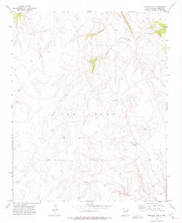
1971 Map of Goetsch Lake
USGS Topo · Published 1975About this map
Goetsch Ranch and its eponymous Goetsch Lake anchor the eastern slopes of this 1970s landscape, providing a rare look at the local ranching infrastructure of San Miguel County during this era. The topography is defined by the winding course of Tipton Creek, which cuts through the high country as it flows generally northward. This survey captures a moment when the boundaries of Las Vegas and Mora intersect in a sparsely settled region, highlighting the transition between these two prominent New Mexico districts. The land is marked by detailed elevation contours and secondary roads that connect isolated homesteads to the wider region, reflecting the enduring rural character of the high plains before further modernization changed the local footprint.
Find a feature on this map
7 named features on this map. Tap any name to fly to it.
Don’t see what you’re looking for? This feature index may not catch every label — zoom into the map to look around manually.
Map Details
Editions of this 1971 Goetsch Lake Map
This is the sole edition of this map. No revisions or reprints were ever made.
Other maps of this area

1889 · Las Vegas
USGS Topo · 1:125,000

1891 · Las Vegas
USGS Topo · 1:125,000

1892 · Watrous
USGS Topo · 1:125,000

1893 · Las Vegas
USGS Topo · 1:125,000

1894 · Watrous
USGS Topo · 1:125,000

1954 · Santa Fe
USGS Topo · 1:250,000

1958 · Santa Fe
USGS Topo · 1:250,000
1963 · Las Vegas SE
USGS Topo · 1:24,000
1963 · Loma Parda
USGS Topo · 1:24,000
1963 · Onava
USGS Topo · 1:24,000