
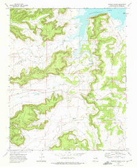
1972 Map of La Silla
USGS Topo · Published 1975About this map
Mesa Variadero and the surrounding high plains of San Miguel County dominate this early 1970s landscape, where drainage patterns define the geography of the high desert. The prominent landform of La Silla stands as a landmark above the meandering course of Garita Creek, which cuts through the central portion of the quadrangle. This era shows a sparsely settled ranching territory, indicated by the occasional Well and Spring that served as vital water sources for livestock in an arid environment. To the south, the terrain rises significantly toward North Mesa and West Mesa, separated by the drainage of Little Cuervo Creek. These mesas and their steep escarpments illustrate the geological transition between the flatlands and the higher plateau regions of eastern New Mexico, providing a clear view of the hydrological network including Pino Creek.
Find a feature on this map
10 named features on this map. Tap any name to fly to it.
Don’t see what you’re looking for? This feature index may not catch every label — zoom into the map to look around manually.
Map Details
Editions of this 1972 La Silla Map
This is the sole edition of this map. No revisions or reprints were ever made.
Other maps of this area

1892 · Corazon
USGS Topo · 1:125,000

1894 · Corazon
USGS Topo · 1:125,000

1954 · Santa Fe
USGS Topo · 1:250,000

1958 · Santa Fe
USGS Topo · 1:250,000

1963 · Mesa Cherisco
USGS Topo · 1:24,000

1963 · Mesita Del Gato
USGS Topo · 1:24,000

1964 · Neafus Ranch
USGS Topo · 1:24,000

1972 · Variadero
USGS Topo · 1:24,000

1972 · Four V Ranch
USGS Topo · 1:24,000
1972 · Bookout Ranch
USGS Topo · 1:24,000