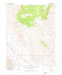
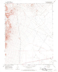
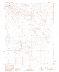
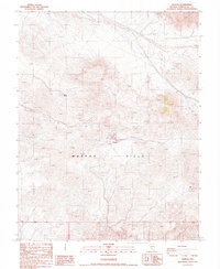
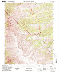
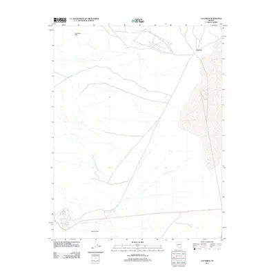
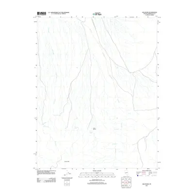
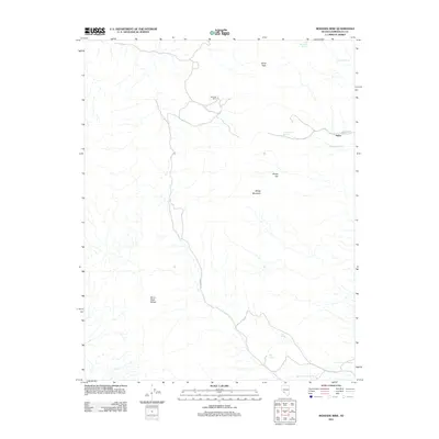
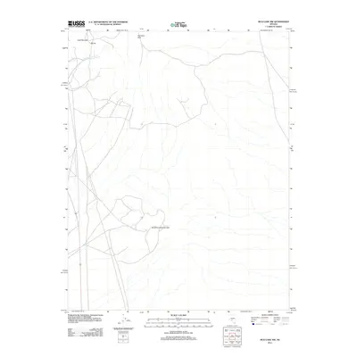
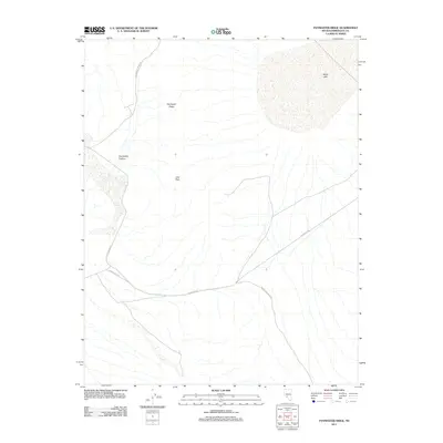
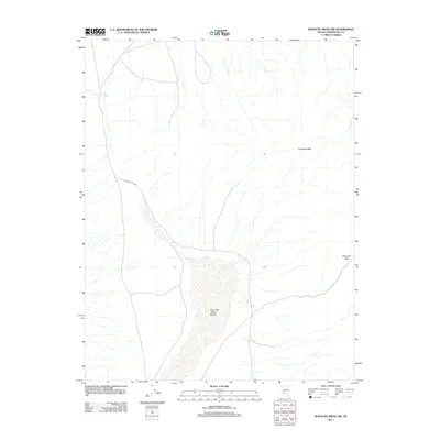
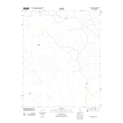
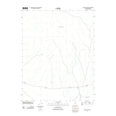
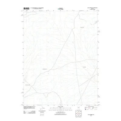
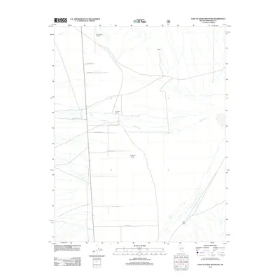
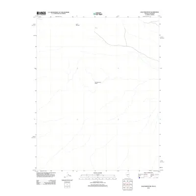
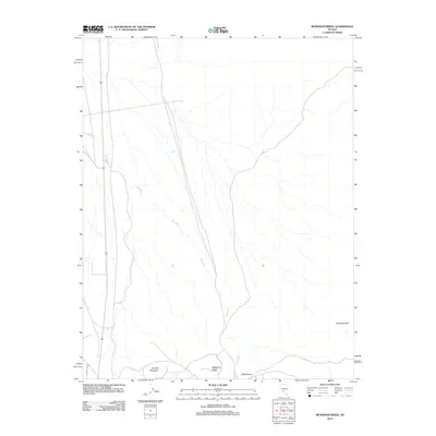
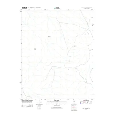
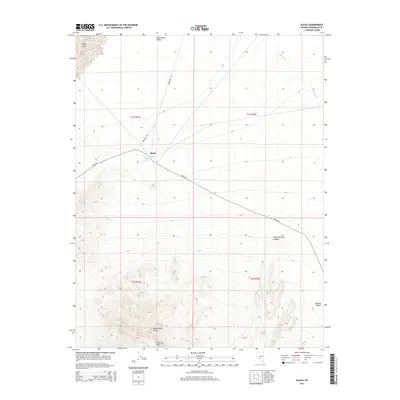
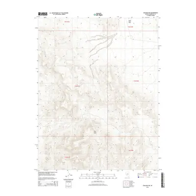
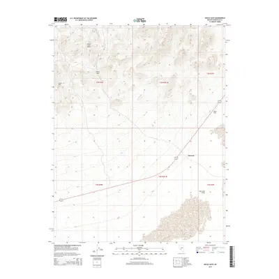
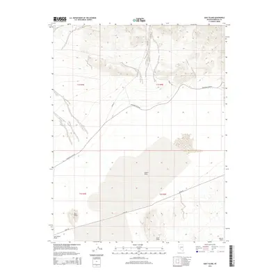
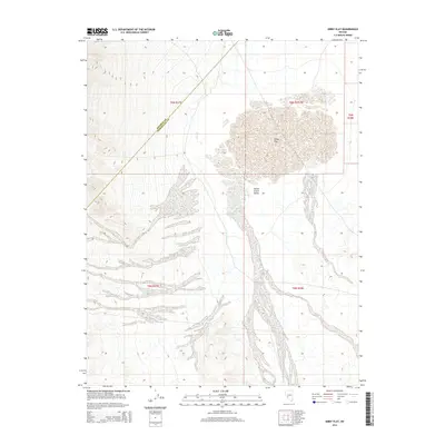
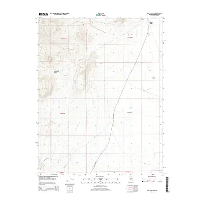
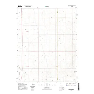
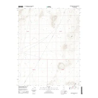
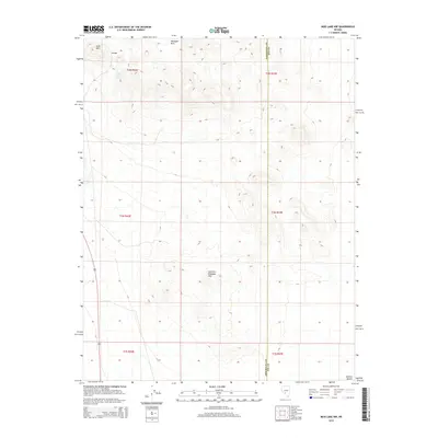
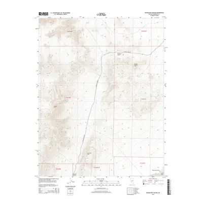
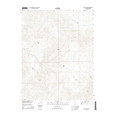
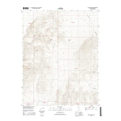
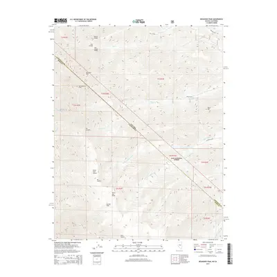
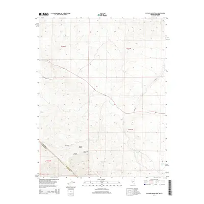
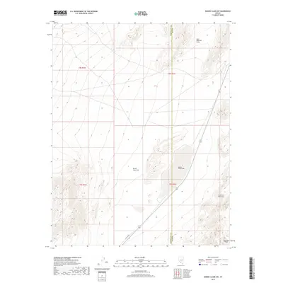
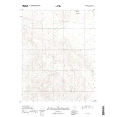
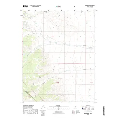
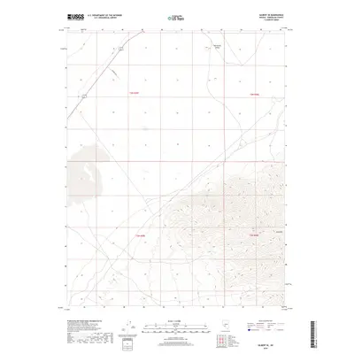
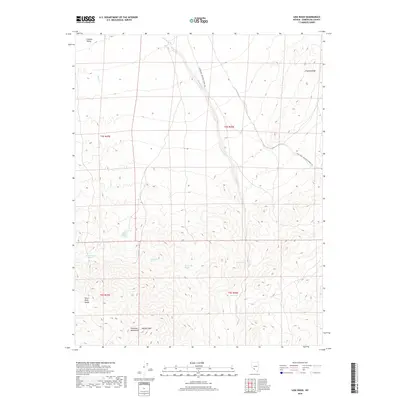
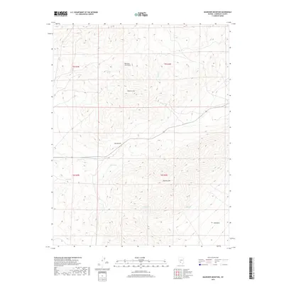
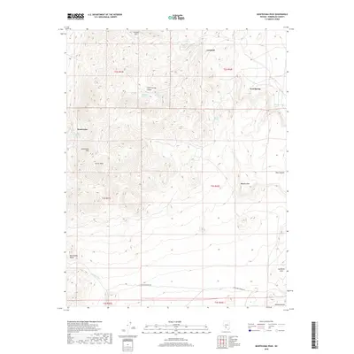
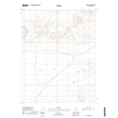
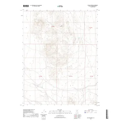
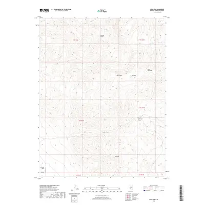
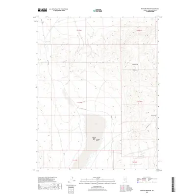
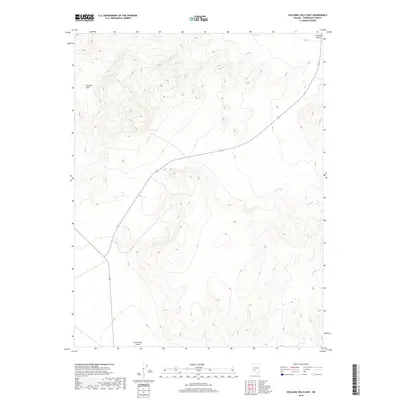
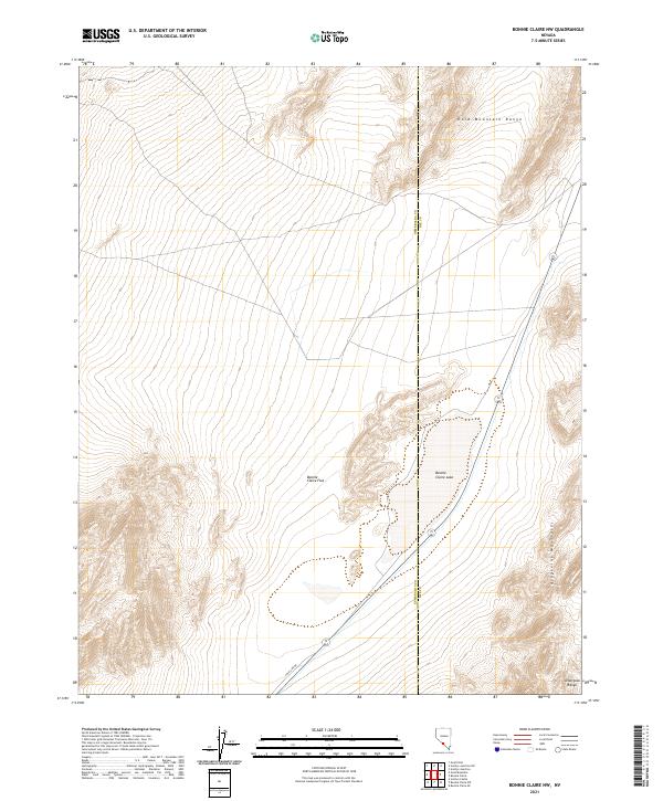
1968 Map of Bonnie Claire SW
USGS Topo · Published 1970About this map
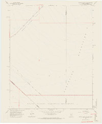
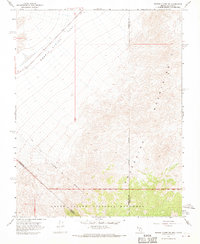
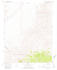
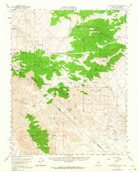
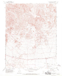
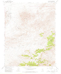
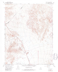
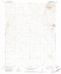
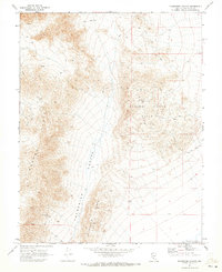
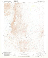
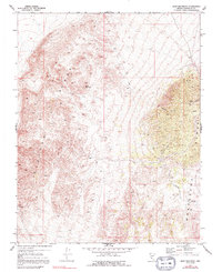
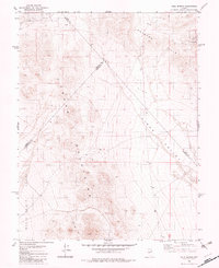
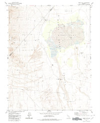
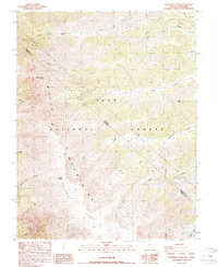
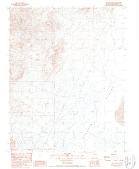
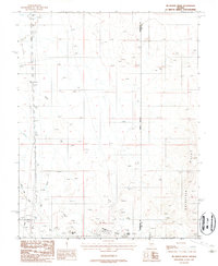
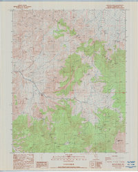
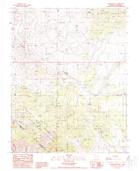
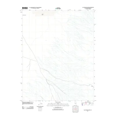
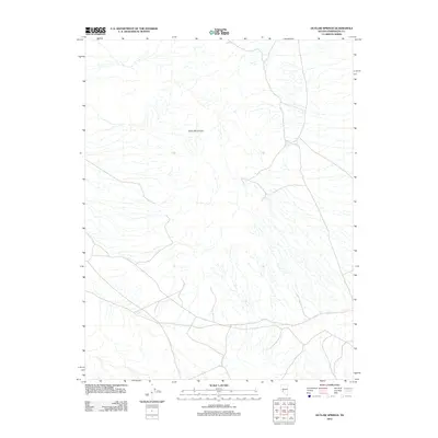
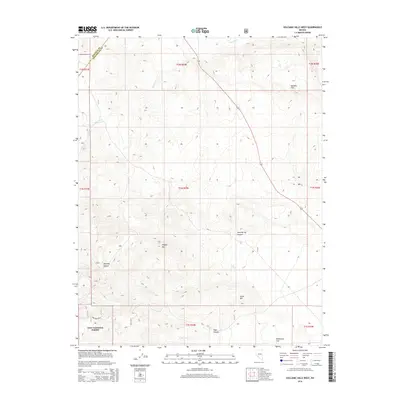
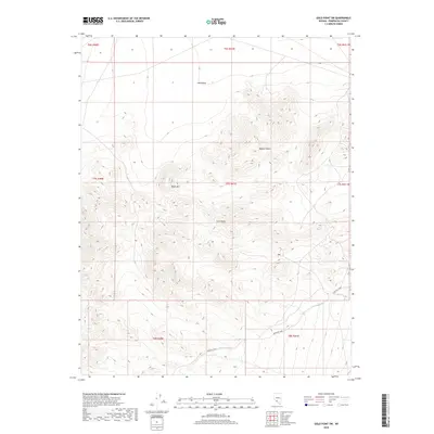
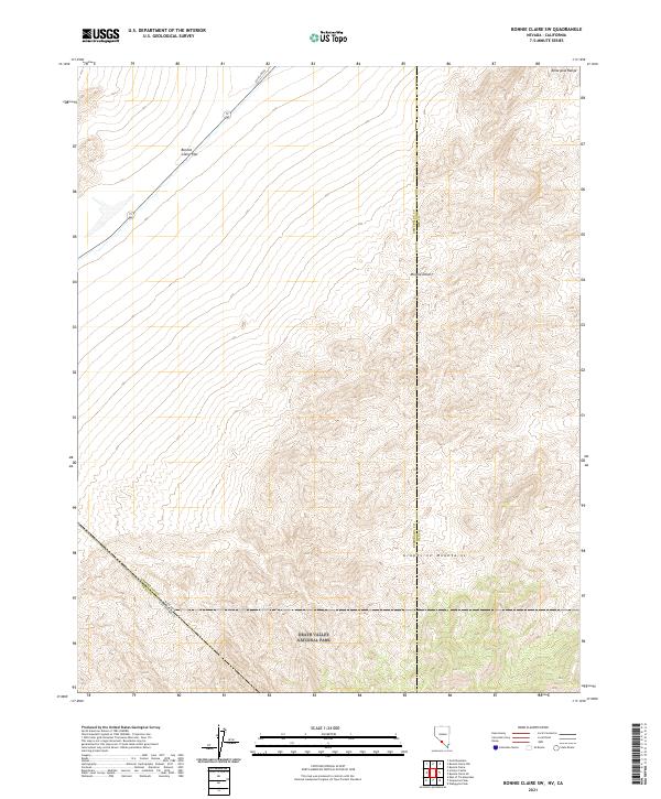
The Von Schmidt Line (1873) (Indefinite) cuts a diagonal path across this arid landscape, marking an early attempt to define the boundary between Nevada and California. This high-desert terrain, mapped in the late 1960s, is dominated by the expanse of Bonnie Claire Flat and the rising slopes of the Grapevine Mountains. The map documents a sparsely developed area where travel is largely restricted to a single Jeep Trail winding through the alluvial fans. In the southern portion of the sheet, the boundary of Death Valley National Monument signifies the protected status of these remote desert basins. Small but vital water sources like the Seep are documented near the mountain foothills, providing a rare point of interest for those tracing the history of desert travel or early surveying efforts like the Von Schmidt Line.
Find a feature on this map
12 named features on this map. Tap any name to fly to it.
Don’t see what you’re looking for? This feature index may not catch every label — zoom into the map to look around manually.
Map Details
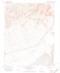
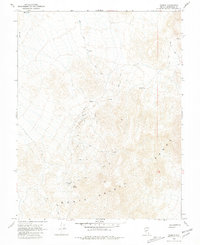
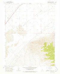
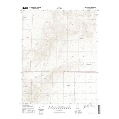
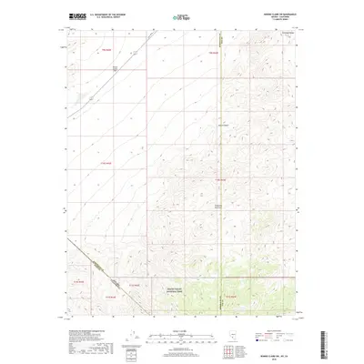
Editions of this 1968 Bonnie Claire SW Map
4 editions found
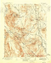
Historical Maps of Nye County Through Time
308 maps found

1908 Lida
Esmeralda County, NV
1913 Lida
Esmeralda County, NV
1957 Magruder Mtn
Esmeralda County, NV
1961 Lone Mtn
Esmeralda County, NV
1963 Davis Mountain
Esmeralda County, NV
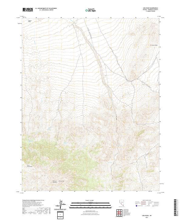
1963 Lida Wash
Esmeralda County, NV
1963 Piper Peak
Esmeralda County, NV
1963 Rhyolite Ridge
Esmeralda County, NV
1963 Silverpeak
Esmeralda County, NV
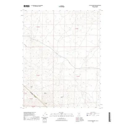
1967 Columbus
Esmeralda County, NV
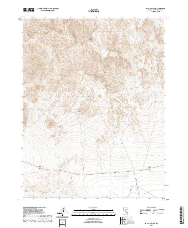
1968 Blair Junction
Esmeralda County, NV
1968 Bonnie Claire NW
Esmeralda County, NV
1968 Bonnie Claire SW
Esmeralda County, NV

1968 Coaldale
Esmeralda County, NV
1968 Coaldale NE
Esmeralda County, NV
1968 Crow Springs
Esmeralda County, NV
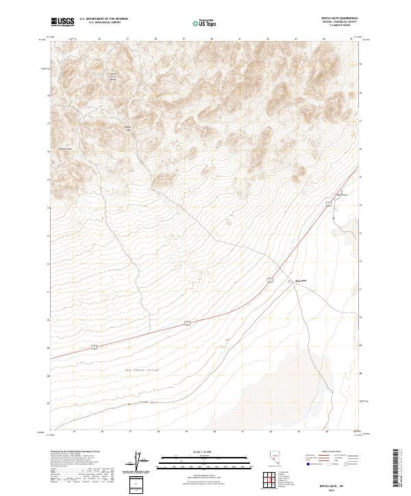
1968 Devils Gate
Esmeralda County, NV
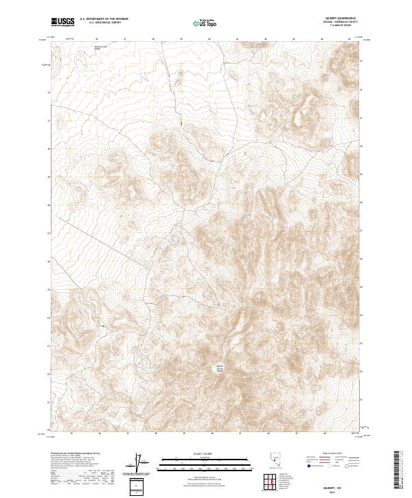
1968 Gilbert
Esmeralda County, NV
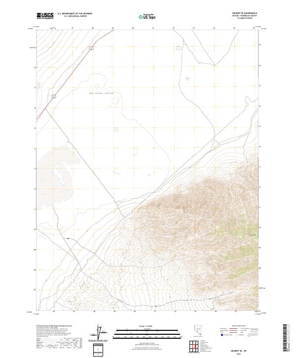
1968 Gilbert SE
Esmeralda County, NV
1968 Gold Point
Esmeralda County, NV
1968 Gold Point SW
Esmeralda County, NV
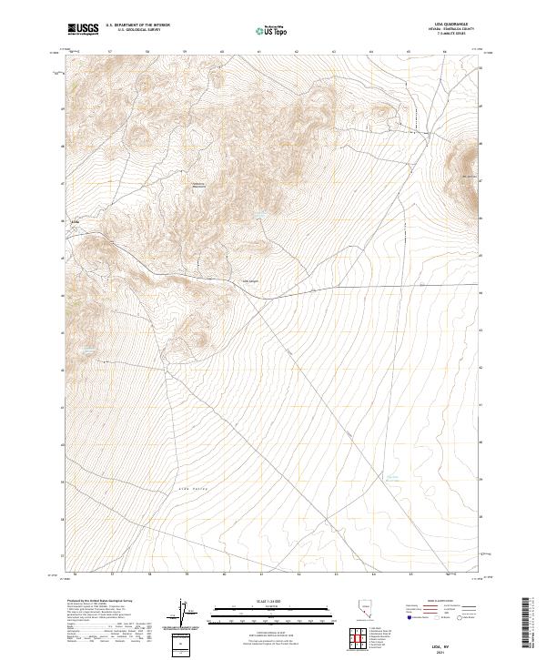
1968 Lida
Esmeralda County, NV
1968 Mount Jackson
Esmeralda County, NV
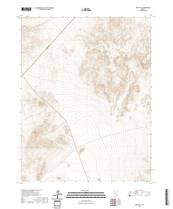
1968 Rock Hill
Esmeralda County, NV
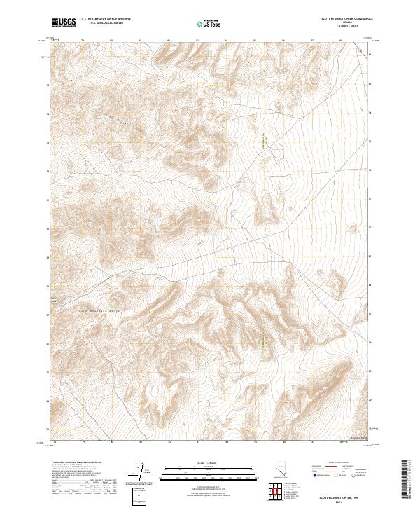
1968 Scottys Junction SW
Esmeralda County, NV
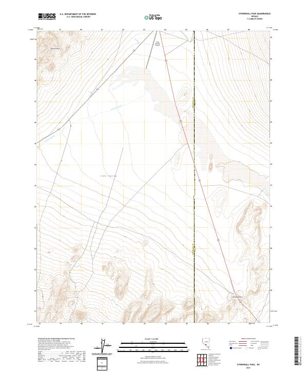
1968 Stonewall Pass
Esmeralda County, NV
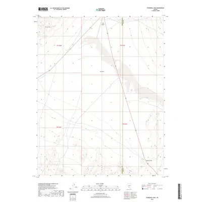
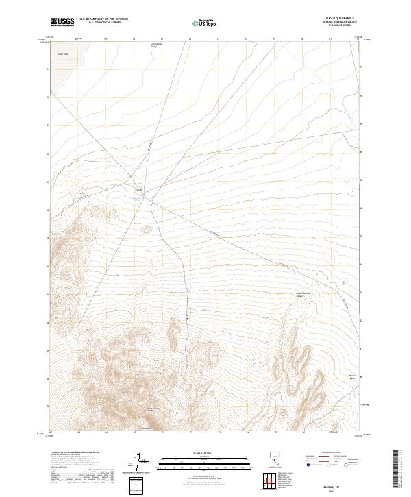
1970 Alkali
Esmeralda County, NV
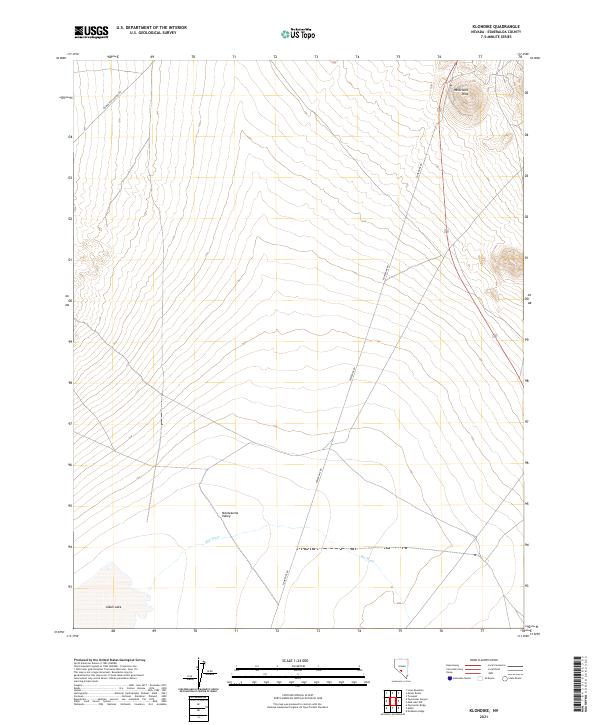
1970 Klondike
Esmeralda County, NV
1970 Montezuma Peak
Esmeralda County, NV
1970 Montezuma Peak SE
Esmeralda County, NV
1970 Montezuma Peak SW
Esmeralda County, NV
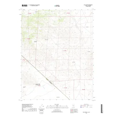
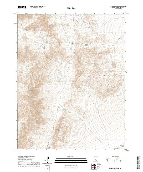
1970 Paymaster Canyon
Esmeralda County, NV
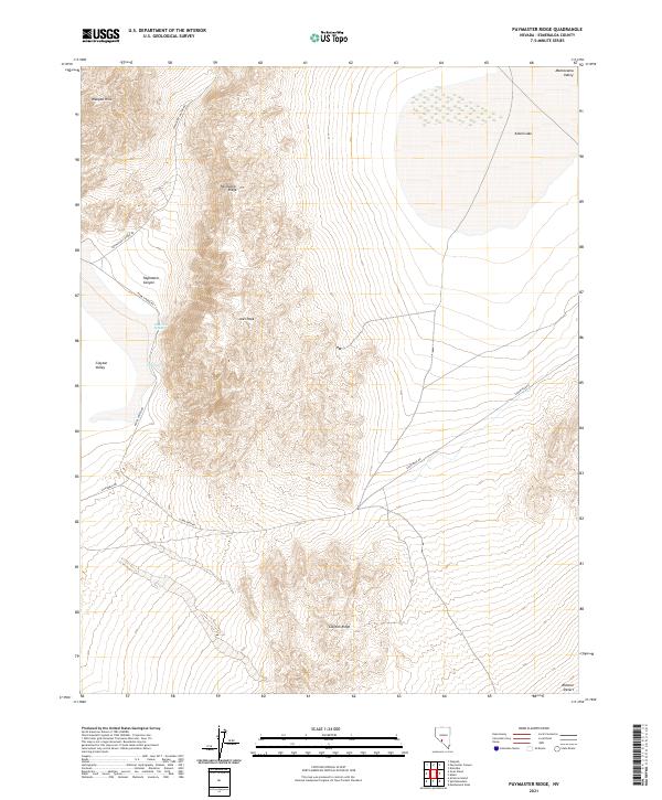
1970 Paymaster Ridge
Esmeralda County, NV
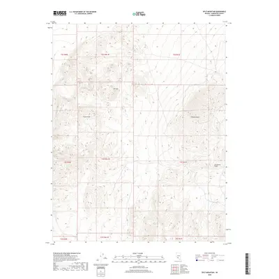
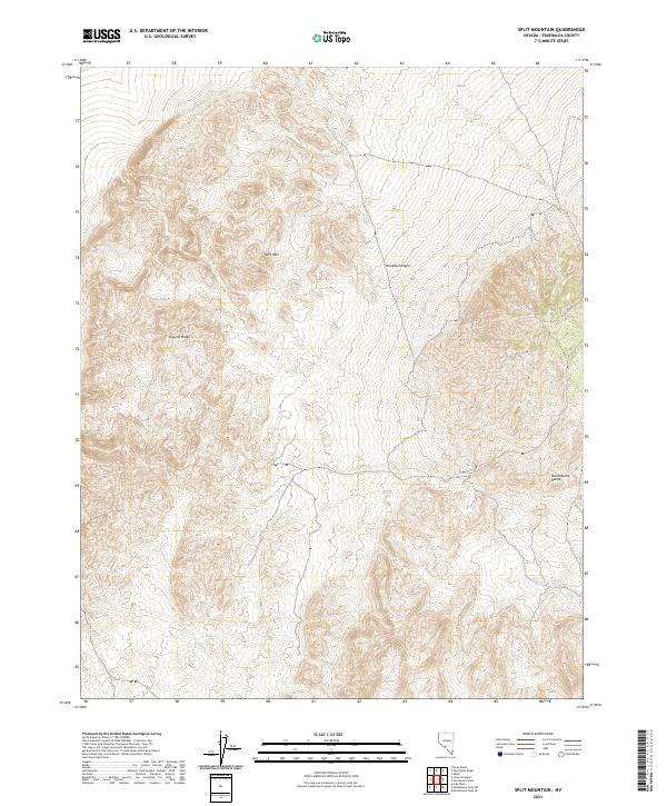
1970 Split Mountain
Esmeralda County, NV
1980 Cole Spring
Esmeralda County, NV
1980 Kibby Flat
Esmeralda County, NV
1980 Outlaw Springs
Esmeralda County, NV
1980 Outlaw Springs SE
Esmeralda County, NV
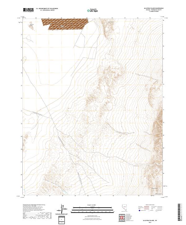
1987 Alcatraz Island
Esmeralda County, NV
1987 Boundary Peak
Esmeralda County, NV
1987 Davis Mountain
Esmeralda County, NV
1987 East of Davis Mtn.
Esmeralda County, NV
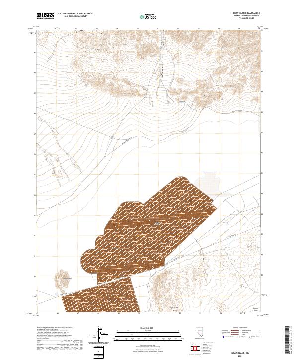
1987 Goat Island
Esmeralda County, NV

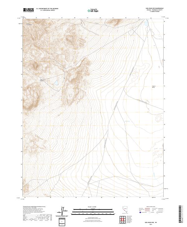
1987 Lida Wash
Esmeralda County, NV
1987 Lida Wash NW
Esmeralda County, NV
1987 Lida Wash SW
Esmeralda County, NV
1987 Lone Mountain
Esmeralda County, NV
1987 Magruder Mtn
Esmeralda County, NV
1987 McMahon Ridge
Esmeralda County, NV
1987 Millers
Esmeralda County, NV
1987 Mohawk Mine
Esmeralda County, NV
1987 Mt. Butte
Esmeralda County, NV
1987 Mud Lake NW
Esmeralda County, NV
1987 North of Silver Peak
Esmeralda County, NV
1987 Oasis Divide
Esmeralda County, NV
1987 Piper Peak
Esmeralda County, NV
1987 Rhyolite Ridge
Esmeralda County, NV
1987 Rhyolite Ridge NE
Esmeralda County, NV
1987 Rhyolite Ridge NW
Esmeralda County, NV
1987 Rhyolite Ridge SW
Esmeralda County, NV
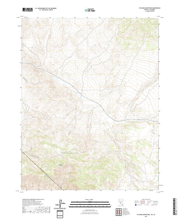
1987 Sylvania Mts
Esmeralda County, NV
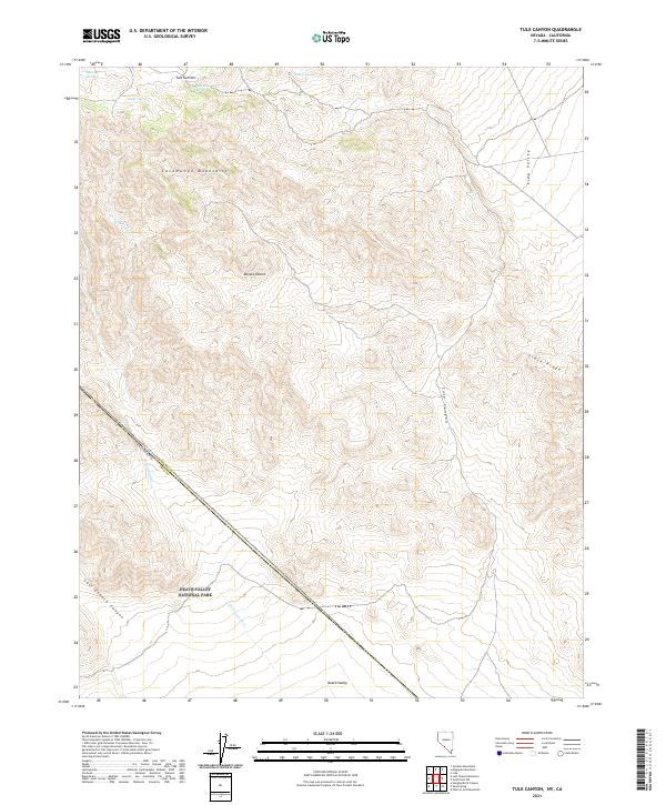
1987 Tule Canyon
Esmeralda County, NV
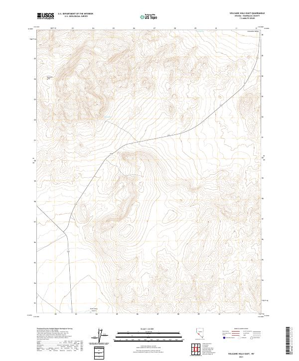
1987 Volcanic Hills East
Esmeralda County, NV
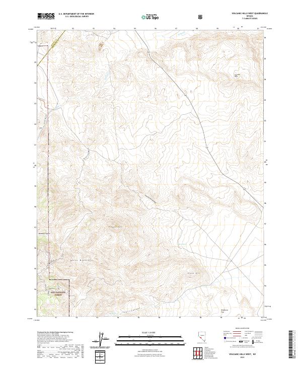
1987 Volcanic Hills West
Esmeralda County, NV
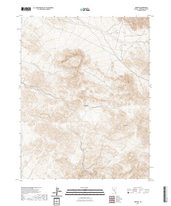
1987 Weepah
Esmeralda County, NV
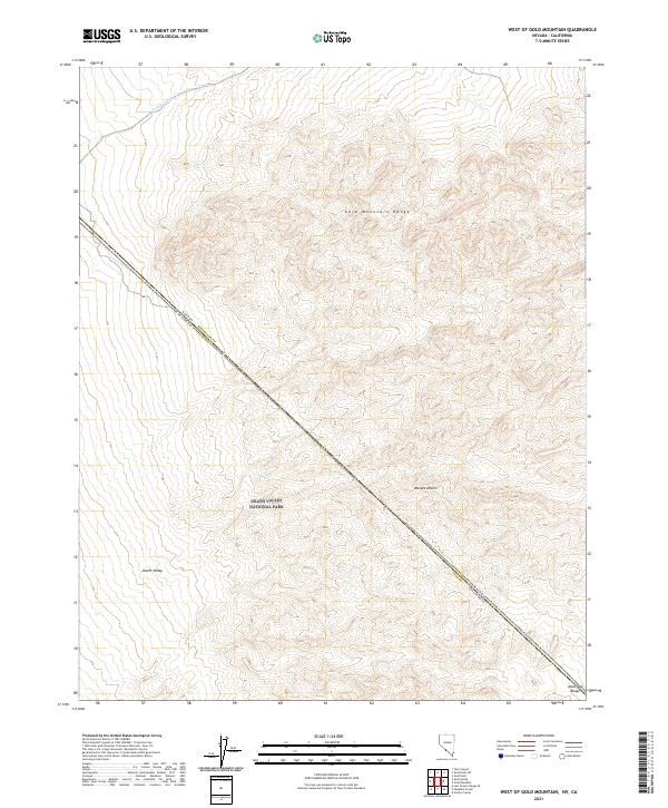
1987 West of Gold Mountain
Esmeralda County, NV
1988 Gold Mountain
Esmeralda County, NV
1988 Ralston
Esmeralda County, NV
1994 Boundary Peak
Esmeralda County, NV
1994 Davis Mountain
Esmeralda County, NV
1994 East of Davis Mtn.
Esmeralda County, NV
1994 Volcanic Hills West
Esmeralda County, NV
2011 Alcatraz Island
Esmeralda County, NV
2011 Alkali
Esmeralda County, NV
2011 Bonnie Claire NW
Esmeralda County, NV
2011 Bonnie Claire SW
Esmeralda County, NV
2011 Columbus
Esmeralda County, NV
2011 Gold Point
Esmeralda County, NV
2011 Klondike
Esmeralda County, NV
2011 Lida
Esmeralda County, NV
2011 Lida Wash
Esmeralda County, NV
2011 Lida Wash NW
Esmeralda County, NV
2011 Lida Wash SW
Esmeralda County, NV
2011 Magruder Mountain
Esmeralda County, NV
2011 Mohawk Mine
Esmeralda County, NV
2011 Montezuma Peak
Esmeralda County, NV
2011 Montezuma Peak SE
Esmeralda County, NV
2011 Montezuma Peak SW
Esmeralda County, NV
2011 Mud Lake NW
Esmeralda County, NV
2011 North of Silver Peak
Esmeralda County, NV
2011 Oasis Divide
Esmeralda County, NV
2011 Paymaster Canyon
Esmeralda County, NV
2011 Paymaster Ridge
Esmeralda County, NV
2011 Piper Peak
Esmeralda County, NV
2011 Ralston
Esmeralda County, NV
2011 Rhyolite Ridge
Esmeralda County, NV
2011 Rhyolite Ridge NW
Esmeralda County, NV
2011 Rhyolite Ridge SW
Esmeralda County, NV
2011 Scottys Junction SW
Esmeralda County, NV
2011 Stonewall Pass
Esmeralda County, NV
2011 Tule Canyon
Esmeralda County, NV
2011 Volcanic Hills East
Esmeralda County, NV
2011 Weepah
Esmeralda County, NV
2011 West of Gold Mountain
Esmeralda County, NV
2012 Blair Junction
Esmeralda County, NV
2012 Boundary Peak
Esmeralda County, NV
2012 Coaldale
Esmeralda County, NV
2012 Coaldale NE
Esmeralda County, NV
2012 Cole Spring
Esmeralda County, NV
2012 Crow Springs
Esmeralda County, NV
2012 Davis Mountain
Esmeralda County, NV
2012 Devils Gate
Esmeralda County, NV
2012 East of Davis Mountain
Esmeralda County, NV
2012 Gilbert
Esmeralda County, NV
2012 Gilbert SE
Esmeralda County, NV
2012 Goat Island
Esmeralda County, NV
2012 Gold Mountain
Esmeralda County, NV
2012 Gold Point SW
Esmeralda County, NV
2012 Kibby Flat
Esmeralda County, NV
2012 Lone Mountain
Esmeralda County, NV
2012 McMahon Ridge
Esmeralda County, NV
2012 Millers
Esmeralda County, NV
2012 Mount Butte
Esmeralda County, NV
2012 Mount Jackson
Esmeralda County, NV
2012 Outlaw Springs
Esmeralda County, NV
2012 Outlaw Springs SE
Esmeralda County, NV
2012 Rhyolite Ridge NE
Esmeralda County, NV
2012 Rock Hill
Esmeralda County, NV
2012 Split Mountain
Esmeralda County, NV
2012 Sylvania Mountains
Esmeralda County, NV
2012 Volcanic Hills West
Esmeralda County, NV
2014 Alcatraz Island
Esmeralda County, NV
2014 Alkali
Esmeralda County, NV
2014 Blair Junction
Esmeralda County, NV
2014 Bonnie Claire SW
Esmeralda County, NV
2014 Coaldale
Esmeralda County, NV
2014 Coaldale NE
Esmeralda County, NV
2014 Cole Spring
Esmeralda County, NV

2014 Columbus
Esmeralda County, NV
2014 Crow Springs
Esmeralda County, NV
2014 Davis Mountain
Esmeralda County, NV
2014 Devils Gate
Esmeralda County, NV
2014 East of Davis Mountain
Esmeralda County, NV
2014 Gilbert
Esmeralda County, NV
2014 Gilbert SE
Esmeralda County, NV
2014 Goat Island
Esmeralda County, NV
2014 Gold Mountain
Esmeralda County, NV
2014 Gold Point
Esmeralda County, NV
2014 Gold Point SW
Esmeralda County, NV
2014 Kibby Flat
Esmeralda County, NV
2014 Klondike
Esmeralda County, NV
2014 Lida
Esmeralda County, NV
2014 Lida Wash
Esmeralda County, NV
2014 Lida Wash NW
Esmeralda County, NV
2014 Lida Wash SW
Esmeralda County, NV
2014 Lone Mountain
Esmeralda County, NV
2014 Magruder Mountain
Esmeralda County, NV
2014 McMahon Ridge
Esmeralda County, NV
2014 Millers
Esmeralda County, NV
2014 Mohawk Mine
Esmeralda County, NV
2014 Montezuma Peak
Esmeralda County, NV
2014 Montezuma Peak SE
Esmeralda County, NV
2014 Montezuma Peak SW
Esmeralda County, NV
2014 Mount Butte
Esmeralda County, NV
2014 Mount Jackson
Esmeralda County, NV
2014 Mud Lake NW
Esmeralda County, NV
2014 Oasis Divide
Esmeralda County, NV
2014 Outlaw Springs
Esmeralda County, NV
2014 Outlaw Springs SE
Esmeralda County, NV
2014 Paymaster Canyon
Esmeralda County, NV
2014 Paymaster Ridge
Esmeralda County, NV
2014 Piper Peak
Esmeralda County, NV
2014 Ralston
Esmeralda County, NV
2014 Rhyolite Ridge
Esmeralda County, NV
2014 Rhyolite Ridge NW
Esmeralda County, NV
2014 Rock Hill
Esmeralda County, NV
2014 Scottys Junction SW
Esmeralda County, NV
2014 Split Mountain
Esmeralda County, NV
2014 Stonewall Pass
Esmeralda County, NV
2014 Tule Canyon
Esmeralda County, NV
2014 Volcanic Hills East
Esmeralda County, NV
2014 Volcanic Hills West
Esmeralda County, NV
2014 Weepah
Esmeralda County, NV
2014 West of Gold Mountain
Esmeralda County, NV
2015 Bonnie Claire NW
Esmeralda County, NV
2015 Boundary Peak
Esmeralda County, NV
2015 North of Silver Peak
Esmeralda County, NV
2015 Rhyolite Ridge NE
Esmeralda County, NV
2015 Rhyolite Ridge SW
Esmeralda County, NV
2015 Sylvania Mountains
Esmeralda County, NV
2018 Alcatraz Island
Esmeralda County, NV
2018 Alkali
Esmeralda County, NV
2018 Blair Junction
Esmeralda County, NV
2018 Bonnie Claire NW
Esmeralda County, NV
2018 Bonnie Claire SW
Esmeralda County, NV
2018 Boundary Peak
Esmeralda County, NV
2018 Coaldale
Esmeralda County, NV
2018 Coaldale NE
Esmeralda County, NV
2018 Cole Spring
Esmeralda County, NV
2018 Columbus
Esmeralda County, NV
2018 Crow Springs
Esmeralda County, NV
2018 Davis Mountain
Esmeralda County, NV
2018 Devils Gate
Esmeralda County, NV
2018 East of Davis Mountain
Esmeralda County, NV
2018 Gilbert
Esmeralda County, NV
2018 Gilbert SE
Esmeralda County, NV
2018 Goat Island
Esmeralda County, NV
2018 Gold Mountain
Esmeralda County, NV
2018 Gold Point
Esmeralda County, NV
2018 Gold Point SW
Esmeralda County, NV
2018 Kibby Flat
Esmeralda County, NV
2018 Klondike
Esmeralda County, NV
2018 Lida
Esmeralda County, NV
2018 Lida Wash
Esmeralda County, NV
2018 Lida Wash NW
Esmeralda County, NV
2018 Lida Wash SW
Esmeralda County, NV
2018 Lone Mountain
Esmeralda County, NV
2018 Magruder Mountain
Esmeralda County, NV
2018 McMahon Ridge
Esmeralda County, NV
2018 Millers
Esmeralda County, NV
2018 Mohawk Mine
Esmeralda County, NV
2018 Montezuma Peak
Esmeralda County, NV
2018 Montezuma Peak SE
Esmeralda County, NV
2018 Montezuma Peak SW
Esmeralda County, NV
2018 Mount Butte
Esmeralda County, NV
2018 Mount Jackson
Esmeralda County, NV
2018 Mud Lake NW
Esmeralda County, NV
2018 North of Silver Peak
Esmeralda County, NV
2018 Oasis Divide
Esmeralda County, NV
2018 Outlaw Springs
Esmeralda County, NV
2018 Outlaw Springs SE
Esmeralda County, NV
2018 Paymaster Canyon
Esmeralda County, NV
2018 Paymaster Ridge
Esmeralda County, NV
2018 Piper Peak
Esmeralda County, NV
2018 Ralston
Esmeralda County, NV
2018 Rhyolite Ridge
Esmeralda County, NV
2018 Rhyolite Ridge NE
Esmeralda County, NV
2018 Rhyolite Ridge NW
Esmeralda County, NV
2018 Rhyolite Ridge SW
Esmeralda County, NV
2018 Rock Hill
Esmeralda County, NV
2018 Scottys Junction SW
Esmeralda County, NV
2018 Split Mountain
Esmeralda County, NV
2018 Stonewall Pass
Esmeralda County, NV
2018 Sylvania Mountains
Esmeralda County, NV
2018 Tule Canyon
Esmeralda County, NV
2018 Volcanic Hills East
Esmeralda County, NV
2018 Volcanic Hills West
Esmeralda County, NV
2018 Weepah
Esmeralda County, NV
2018 West of Gold Mountain
Esmeralda County, NV
2021 Alcatraz Island
Esmeralda County, NV
2021 Alkali
Esmeralda County, NV
2021 Blair Junction
Esmeralda County, NV
2021 Bonnie Claire NW
Esmeralda County, NV
2021 Bonnie Claire SW
Esmeralda County, NV
2021 Boundary Peak
Esmeralda County, NV
2021 Coaldale
Esmeralda County, NV
2021 Coaldale NE
Esmeralda County, NV
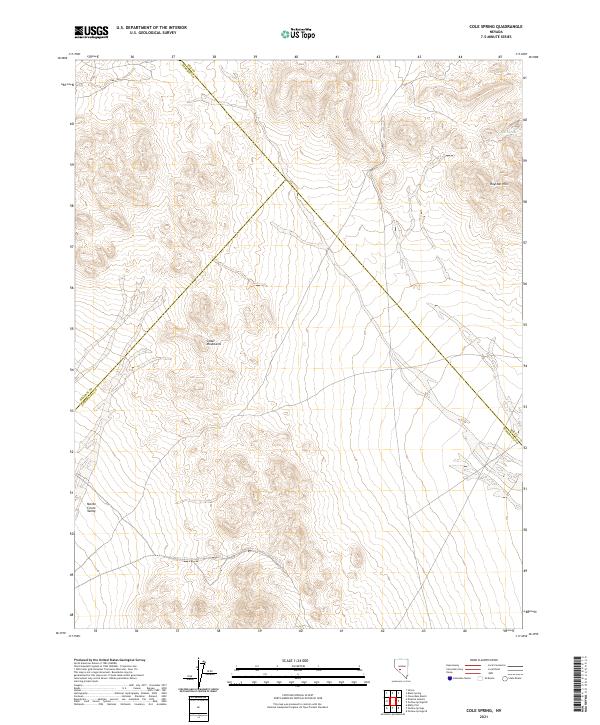
2021 Cole Spring
Esmeralda County, NV
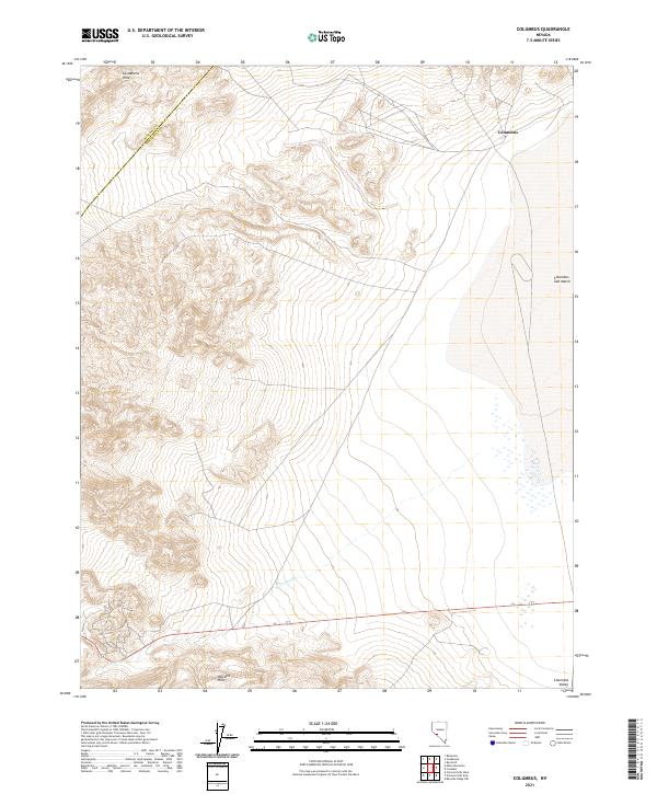
2021 Columbus
Esmeralda County, NV
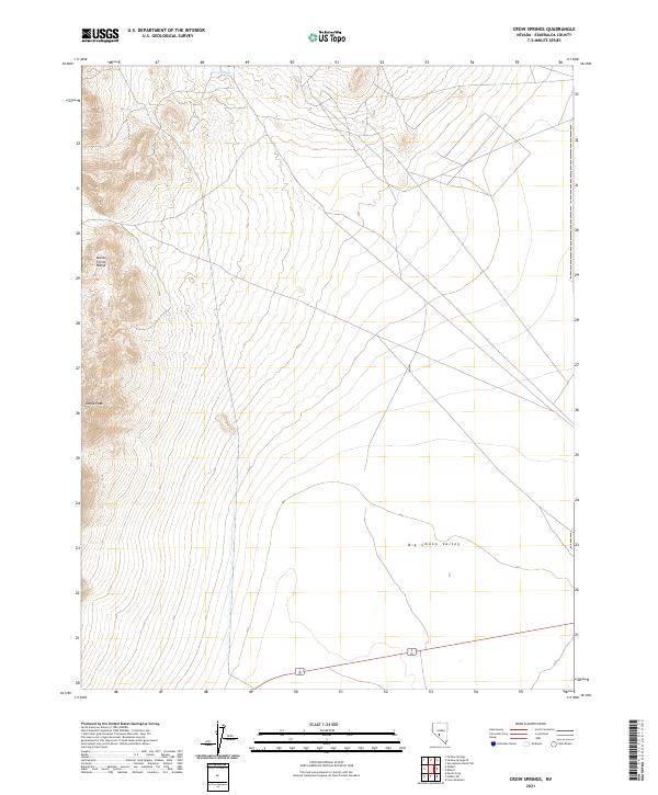
2021 Crow Springs
Esmeralda County, NV
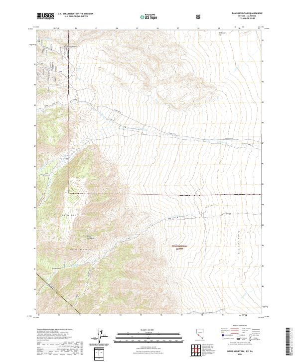
2021 Davis Mountain
Esmeralda County, NV
2021 Devils Gate
Esmeralda County, NV

2021 East of Davis Mountain
Esmeralda County, NV
2021 Gilbert
Esmeralda County, NV
2021 Gilbert SE
Esmeralda County, NV
2021 Goat Island
Esmeralda County, NV
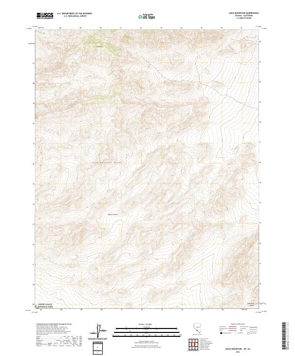
2021 Gold Mountain
Esmeralda County, NV
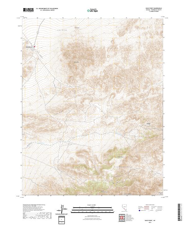
2021 Gold Point
Esmeralda County, NV
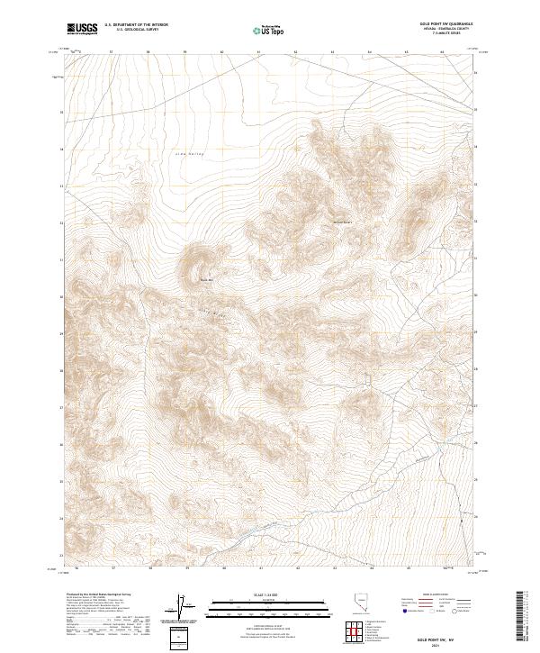
2021 Gold Point SW
Esmeralda County, NV
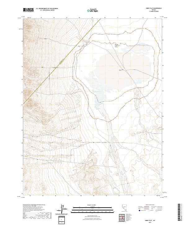
2021 Kibby Flat
Esmeralda County, NV
2021 Klondike
Esmeralda County, NV
2021 Lida
Esmeralda County, NV
2021 Lida Wash
Esmeralda County, NV
2021 Lida Wash NW
Esmeralda County, NV
2021 Lida Wash SW
Esmeralda County, NV
2021 Lone Mountain
Esmeralda County, NV
2021 Magruder Mountain
Esmeralda County, NV
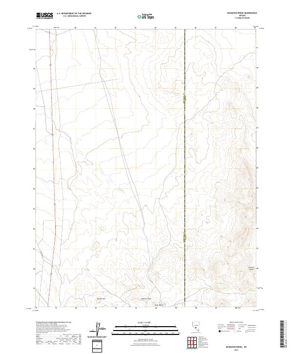
2021 McMahon Ridge
Esmeralda County, NV
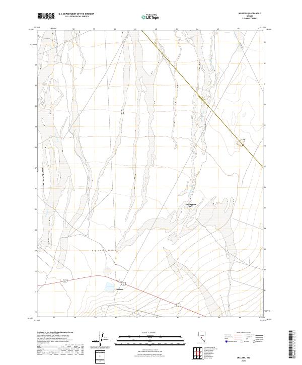
2021 Millers
Esmeralda County, NV
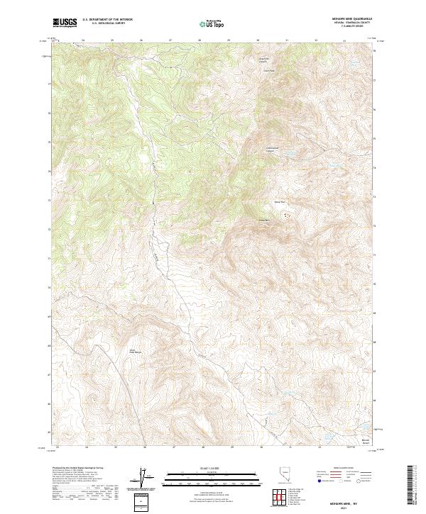
2021 Mohawk Mine
Esmeralda County, NV
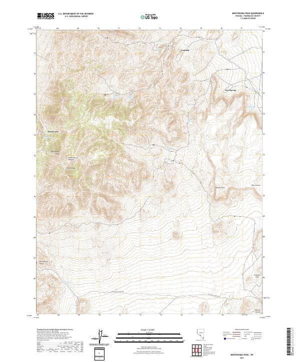
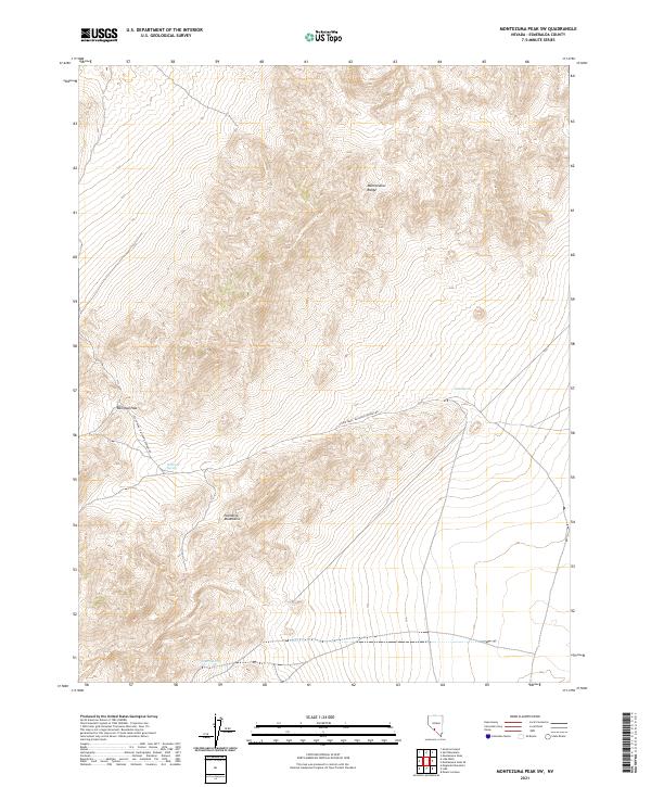
2021 Montezuma Peak
Esmeralda County, NV
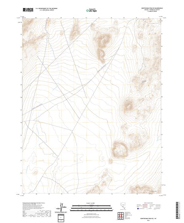
2021 Montezuma Peak SE
Esmeralda County, NV
2021 Montezuma Peak SW
Esmeralda County, NV
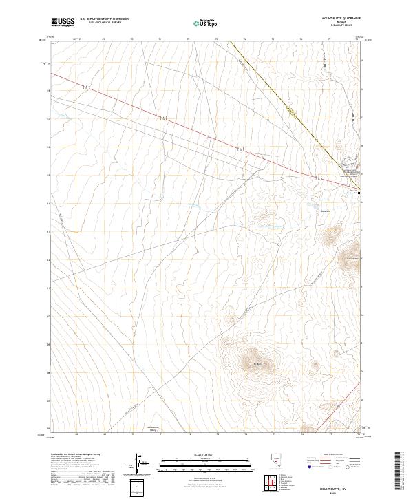
2021 Mount Butte
Esmeralda County, NV
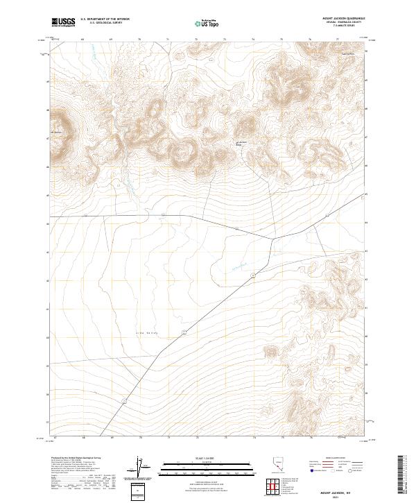
2021 Mount Jackson
Esmeralda County, NV
2021 Mud Lake NW
Esmeralda County, NV
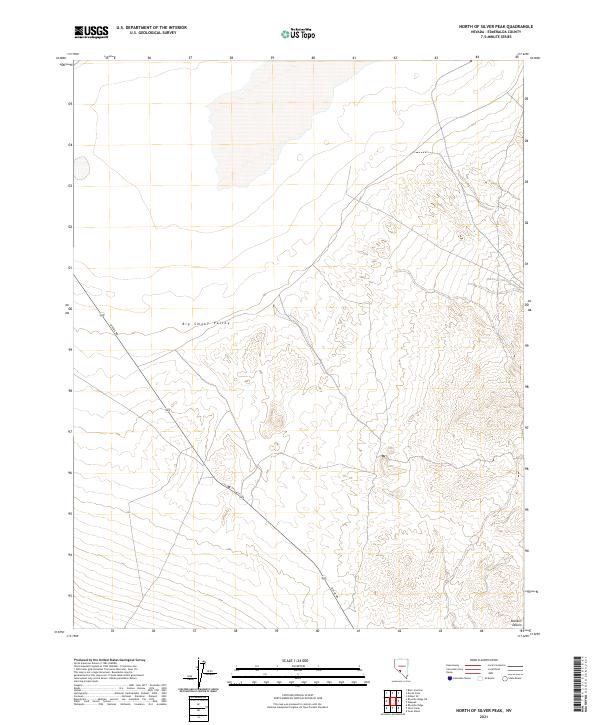
2021 North of Silver Peak
Esmeralda County, NV
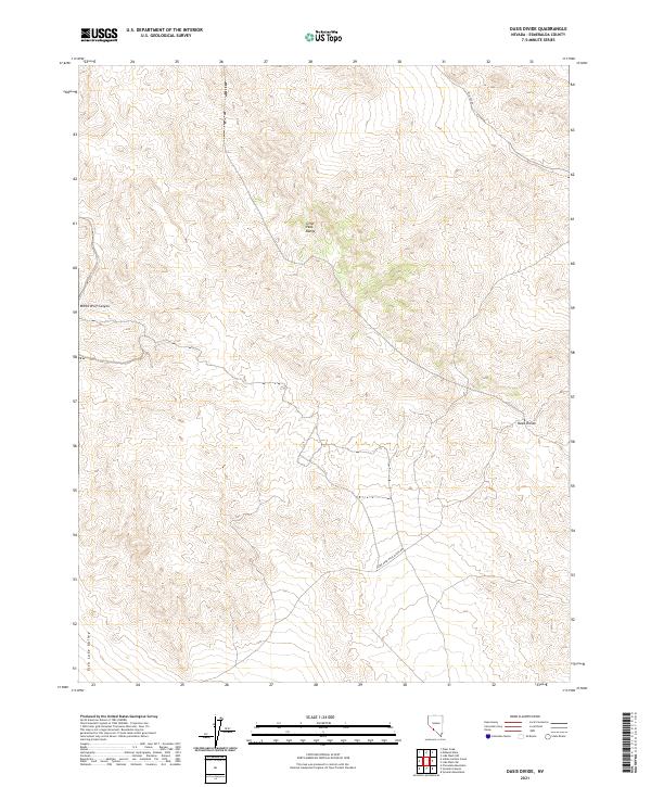
2021 Oasis Divide
Esmeralda County, NV
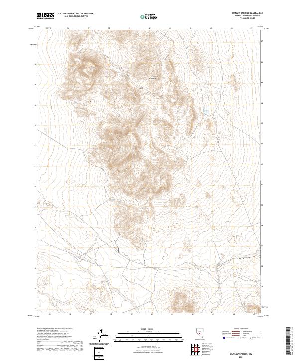
2021 Outlaw Springs
Esmeralda County, NV
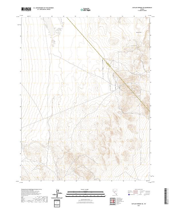
2021 Outlaw Springs SE
Esmeralda County, NV
2021 Paymaster Canyon
Esmeralda County, NV
2021 Paymaster Ridge
Esmeralda County, NV
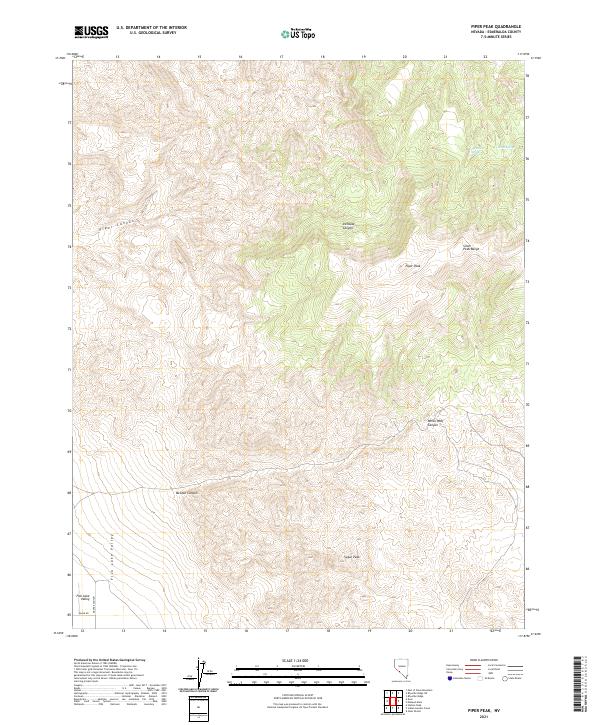
2021 Piper Peak
Esmeralda County, NV
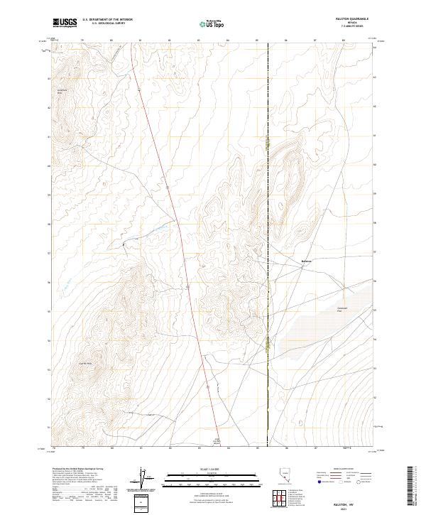
2021 Ralston
Esmeralda County, NV
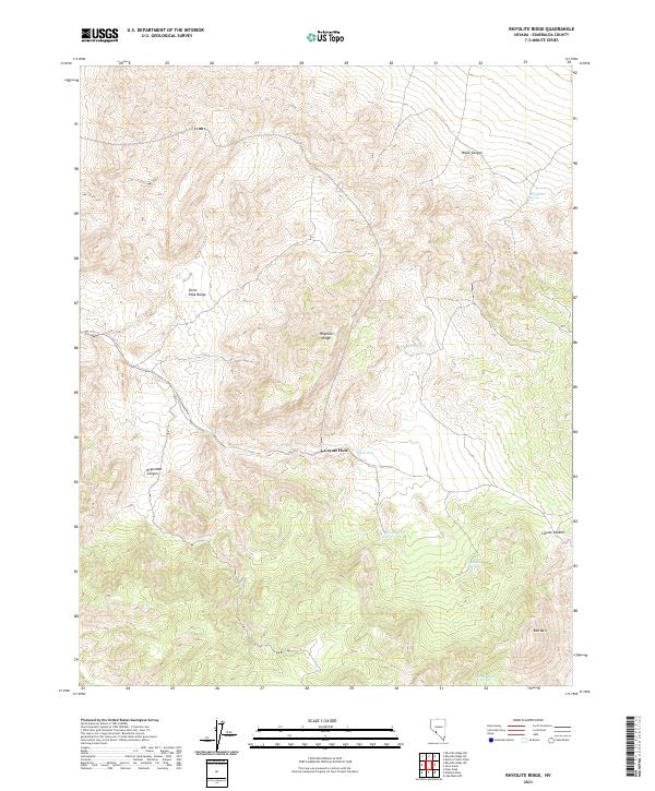
2021 Rhyolite Ridge
Esmeralda County, NV
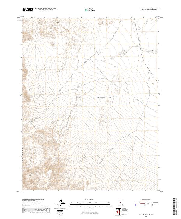
2021 Rhyolite Ridge NE
Esmeralda County, NV
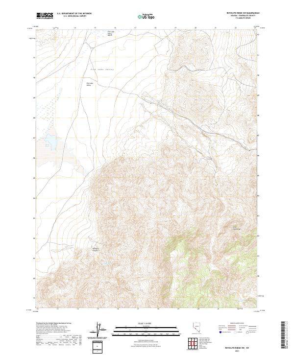
2021 Rhyolite Ridge NW
Esmeralda County, NV
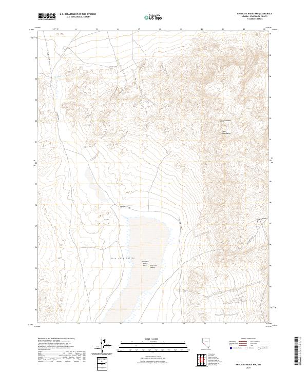
2021 Rhyolite Ridge SW
Esmeralda County, NV
2021 Rock Hill
Esmeralda County, NV
2021 Scottys Junction SW
Esmeralda County, NV
2021 Split Mountain
Esmeralda County, NV
2021 Stonewall Pass
Esmeralda County, NV
2021 Sylvania Mountains
Esmeralda County, NV
2021 Tule Canyon
Esmeralda County, NV
2021 Volcanic Hills East
Esmeralda County, NV
2021 Volcanic Hills West
Esmeralda County, NV
2021 Weepah
Esmeralda County, NV
2021 West of Gold Mountain
Esmeralda County, NV