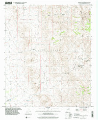
1996 Map of Hembrillo Basin
USGS Topo · Published 2002About this map
White Sands Missile Range dominates this landscape, showing a high-desert environment defined by military restricted boundaries and isolated watering points. Significant topographical features like Victoria Peak and the Hembrillo Pass provide natural landmarks in a region largely devoid of modern development. The map reveals a reliance on scattered water sources such as the CCC Tank, Kaylor Tank, and Upper Hembrillo Spring to sustain activity in the arid terrain. Historical land use is hinted at by several prospects and a Mine located in the northern reaches, while cattle-ranching infrastructure is evident through the Green Valley Windmill and Blackshire Well. The boundary between Sierra and Doña Ana counties cuts through the southern portion of the basin, marking a geopolitical divide in an otherwise contiguous wilderness of draws and canyons like Lyons Draw and Gilmore Draw.
Find a feature on this map
24 named features on this map. Tap any name to fly to it.
Don’t see what you’re looking for? This feature index may not catch every label — zoom into the map to look around manually.
Map Details
Editions of this 1996 Hembrillo Basin Map
This is the sole edition of this map. No revisions or reprints were ever made.
Other maps of this area

1916 · Tonuco
USGS Topo · 1:125,000

1916 · Salinas Peak
USGS Topo · 1:125,000

1932 · Tonuco
USGS Topo · 1:125,000

1948 · Sowell
USGS Topo · 1:62,500

1948 · Chicken Well
USGS Topo · 1:62,500

1948 · Kaylor Mountain
USGS Topo · 1:62,500

1948 · Black Top Mountain
USGS Topo · 1:62,500

1954 · Tularosa
USGS Topo · 1:250,000

1955 · Las Cruces
USGS Topo · 1:250,000

1958 · Las Cruces
USGS Topo · 1:250,000