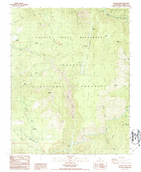
1987 Map of Hockett Peak
USGS Topo · Published 1987About this map
The Great Western Divide anchors this high-altitude landscape within the Sequoia National Forest, where the complex drainage of the Little Kern River and Kern River shapes the geography. This 1980s-era survey documents the preservation and primitive use of the Golden Trout Wilderness, highlighted by several established backcountry sites such as the Trout Meadows FS Station and Pyles Camp. The map provides detailed coordinates for high sierra navigation, from the prominence of Hockett Peak to the confluence at the Forks of the Kern. Notable timber and water resources are marked throughout, including the Freeman Grove and numerous riparian clearings like Lloyd Meadows and Trout Meadows. This period represents the landscape as it functioned after wilderness designations, maintaining established Forest Service outposts and gaging stations along the major river systems.
Find a feature on this map
41 named features on this map. Tap any name to fly to it.
Don’t see what you’re looking for? This feature index may not catch every label — zoom into the map to look around manually.
Map Details
Editions of this 1987 Hockett Peak Map
This is the sole edition of this map. No revisions or reprints were ever made.
Other maps of this area

1904 · Kaweah
USGS Topo · 1:125,000

1905 · Olancha
USGS Topo · 1:125,000

1907 · Olancha
USGS Topo · 1:125,000

1909 · Kaweah
USGS Topo · 1:125,000

1937 · Kaweah
USGS Topo · 1:125,000

1948 · Fresno
USGS Topo · 1:250,000

1955 · Fresno
USGS Topo · 1:250,000

1956 · Fresno
USGS Topo · 1:250,000

1956 · Hockett Peak
USGS Topo · 1:62,500

1956 · Mineral King
USGS Topo · 1:62,500